Monday, 10 February 2020, 12:30 CET
|
|
|

|
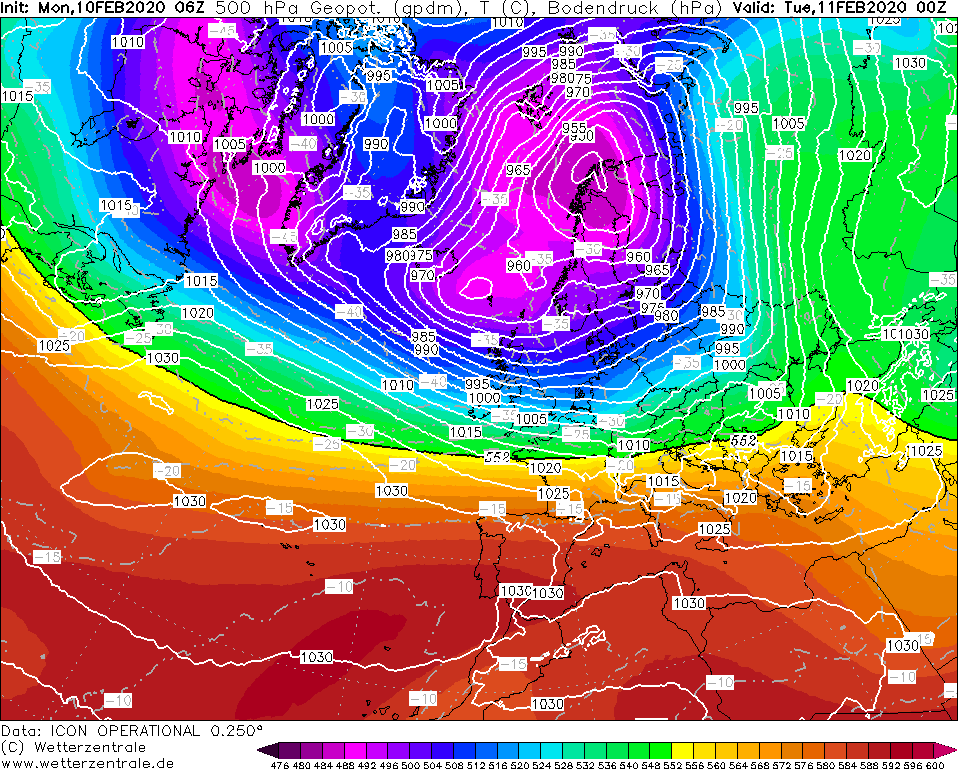
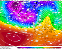
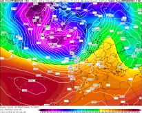
500 hPa Geopotential and
Temperature, 11.02., 00 UTC
Image Credit: Wetterzentrale
|
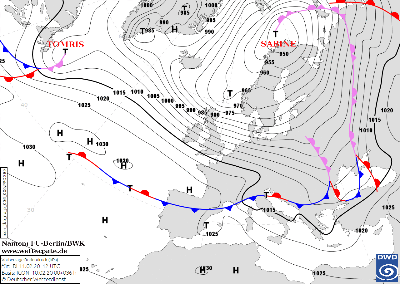
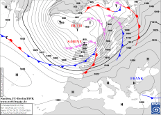
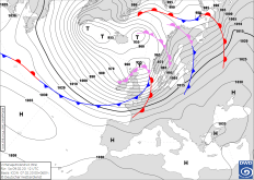
Sea level pressure and fronts, 11.02., 12 UTC
Image Credit: DWD
|
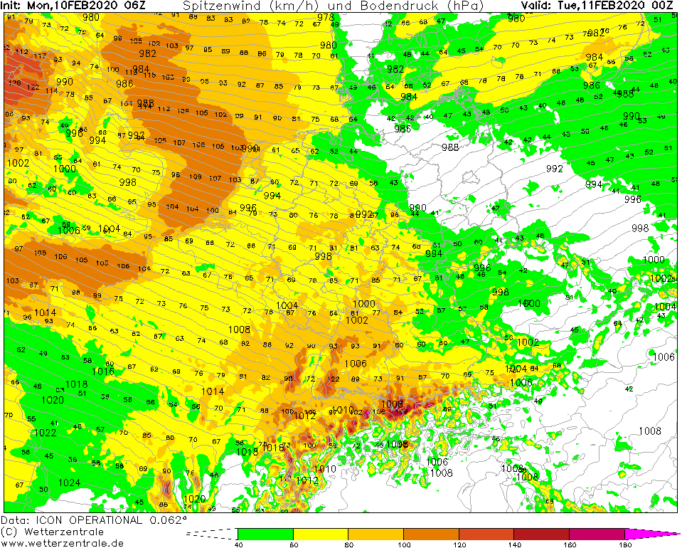
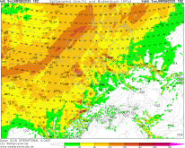
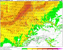
Gusts, 11.02., 00 UTC
Image Credit: Wetterzentrale
|
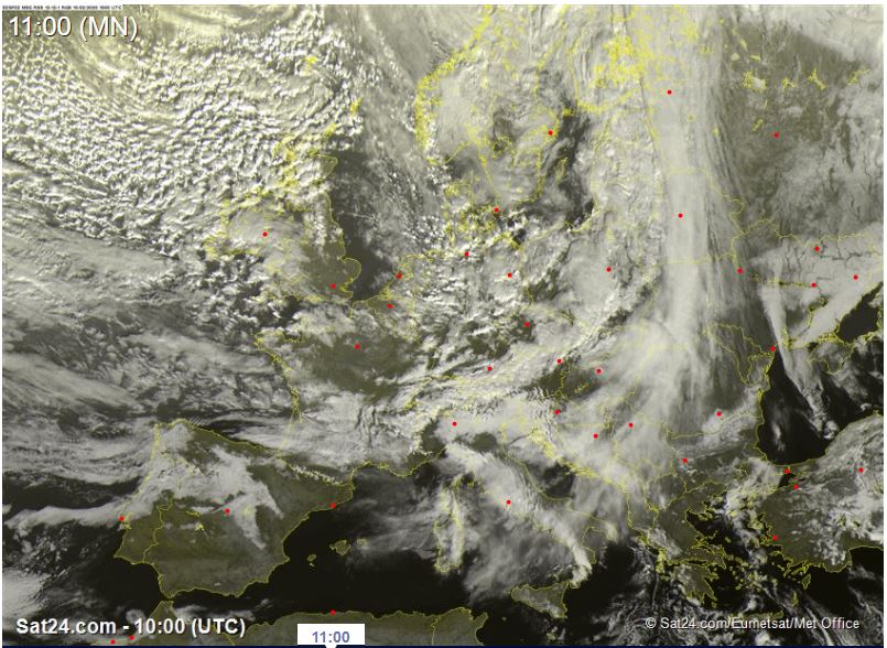
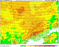
Satellite image (visible), 10.02., 10 UTC
Image Credit: Sat24
|
Winterstorm
Western and Central Europe
Issued: Monday, 10 February 2020, 12:30 CET
Still mean winds of up to 50 kph and gusts up to 100 kph in the mainland. On mountain tops and the North Sea coast up to 130 kph possible.
While the maximum gusts occur in the night to Tuesday, it remains windy until Wednesday.
Feb 09 - Feb 11, 2020
While low pressure are Sabine is shifting northwards on the west coast of Scandinavia, Central Europe is still affected by a strong
horizontal pressure gradient. A so far nameless depression, which forms in the night of Tuesday night between the north of Great Britain
and the south of Norway, intensifies this pressure gradient. This causes an increase in wind speeds during the night of Tuesday. As
in the previous night, the maximum wind speeds do not occur in the north of the country as usual, but in Rhineland-Palatinate, Baden
Württemberg and Bavaria. Wind gusts of up to 100 kph are to be expected. In the Black Forest and in the northern part of the Alps up
to 130 kph are possible. Similar values are reached on the coast of Belgium and the Netherlands.
On Tuesday noon, wind speeds increase in the north of the country. Gusts of up to 100 kph are also possible here. On Tuesday evening
the wind speeds decrease, but it remains windy.
Further restrictions in road and railway traffics are still very likely. The danger of falling trees and flying objects remains.
Saturday, 08 February 2020, 22:30 CET
|
|
|
|
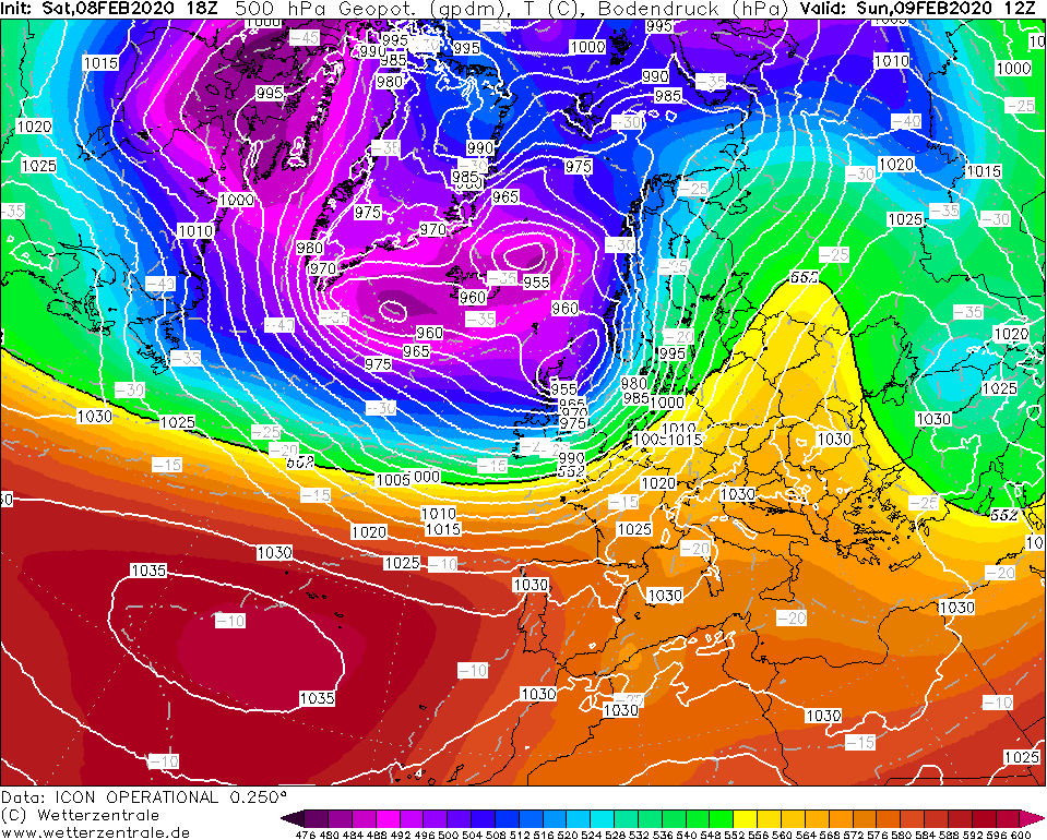
500 hPa Geopotential and
Temperature, 09.02., 12 UTC
Image Credit: Wetterzentrale
|
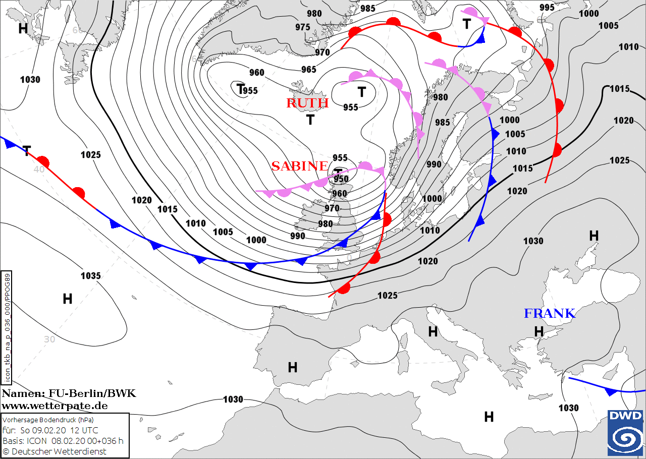
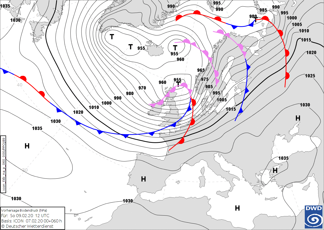
Sea level pressure and fronts, 09.02., 12 UTC
Image Credit: DWD
|
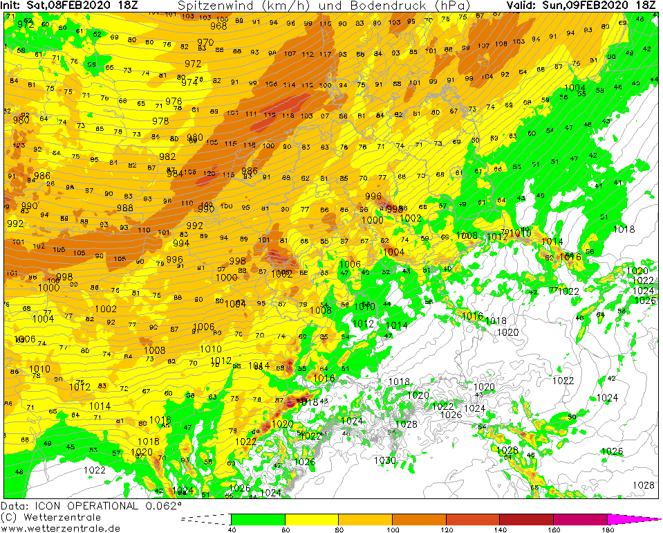
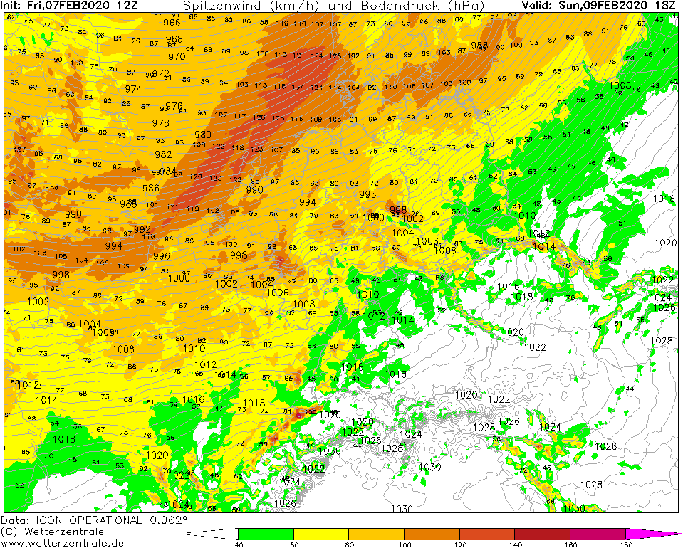
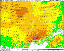
Gusts, 09.02., 18 UTC
Image Credit: Wetterzentrale
|
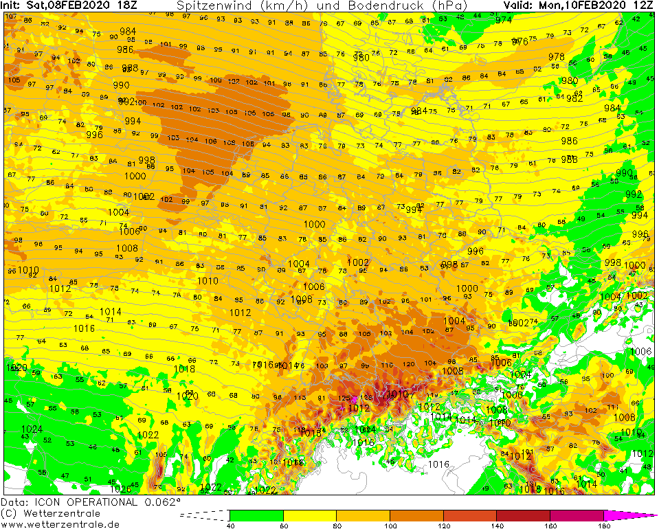
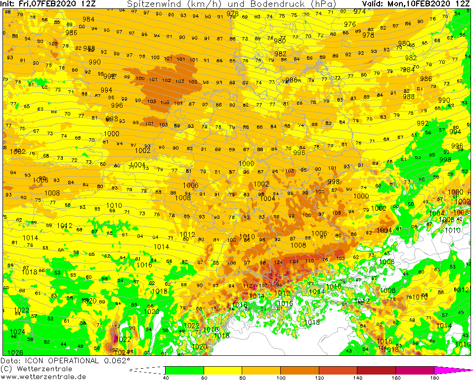
Gusts, 10.02., 12 UTC
Image Credit: Wetterzentrale
|
Winterstorm
Western and Central Europe
Issued: Saturday, 08 February 2020, 22:30 CET
Low pressure area Sabine provides hurricane force gusts up to 150 kph throughout Germany. Maximum wind speeds will arrive on
Sunday morning at the North Sea coast and propagate towards the south east. In Bavaria the winds are expected to peak on Monday morning.
Feb 09 - Feb 11, 2020
On Sunday, stormy winds coming from the northwest spread over Central Europe. In a large area of low pressure
around Iceland, the surrounding depression Sabine with a core pressure of less than 950 hPa forms in the north
of the British Isles. Already on Sunday morning, stormy winds can be expected on the North Sea coast. Hurricane force gusts of up to 150 kph will occur.
The wind field spreads to the southeast in the course of the day. While in central Germany somewhat less strong gusts of up to 110 kph are expected,
hurricane gusts of up to 140 kph will occur in the second half of the night to Monday in Baden Württemberg and Bavaria. In the southeast of Bavaria,
maximum wind speeds are expected to be reached on Monday morning. On German mountain peaks such as the Feldberg or the Brocken, gusts of up to 160
kph are possible. From Monday afternoon on, the winds will weaken, but it will remain stormy throughout Germany until Tuesday with gusts of up to 100 kph.
Restrictions in road and railway traffics are very likely. There is danger of falling trees and flying objects. Roofs may be uncovered.
Friday, 07 February 2020, 22:30 CET
|
|
|
|
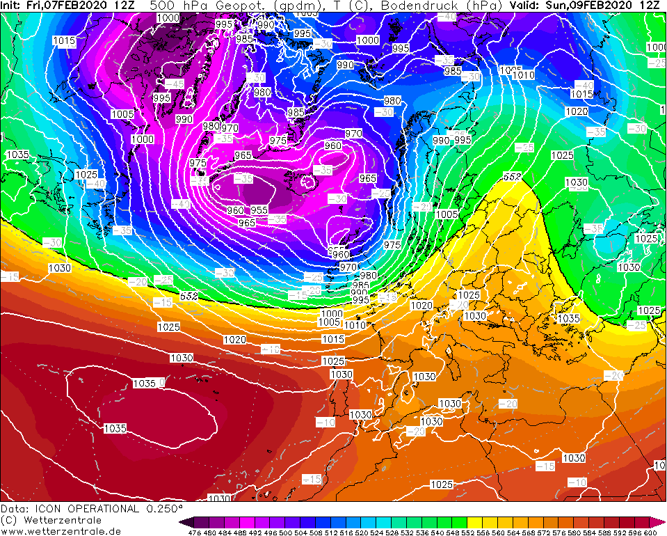
500 hPa Geopotential and
Temperature, 09.02., 12 UTC
Image Credit: Wetterzentrale
|
Sea level pressure and fronts, 09.02., 12 UTC
Image Credit: DWD
|
Gusts, 09.02., 18 UTC
Image Credit: Wetterzentrale
|
Gusts, 10.02., 12 UTC
Image Credit: Wetterzentrale
|
Winterstorm
Western and Central Europe
Issued: Friday, 07 February 2020, 22:30 CET
In a broad area of strong horizontal pressure gradient there are stormy winds and hurricane-like gusts over Central Europe, especially at
the North Sea coast and southern Germany. In the Night to Monday gusts up to 140 kph are possible.
Feb 09 - Feb 11, 2020
A broad trough reaching from Greenland to the east of Scandinavia and an associated low pressure area will lead to
severe winds in Western and Central Europe. With the center located north of the British Islands, the distance to Central Europe is quite large.
High pressure over Italy, the Mediterranean Sea and the Balkan region provide a large-scale area of high horizontal pressure gradient
from sunday evening until Tuesday.
Mean wind speeds of up to 80 kph may occur on the North Sea coast, especially in the Netherlands. Gusts up to 140 kph have to be taken into account.
While the mean wind speeds in general are lower in the midland, the highest gusts occur in southern Germany due to a wave disturbance over Central Germany.
On Mountain tops like Feldberg gusts up to 165 kph are possible. With the formation of a sorrounding low pressure area - which is difficult to predict - gusts up to 140 kph are possible even in the lowlands.
In addition to storm and flood damage in the coastal areas of the North Sea, the storm poses a particular danger from swirling objects and falling trees or electricity poles.
Restriction in road and railway traffic are very likely.
Issued: February 07, 2019, 22:30 CET
FS
Issued: February 08, 2019, 22:30 CET
FS
Issued: February 10, 2019, 12:30 CET
FS
|