Monday, 09 December 2019, 19:30 CET

|
|

|
|
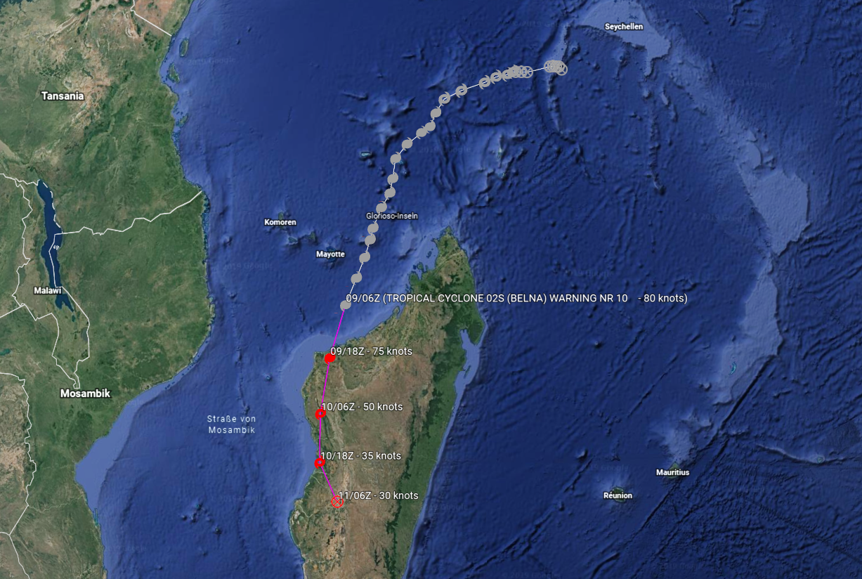
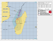
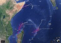
BELNAs trajectory, 09.12., 06 UTC
Image Credit: JWTC and
Google Earth
|
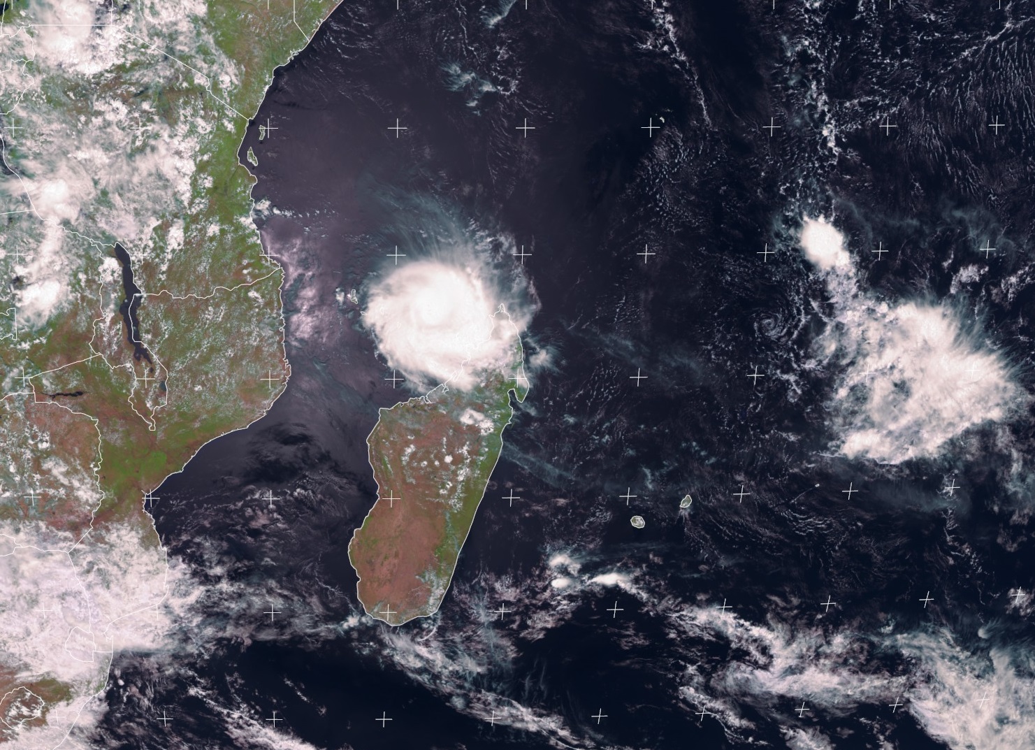
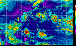
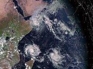
Satellite image, 09.12., 12 UTC
Image Credit: EUMETSAT
|
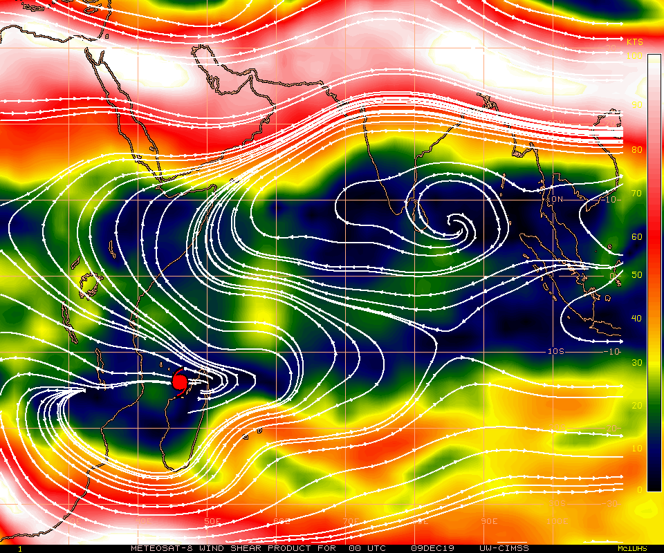
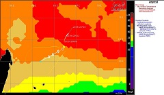
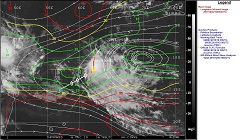
Vertical wind shear, 09.12., 00 UTC
Image Credit: CIMSS
|
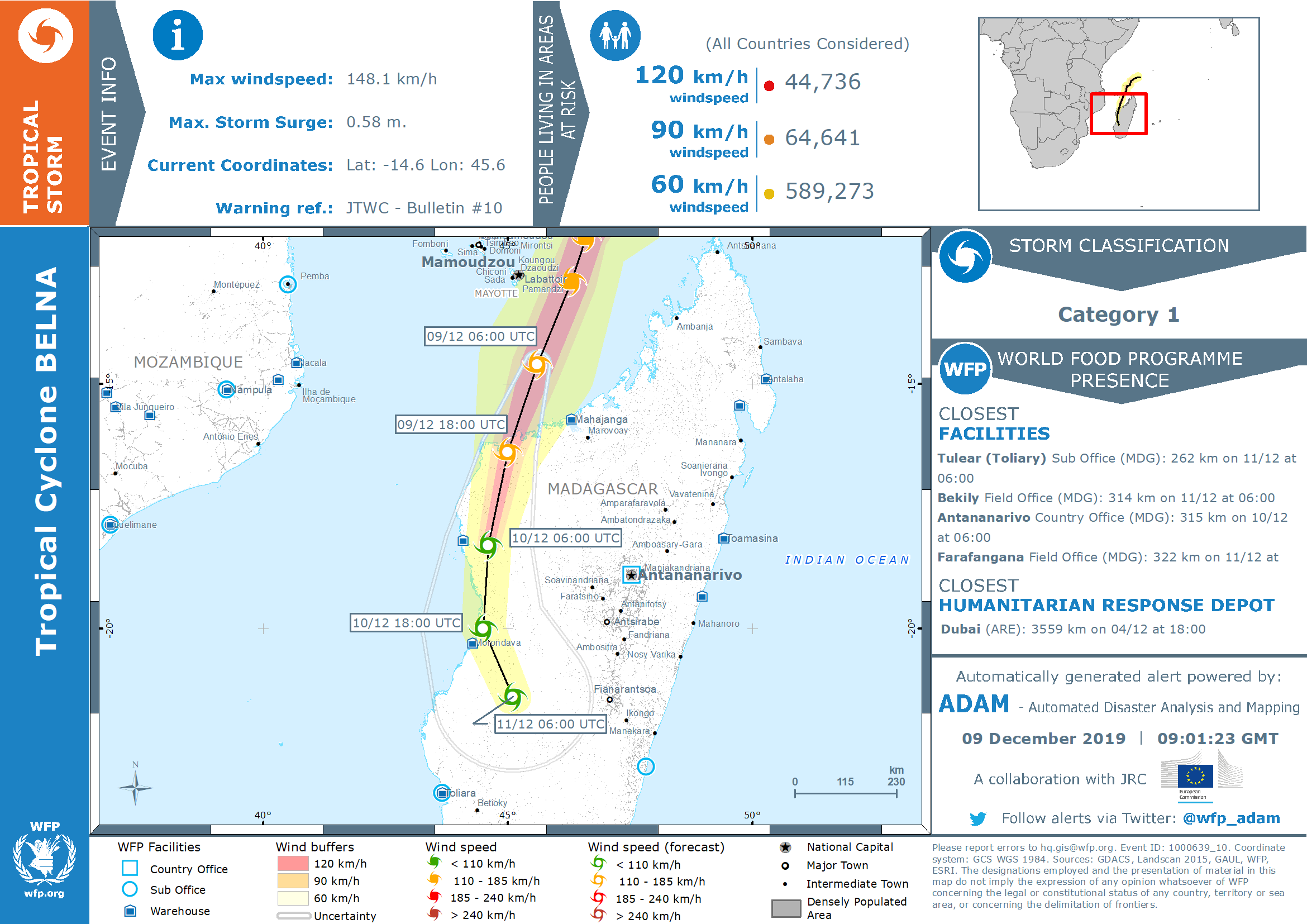
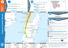
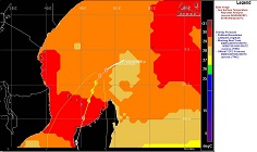
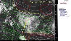
Event overview,
Image Credit: GDACS
|
Tropical Cyclones
Indian Ocean
Issued: Monday, 09 December 2019, 19:30 CET
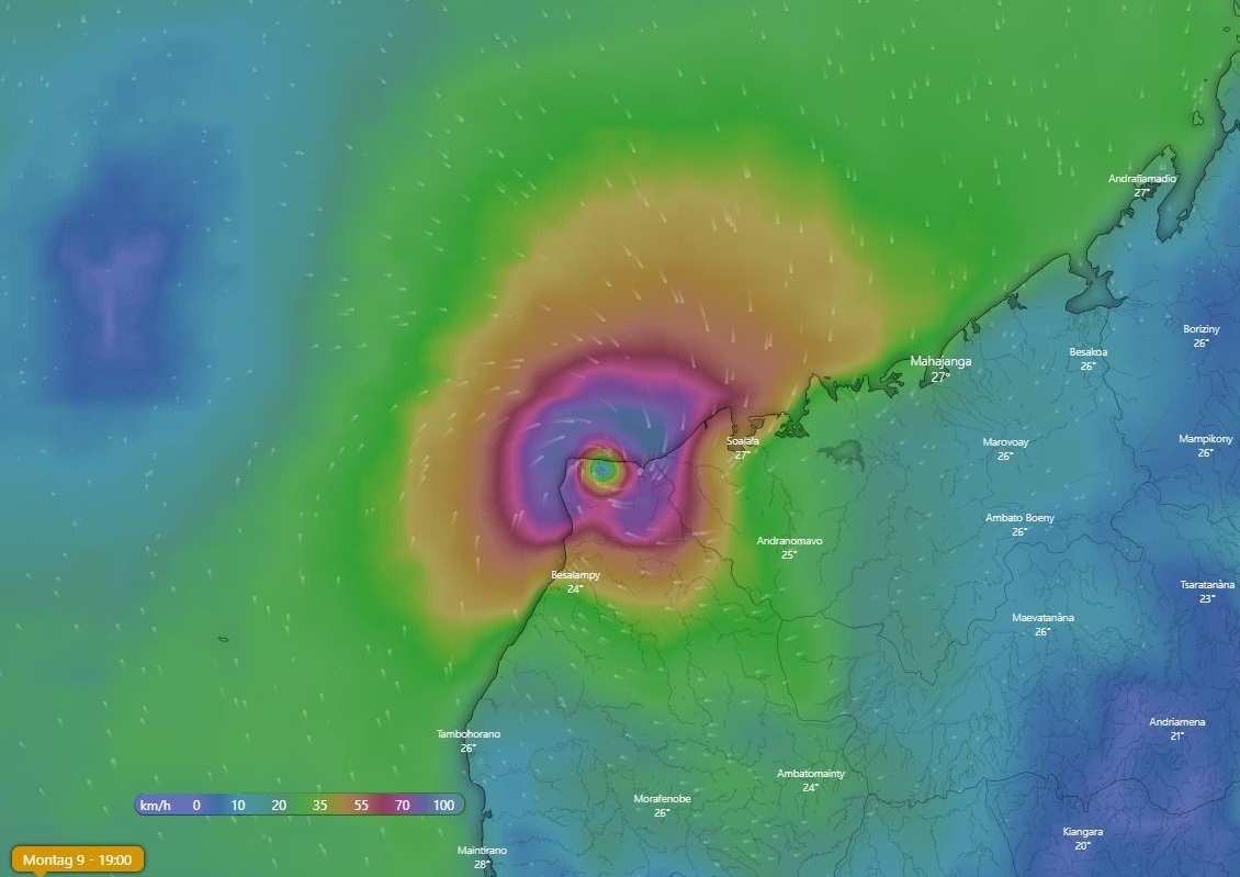
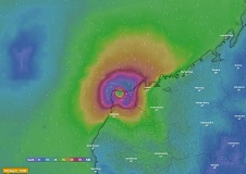
Tropical Cyclone BELNA still provides mean winds up to 150 kph and gusts up to 185 kph. The system has made
landfall on todays Monday afternoon between Soalala and Soanenga in area with very little but not negligible habitation.
Up to 250 mm/48h possible.
06.-10.12 2019
Tropical Cyclone BELNA has made landfall in northwestern Madagascar on todays Monday evening as Category 2 Cyclone.
BELNA has weakened to an upped end Category 1 tropical storm. The displacement speed of the system is almost constant
around approx. 18 kph in southwest direction. Until Tuesday evening BELNA will weaken only slightly and will remain at
least a category 1 cyclone. Due to increasing wind shear in the south of Madagascar and the continuing influence of
friction, the storm will weaken rapidly from Wednesday onwards.
The northwest of Madagascar is a rather densely populated region without major cities. Nevertheless, more than 60,000
people are exposed to stormy winds, almost 45,000 people even hurricane like winds. In addition to the risk of storm
damage, the northwest coast of Madagascar is also at considerable risk of storm surges and flooding.
Sunday, 08 December 2019, 13:00 CET
|

|
|
|
BELNAs trajectory, 08.12., 06 UTC
Image Credit: JWTC
|
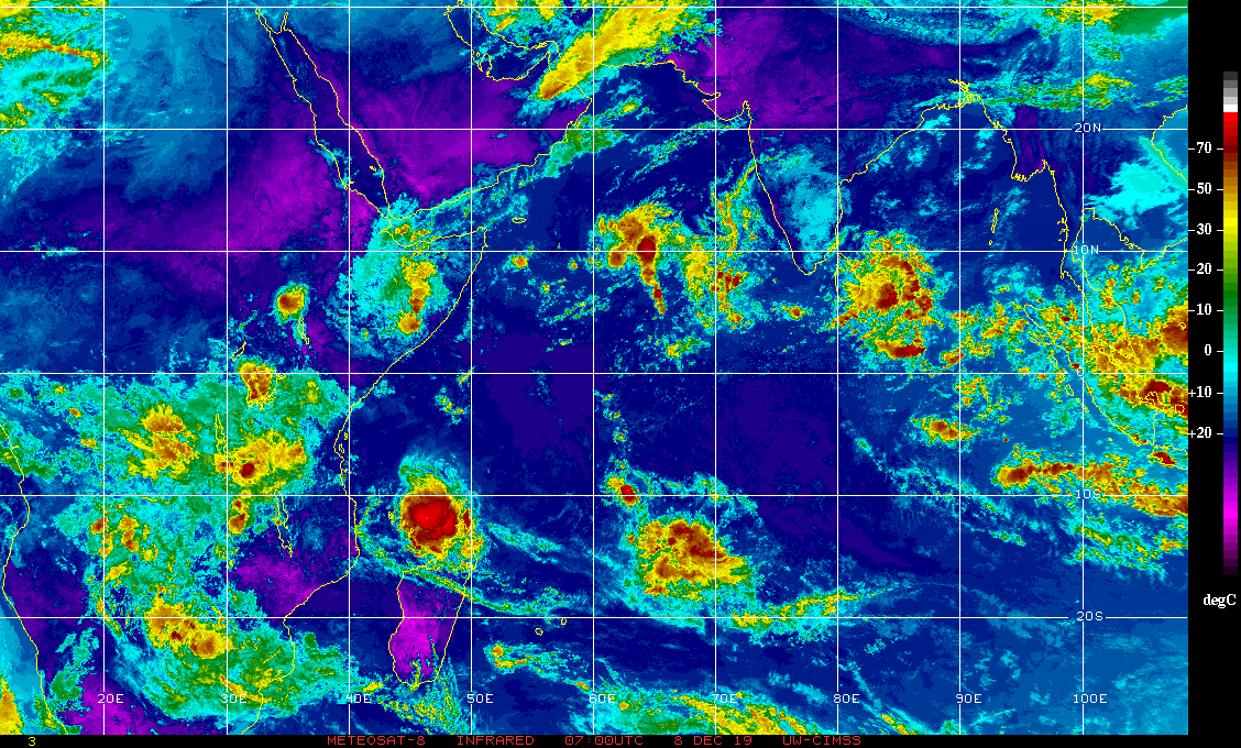
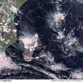
Satellite image (visible), 08.12., 09 UTC
Image Credit: EUMETSAT
|
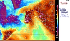
Cloud top temperatures, 08.12., 07 UTC
Image Credit: CIMSS
|
Mean wind speed, 09.12., 18 UTC
Image Credit: Windy
|
Tropical Cyclones
Indian Ocean
Issued: Sunday, 06 December 2019, 13:00 CET
Tropical Storm PAWAN has made landfall in norhern Somalia with very low wind speeds. AMBALI has decreased as expected after
its very short but record breaking intensification. BELNA has strengtened to Category 2 and is likely to increase to Category 3
before making landfall in northwestern Madagascar on Monday evening.
06.-10.12 2019
Category 2 Cyclone BELNA is currently located about 300 km west of Antsiranana, the capital of Madagascar's northernmost region, Diana.
With a displacement speed of 15 kph, the system moves in a south-southwestern direction. The current maximum sustained winds are 165 kph.
Due to still low vertical wind shear (approx. 25 kph difference between 200 and 850 hPa) and high water temperatures in the Strait of
Mozambique, an intensification to Category 3 be expected.
BELNA will reach peak intensity on todays Sunday evening with sustained winds of 205 kph and gusts of up to 250 kph. The proximity to
the northwest coast of Madagascar leads to increasing friction, which will prevent further intensification from tomorrow, 09 December.
The landfall is expected on 09 December at about 16 UTC. BELNA is expected to be an upper category 2 cyclone at this time.
Due to the clockwise rotation, the highest wind speeds occur in the eastern quadrants of the storm.
Furthermore, waves up to 8 m height are possible. Precipitation can reach values upo to 300 mm/48h.
Multiple estuaries like the Bay of Bombeteka are threatened to be flooded by precipitation or storm surge.
Friday, 06 December 2019, 20:00 CET
|

|
|
|
PAWANs, BELNAs, AMBALIs trajectory
Image Credit: JWTC and
Google Earth
|
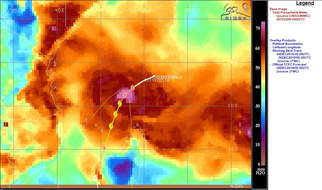
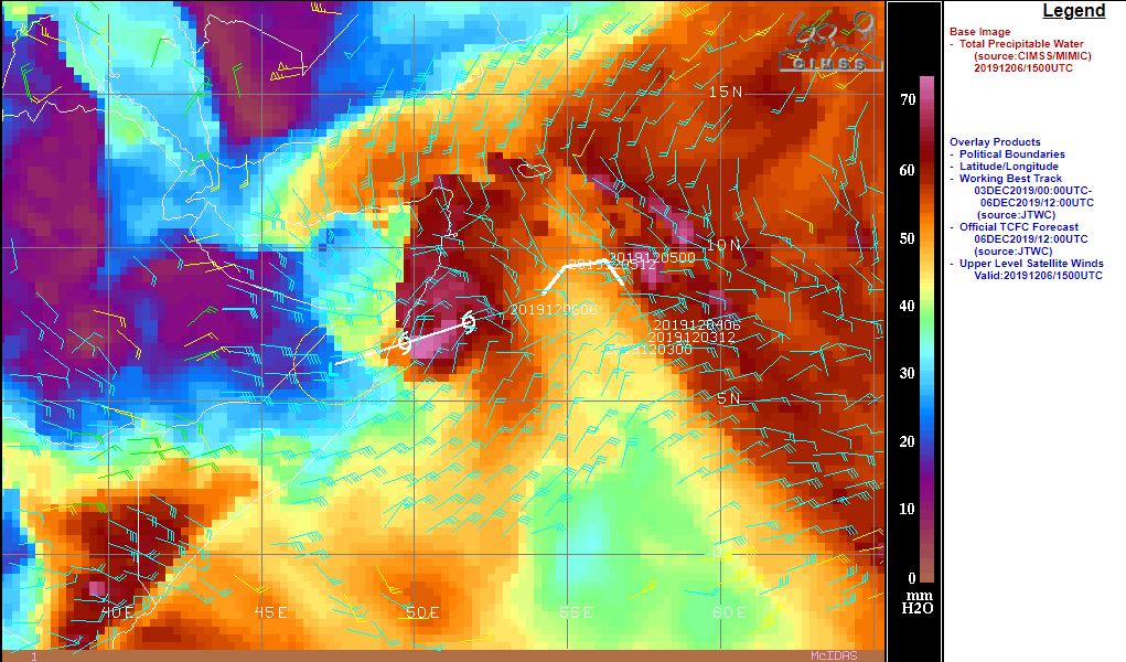
Total precipitable water around BELNA, 06.12.
Image Credit: CIMSS
|
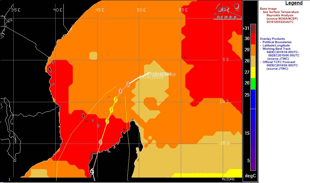
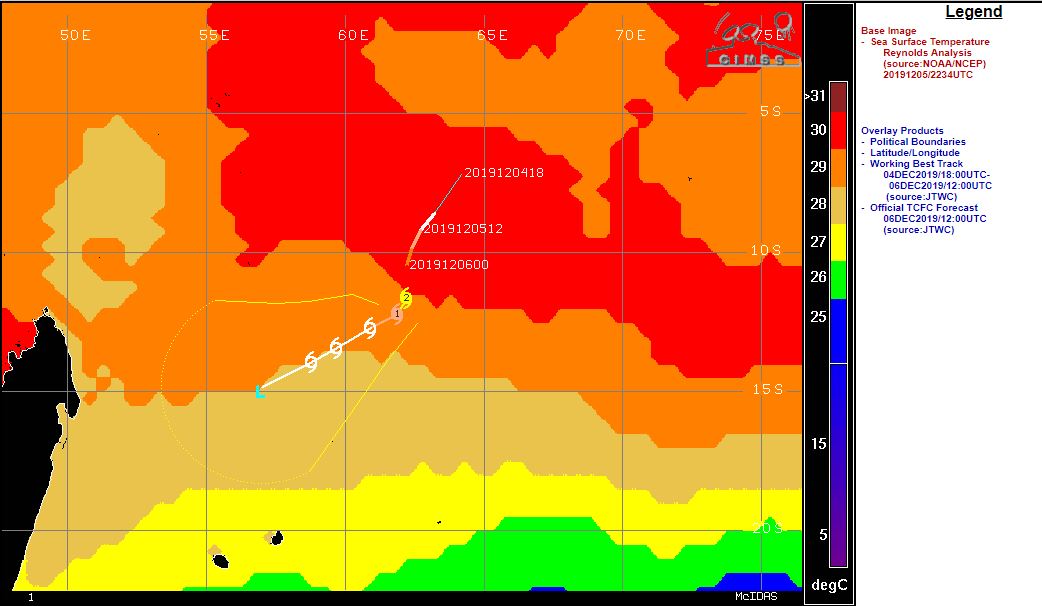
Sea surface temperature around BELNA, 06.12.
Image Credit: CIMSS
|
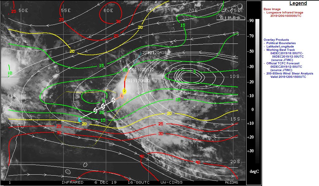
Vertical wind shear around BELNA, 06.12.
Image Credit: CIMSS
|
|
|
|
|
Satellite image (visible), 06.12., 12 UTC
Image Credit: EUMETSAT
|
Total prec. water and 300 hPa wind (PAWAN), 06.12.
Image Credit: CIMSS
|
Sea surface temperature around AMBALI, 06.12.
Image Credit: CIMSS
|
Vertical wind shear around AMBALI, 06.12.
Image Credit: CIMSS
|
Tropical Cyclones
Indian Ocean
Issued: Friday, 06 December 2019, 20:00 CET
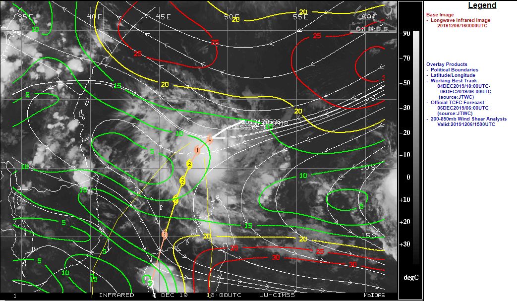
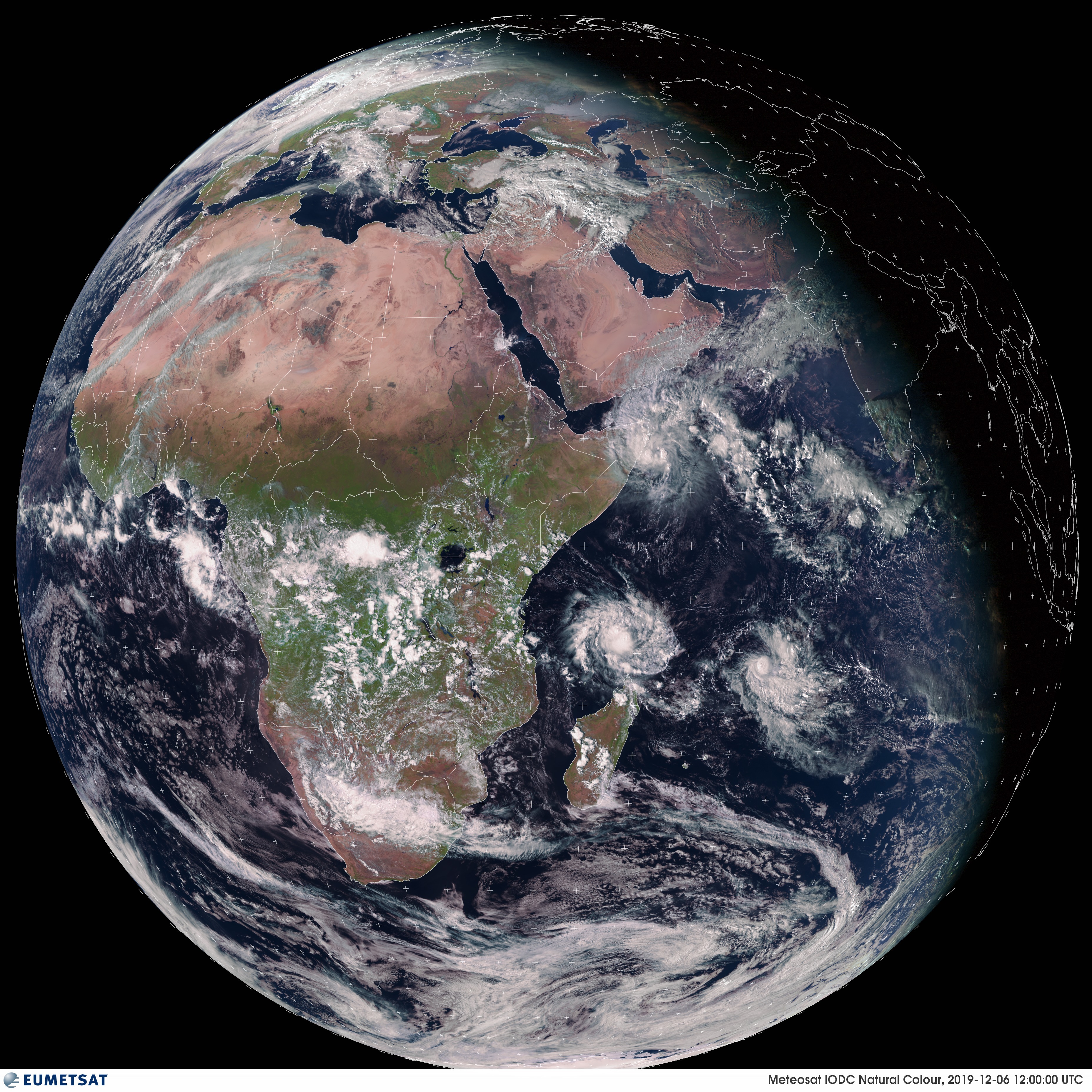
Three named system in the Indian Ocean. PAWAN is heading towards Somalia as a tropical storm. AMBALI sets a new
southern hemisphere-record for the most rapid intensification in 24 hours. BELNA approaches Madagascar as Category 2 Cyclone.
06.-10.12 2019
The Indian Ocean currently has three named tropical systems. On the northern hemisphere, tropical storm
PAWAN is heading towards Somalia with a displacement velocity of 18 kph. The landfall of the system is
expected on 07 December at about 03 am. By the introduction of dry air from the Somali desert, the tropical
storm weakens and will have wind speeds of up to 60 kph only. Nevertheless, rainfall of up to 50 mm/24h
can fall on the coast of Somalia, even in desterted areas.
BELNA and AMBALI are located on the southern hemisphere. The maximum sustained winds of AMBALI have intensified
by 180 kph in the past 24 hours, which sets a new record on the southern hemisphere for the most rapid
intensification within 24 hours. The system evolved from a tropical depression to the first Cyclone with major
hurricane strength of the 2019-2020 Southern Hemisphere season. The tropical cyclone moves with a displacement
speed of 11 kph in a southwesterly direction. There it encounters an area of colder sea surface temperatures
(below 28°C) and strong vertical wind shear (marked with red isolines in the wind shear graph). According to current
forecasts, AMBALI will rapidly weaken again
without ever having an effect on inhabited areas.
The second system on the southern hemisphere, BELNA, is currently a Category 1 Cyclone. The storm moves southwest
with 12 kph and approaches Madagascar. On its tracetory, BELNA transits high sea surface temperatures of more than 30°C
and an area of low vertical wind shear (marked with green isolines in the wind shear graph). According to current forecasts,
the storm will have become a Category 2 cyclone by 08 December with wind speeds of up to 170 kph and gusts of up to 205 kph.
On 09 December, a landfall as Category 1 Cyclone is possible in northwestern Madagascar, an area vulnerable to storm surges
and flooding due to many river estuaries and neighbouring mountains.
In addition to the three named storms there is an Invest Area called 92A / 92B with strong but unorganized convection on the
northern hemisphere. The formation of a tropical storm or even tropical cyclone is possible in the coming days. The system is
expected to follow a trajectory similar to tropical storm PAWAN. In this case, an intensification would be unlikely, as the
sea surface temperature in these area is already below 28°C due to upwelling caused by PAWAN.
Issued: December 06, 2019, 20:00 CET
FS
Issued: December 08, 2019, 13:00 CET
FS
Issued: December 09, 2019, 19:30 CET
FS
|