Saturday 29 June 2019, 09:30 CET
Heat wave
Germany, France, Benelux
Issued: Saturday, 29 June 2019, 09:30 CET
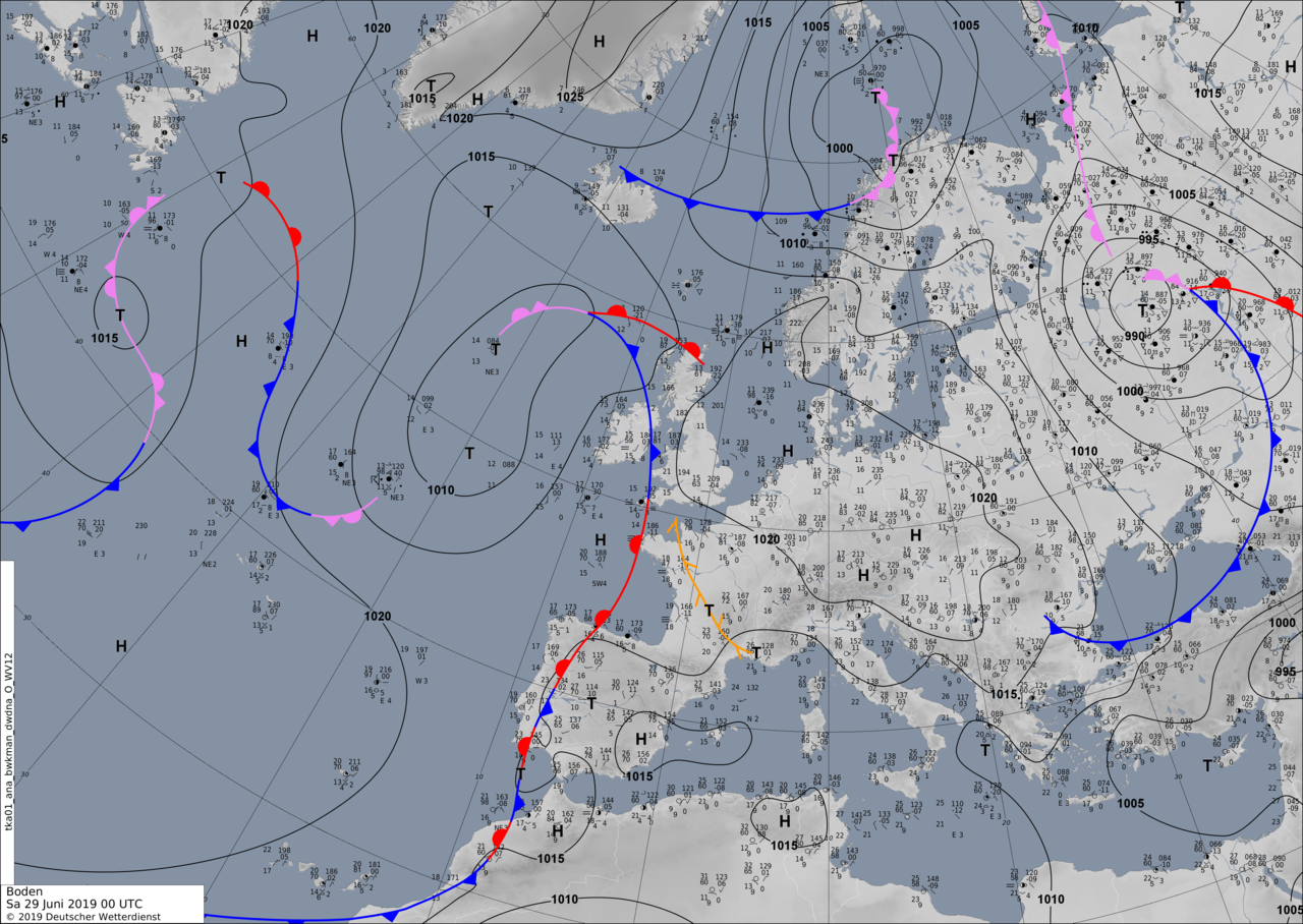
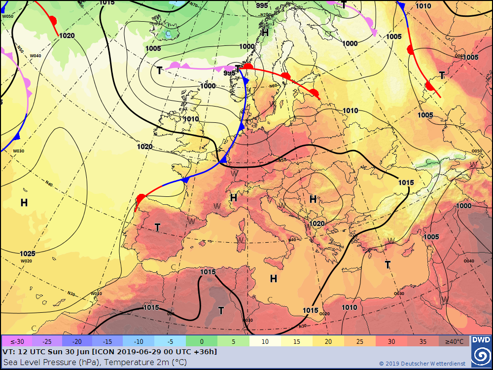
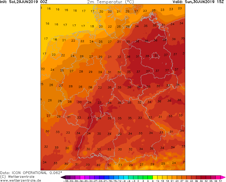
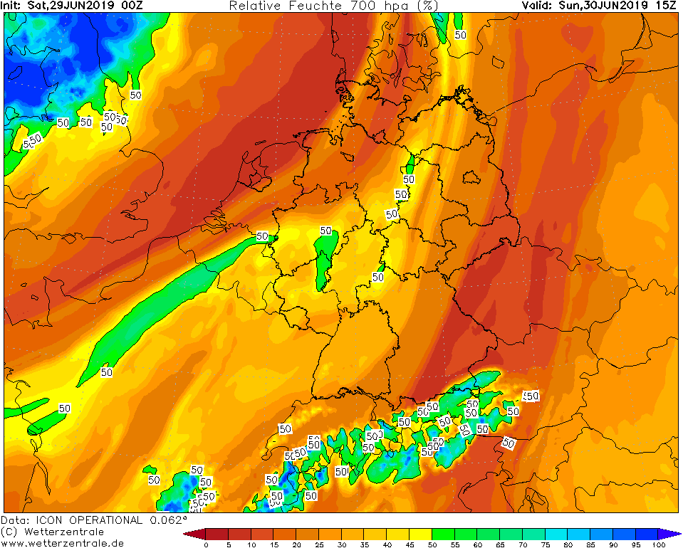
In many parts of Central and Southern Europe there is another peak of the existing heat wave this weekend. This will be on Sunday 30 June. Also in Germany the
temperatures will rise to 39�C. The Rhine valley and the northeast are particularly affected again.
24-30 June 2019
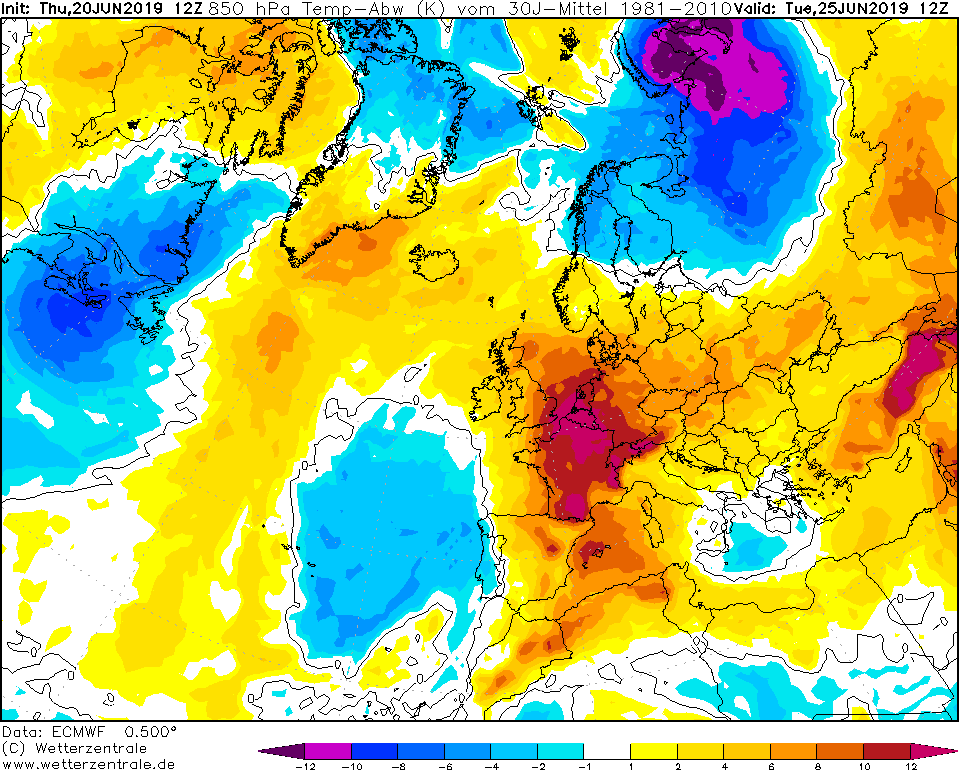
The heat and also the drought have Central and Southern Europe firmly under control at the moment. It was only last Wednesday that the temperature
rose to over 35�C in Germany and even over 40�C in France. Tomorrow, Sunday, the second peak of the heat wave is expected. In Germany the temperatures
rise again around 39�C, possible would be also 40�C due to the warm air advection from the south and the high solar irradiation. The reason for the warm
air advection from southern Europe is a pronounced high pressure area coupled to a ridge.
In France, temperatures around 40�C are also expected again.
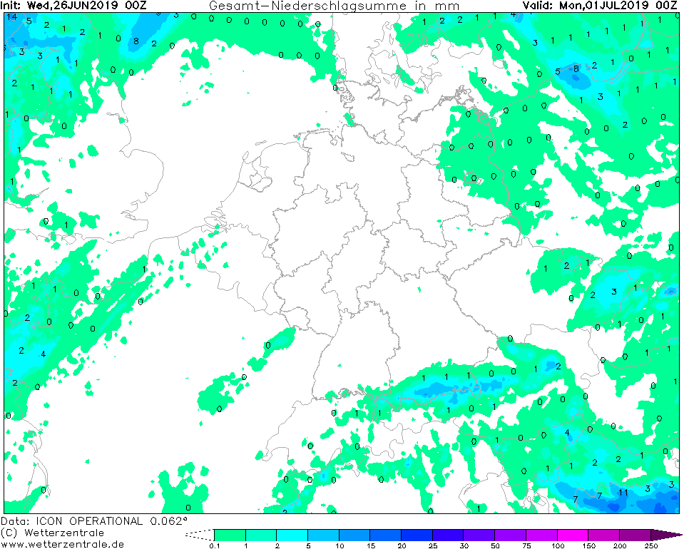
In addition to the risks to human health, there is also an increased threat of forest fires. The lack of precipitation until at least the
beginning of next week will further increase this danger.
However, the nights on weekends will be much cooler since the air mass is drier than that of Wednesday and Thursday. Locally the temperature can
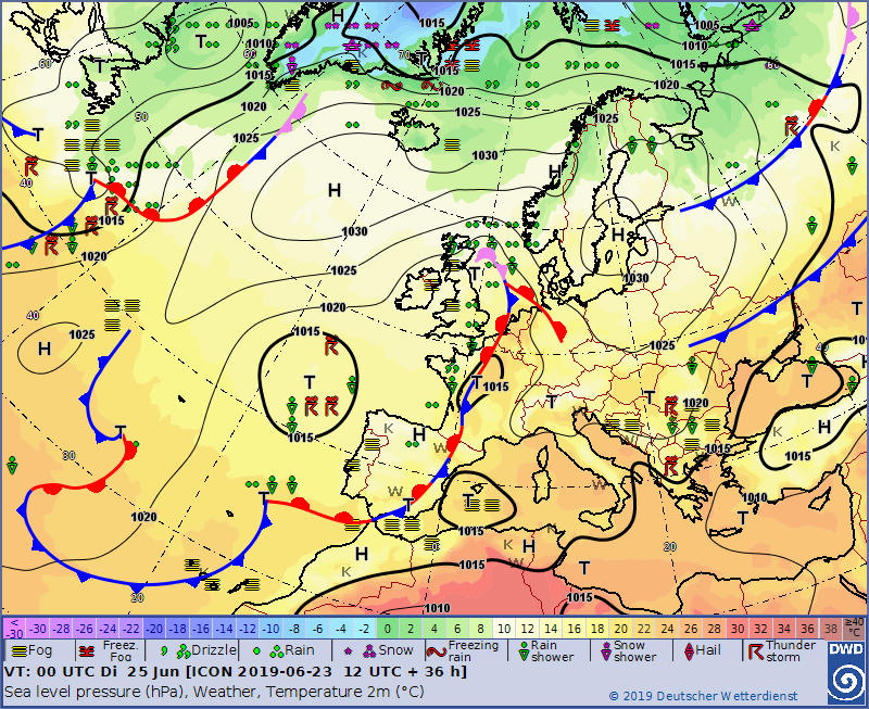
sink to single-digit values. The heat will remain until Monday, when a trough will bring cooler air and precipitation to Germany.
Wednesday 26 June 2019, 10:00 CET
Heat wave
Germany, France, Benelux
Issued: Wednesday, 26 June 2019, 10:00 CET
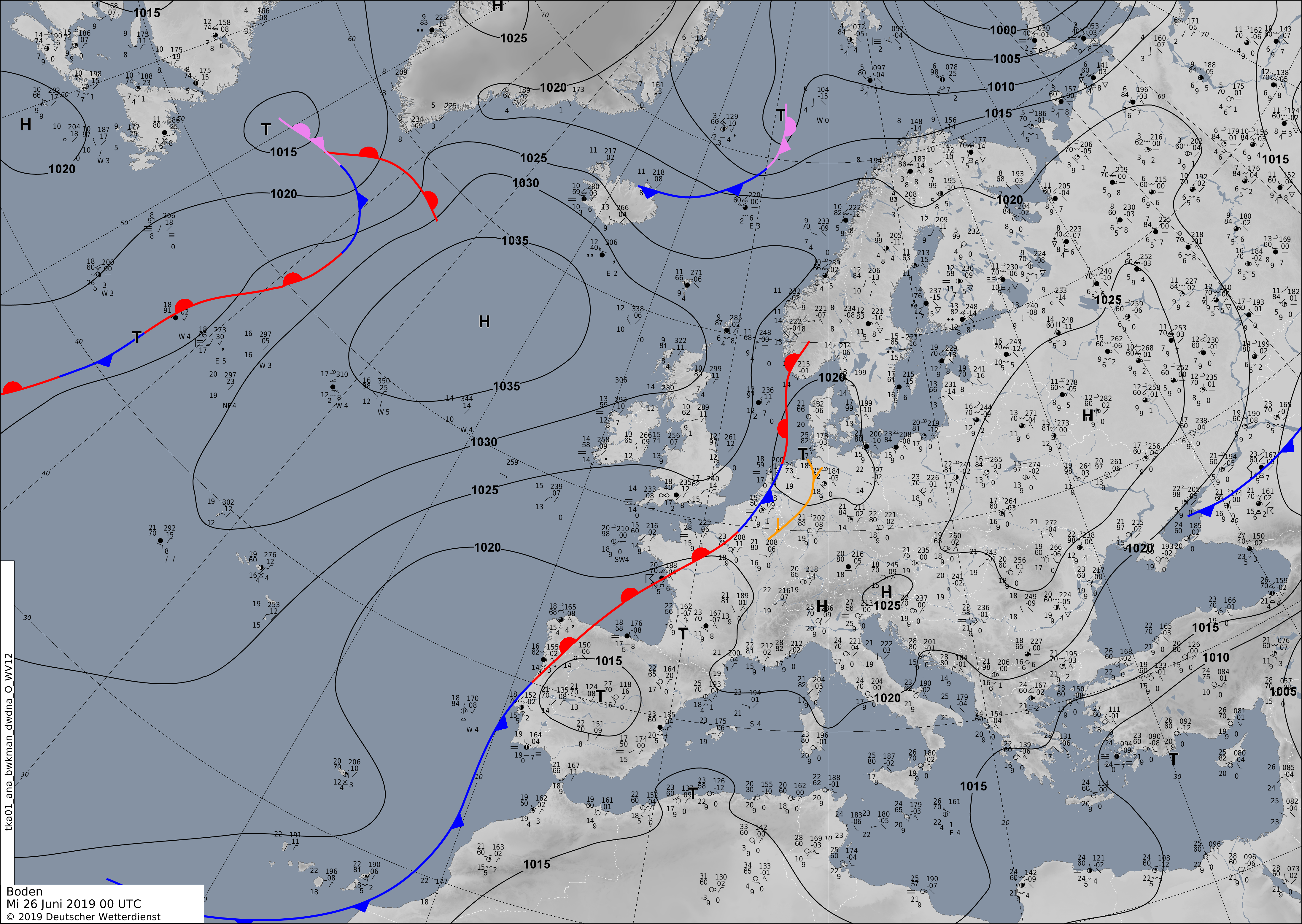
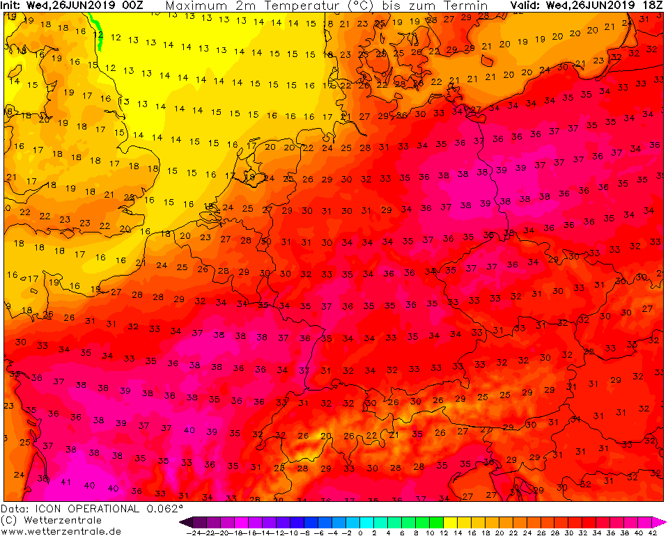
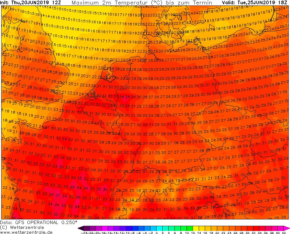
In many parts of Central Europe, the heat wave peaks on today's Wednesday. In Germany up to 39°C are possible. Hot Spots are the Rhine Valley and Brandenburg.
In France even up to 42°C may occur.
24-30 June 2019
Today, Wednesday, in many places, is the hottest day of the year so far. The night from Tuesday to Wednesday remained very warm in many locations
with temperatures above 20°C due to slight cirrus formation on the previous evening. The solar radiation, which is almost maximum due to the seasonal
conditions, today provides temperatures of up to 39°C in Germany. Temperatures will be the highest in the Rhine Valley and in Brandenburg.
In addition to the risks to human health, there is also an increased threat of forest fires. The lack of precipitation until at least the
beginning of next week will further increase this danger.
On Thursday, a weakly pronounced trough over Scandinavia brings some cold air to Central Europe. The maximum temperatures of the day remain high,
but due to the lower humidity the air is cooled down to well below 20°C in the following nights, locally even below 10°C.
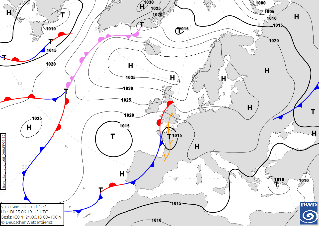
Monday 24 June 2019, 17:00 CET
Heat wave
Germany, France, Benelux
Issued: Monday, 24 June 2019, 17:00 CET
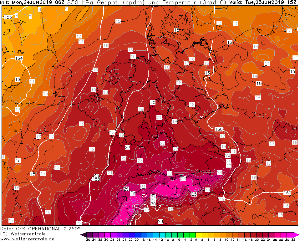
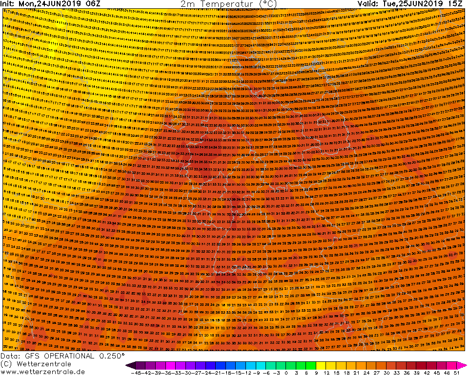
Next week, a cout off low directs very warm air from the south towards Central Europe. Up to 35°C possible on Tuesday and 39°C on Wednesday.
24-30 June 2019
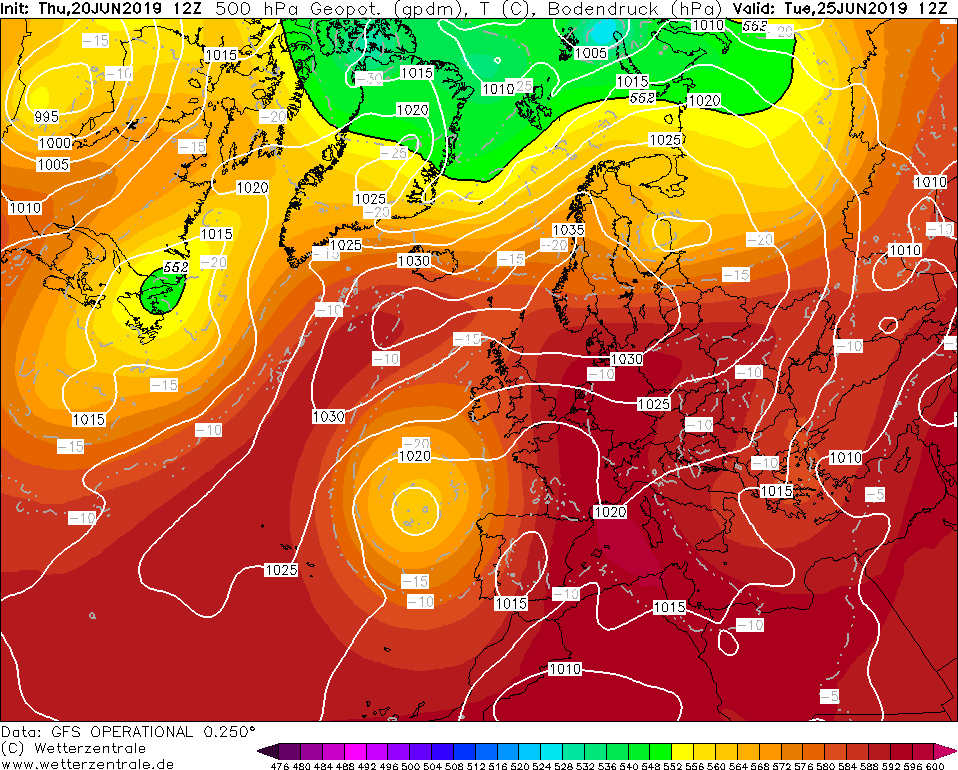
The Azores high will be displaced to Central Europe this week and by the interaction with a cutoff low over
the Atlantic Ocean and thus very hot air from the Sahara will be advected to Central Europe.
Already on todays Tuesday, temperatures above 30°C were registered, as in Mannheim with 31°C. With the heat and
especially the drought the danger of forest fires increases, especially in the northeast. Drought has prevailed
there since 2018.
The heat wave is expected to peak in the middle of the week. On Wednesday, it is very likely that the
temperatures will rise to 37°C, within cities also over 37°C. At the end of the week and on weekends the
temperatures will drop to about 30°C again. The air mass will change, humid air is displaced by a dry air mass.
The highest temperatures are generally expected in the east of Germany and in the Upper Rhine Plain (North BW).
Due to the very dry air, the risk of heat thunderstorms is very low.
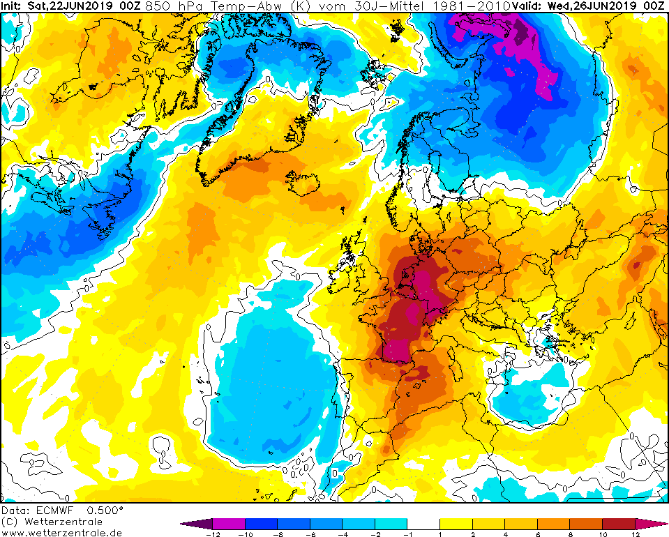
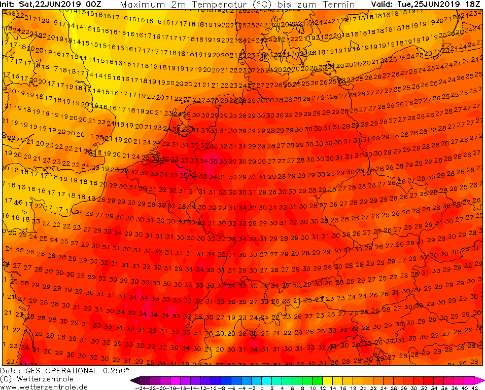
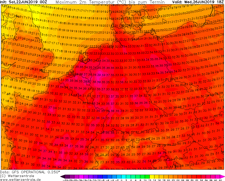
Saturday 22 June 2019, 09:30 CET
Heat wave
Germany, France, Benelux
Issued: Saturday, 22 June 2019, 09:30 CET
Next week, a cut off low directs very warm air from the south towards Central Europe. Up to 35°C possible on Tuesday and 39°C on Wednesday.
24-30 June 2019
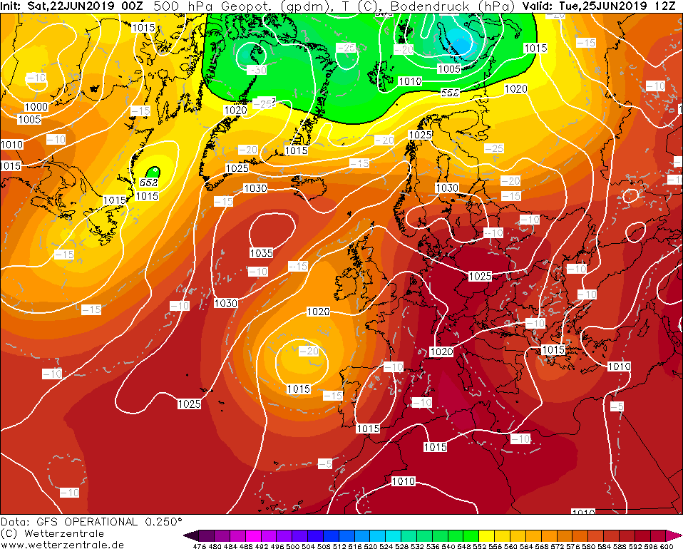
At the weekend the typical Azores high is displaced by a cut off low pressure area. The low pressure area is positioning itself
during the next week about 1000 km west-northwest of the Azores. At the front-side, very warm air is directed from the Iberian
peninsula and Africa to Central Europe.
Already on Tuesday in the west of Germany up to 35°C are possible. On Wednesday the temperature can rise up to 39°C at the
same place. Also in the Rhine Valley and in the northeast of the country more than 35°C are to be expected.
It is likely that the heat wave will intensify at the end of the week. Then up to 42°C are predicted. The current heat
record for Germany is 40.3°C (Kitzingen, Bavaria).
Friday 21 June 2019, 10:30 CET
Heat wave
Germany, France, Benelux
Issued: Friday, 21 June 2019, 10:30 CET
In the course of the next week very warm air from the Iberian peninsula and Africa reaches Central Europe.
Temperatures of up to 35°C are possible in Germany and France, locally up to 40°C.
24-30 June 2019
At the weekend, the Azores High (ULLA) is extending in a northeasterly direction. Thereby very warm air reaches Central Europe
with temperatures up to 25°C in 850 hPa. A cut-off low pressure area positions itself approximately 1000 km
northeastern of the Azores and continues to steer warm air masses from the Iberian Peninsula and even
Africa to Central Europe.
At the beginning of the week (Monday and Tuesday) up to 35°C are expected in Germany and up to 38°C in France. It is likely
that the heat wave will intensify during the week. At the end of the week up to 38°C in Germany and 40°C in France may occur.
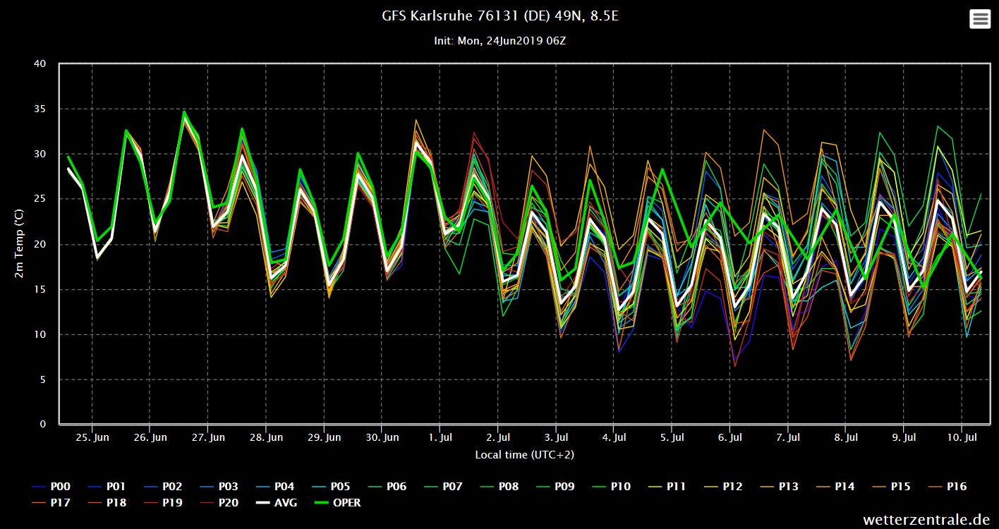
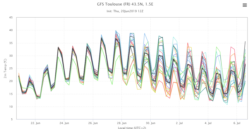
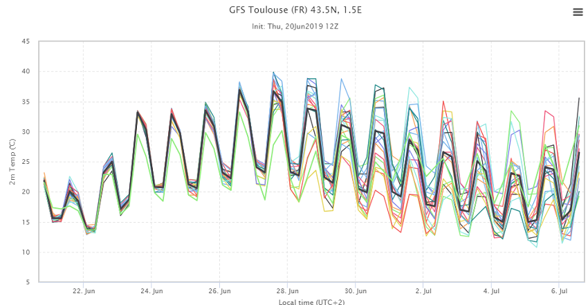
|
2m temperature (ensemble) for Toulouse (FR), ensemble forecast |
Source:
Wetterzentrale
|
 |
Issued: June 21, 2019, 10:30 CET
FS
Issued: June 22, 2019, 09:30 CET
FS
Issued: June 24, 2019, 17:00 CET
CL&MG
Issued: June 26, 2019, 10:00 CET
FS
Issued: June 29, 2019, 09:30 CET
MG
|