Wednesday, 13 March 2019, 16:15 CET

|
|
|
|
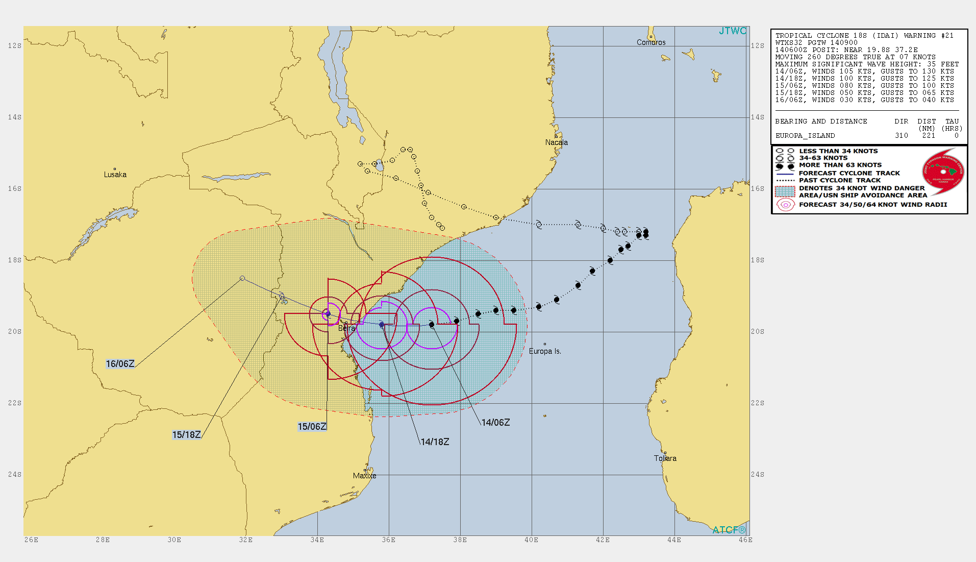
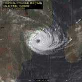
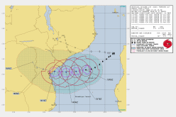
Track cyclone IDAI, 14.03., 06 UTC
Image Credit: JTWC
|
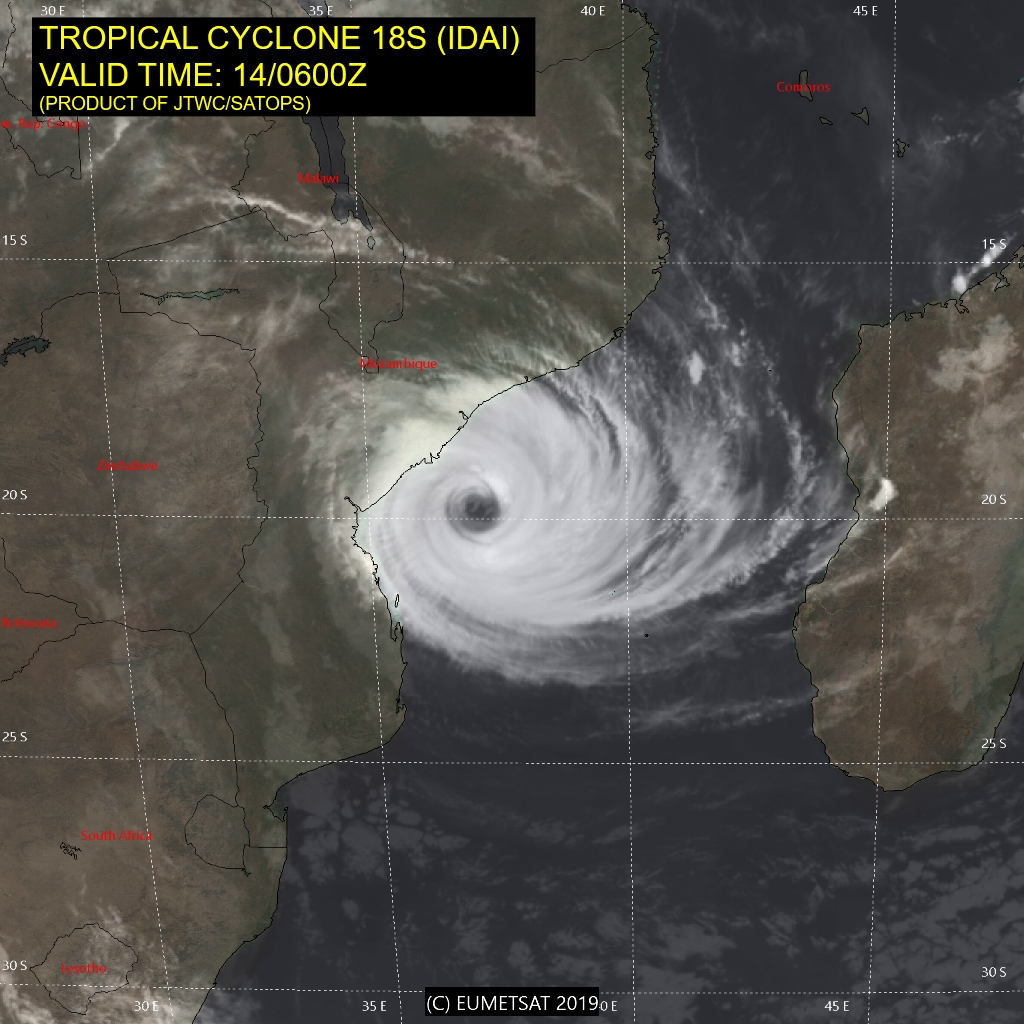
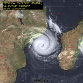
Satellite image, 14.03., 06 UTC
Image Credit: JTWC
|
Water temperature, 12.03., 00 UTC
Image Credit: Wetterzentrale
|
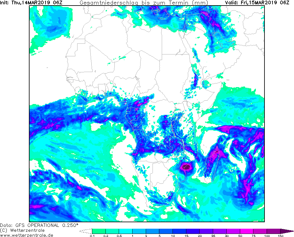
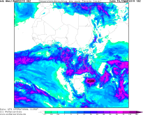
24 h precipitation, 15.03., 06 UTC
Image Credit: Wetterzentrale
|
Tropical cyclone IDAI - Warning
Mozambique
Issued: Wednesday, 13 March 2019, 16:15 CET
Tropical storm IDAI (actual cyclone category 3) arrives today (Thursday) on the coast of Mozambique. In Beira already mean winds of 50 kph have been registered.
13-14 March 2019
Tropical cyclone IDAI is located about 250 km east of Beira at Thursday at 06 UTC. It moves west at a speed of 13 kph and is expected to make landfall 20 km north of Beira.
The core pressure is about 960 hPa.
With maximum mean winds of 195 kph and gusts of up to 240 kph, IDAI belongs to category 3. During landfall, the radius of 64 kt (118 kph) winds is about 40 km.
For Beira, average wind speeds of more than 120 kph and gusts of more than 160 kph are expected. Also for the cities Dondo and Mafambisse gusts of more than 140 kph are expected.
Due to higher friction on land the wind speeds decrease rapidly. Already 12 hours after landfall the maximum mean wind speeds are only 80 kph with gusts up to 100 kph.
Due to the high amount of water collected, IDAI generates abundant precipitation in its area of influence. Locally, precipitation intensities of more than 50 mm/3h are possible.
More than 150 mm rain may fall in 24 hours. This can lead to flooding and landslides.
Wednesday, 13 March 2019, 16:15 CET
|
|
|
|
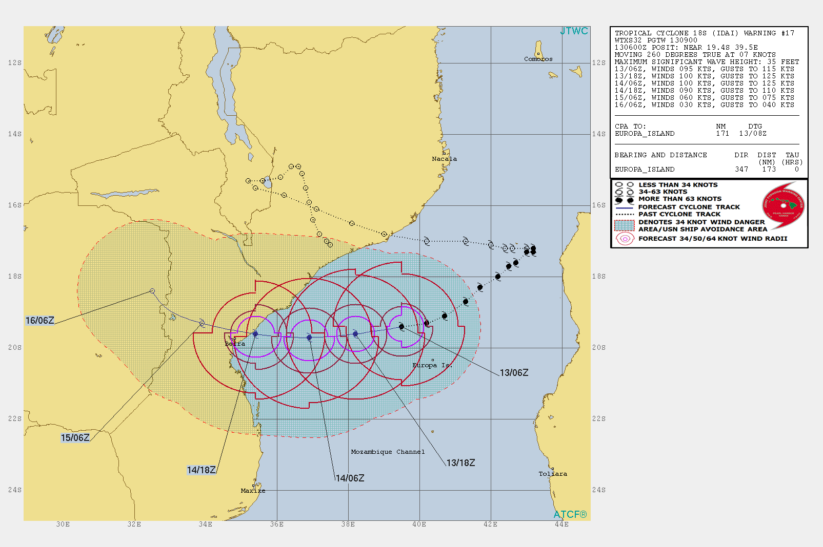
Track cyclone IDAI, 13.03., 12 UTC
Image Credit: JTWC
|
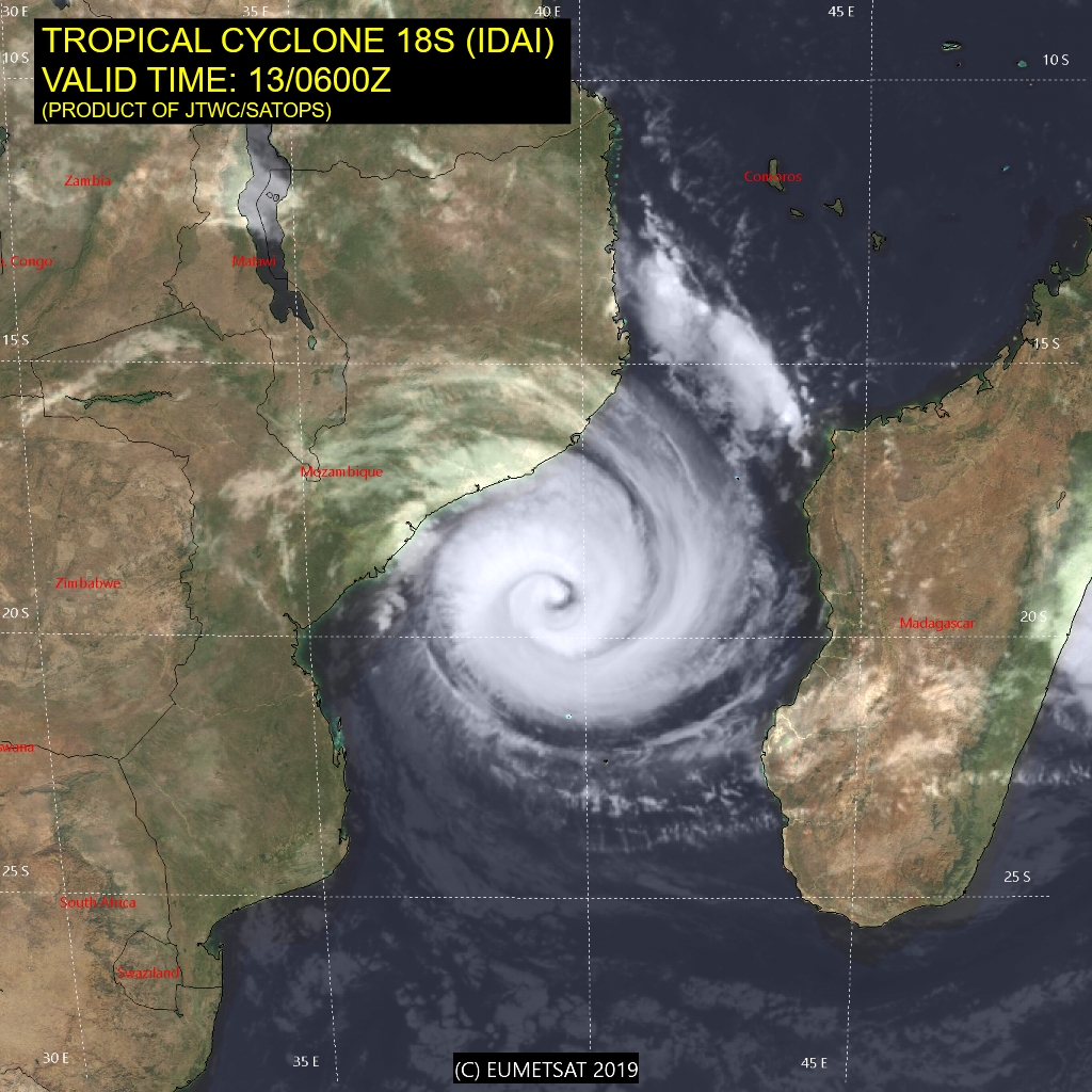
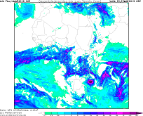
Satellite image, 13.03., 06 UTC
Image Credit: JTWC
|
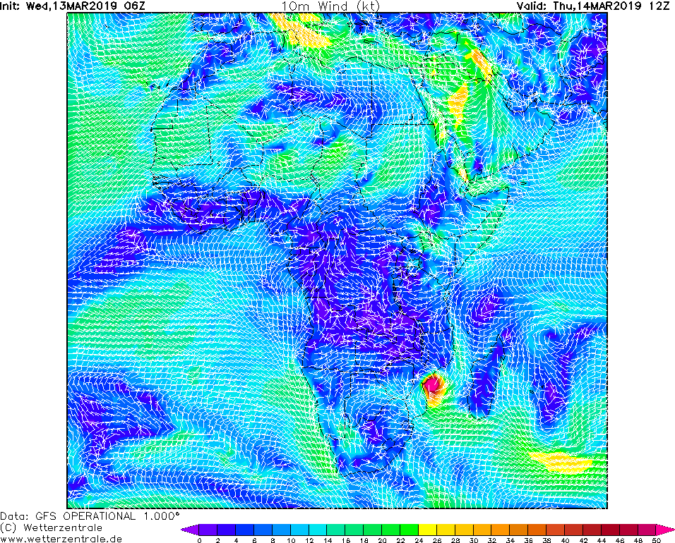
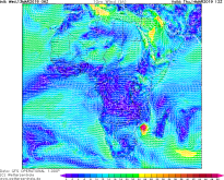
10 m wind , 14.03., 12 UTC
Image Credit: Wetterzentrale
|
Accumulated precipitation, 15.03., 18 UTC
Image Credit: Wetterzentrale
|
Tropical cyclone IDAI - Warning
Mozambique
Issued: Wednesday, 13 March 2019, 16:15 CET
Tropical storm IDAI (actual cyclone category 2) arrives tomorrow evening in the area of the east coast of Mozambique north of Beira on land.
13-14 March 2019
Tropical storm IDAI currently belongs to hurricane category 2 with gusts of up to 95 knots (176 kph) and
a core pressure of 960 hPa. The cyclone centre is located about 400 km east of the city of Beira in eastern
Mozambique. According to current forecasts, the cyclone is moving westward at a velocity of 5 kn (10 kph)
in a westerly arc. Until noon tomorrow, IDAI still belongs to category 2, until it weakens shortly before
land and is reduced to category 1. The landfall is expected tomorrow evening south of the city of Machece.
The landfall will still have wind speeds of up to 65 knots (120 kph). After land fall, the wind speed
decreases rapidly due to increasing friction and the hurricane quickly degrades to a tropical storm.
There is also the danger of heavy precipitation. Within 24 hours precipitation of more than 100 mm
can occur. Tomorrow there will be an update on this page with detailed information about track and
intensity.
The high wind speeds and massive rainfall can cause major damage to buildings and infrastructure
in the IDAI catchment area. In addition, a storm surge is expected, which can cause destruction in
the coastal area.
Issued: Mar 13, 2019, 16:15 CET
CL
Issued: Mar 14, 2019, 13:15 CET
FS
|