|
In the second half of the month of May a tropical cyclone formed over the Western Pacific, maturing into Typhoon MAWAR, the strongest tropical cyclone on record in the Northern Hemisphere in the month of May and the strongest cyclone to date of the year 2023, with sustained winds of up to 295 kph and a minimum central pressure dropping to 897 hPa according to the JTWC.
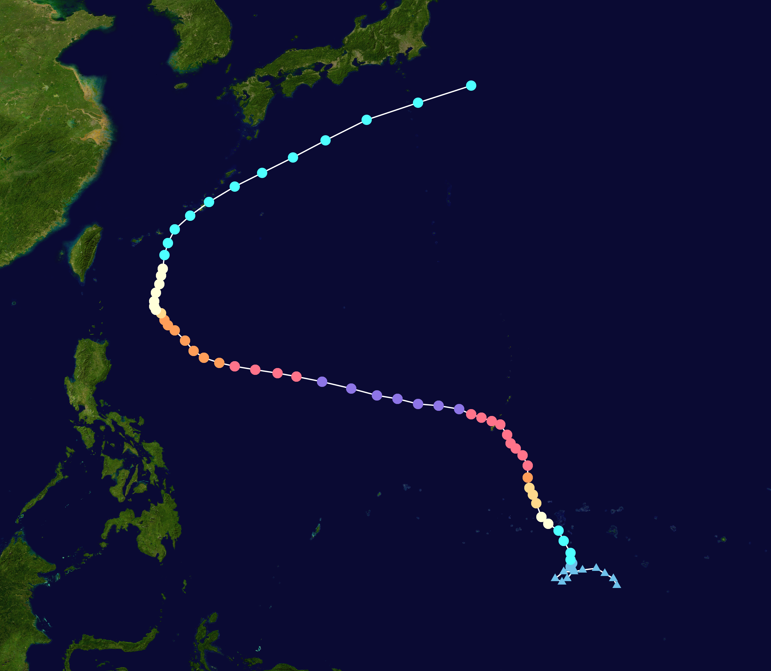
The tropical disturbance maturing into Typhoon MAWAR formed on May 17, 2023, over the Western Pacific around 900 km south of the island of Guam. Compared to any other basin in the world, the Western Pacific provides warm enough ocean waters for tropical cyclone formation year-round. For example, the Atlantic Basin usually only provides warm enough ocean waters for tropical cyclone formation from June through November. In the following days, the tropical disturbance lingered south of Guam showing only slow increase in intensity.
|
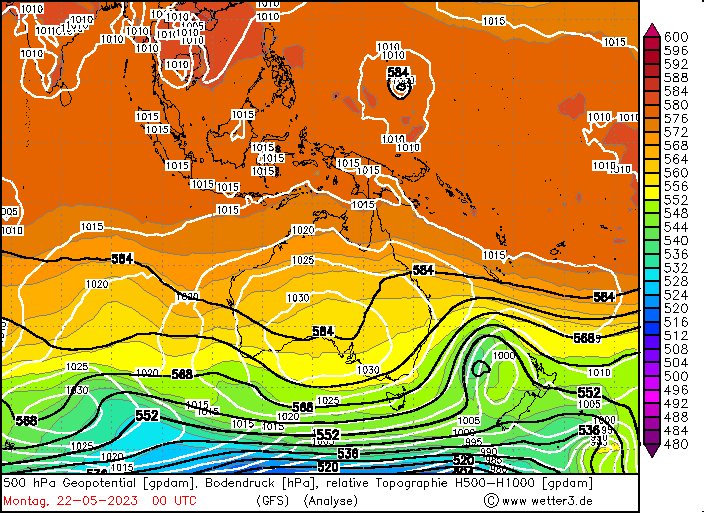
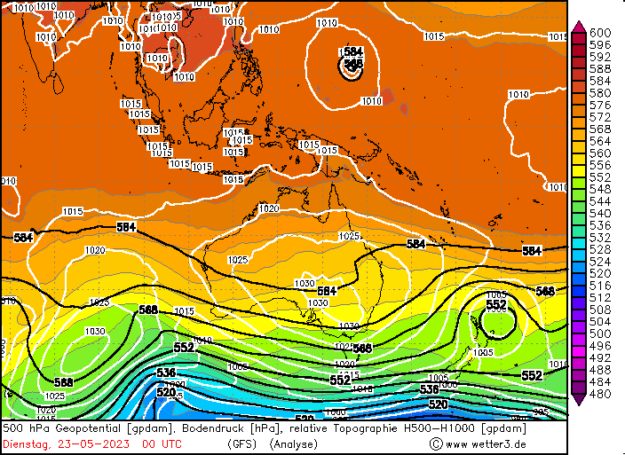
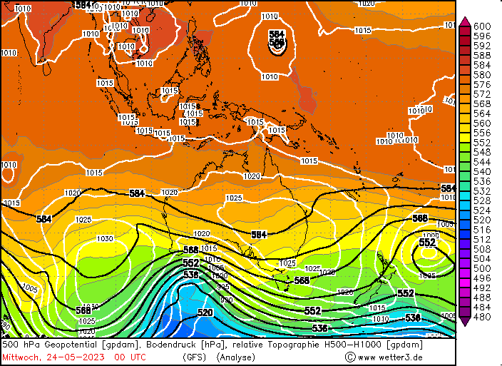
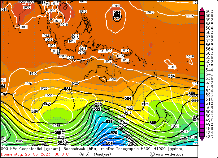
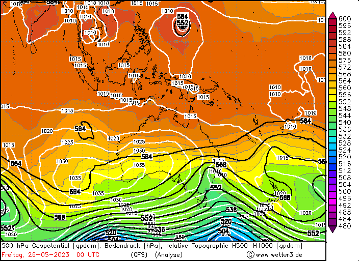
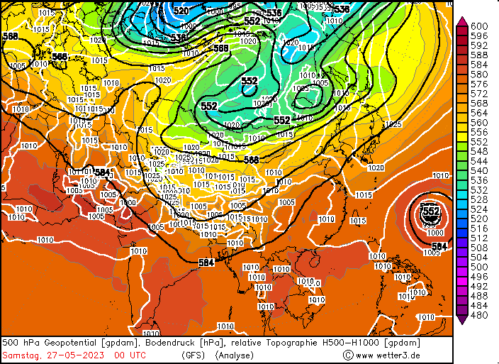
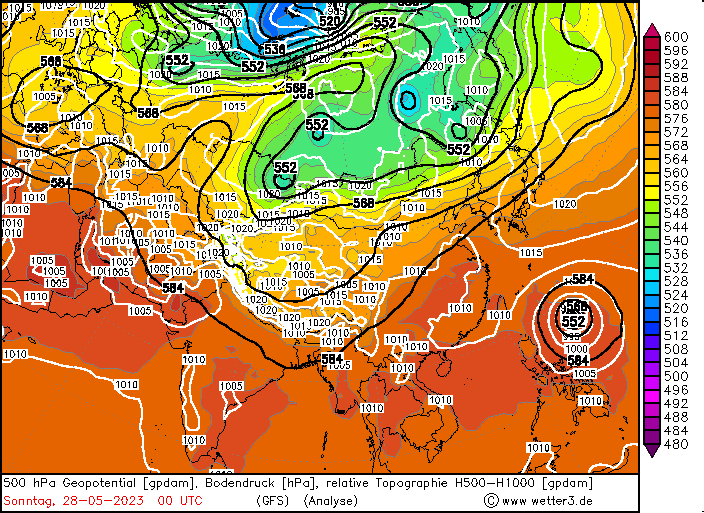
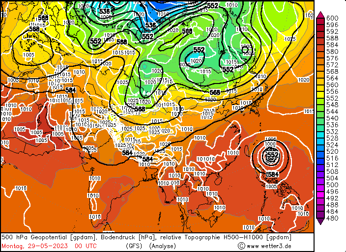
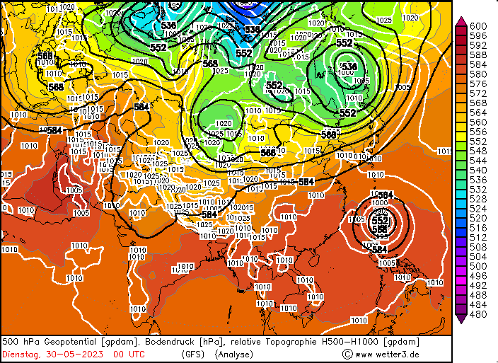
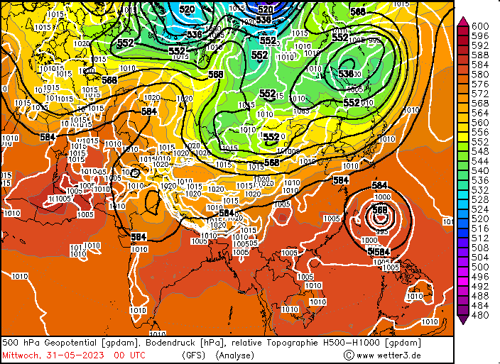
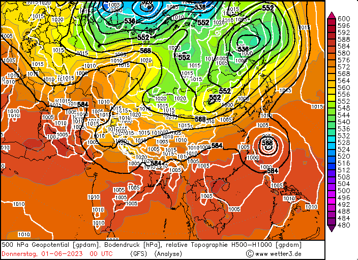
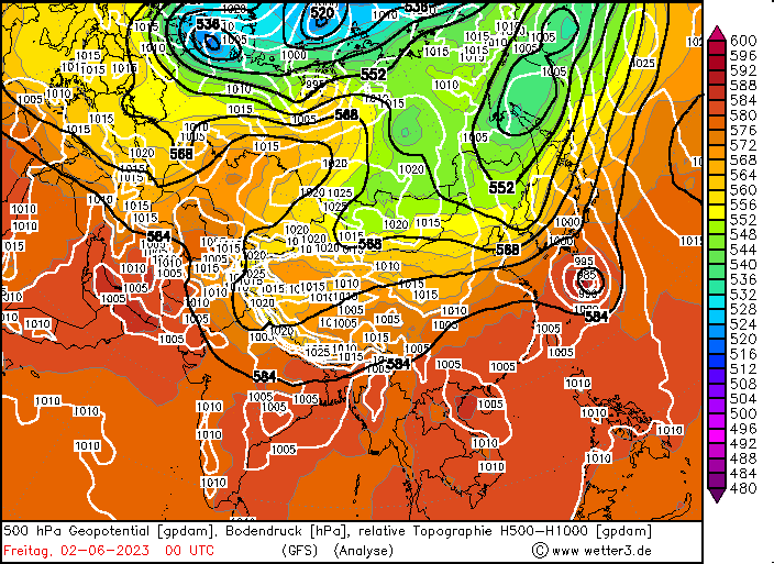
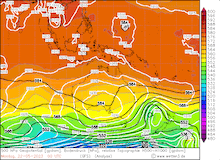
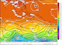
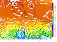
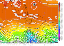
500 hPa Geopotential and surface pressure over the Western Pacific 22.05.2023 00 UTC - 02.06.2023 00 UTC (map section: Australia 22.05.2023 - 26.05.2023, Asia 27.05.2023 - 02.06.2023), source:
wetter3
|
 |
 |
 |
 |
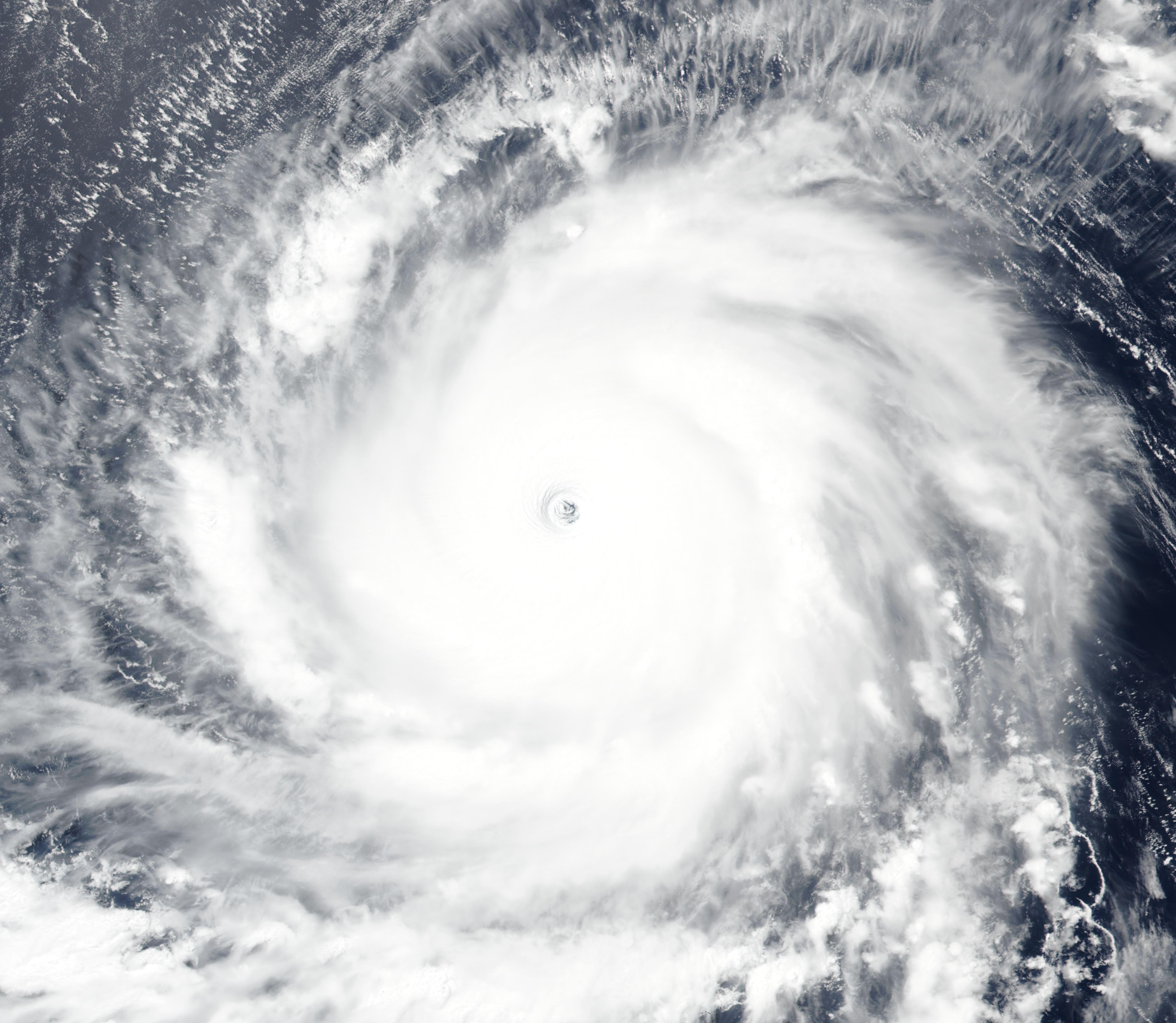
By May 21, 2023, the tropical disturbance intensified into Typhoon MAWAR on a northward trajectory towards the island of Guam, with warm ocean waters providing the energy source for the intensification of the system. On May 22, 2023, a distinct eye formed within the cyclone center, indicating that MAWAR was further intensifying. In the following days, the cyclone underwent a rapid intensification period, by May 23, 2023, the winds in the cyclone reached 255 kph, even though, the cyclone underwent an eye wall replacement cycle. This usually leads to the tropical cyclone weakening, as the diameter of the eye of the cyclone increases, in case of Typhoon MAWAR, no weakening of the cyclone was observed.
|
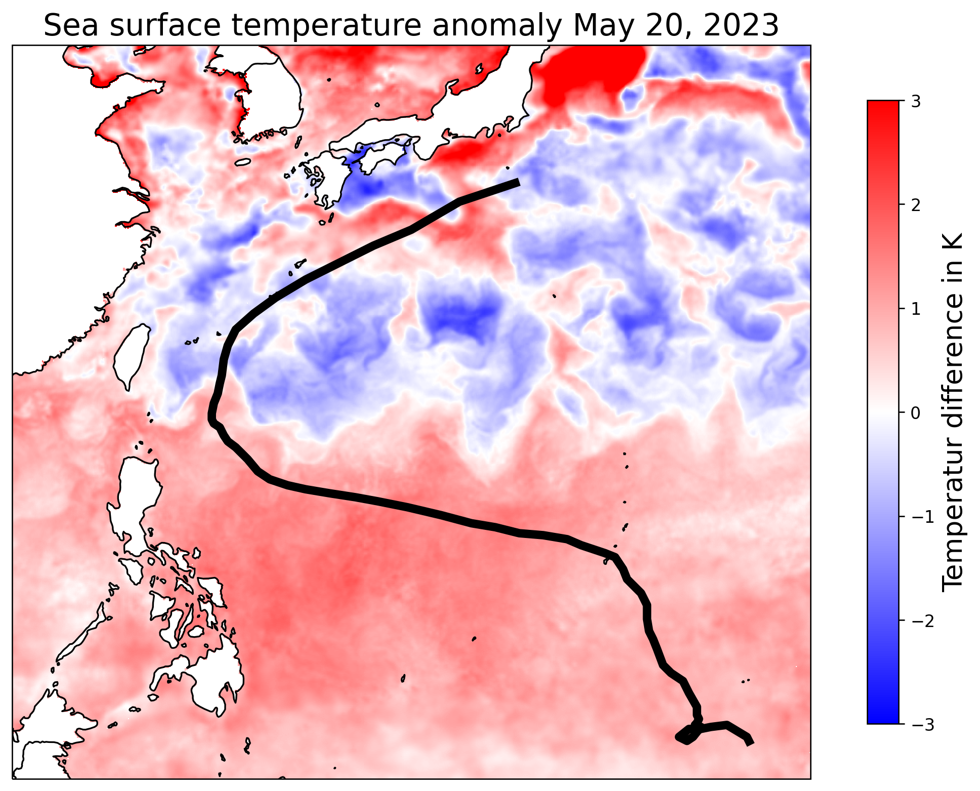
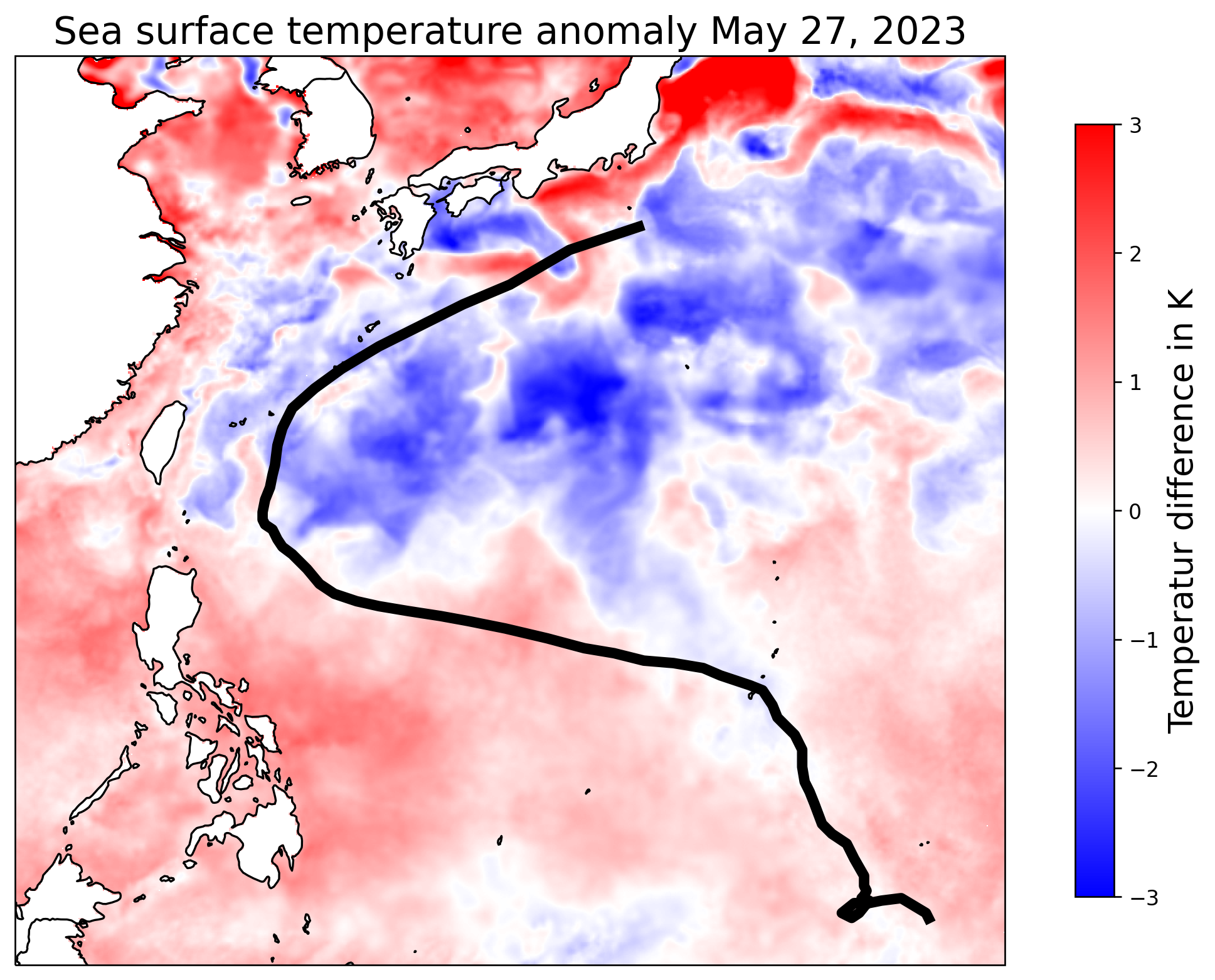
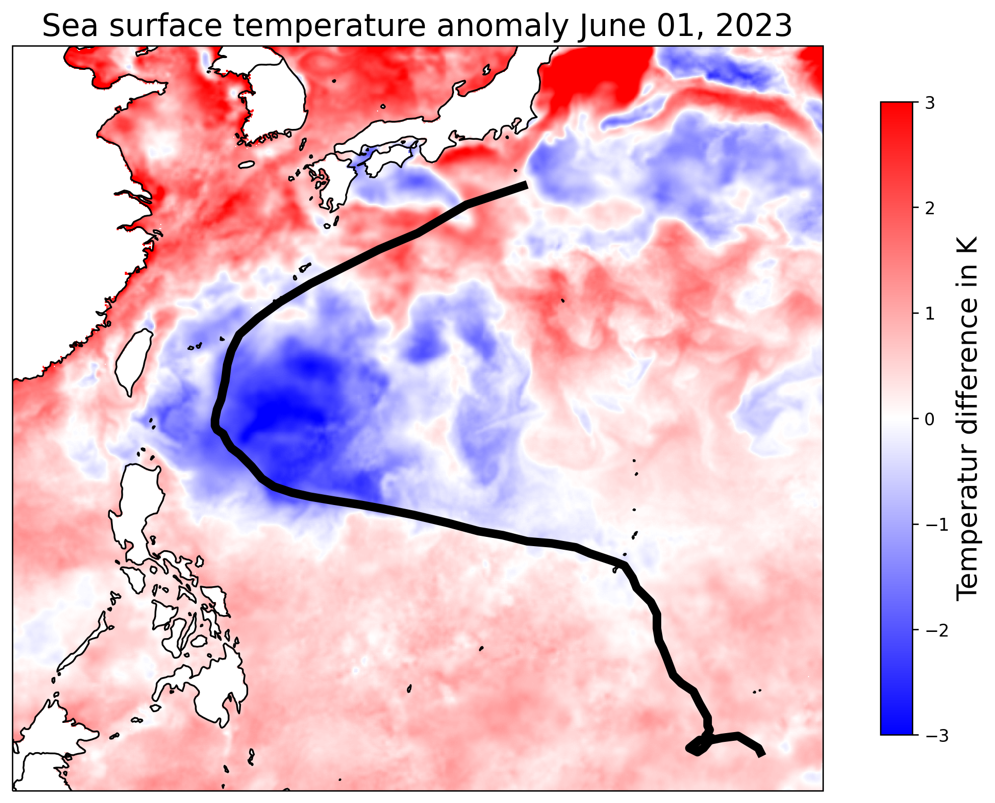
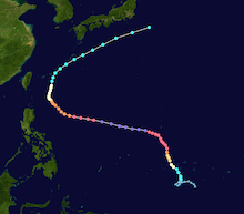
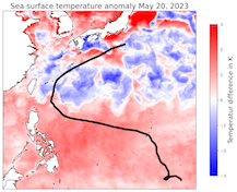
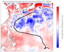
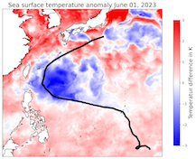
Track and intensity of Typhoon MAWAR (left), source: NASA, development of the sea surface temperature anomalies over the Western Pacific 20.05.2023 - 01.06.2023, source:
NASA, visualization: K. Gramlich
|
 |
 |
 |
 |
On May 24, 2023, MAWAR passed around the northern tip of the island of Guam through the Rota Channel, with the southern edge of the eye wall of the cyclone affecting the northern tip of the island of Guam. During the passage of the cyclone, multiple weather stations on the island recorded precipitation totals of more than 500 mm, with a rain gauge at Dededo recording 722 mm of precipitation. The Antonio B. Won Pat International Airport recorded wind gusts of up to 168.5 kph. Even though, MAWAR was the most powerful tropical cyclone to affect Guam in the last 20 years, the damages were comparatively small, mostly limited to uprooted trees, localized flooding due to heavy rains and the storm surge, and power outages.
After the passage of Guam, MAWAR changed course to an easterly direction and intensifying further to a category 5 cyclone, with maximum sustained winds of up to 295 kph according to the JTWC on May 26, 2023, after the eye wall replacement cycle was completed. During that period, MAWAR had a very symmetric structure with a distinct eye in the cyclone center. Further, MAWAR is only one of the few tropical cyclones to reach a minimum central pressure below 900 hPa, although most of these extreme tropical cyclones are observed over the Western Pacific.
By May 27, 2023, nearing the northern parts of the Philippines, Typhoon MAWAR began gradually weakening due cooler ocean water and the influx of dry air masses. In the following days, Typhoon MAWAR changed course to a westerly direction and the intensity decreased further, missing both the Philippines and the island of Taiwan, while integrating into the main westerly current of the midlatitudes. By May 31, 2023, MAWAR weakened to a tropical cyclone, while nearing the southern tip of the Japanese Archipelago.
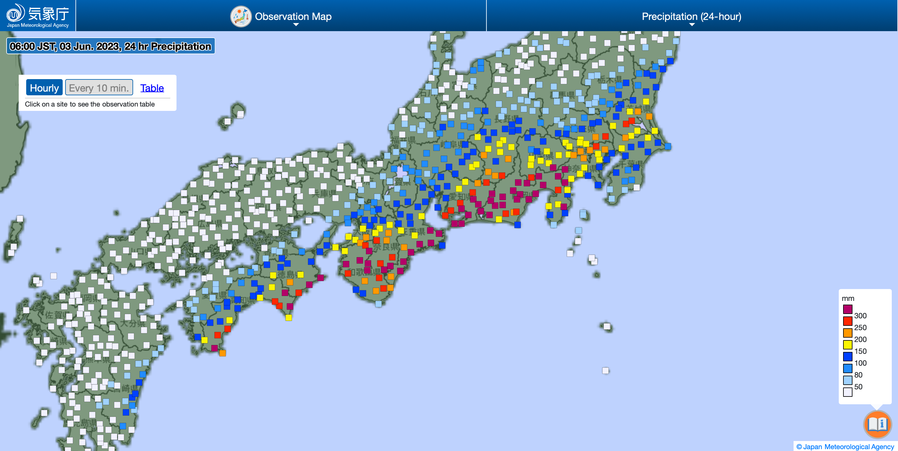
By June 02, 2023, cyclone MAWAR began its extratropical transition, affecting the southeastern flank of the main island of Japan with extreme precipitation. In a 24 h-period, widespread precipitation totals reached more than 250 mm, locally up to 500 mm of rain were recorded on June 2, 2023. The torrential rainfall led to severe flooding affecting the densely populated southeastern side of Japan.
After the extratropical transition MAWAR is integrated into the main westerly mid-latitude current. Overall, Typhoon MAWAR was the strongest tropical cyclone forming on the Northern Hemisphere in the month of May on record with sustained winds reaching up to 295 kph.
Text: KG
June 03, 2023
|