|
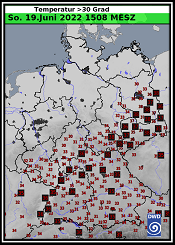
The first powerful heat wave of the 2022 summer season set numerous decade and month records in Germany. On June 19, maximum temperatures of 39.2 °C were recorded in Dresden-Strehlen and Cottbus.
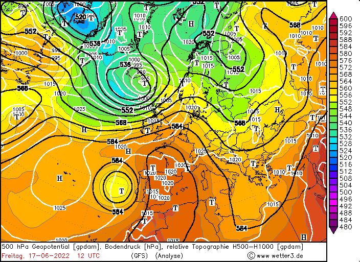
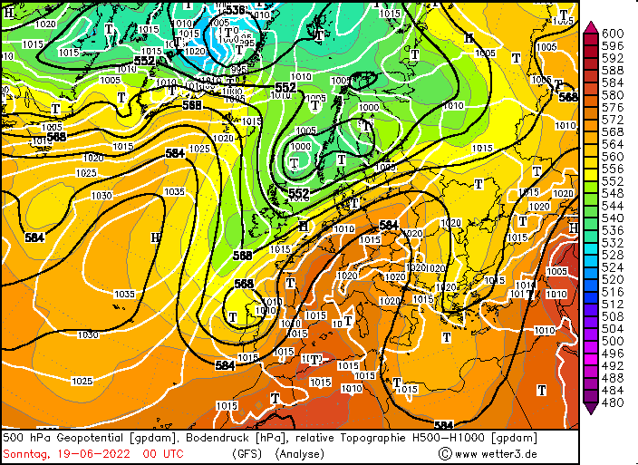
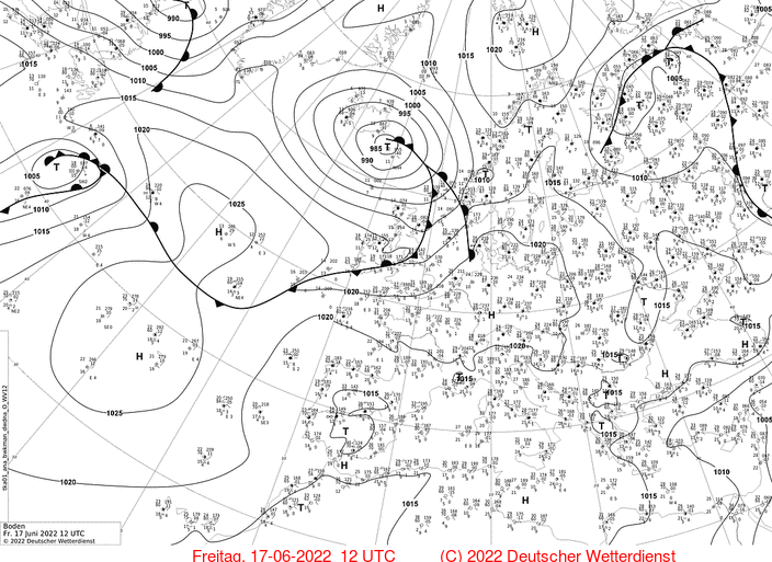
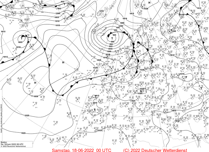
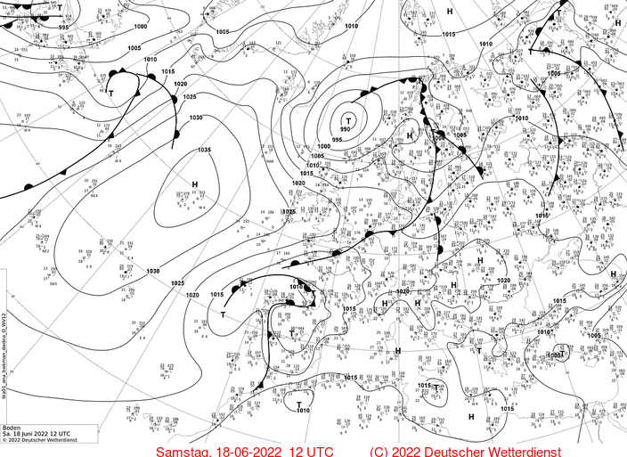
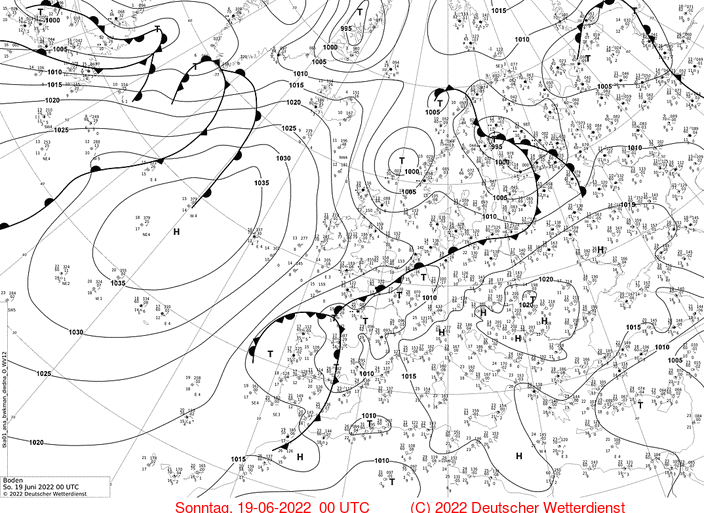
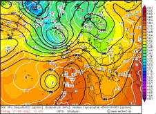
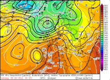
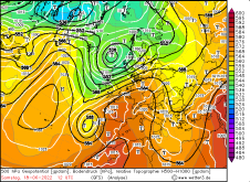
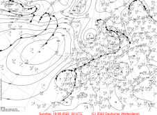
From June 17 to June 19, the first heat wave of the summer saison 2022 spread over Central and Western Europe. Between a cut-off trough off the coast of Portugal and a ridge
over the western part of the Mediterranean Sea very warm air masses were guided towards Central and Western Europe. On Saturday, the 850 hPa temperature in France reached
values around 27 °C, and values above 20 °C also occurred over Germany on Saturday and Sunday. On Saturday, the focus of the heat was over France and Western Germany. In Germany, the highest temperatures
were recorded in Waghäusel-Kirrlach und Bad Kreuznach with 37,1 °C. While it was still windless in large parts of Germany on Saturday, moderate to strong southwesterly winds prevailed on Sunday.
Nevertheless, temperatures did not peak on Saturday, but on Sunday.
|
500 hPa Geopotential and sea level pressure, June 17 - 19, source:
DWD
|
 |
 |
 |
 |
 |
 |
 |
 |
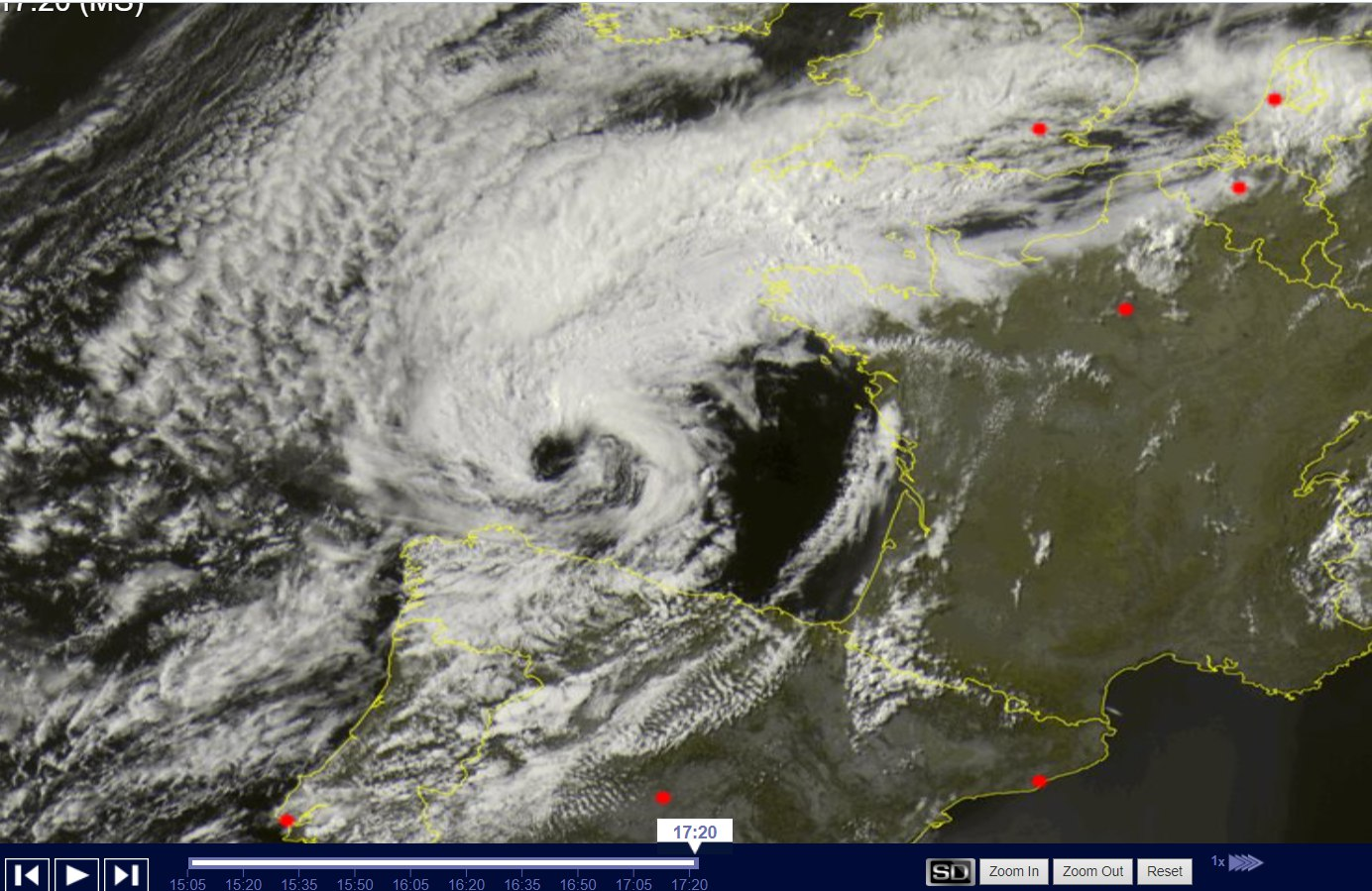
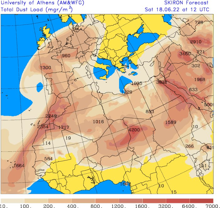
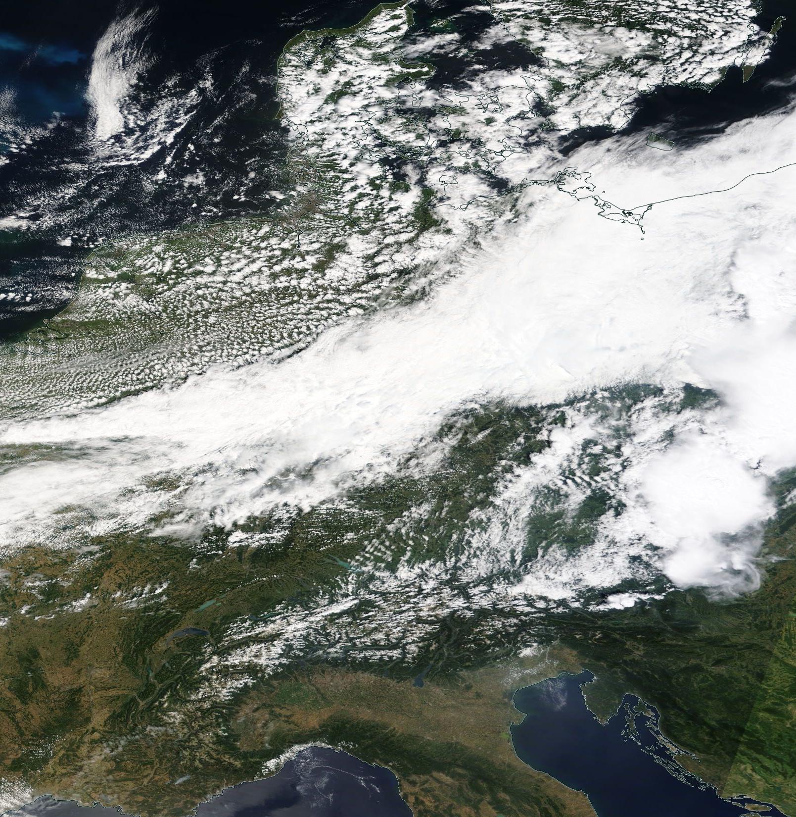
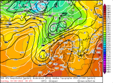
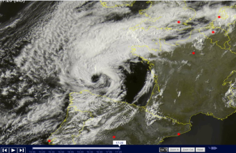
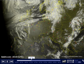
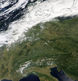
On Saturday, temperatures did not quite reach the high values forecasted by the models as advection of Saharan dust at the front of the low-pressure area dimmed the solar
radiation somewhat. The low pressure system can clearly be seen in the satellite image below (left image). In the satellite image from early morning (center image) the dust is
also evident causing an area of reduced visibility. The measured values of the radiation intensity at the measuring station of the Institute of Meteorology at KIT indicate a
loss of incoming shortwave radiation of approx. 125 J/m².
|
Total dust load and satellite image (visible), June 18, source:
SKIRON
Sat24
|
 |
 |
 |
|
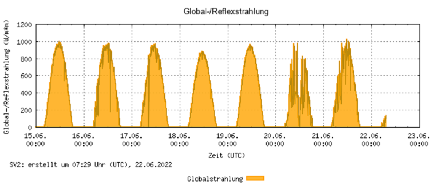
Incoming shortwave radioation in Karlsruhe, June 15 - 22, source:
KIT IMK-TRO
|
 |
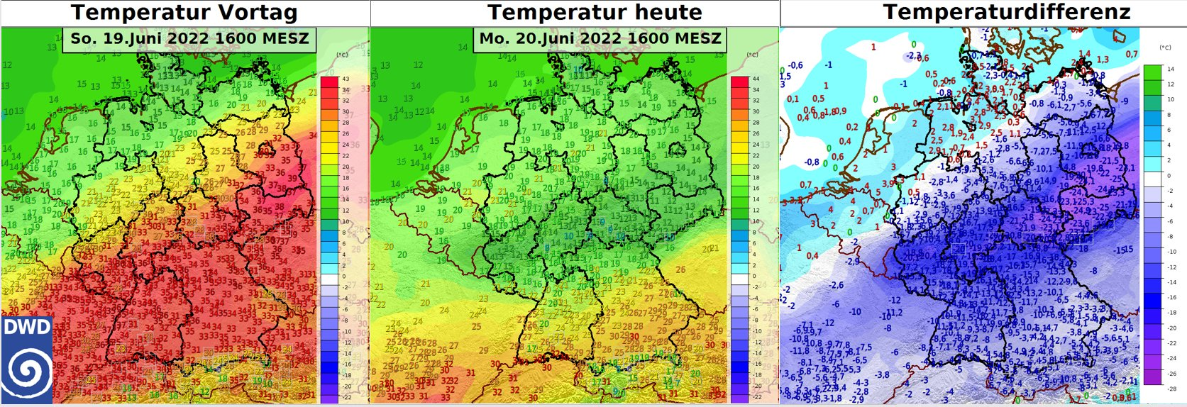
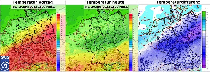
On Sunday, the focus of the heat wave shifted further over the east of the country. Strong horizontal temperature contrasts occurred, with daily highs of around 16°C on
the North Sea coast and up to 39°C in Saxony and Brandenburg. The highest values were recorded at the stations Dresden-Stehlen and Cottbus with 39.2 °C. In both cases,
this marked the highest temperature ever measured in June at these stations. The germany-wide June record for Germany (39.6 °C in Bernburg/Saale) was not reached. However,
for the mid-June decade (June 11 - 20), the previous record of 38.3 °C (Herten) was clearly exceeded.
|
2 m temperature observations, June 19 and 20 source:
DWD
|
 |
 |
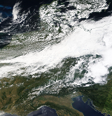
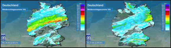
In the north and northwest of the country, precipitation already occurred on Saturday, and on Sunday and Monday rain occurred also further across central Germany. Daily
precipitation amounts of more than 15 mm occurred in a diagonal strip from Rhineland-Palatinate and North Rhine-Westphalia to Brandenburg. Around the Eifel and the Harz,
20 to 30 mm were recorded in some areas. The top spot was Lauperath-Scheidchen in western Rhineland-Palatinate with 33 mm, closely followed by Sondershausen (northern Thuringia)
with just under 32 mm. The rainfall at least somewhat relieved the drought, which was particularly severe in the eastern part of the country. They also made it easier to extinguish
forest fires in some parts of Brandenburg.
|
Satellite image (visible) from June 19 and daily precipitation from June 19 and 20, source:
DWD
|
 |
 |
 |
Text: FS
June 22, 2022
|