|
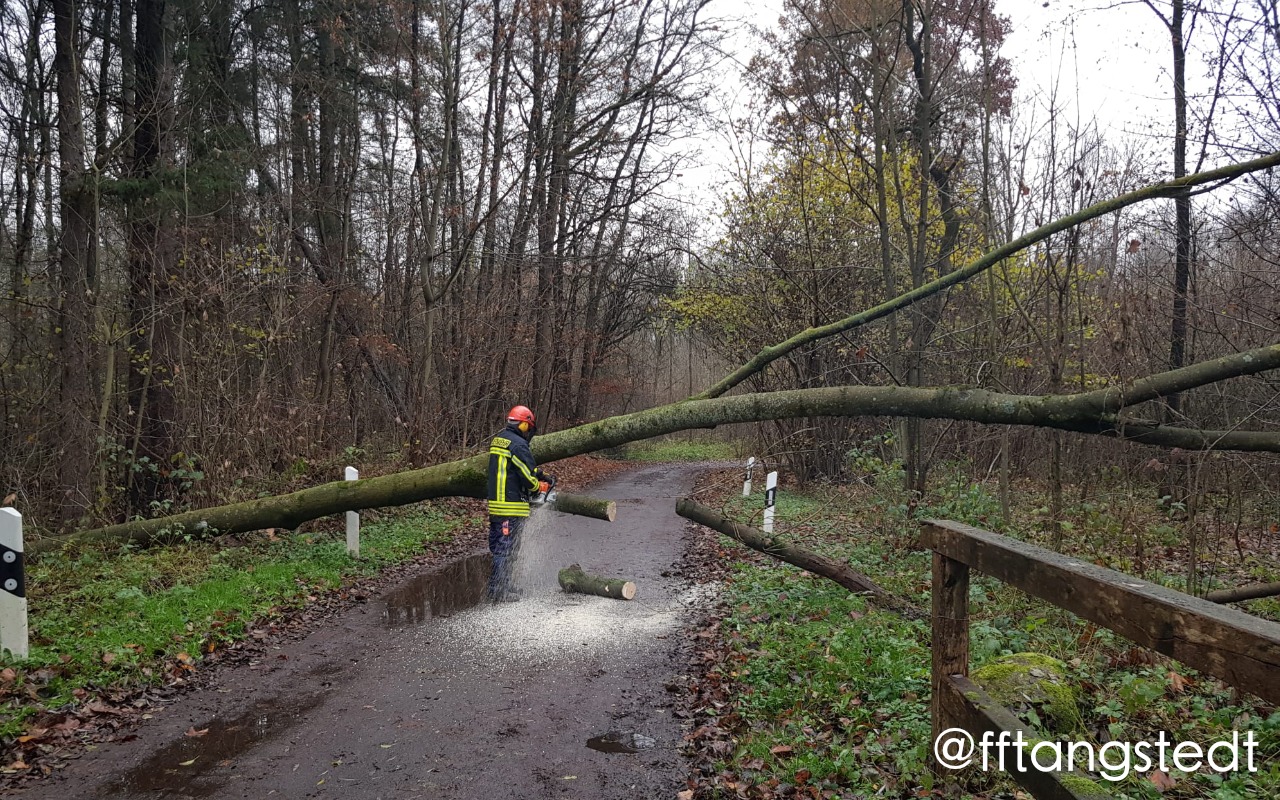
Storm low Daniel created wind gusts up to 141 kph in Germany. Small damages in infrastructure, cutted trees and a moderate storm surge at the north sea coast were the results of the cyclone.
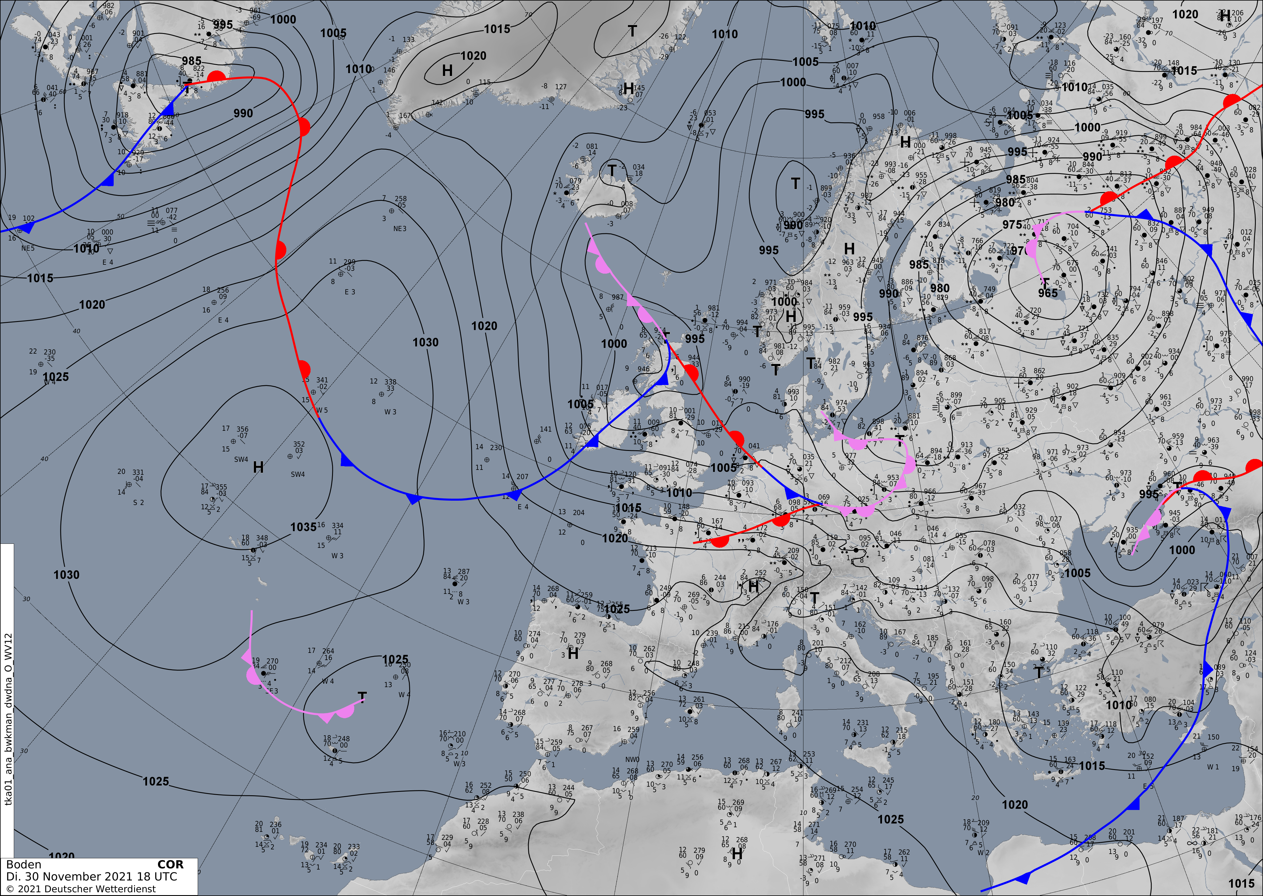
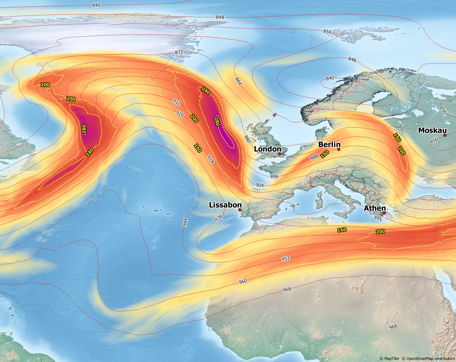
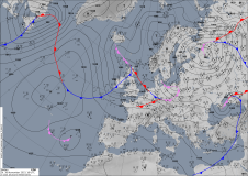
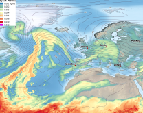
Storm low Daniel formed near Scotland at the eastside of a trough lying west of Great Britain. On November 30, 18 UTC, the storm
was located close to the north coast of Scotland. Surface analysis shows a broad range between the warm and cold front. This spread indicates that the cyclone is in the development stage.
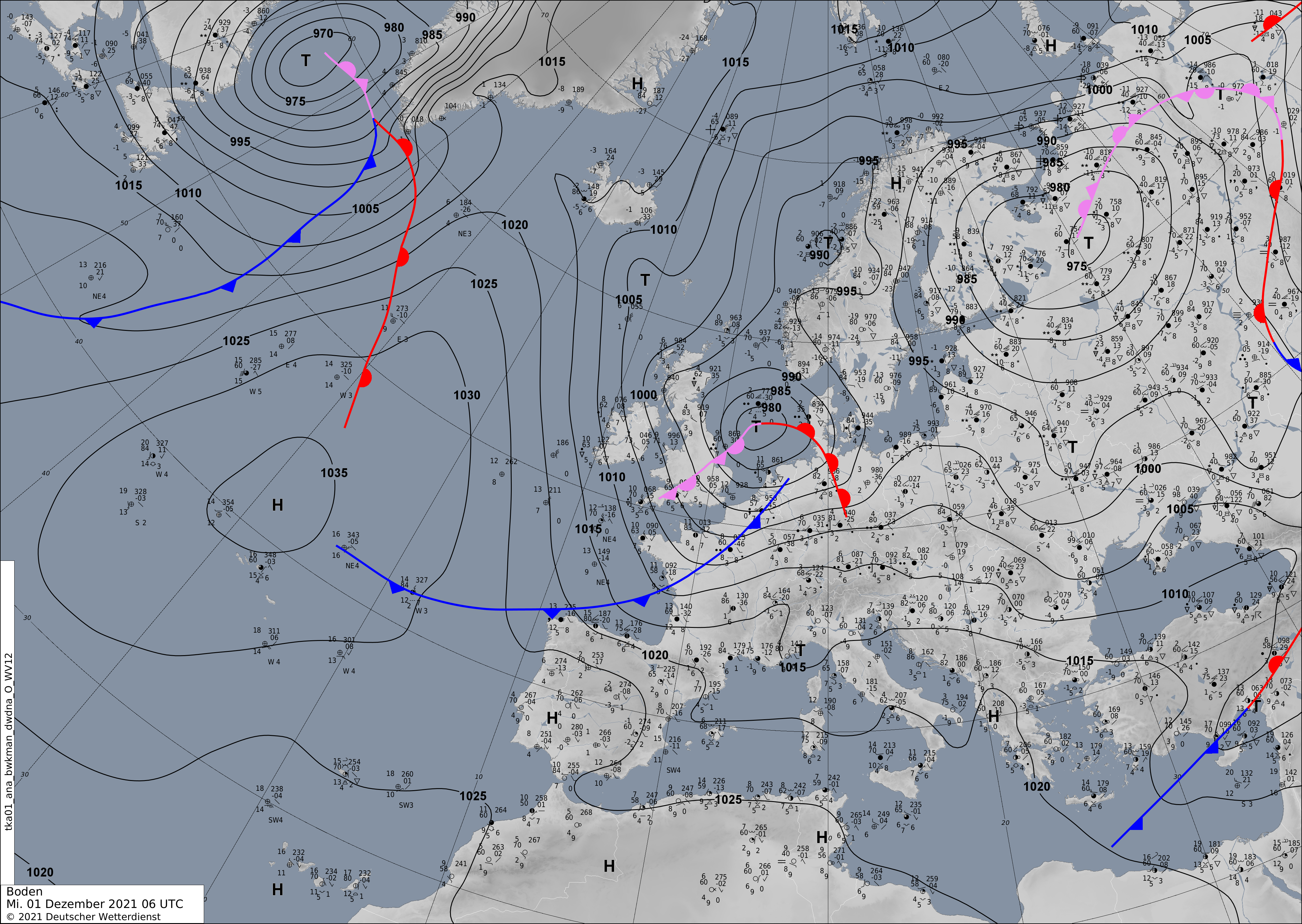
Over the next 12 hours, Daniel intensifies strongly. The pressure difference between the storm center and the high-pressure system over the southwest Atlantic rises rapidly. The pressure in the core falls to 975 hPa. In the following hours, the storm moves to the east sea. The cold front is separated from the storm low, and an occlusion front is visible.
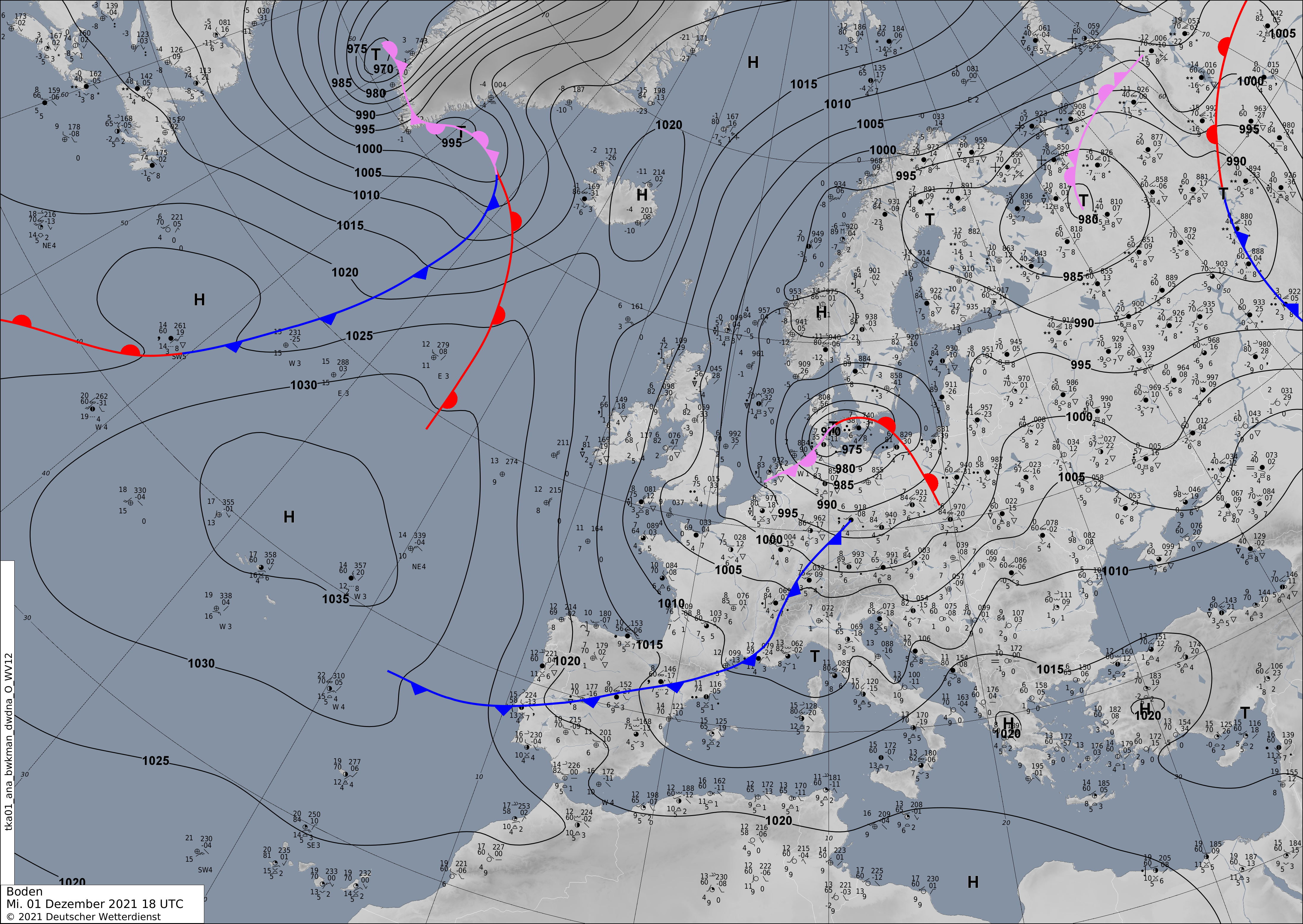
Over the east sea, the occlusion front secludes the warm front, and the storm pressure and intensity decrease.
|
Sea level pressure, fronts and surface observations, 30.11. 18 UTC until 02.12. 06 UTC, source:
DWD
|
 |
 |
 |
|
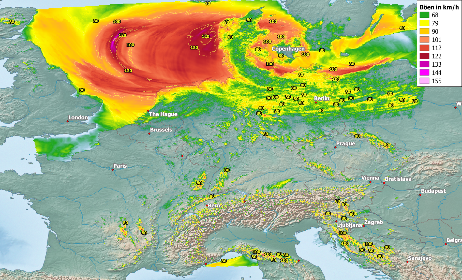
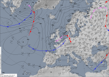
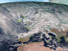
The highest wind speeds occur to the south and southwest of the storm due to the higher pressure gradients. Daniel was located to the northeast of the jetstream in a favorable environment with a strong temperature contrast and a high baroclinity. He developed northwest of Scotland at a frontal zone from a small wave disturbance. Daniel intensified in association with an intense warm air advection into the core in lower layers and upper-level divergence, which overcompensates the low-level convergence.
The inflow of relatively warm and moist air and the band with precipitation led to diabatic heating that contributed to pressure fall. Therefore, Daniel reaches its peak intensity over the north sea close before the transition into the east sea after the strongest warm air advection.
|
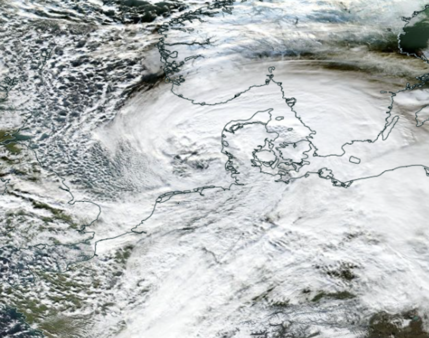
300hPa geopotential and wind, surface wind gusts, specific humidity, satellite image and surface pressure 01.12. 12 Z and 01.12. 06 Z, source:
DWD, vizualisation: Bernhard Mühr
|
 |
 |
 |
 |
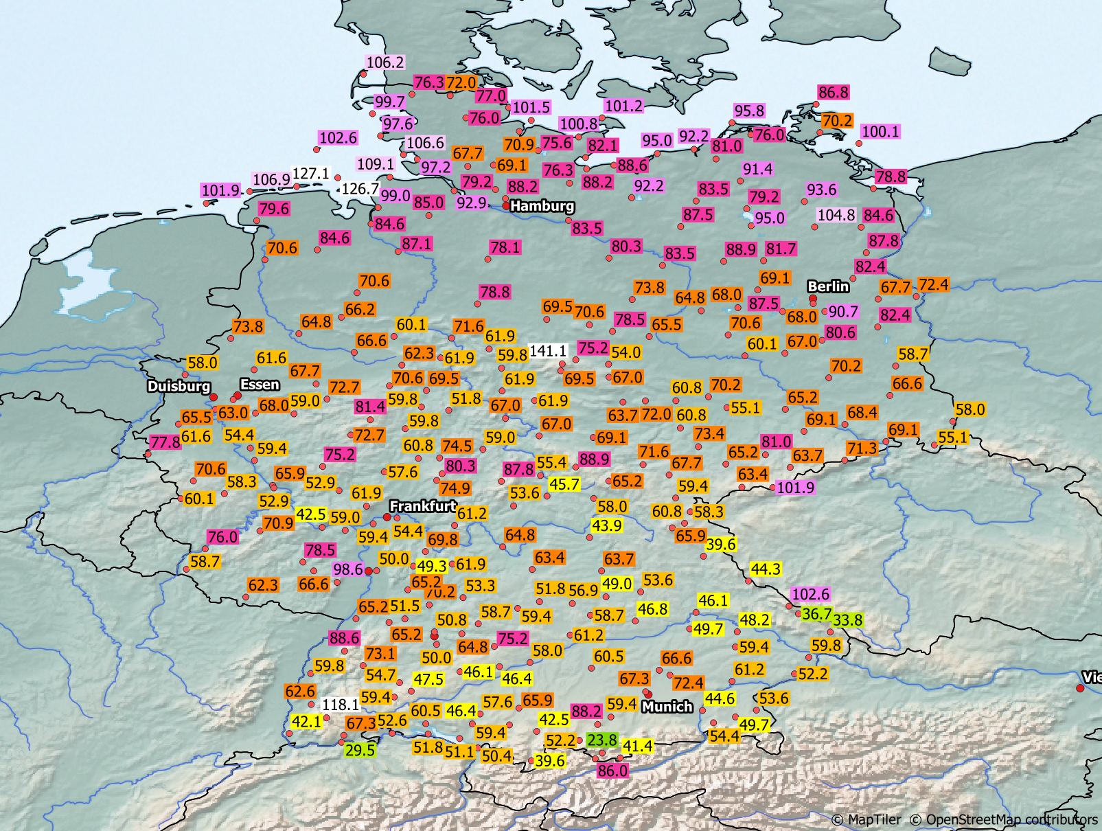
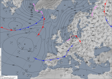
The DWD's national measurement network observations show the intensity and extent of Daniel's wind field. While the Broken marked the peak with a gust of 141 kph, there were also wind gusts of more than 80 kph in the lower parts of northern Germany, in Lower Saxony, Schleswig Holstein, Mecklenburg Western Pomerania, and Brandenburg. The highest gusts are measured at the north sea island and directly at the coasts. Orkan gusts over 119 kph
are recognized there. After the transition of storm low Daniel, the wind direction changed from southwest to north. This wind turn caused
a moderate storm surge at the coasts.
|
Observed gusts from 01.12.2021, source:
DWD, vizualisation: Bernhard Mühr
|
 |
The storm caused only slight damage. Fallen trees caused traffic interruptions and damage to buildings and cars. The ship traffic over the north sea
was interrupted. A moderate storm surge caused higher water levels and in lower coastal areas floodings. In fact, storm low Daniel was no extraordinary event in northern
Germany. Nevertheless, local orkan and severe storm gusts over a broad area indicate the vulnerability to infrastructure even in storm-proofed regions in Germany.
Text: NB
December 03, 2021
|