|
Mild temperatures and significant precipitation caused by a low pressure system off the Brittany Coast.
High water and flooding due to precipitation and snowmelt. Some rivers carried levels in the range of a 10-year flood.
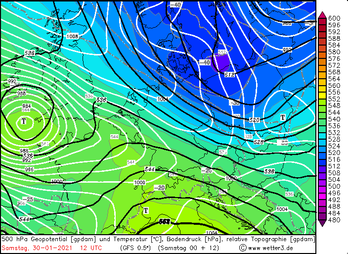
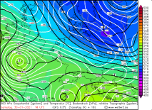
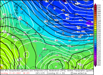
Synoptic pattern
The first half of the winter brought unusually high snow cover for this time of year in the low mountain
ranges and partially also in the surrounding lowlands. The combination of sufficiently low temperatures and
yet significant moisture advection, which is necessary for snowfall down to the lowlands, was found fewer
and fewer times in the past winter seasons. An early split of the polar vortex in the first half of winter
provided some suitable weather situations this year. To explain this phenomenon, let's take a look at the
stratosphere at an altitude of 15 to 30 km. This is where the polar vortex is located. A dynamic system
filled with cold air that separates cold air masses at the poles from warmer air masses in the mid-latitudes
and subtropics. Very low temperatures in the stratosphere strengthen the polar vortex, while high temperatures
can weaken it and initiate a zonal wind reversal. Due to a so-called "sudden stratospheric warming", the
vortex weakened considerably due to the wind reversal in January and became more fragmented. This caused
the polar vortex to split into two halves, so that very cold air masses could flow out to the south unhindered
and thus also hit Central Europe. The interaction of cold arctic air, which caused widespread permanent
frost, and numerous low-pressure areas over the North Sea caused precipitation, which increasingly fell as
snow in the lowlands.
|
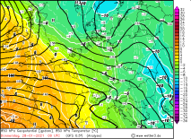
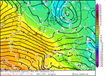
500hPa Geopotential and Temperature, January 30 and 31, 2021:
Wetter3
|
 |
 |
 |
 |
|
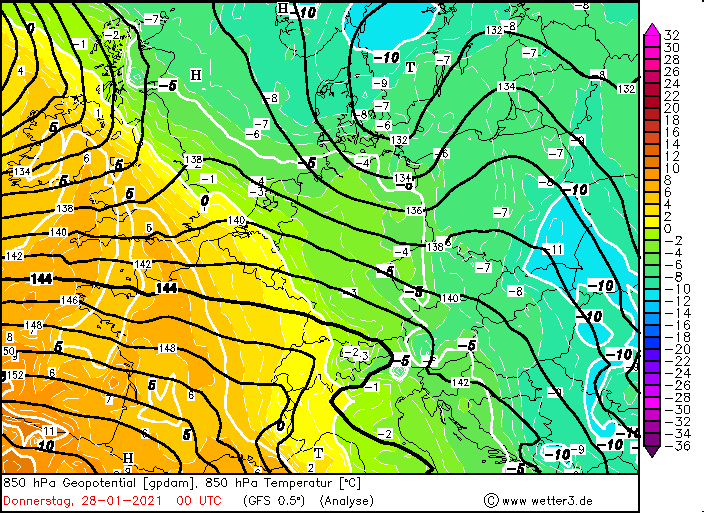
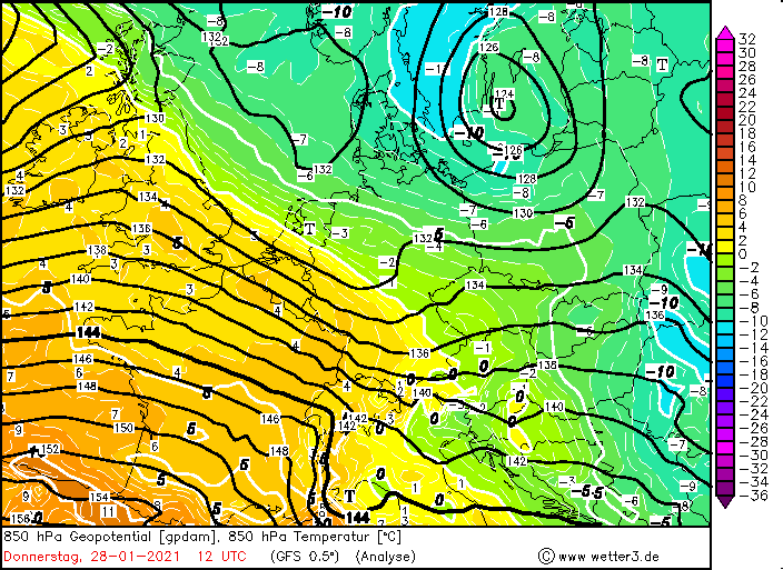
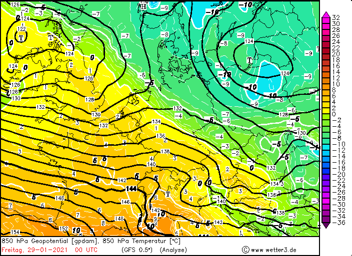
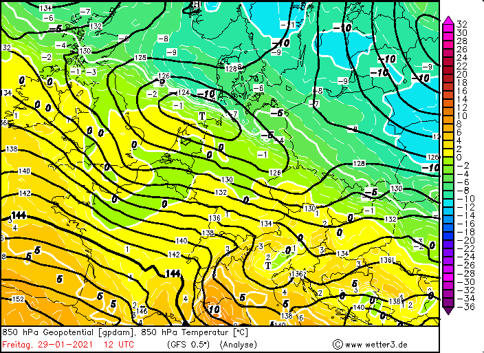
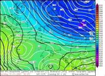
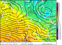
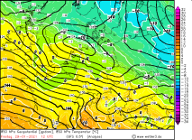
850 hPa Temperature, January 28 and 29 , 2020:
Wetter3
|
 |
 |
 |
 |
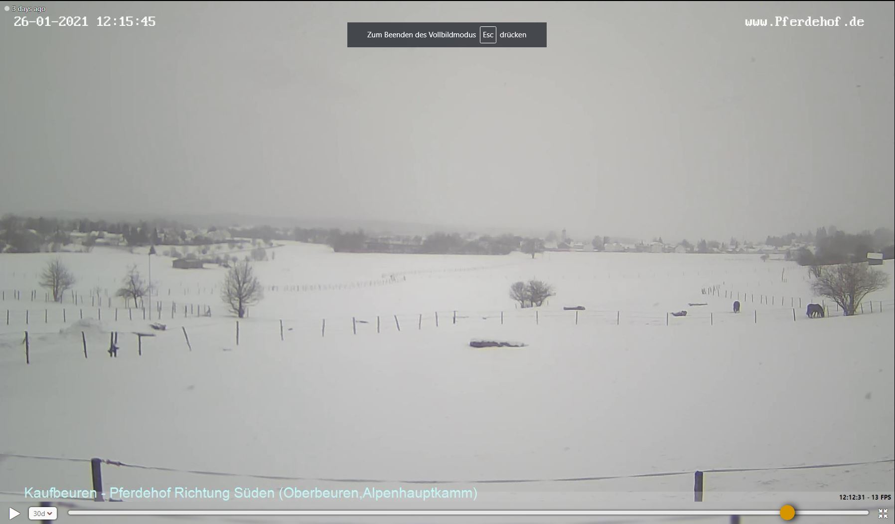
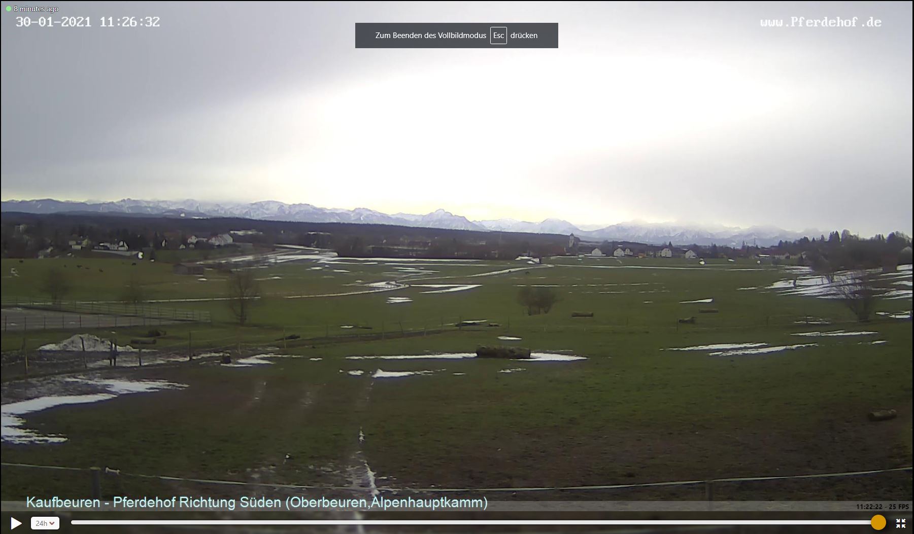
Melting snow
In the last days of the month, a trough coming from the Atlantic pushed the cold air back at least as far
as the north-east of Germany. A small-scale surface low caused a southwesterly flow and a significant
advection of warm air of subtropical origin with temperatures up to +5°C in 850 hPa. Strong winds forced
vertical mixing of the lower troposphere, resulting in widespread temperatures above 10°C at ground level
in the lowlands. The zero-degree limit climbed to as high as 2000m at times, causing thaws throughout the
Black Forest and also in large areas of the Alpine country.
|
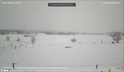
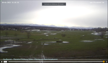
Webcam Images from Kaufbeuren, January 27 and 30, Source:
Windy
|
 |
 |
|
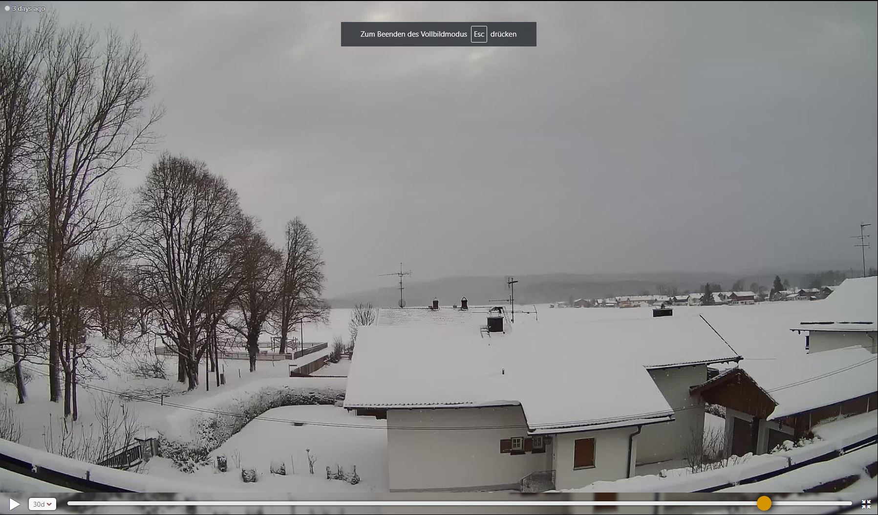
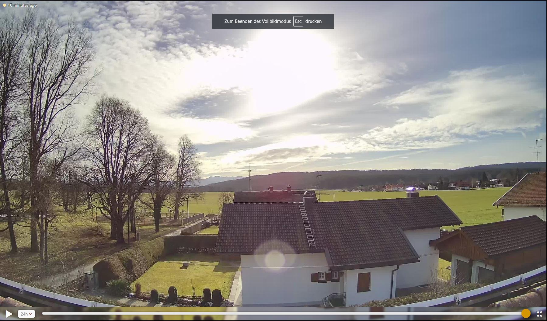
Webcam Images from Mitterdarching, January 27 and 30, Source:
Windy
|
 |
 |
As usual with westerly weather conditions, there was also widespread precipitation due to large-scale
lifting of the moist warm air. In the high altitudes of the low mountain ranges of southern Central Europe
and the Alps, more than 100 mm accumulated in some areas, locally also 150 mm and more. In and above the low
mountain ranges, orographic effects that increase precipitation are also noticeable, especially on the western
side of the Black Forest.
| Location |
Decrease in snow Height |
Time Period |
Anger-Stoissberg
Ruhpolding-Seehaus
Bischosfwiesen-Loipl
Freudenstadt
Eisenbach
Freudenstadt-Kniebis
Baiersbronn-Schoenegrund
Grafenhausen-Hochschwarzwald
Löfflingen Dittishausen
Lossburg
Bernau-Goldbach
Siegsdorf-Höll
Lenzkirch-Ruhbühl
Mudai-Schlossau
Voehrenbach-Urach
Oberpframmern
Traunheut-Frühling
Beerfelden
Obing-Ilzham
|
60cm
50cm
55cm
45cm
39cm
35cm
25cm
80cm
48cm
43cm
41cm
40cm
34cm
27cm
33cm
28cm
22cm
21cm
21cm
|
72h
72h
72h
72h
72h
72h
72h
48h
48h
48h
48h
48h
48h
48h
24h
24h
24h
24h
24h
|
|
Data source: DWD.
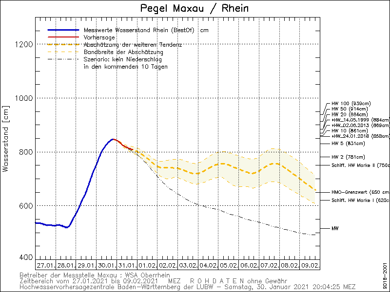
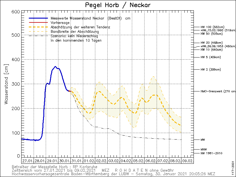
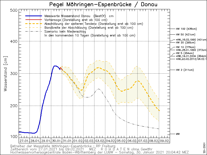
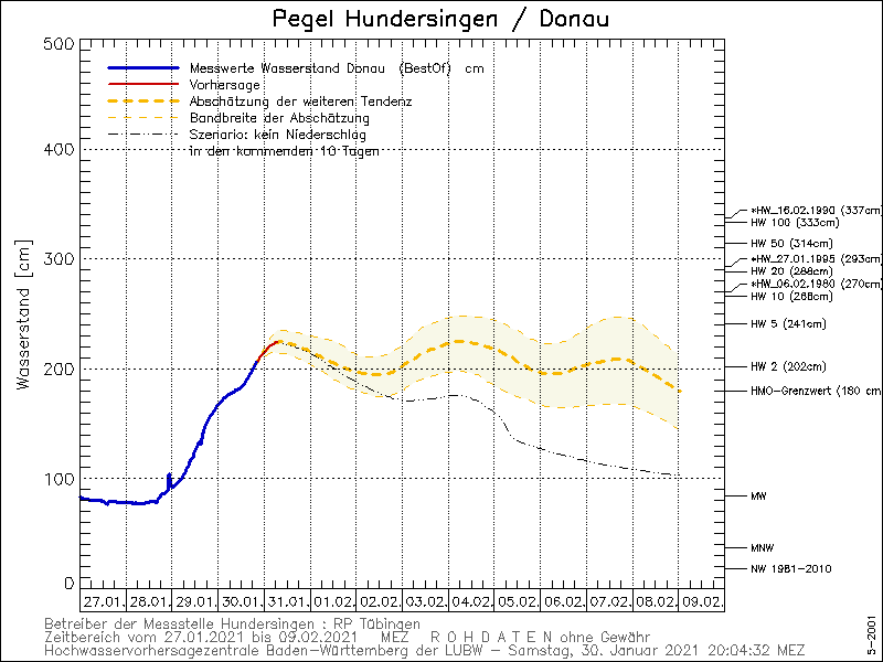
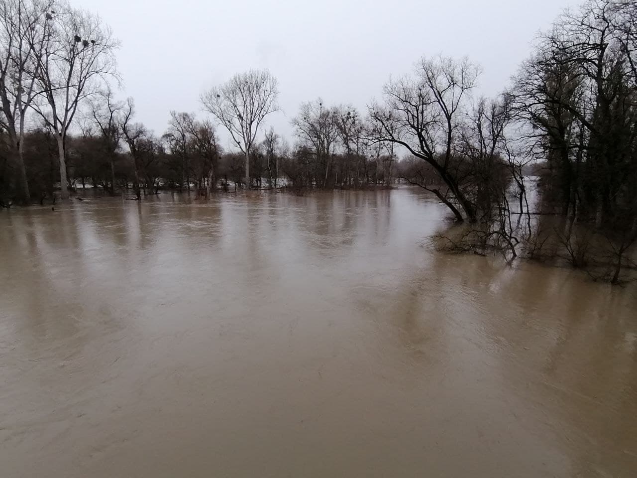
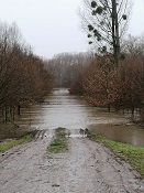
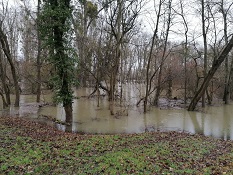
The combination of thaw and heavy rainfall caused several rivers in Baden Württemberg and Bavaria to be
flooded. The threshold values for 2- and 5-year floods were widely exceeded. In isolated cases, there were
even 10-year floods. In Hesse, too, some smaller rivers, feeders to the Kinzig and the Fulda, carried heavy
floods.
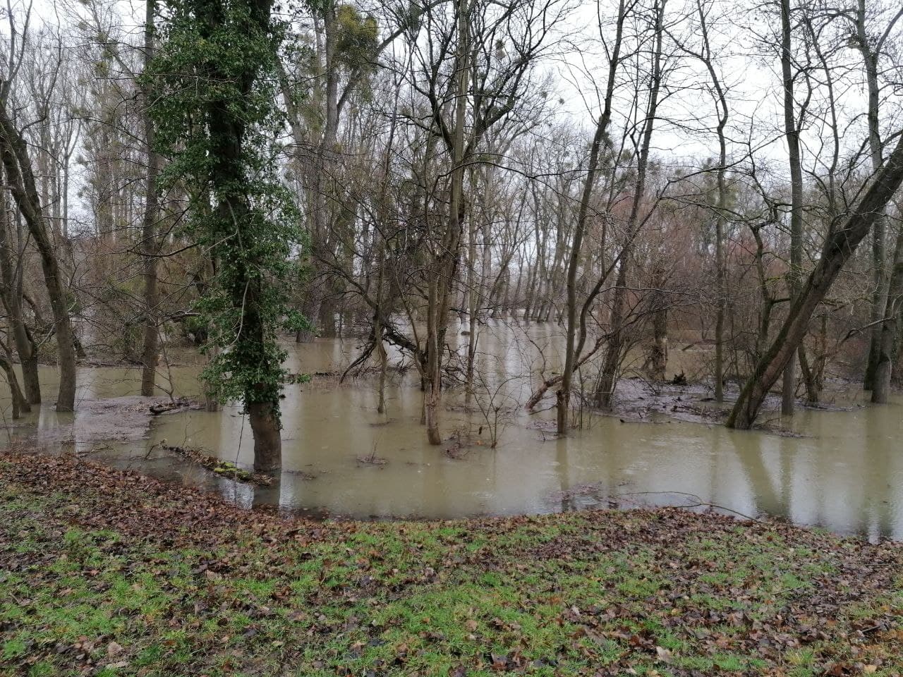
Given further moderate precipitation, the flood situation in the low mountain ranges of the Black Forest,
Swabian Alb, Vogelsberg, Rhön, Jura and Alps will ease only slowly. Several successive low-pressure areas
maintain the westerly flow and continue to direct mild and humid air towards Central Europe. A further
intensification of the flood situation is not expected, however, because by now most of the snow masses
have already thawed up to an altitude of about 700m.
|
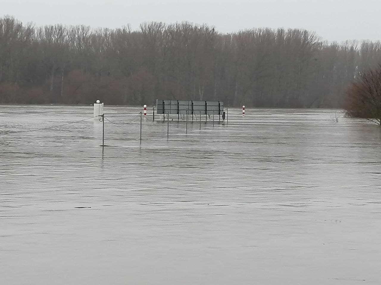
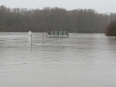
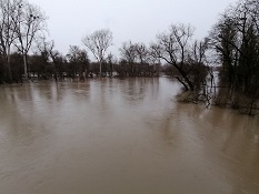
Flooding at the Rhine river near Karlsruhe, January 30, 2021:
Source: Fabian Siegmann
|
 |
 |
 |
 |
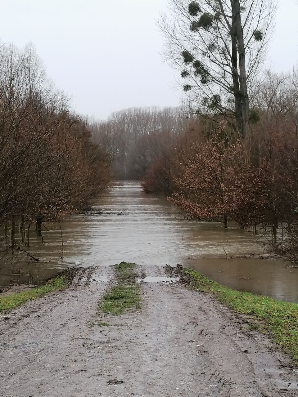
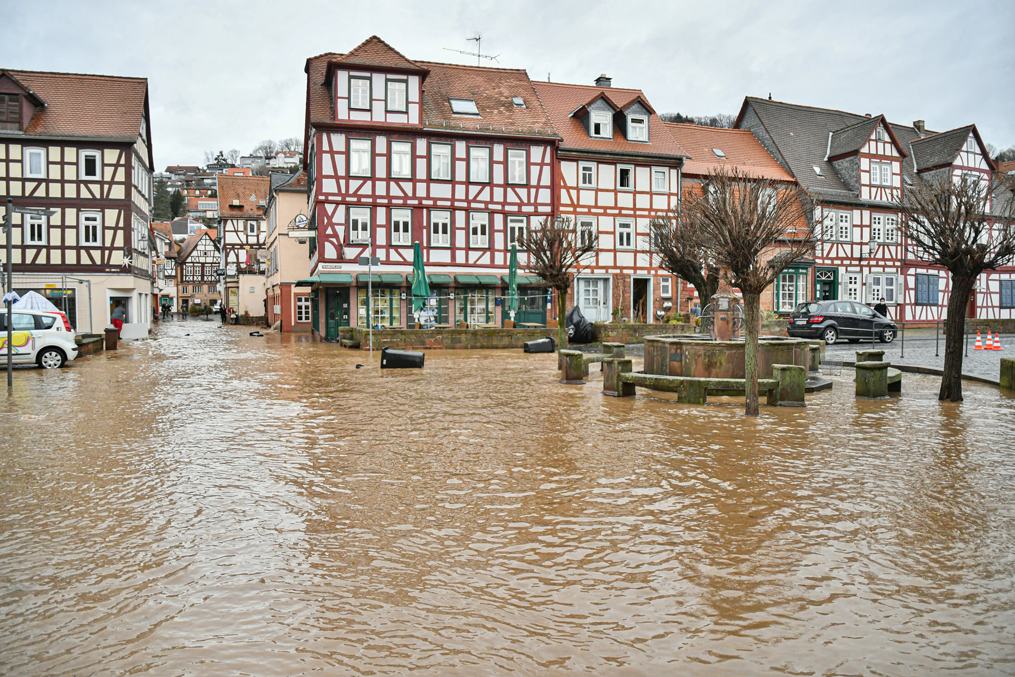
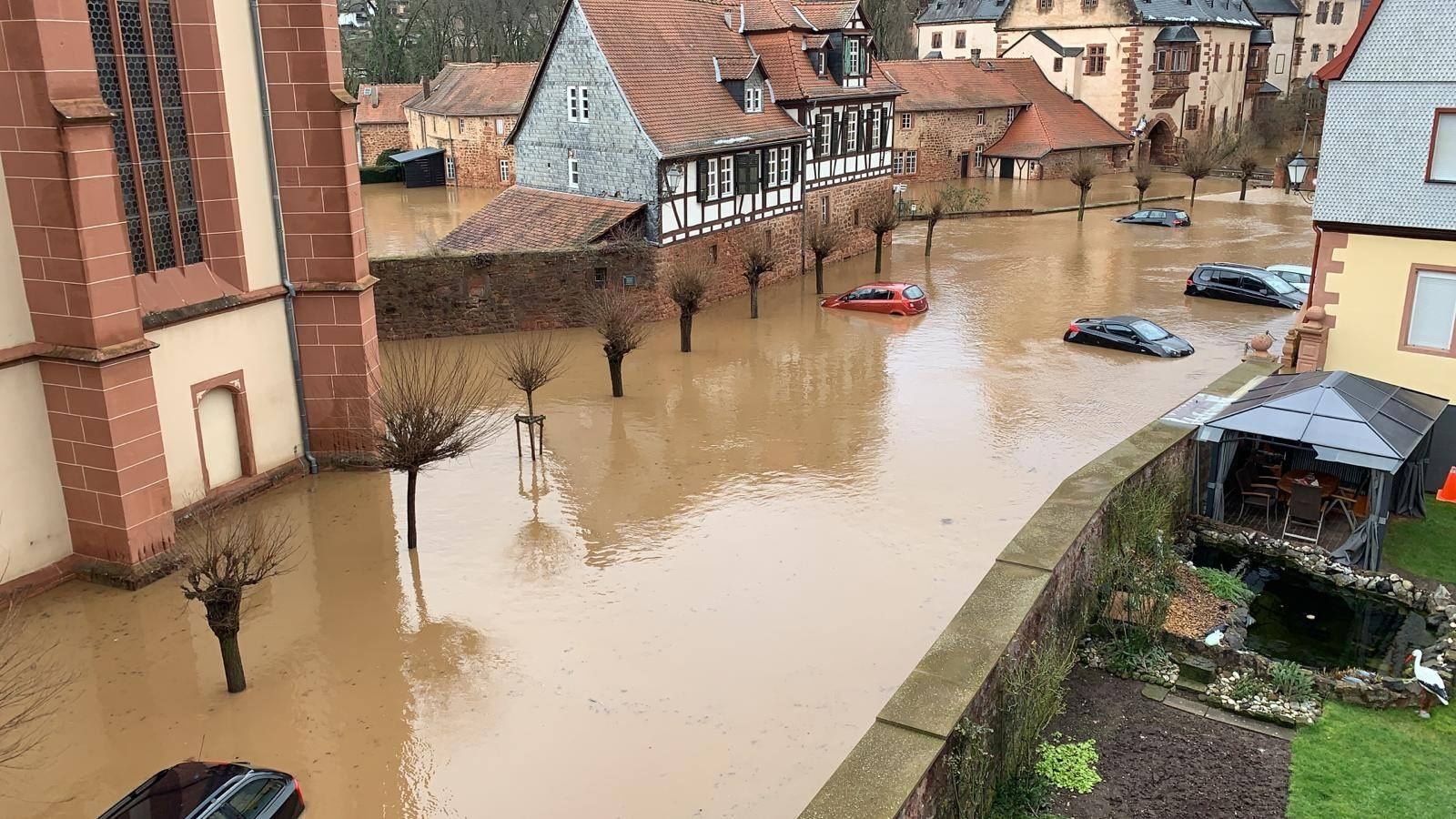
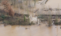
While the larger rivers in Germany are well protected against flooding nowadays, there are still many town
centres that are only shielded from the water masses of the rivers by old protective walls, some of which
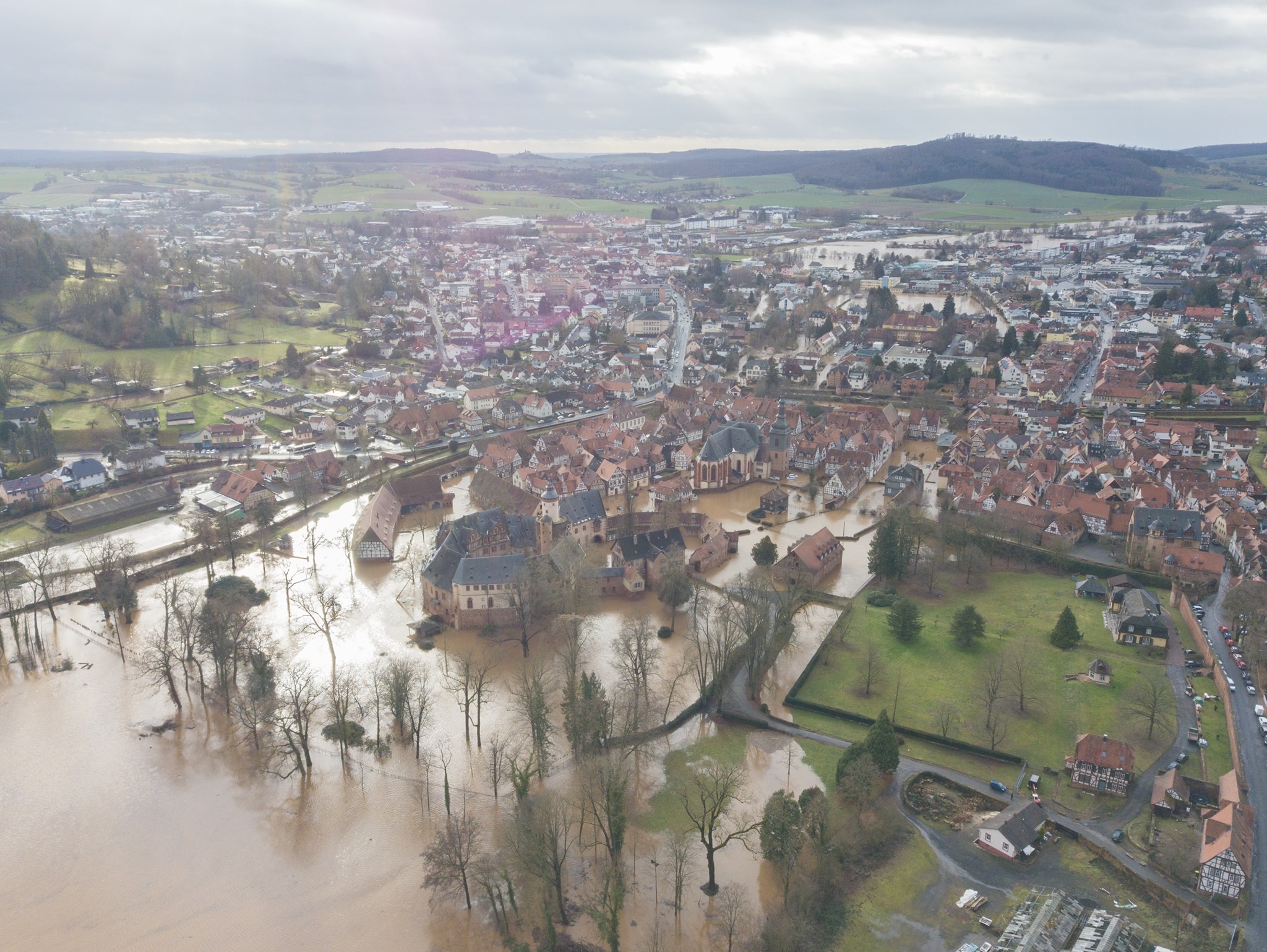
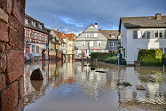
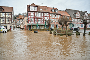
are in need of renovation. In Büdingen, one such protective wall collapsed, allowing large masses of water
to flow unhindered into the historic city centre. The wall had long been considered in urgent need of
restoration and the poor condition of the object had been pointed out for several years.
|
Flooding in Büdingen caused by a collapsed protective wall, January 29, 2021:
Source: Sven Teschke, Büdingen Erleben
|
 |
 |
 |
 |
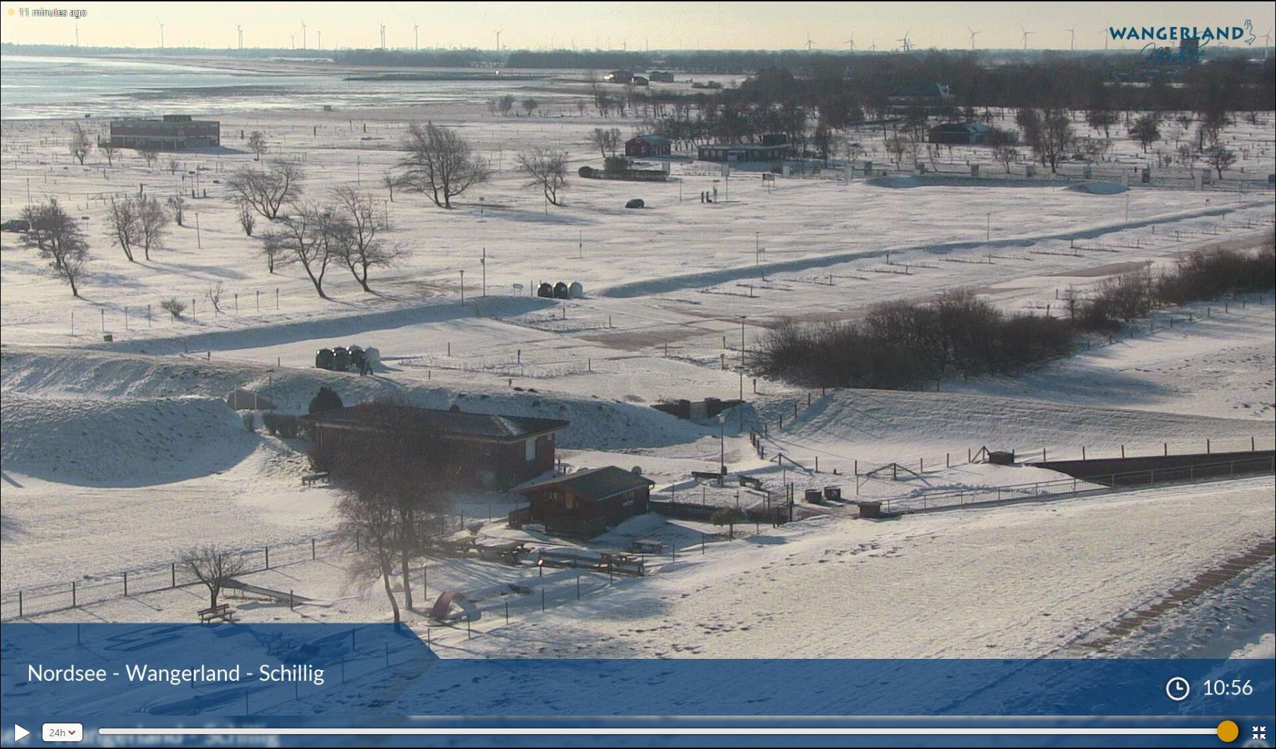
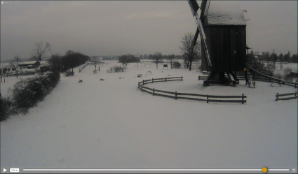
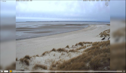
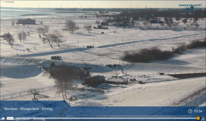
Fresh snow in the Northeast
However, the warm temperatures could not unfold throughout the whole state. A sharp air mass boundary
separated the south and west of the country from the north and east of Germany. A pronounced area of
high pressure over Scandinavia guided cold polar air into the north-eastern areas. Precipitation occurred
especially in the area of the air mass boundary, but also in surrounding areas. Due to the temperatures
below freezing point, this resulted in widespread snowfall even in very unusual places. Thus, a shallow
snow cover could be measured on many North Sea islands such as Sylt, Langeroog or Norderney. Even on the
island of Helgoland in the middle of the North Sea, a minimal blanket of snow remained. Far from the sea
coasts, snow depths of up to 20cm occurred.
|
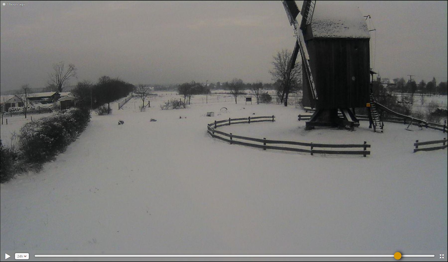
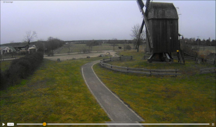
Webcam Images from Colbitz, January 29 and 30, Source:
Windy
|
 |
 |
|
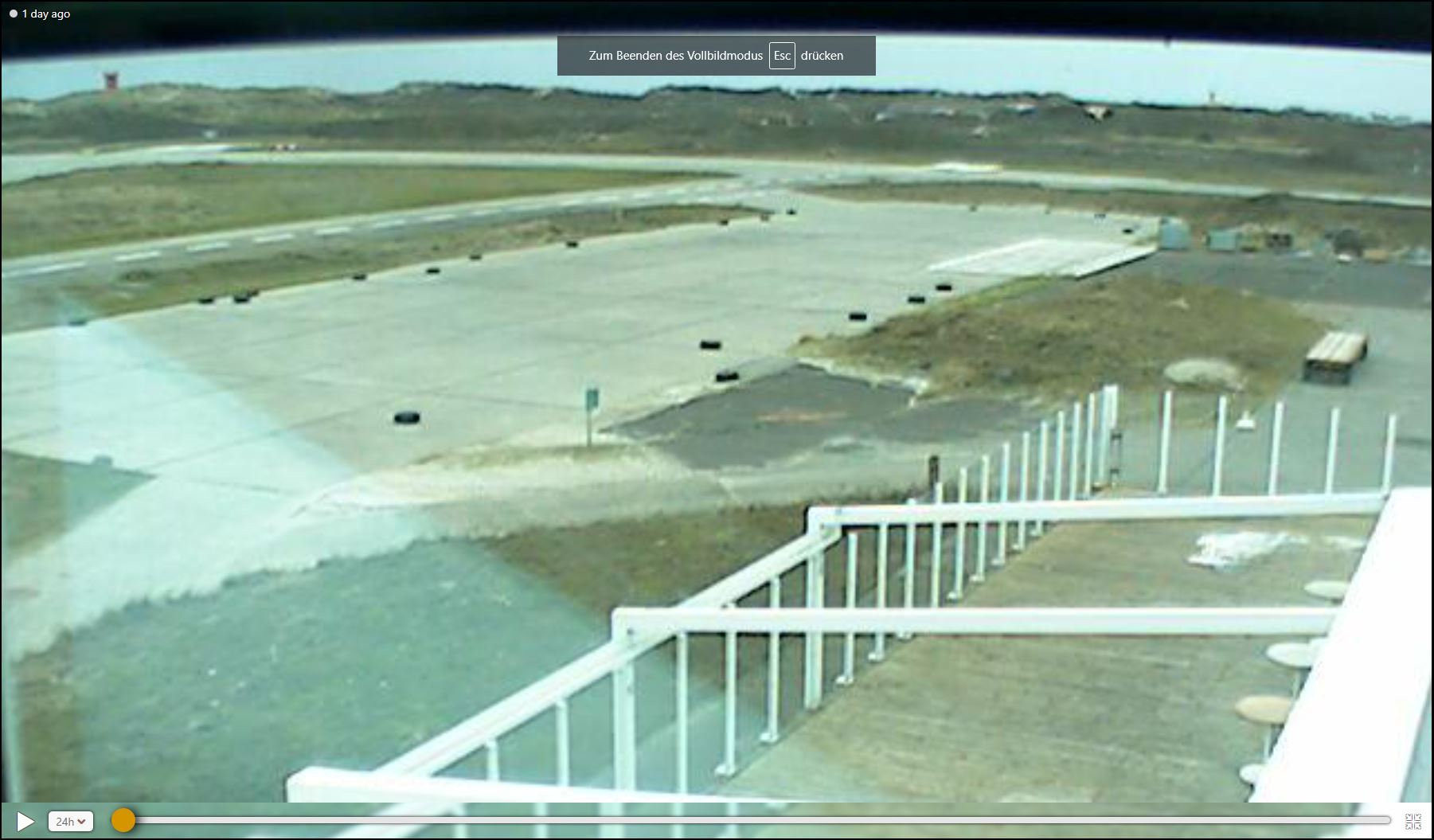
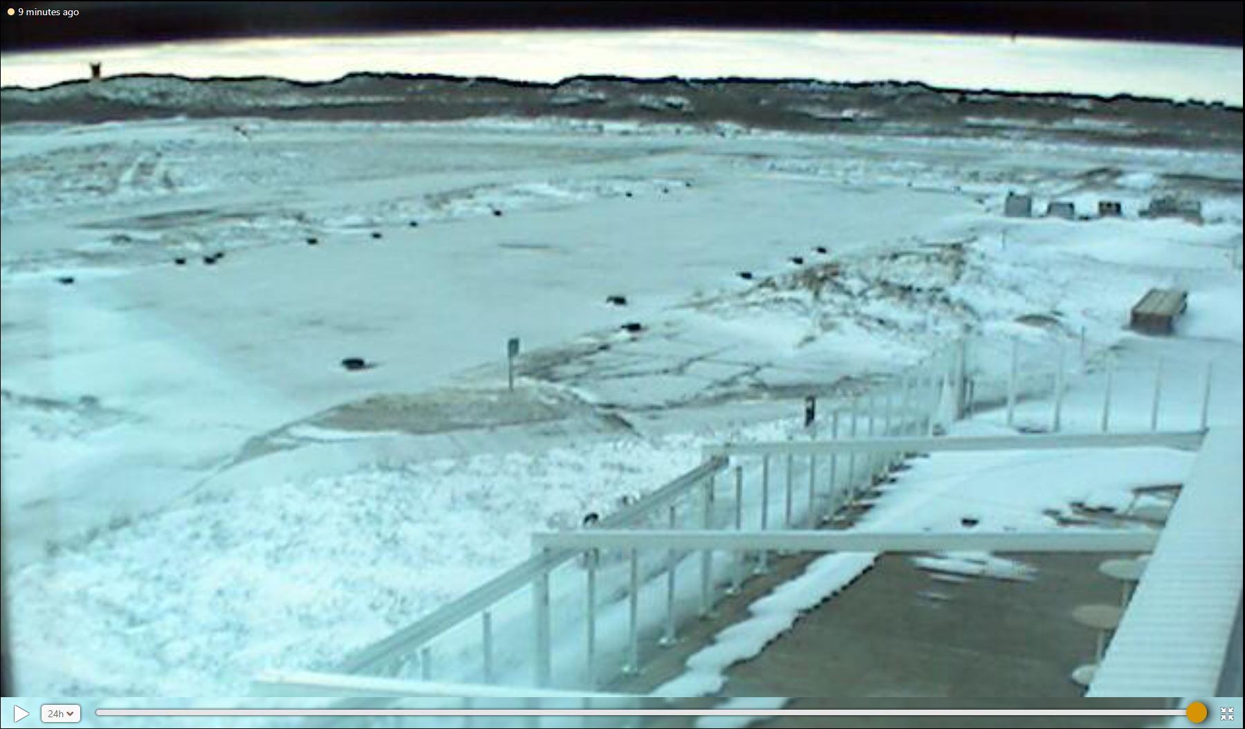
Webcam Images from Helgoland, January 29 and 30, Source:
Windy
|
 |
 |
|
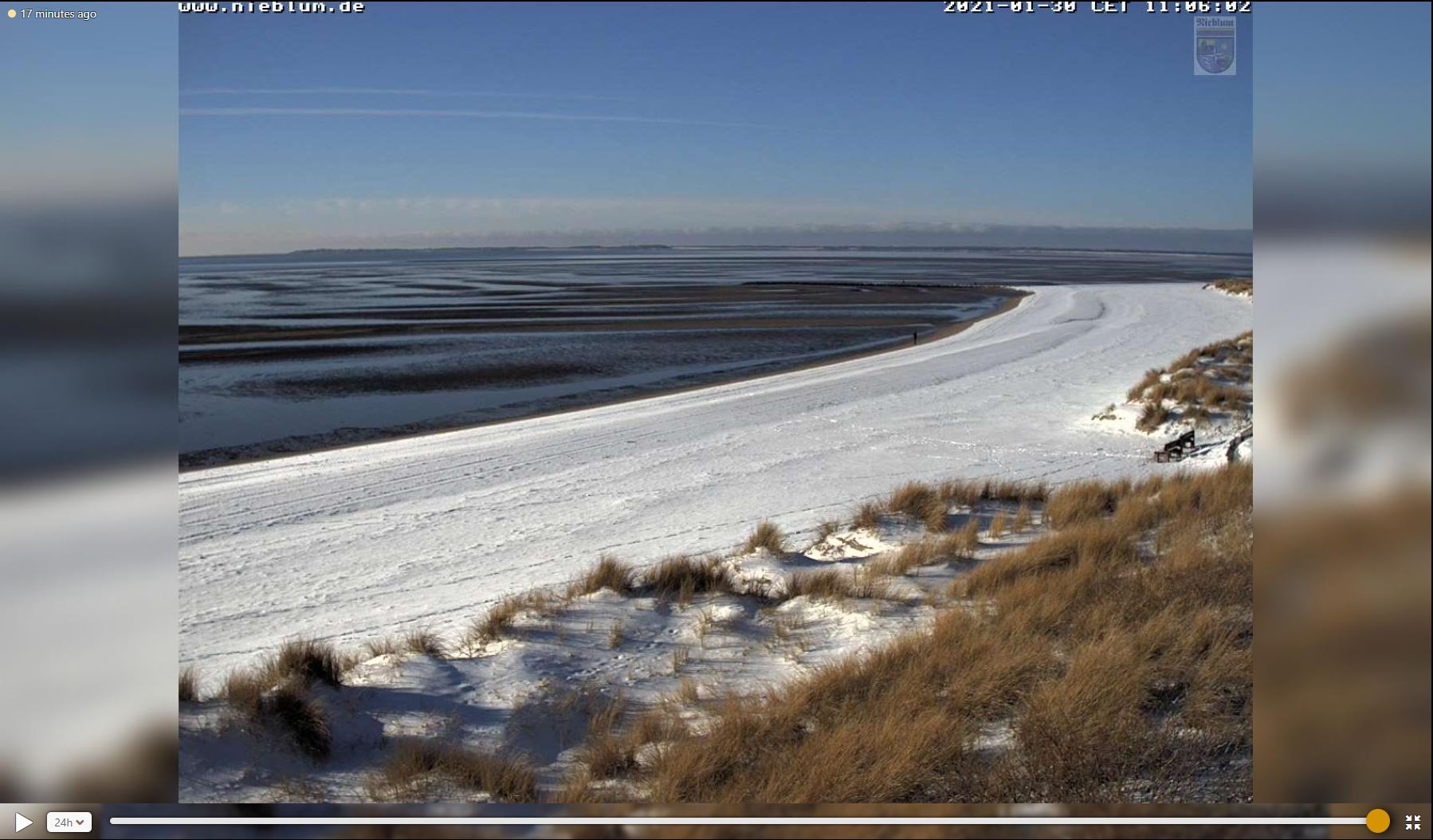
Webcam Images from Nieblum, January 29 and 30, Source:
Windy
|
 |
 |
|
Webcam Images from Schillig, January 29 and 30, Source:
Windy
|
 |
 |
Text: FS
January 31, 2021
|