|
Medicane Ianos was a low-pressure system with some typical characteristics of a Mediterranean cyclone,
which caused severe devastation and flooding in Greece on September 18 and 19, as well as destruction of the local transport, electricity and water supply networks.
Due to the still warm waters of the Mediterranean Sea, a Medicane developed on September 17th southwest of Italy - between Sicily
and the Ionian Sea - which moved towards Greece with wind speeds of up to 150 kph. The initially extratropical low-pressure system,
which was called UDINE by the German Weather Service, was already visible since September 14. Embedded in a upper level high pressure
ridge, which caused late summer weather in Central Europe with air temperatures above 30°C, an area of strong convection was able to
organize itself in the Mediterranean Sea. This is astonishing considering the lack of uplift drivers like layer thickness- or vorticity
advection. Sea surface temperatures in the Ionian Sea around 27°C and an area with hardly any vertical wind shear were sufficient to
create a storm with typical characteristics of a Mediterranean cyclone.
|
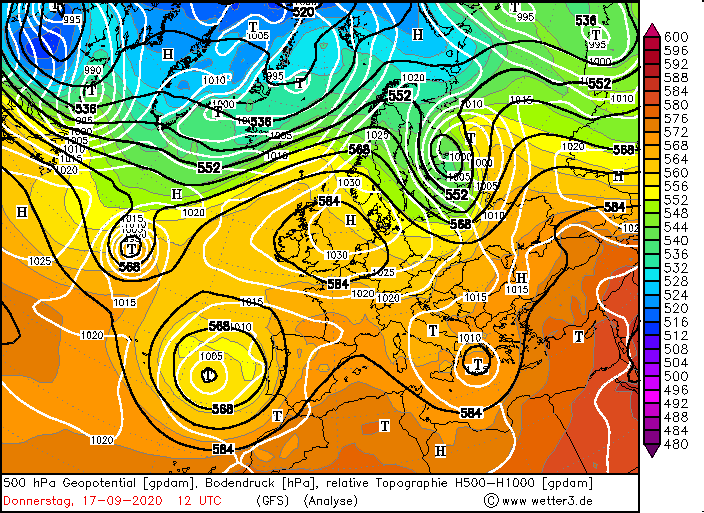
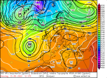
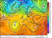
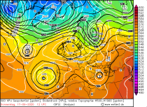
500 hPa Geopotential from 15 to 18 September, source:
wetter3
|
 |
 |
 |
 |
Medicanes are tropical-like cyclones with a warm core, which clearly distinguishes them from extratropical low-pressure systems. The formation
mechanisms of Medicanes are similar to those of tropical cyclones and are based on the thermodynamic imbalance of ocean and atmosphere. Such as
tropical systems, Medicanes form preferentially above warm water. High humidity in the middle tropospheric layer, diabatic processes and minimum
vertical wind shear are preferred conditions as well. Changes caused by climate change, such as an increased sea surface temperature and a poleward
shift of storm tracks indicate an increasing number of medicans in the future. Since the 2010s, the systems have been occurring roughly in the
frequency of one event per year.
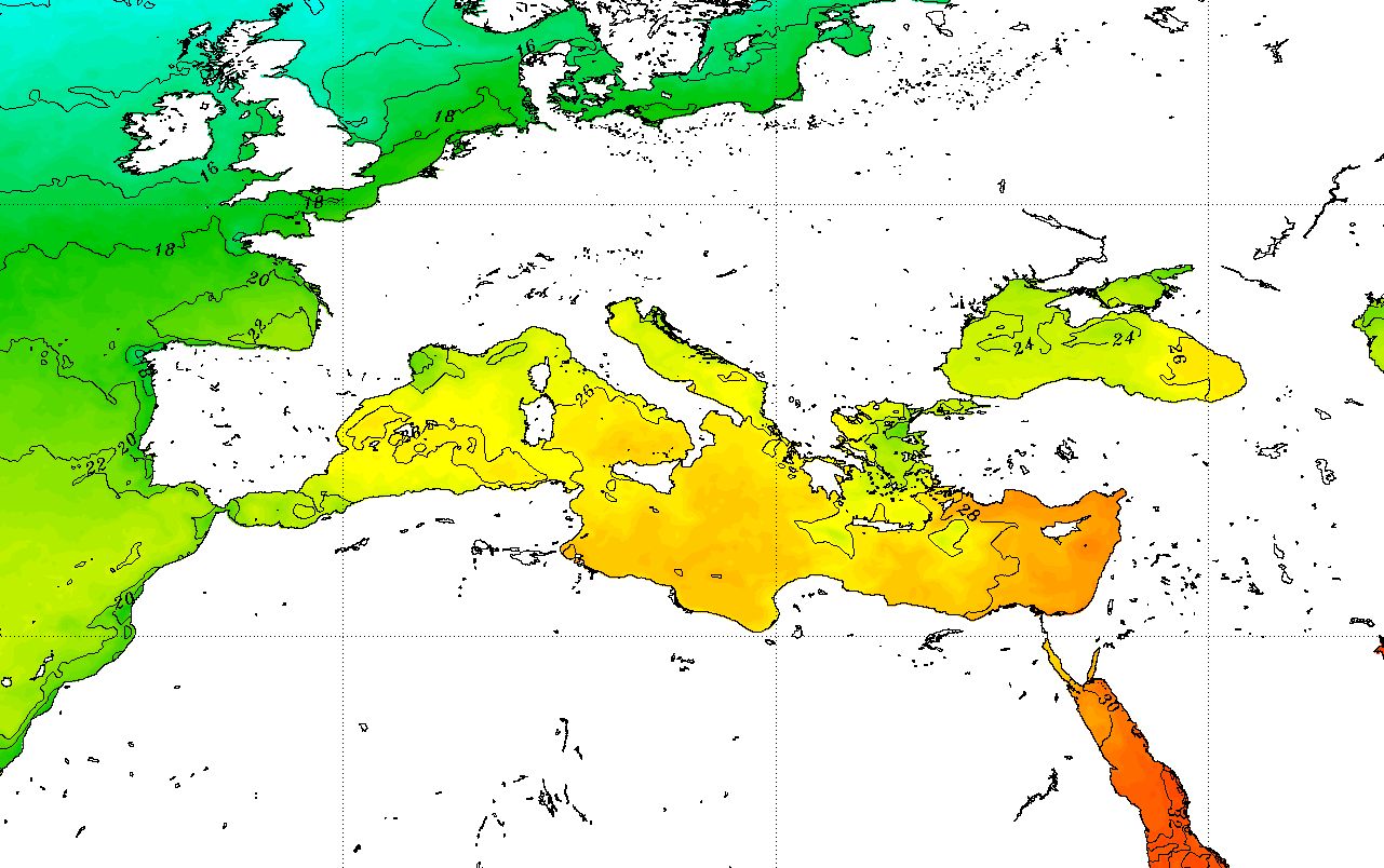
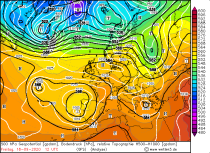
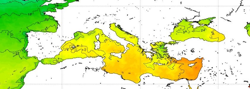
Sea surface temperature during IANOS' development, source:
NOAA
 |
|
The term Medicane, which only emerged in the 1980s, is composed of the English words Mediterranean and Hurricane.
Based on the Saffir-Simpson scale, Medicanes are divided into three categories. With 1-minute-sustained wind of up to
62 kph it is a Mediterranean tropical disturbance. From 63 to 111 kph it is referred to as a Mediterranean tropical storm.
A 1-minute suspended wind speed of more than 112 kph is considered a Medicane. While hurricanes in the USA are often
intensively investigated by flight operations, comparable weather phenomena in the Mediterranean are not beeing investigated
operationally in this way.
|
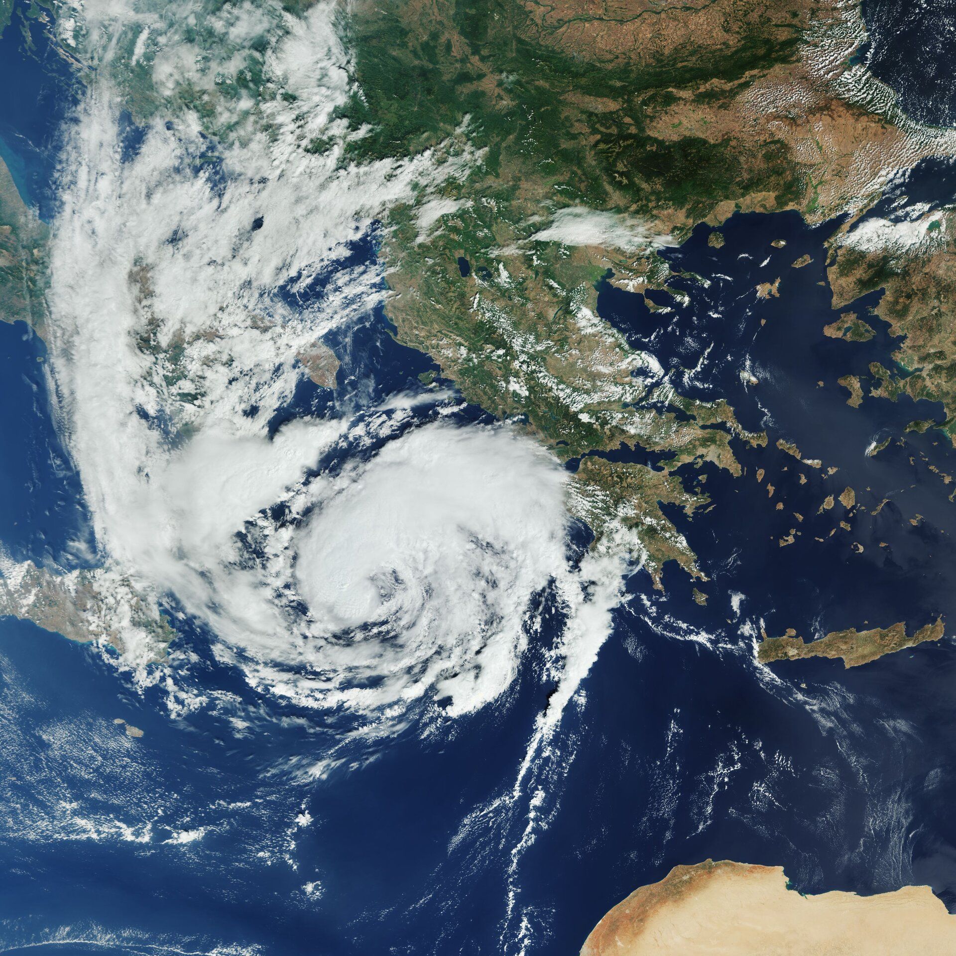
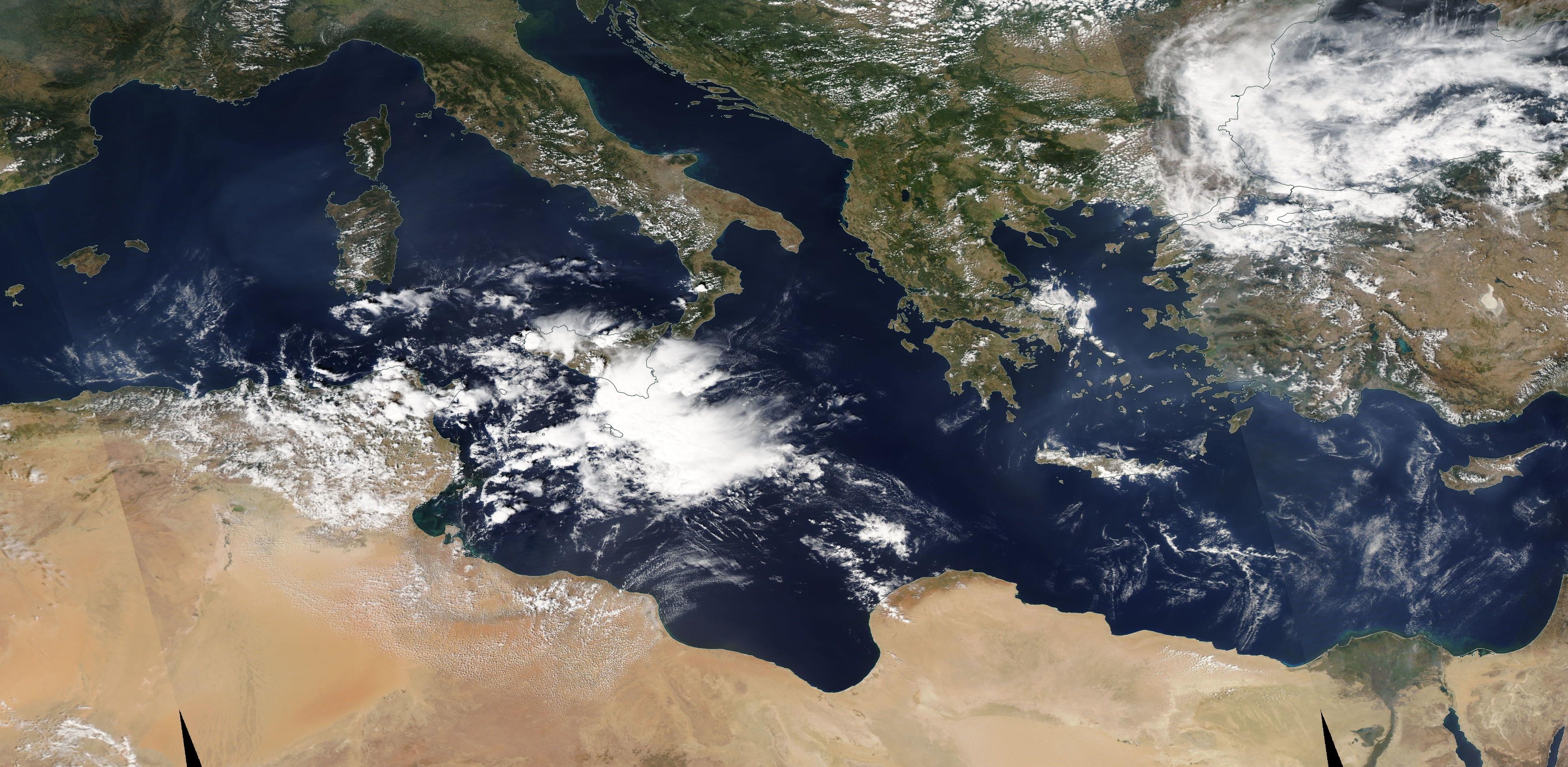
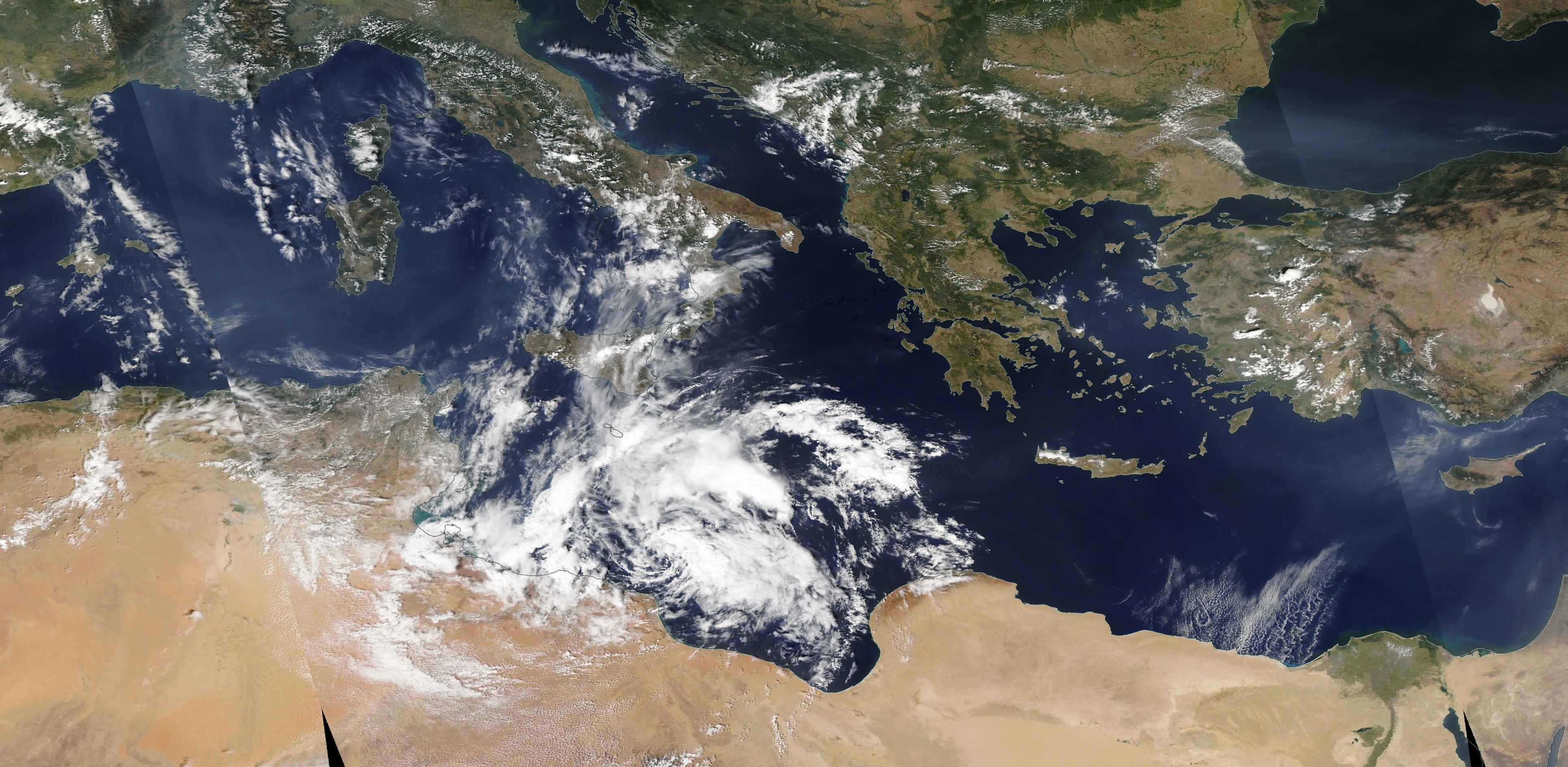
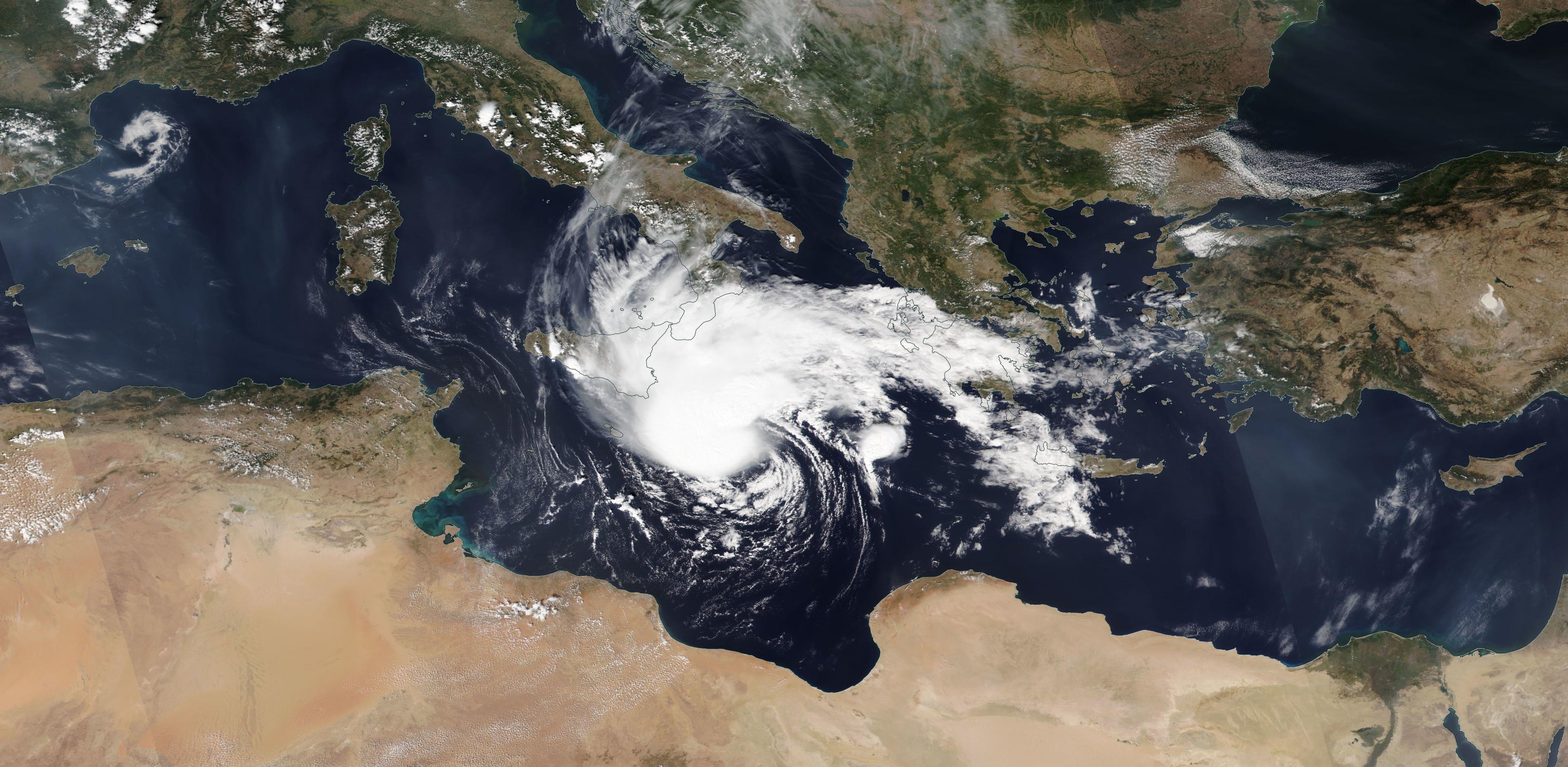
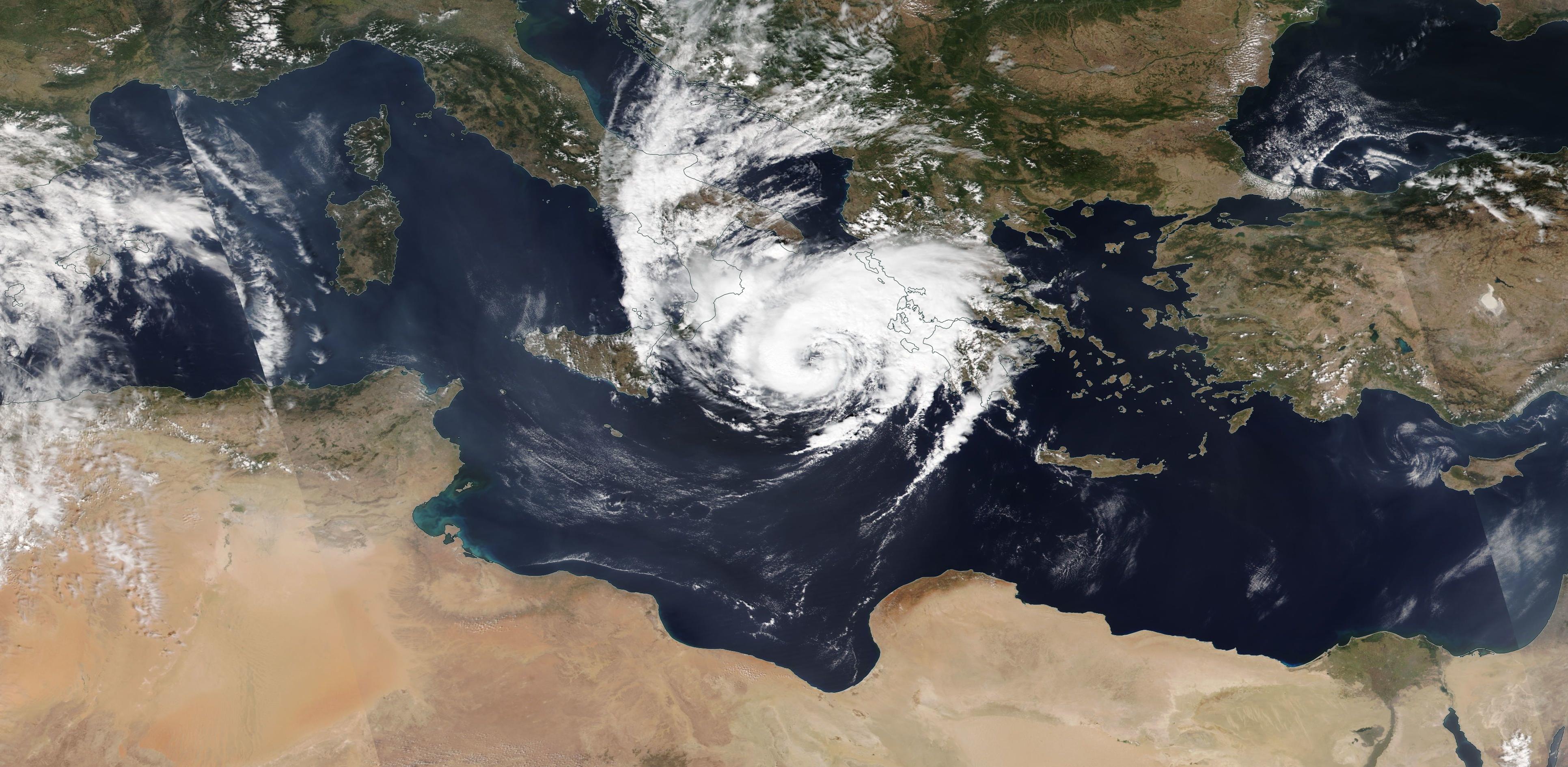
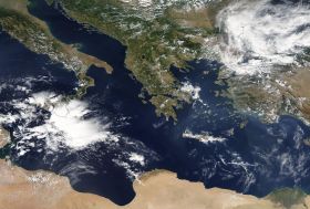
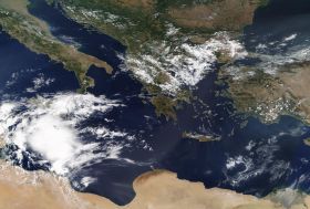
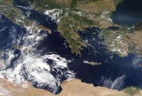
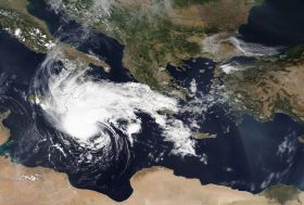
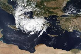
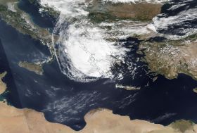
Satellite images (visible) from 13 to 18 September, source:
NASA Worldview
|
 |
 |
 |
 |
 |
 |
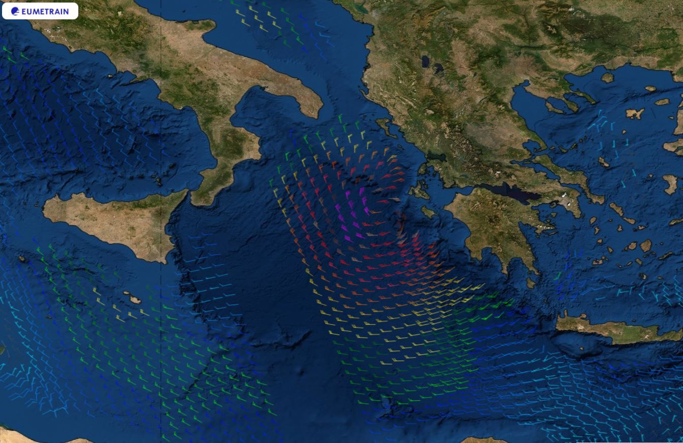
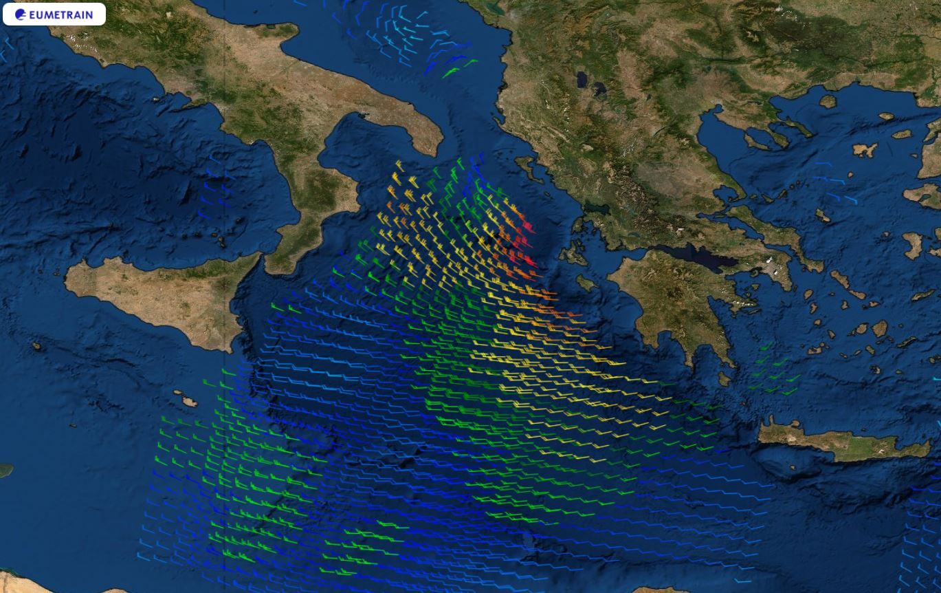
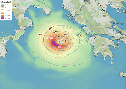
However, satellite-based remote sensing can be used to determine the roughness of the sea
surface, which allows fairly precise conclusions to be drawn about the wind speeds over open sea. Measured wind speeds
of up to 130 kph on September 18th justify the classification of IANOS as Medicane. An existing, albeit slightly
pronounced eye on September 17 also confirms this classification.
|
Satellite based wind measurements on 18 September 06 and 12 UTC, source:
EUMETRAIN
|
 |
 |
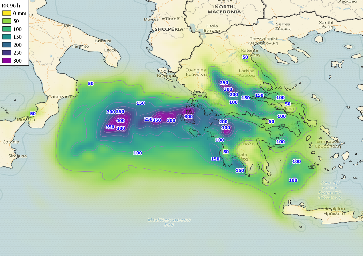
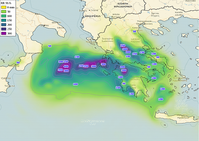
The islands in the southern Ionian Sea were the first affected areas, immediately followed by the Peloponnese.
In the port of Kyllini the ferries could no longer leave port, while in the prefectures of Elis, Achaia, Etolioakarnania,
Arcadia, Messenia, Zakynthos, Kefalonia and Ithaca a state of emergency was declared. In Zakynthos the port was destroyed.
Waves over 7 meters high accompanied by hail and lightning were raging. From there the cyclone crossed over to the mainland
with strong north and later south winds. Many areas in Thessaly were heavily affected. Damage was caused to the road network
and to the power supply. Buildings and fields were flooded, at least 3 people lost their lives.
|
Estimated gusts on 17 September and 96 h precipitation from 17 to 20 September, source:
ARPEGE, Image credit: Bernhard Mühr
|
 |
 |
Text: FS
September 20, 2020
|