|
Long lasting heat wave in Central Europe with temperatures above 35°C in whole Germany peaking at 38.6°C in Trier. Several decade and
monthly records of highest maximum-, mean- and minmum temperature. Many thunderstorms towards the end of the heat wave with a rare thunderstorm
propagating over Karlsruhe creating precipitation of 19.4 mm in one hour.
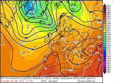
After a first half of summer, which in Central Europe presented itself with inconsistent weather and fairly average
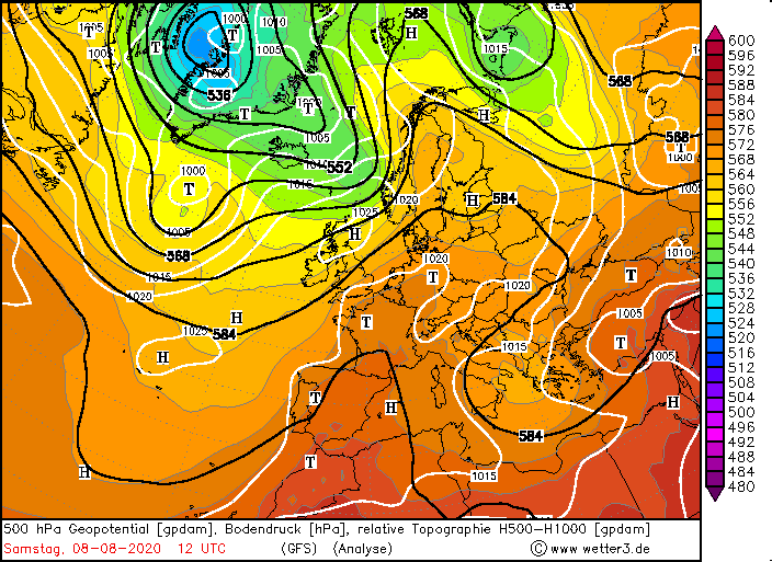
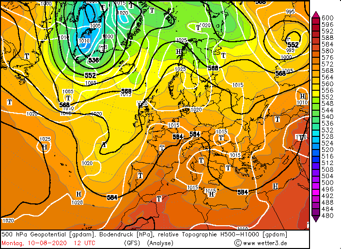
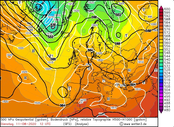
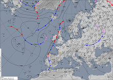
temperatures, the first long-lasting heat wave prevailed in the early stages of August. A trough extending quite far
south over western Europe caused warm air advection from the southwest in the first days of the month, followed by
the influence of colder air at higher levels, resulting in unstable stratification and widespread thunderstorms.
After a cut-off process, the initially still cold low moved across the Balkans, where it quickly died. At the same
time, a ridge stretched across the Iberian Peninsula to Central Europe starting on 06 August and spread across the
whole of Europe in the following days.
|
500 hPa Geopotential 08 until 11 August, source:
wetter3
|
 |
 |
 |
 |
In the west of Germany the 30°C mark was already exceeded on 05 August, and by 08 August the hot air had spread
over the entire country. Apart from the coastal areas and the edge of the Northern Alps, daily maximum temperatures
of over 35°C were recorded throughout Germany between 08 August and 12 August. The highest temperature of 38.6°C was
reached on 09 August in Trier.
|
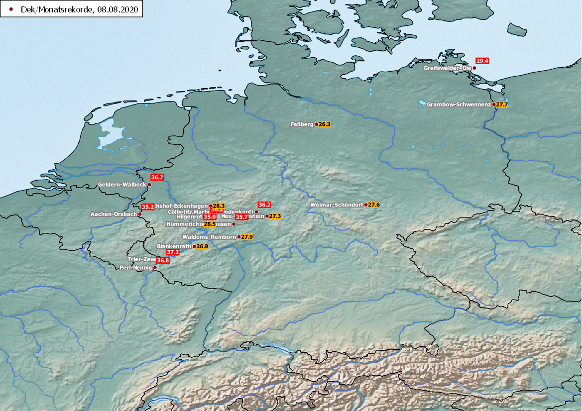
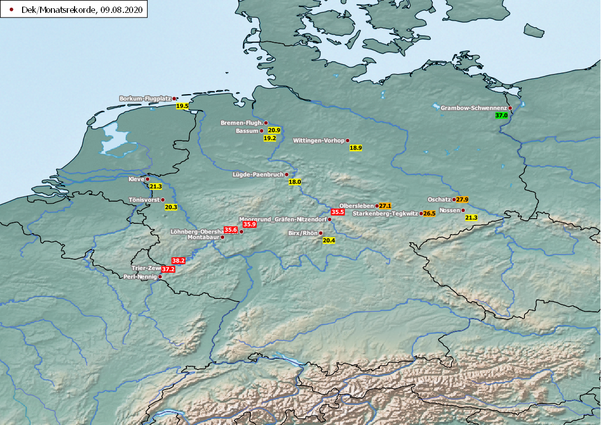
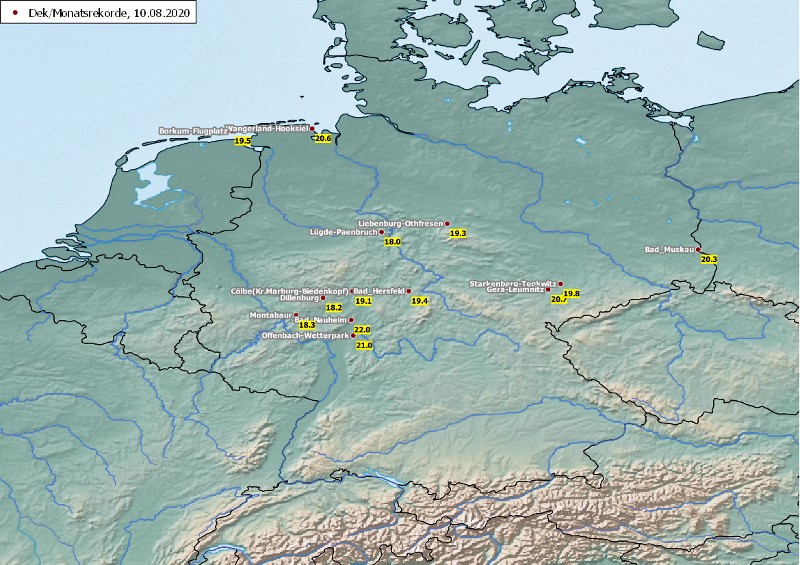
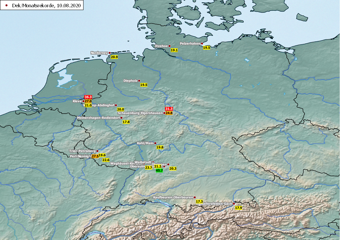
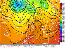
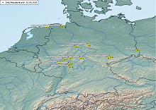
Overview of decade and monthly records. Red: Tmax, Orange: Tmean, Yellow: Tmin, Green: Daily precipitation, source:
DWD
|
 |
 |
 |
 |
In the course of the heat wave there were numerous decade and monthly records of new highest daily maximum-, daily mean-,
and daily minimum temperature. A strong and stationary thunderstorm in the northeast of Germany also caused a new monthly
record of daily precipitation in Grambow Schwennenz (37.0 mm). A selection of record values from stations with already
long series of measurements is shown in the maps above.
|
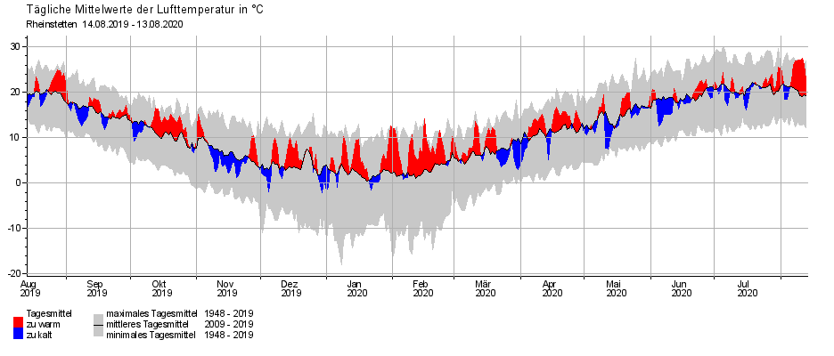
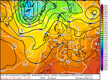
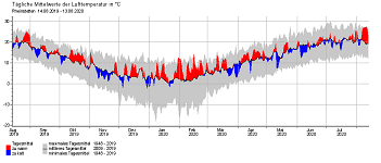
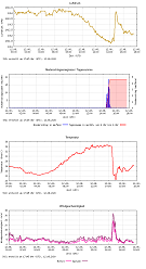
Yearly temperature time series and anomaly for Rheinstetten and Hamburg, accumulated precipitation and anomaly since 01 July for Rheinstetten, source:
DWD
|
 |
 |
 |
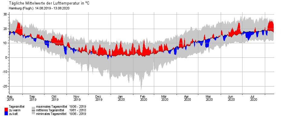
The time series shown here for Rheinstetten (southern Germany) and Hamburg (northern Germany) show the development of
the daily mean temperature for one year, its deviation from the mean value and also its extreme values since the
beginning of the recordings. In addition to the previously variable and averagely warm summer, the heat wave at the
right end of the time series can be seen as a clearly red signal. However, a comparison with last winter also shows
that the heat wave was less abnormal overall than the 2019/2020 winter season, in which similar or even higher temperature
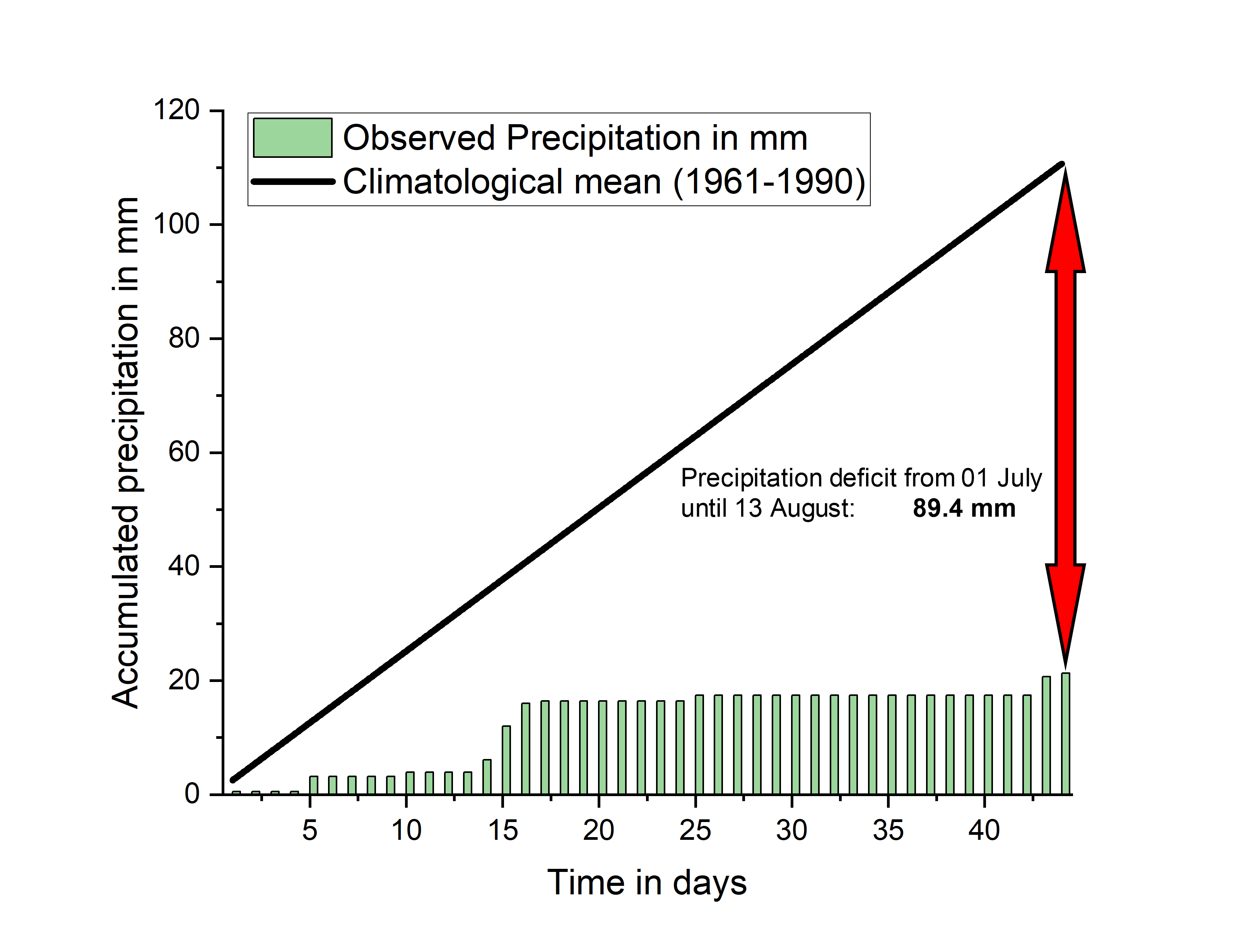
deviations were achieved over a much longer period. The graph on the far right shows the accumulated precipitation since
01 July as a bar chart and the precipitation to be expected for Rheinstetten as a straight line. Despite a July with
inconsistent weather, there is a precipitation deficit of 89.4 mm from 01 July to 13 August, which corresponds to a relative
deficit of 80.7%.
|
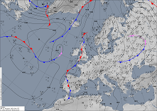
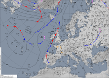
Sea level pressure and fronts, 12 August 00 until 18 UTC , source:
DWD
|
 |
 |
 |
 |
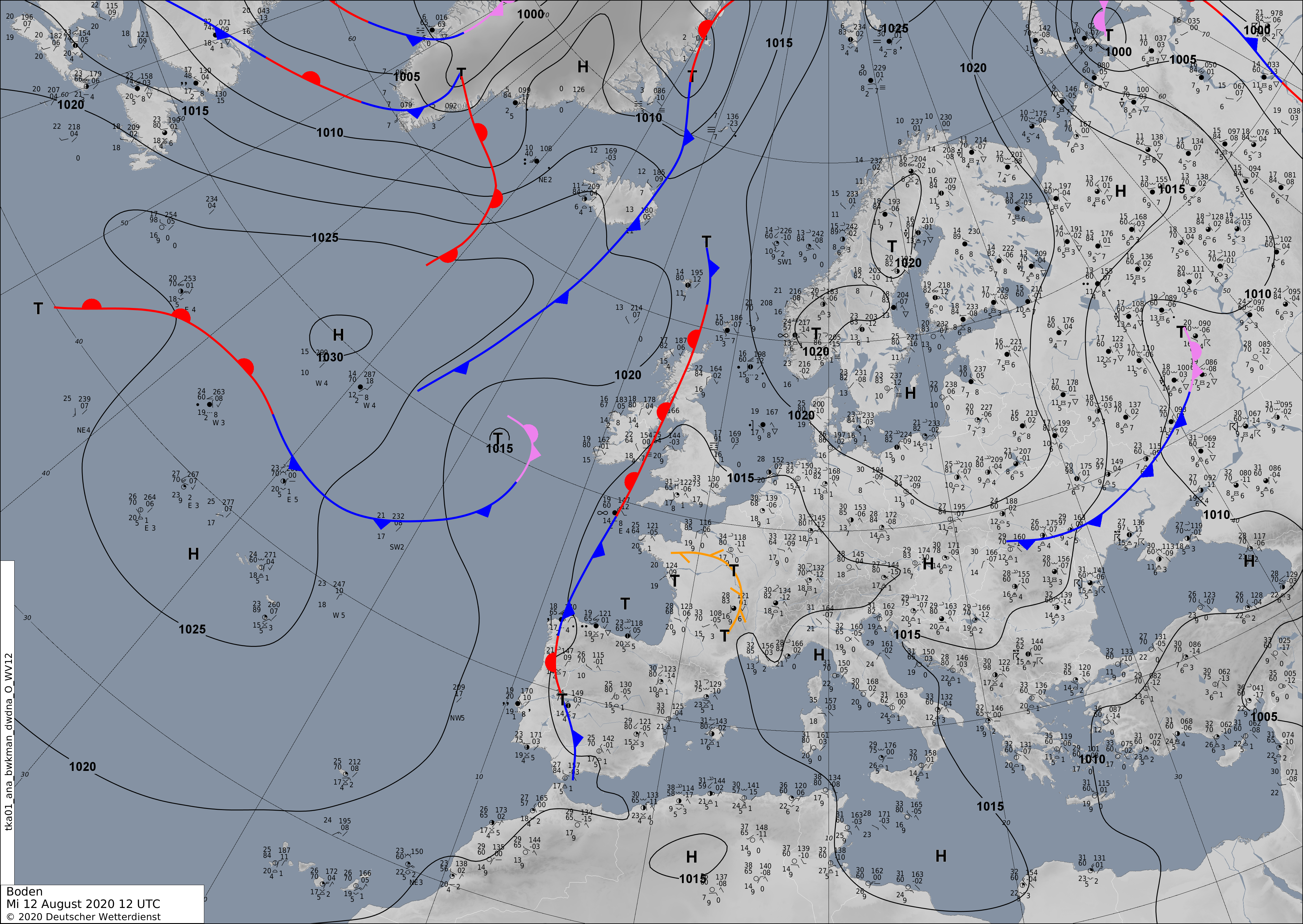
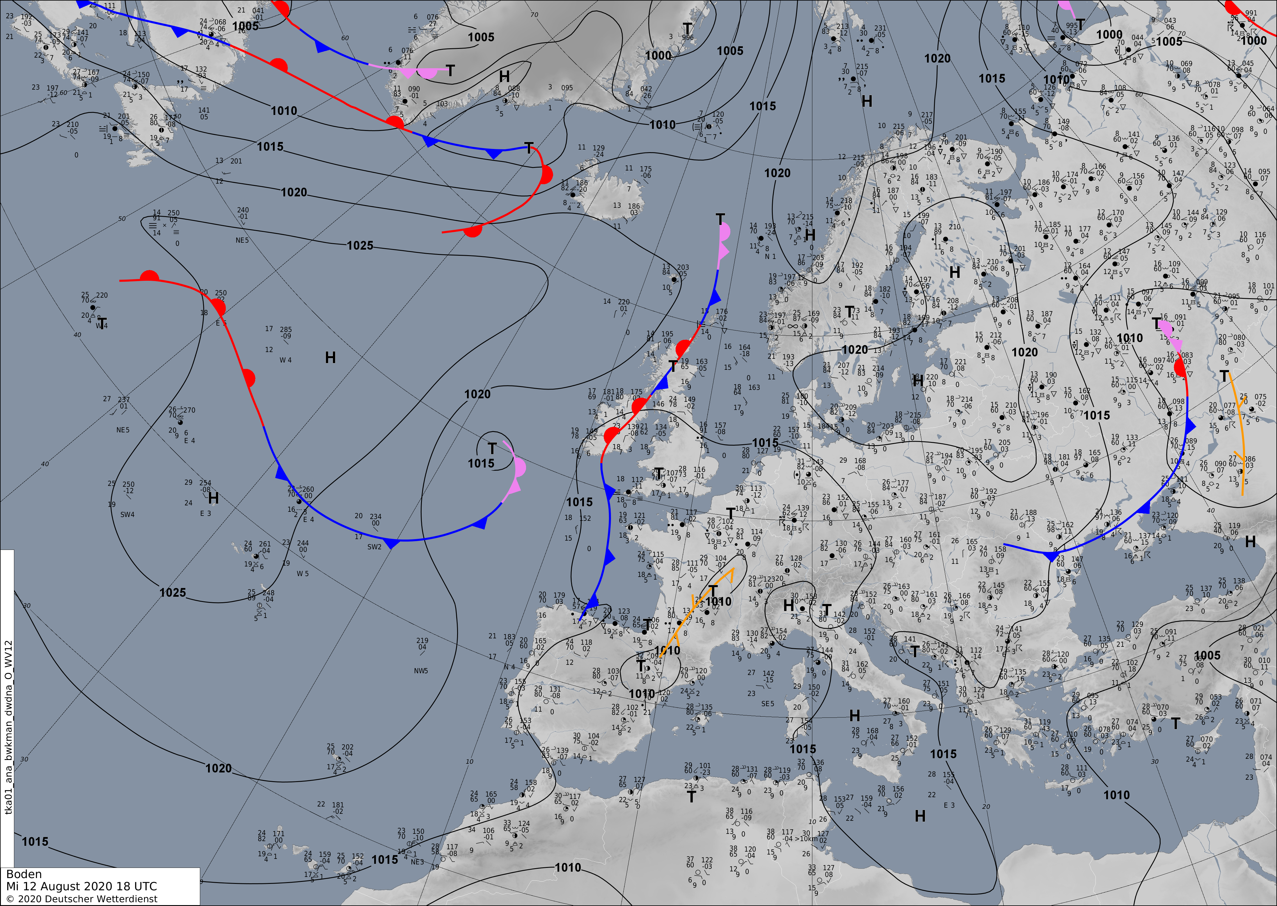
Towards the end of the heat wave, a weakly pronounced trough with a correspondingly surface low could position itself
over the Iberian Peninsula from 11 August. The influence coming from the southwest caused temperatures to rise again,
especially in the Rhine and Saarland, so that values of 36°C to 37°C were reached in many places. However, the increasing
humidity also caused an increased heat stress, not least due to tropical nights with minimum temperatures of more than
20°C, and also caused an increasing tendency to thunderstorms.
|
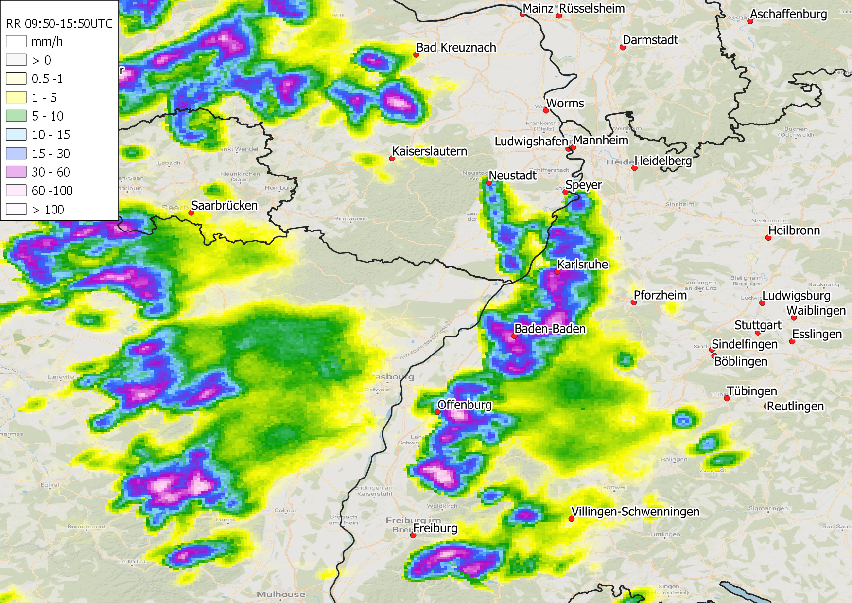
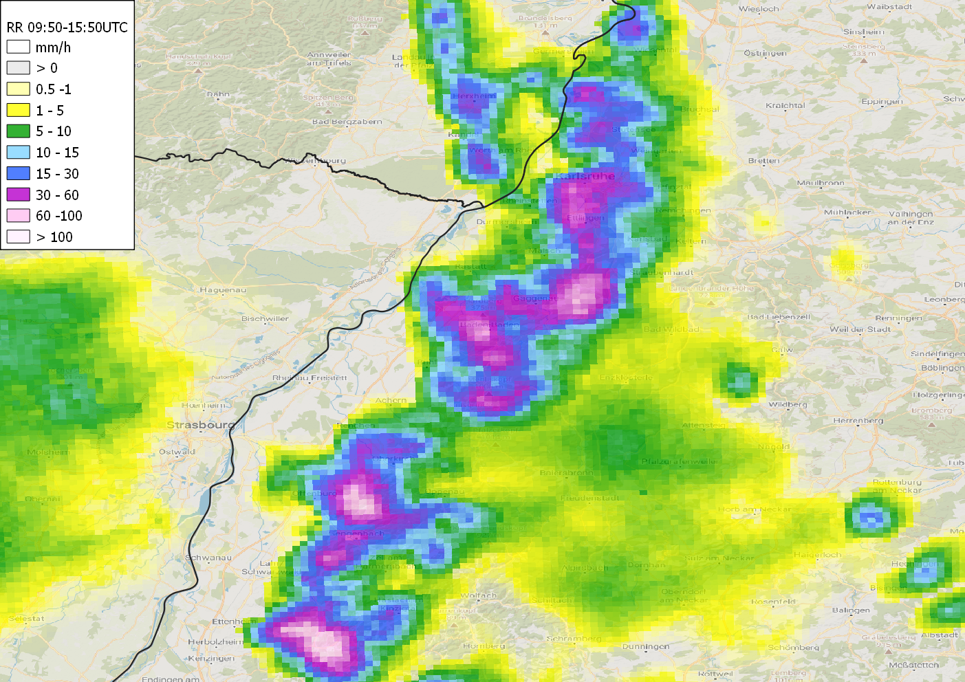
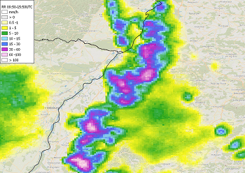
Accumulated precipitation 09:50 until 15:50 UTC for Baden Württemberg, source:
DWD
|
 |
 |
 |
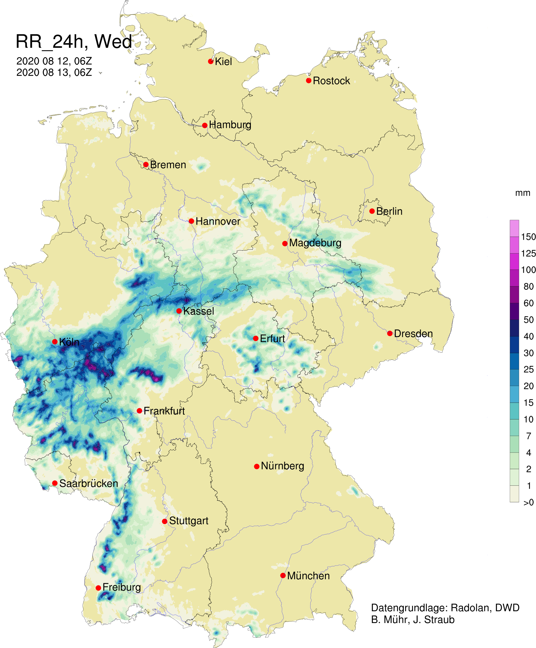
On 12 August, strong convection occurred in western Germany, over the Vosges Mountains and the Black Forest. During this
event 44.6 mm Bayerfeld-Steckweiler-Schmal was measured, in Ettenheim-Ettenheimmuenster it was 32.5 mm. Along the border
between Rhineland-Palatinate and North Rhine-Westphalia even up to 69.0 mm were registered (Linz-Unkel). A thunderstorm
cell on the western edge of the northern Black Forest quickly expanded northwards and found its way into the Rhine valley,
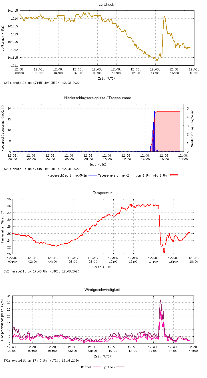
which is otherwise often spared from thunderstorms. The institute's own station in the centre of Karlsruhe registered a
precipitation quantity of 19.4 mm within one hour. The event also marked the end of the heat wave for this region. The
temperature dropped from 35°C to 21°C and did not reach the 30°C mark in the following days either.
|
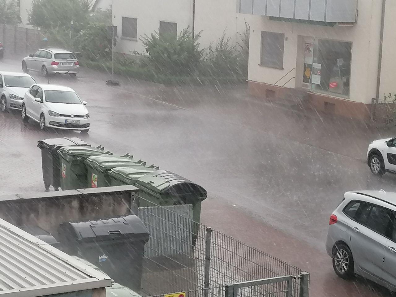
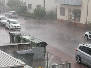
Pictures from hail pilots over Karlsruhe on 12 August, heavy rain in Eggenstein-Leopoldshafen, source:
Thomas Ortlieb, Fabian Siegmann
|
 |
 |
 |
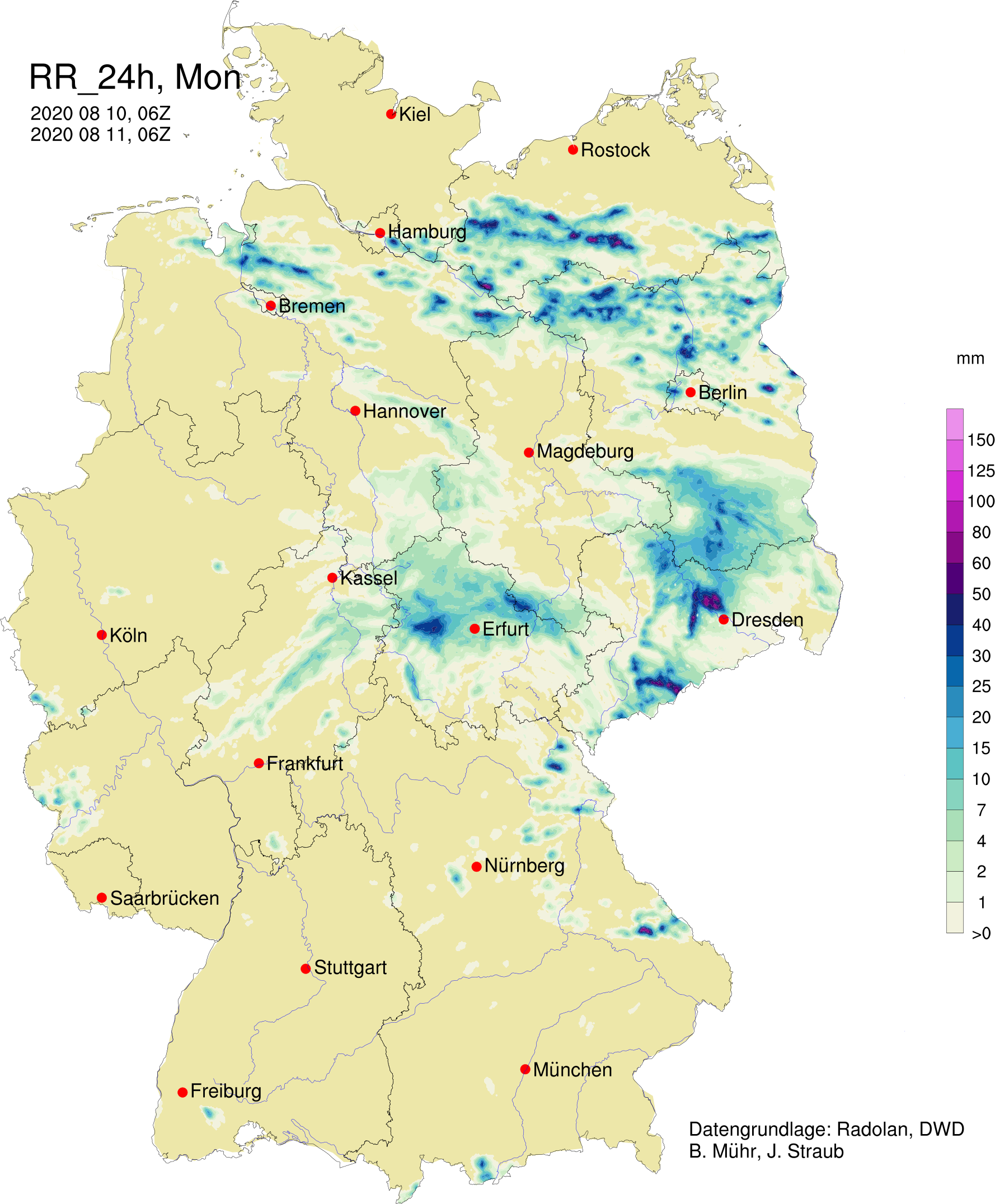
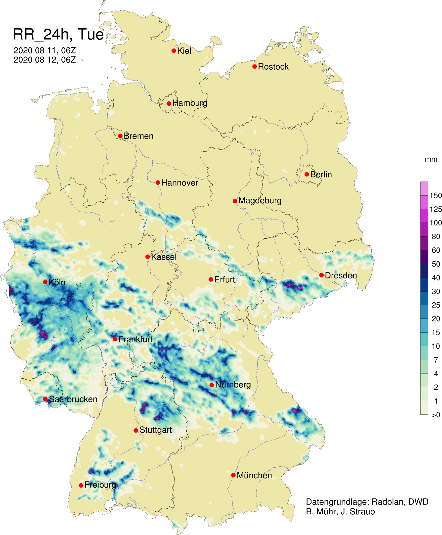
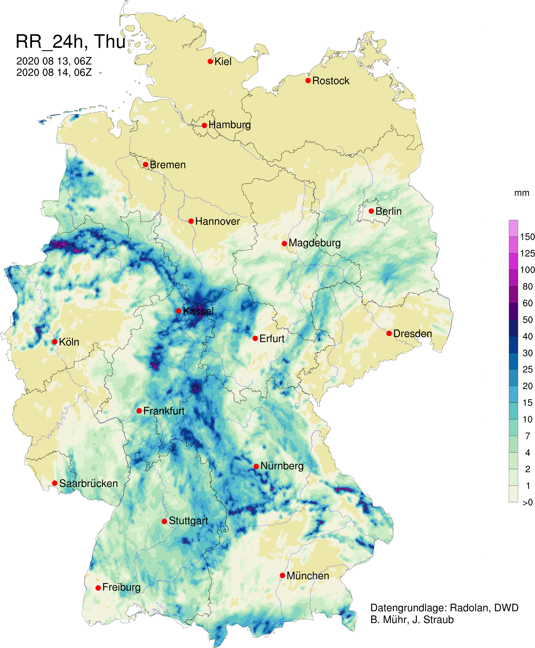
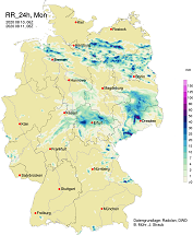
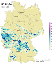
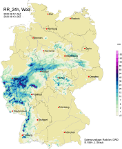
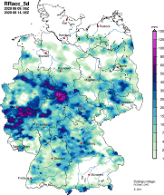
However, a look at the accumulated precipitation sums generated by radar data makes the punctuality of the events
clear. Especially the north and northeast of Germany, which has been suffering from extreme drought since 2018,
was spared from rain again in the past few days. A large discrepancy can also be seen in western Germany, where the
strongest thunderstorms occurred but also locations without any precipitation at all. At 19.4 mm, the daily precipitation
from the Institute's own station corresponds roughly to the amount that should fall within one summer week. However,
the last time a larger value was recorded was 93 days ago (27.0 mm on 11 May).
|
Daily precipitation from 11 to 14 August and 5-day accumulated precipitation from 14 August, source:
Bernhard Mühr
|
 |
 |
 |
 |
 |
Text: FS
August 15, 2020
|