|
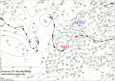
Low pressure area ZACHARIAS and AXEL brought severe precipitation due to thunderstorms and accumulated precipitation in Baden-Württemberg, Bavaria and Brandenburg .
Locally more than 200 mm of precipitation fell within 24 hours.
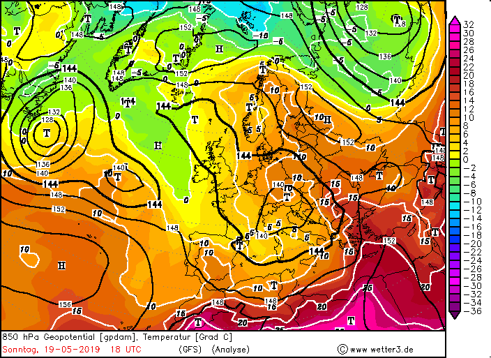
After the year 2018 turned out to be too dry as well as the first months of 2019, the rain came in mid-May in abundance. April already started
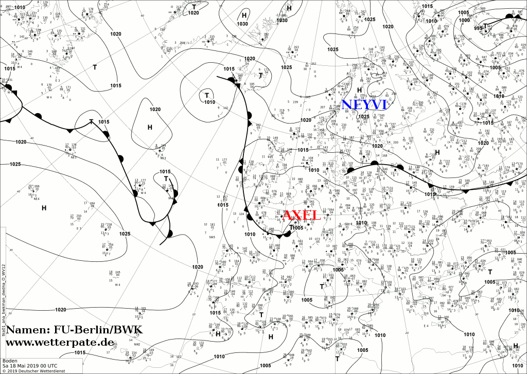
summer-like with temperatures at just under 30 ° C but May started cool with the ''Eisheiligen'' and retained this also. After high NEYVI shifted to the
northeast, it cleared the way for low ZACHARIAS. In addition to ZACHARIAS low AXEL developed in the south of Germany developed as a shallow bottom low.
|
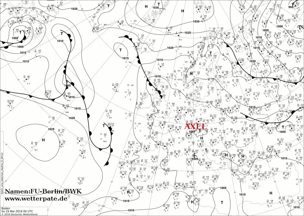
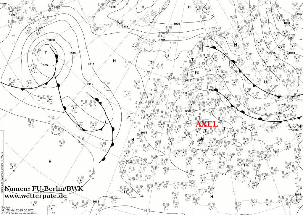
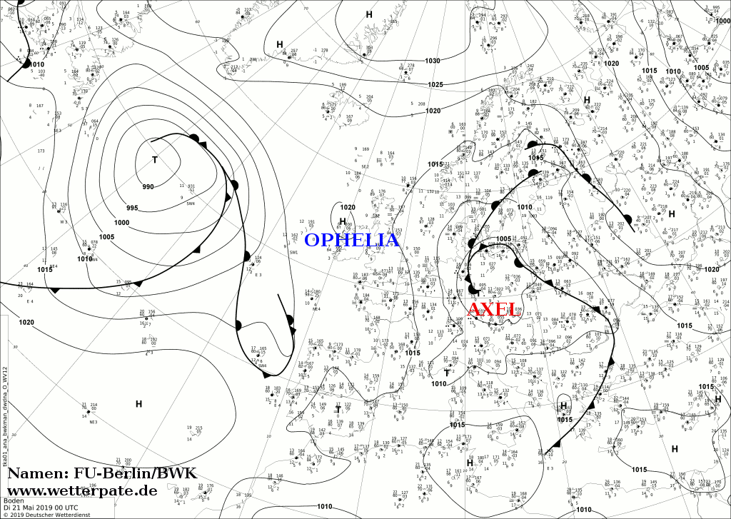
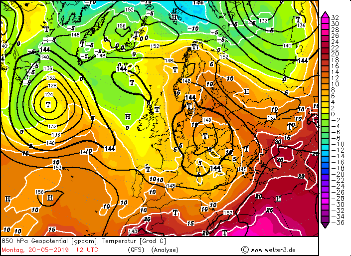
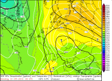
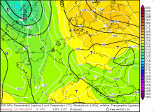
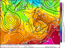
Sea level pressure, 19th Mai to 22nd Mai:
FU-Berlin
|
 |
 |
 |
 |
|
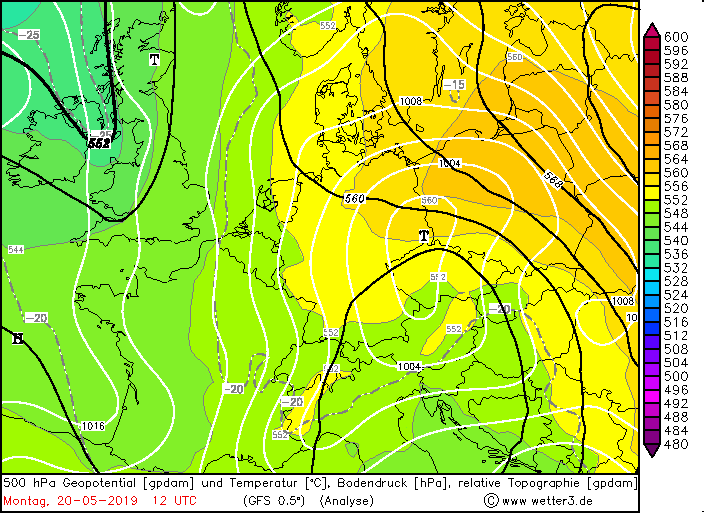
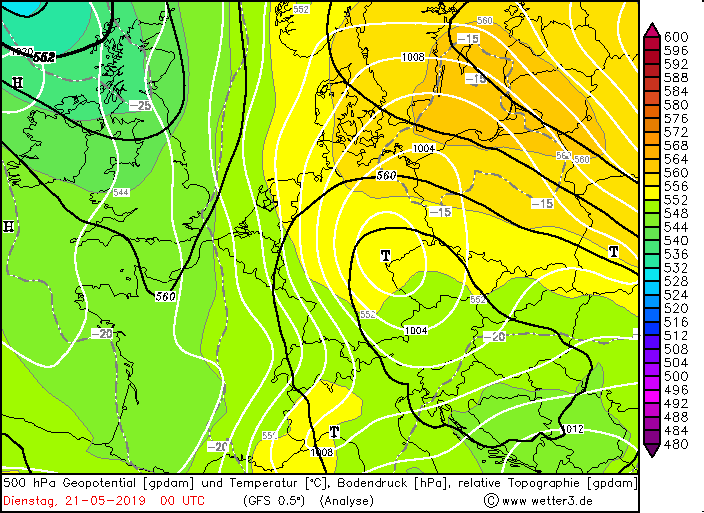
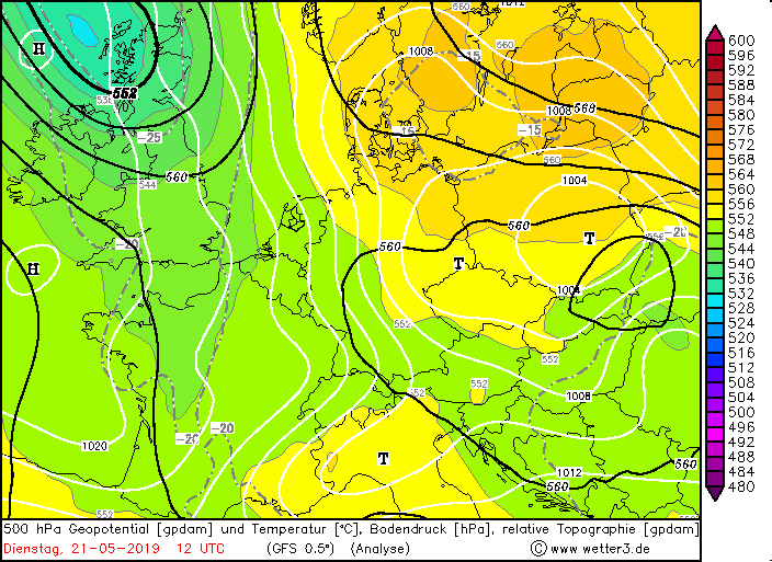
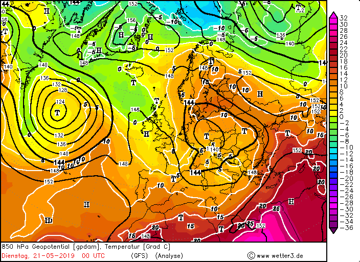
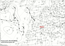
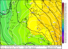
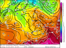
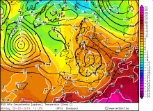
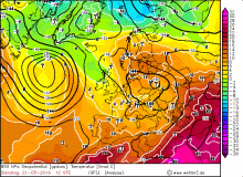
500 hPa Geopotential, 19th Mai to 22nd Mai:
wetter3
|
 |
 |
 |
 |
|
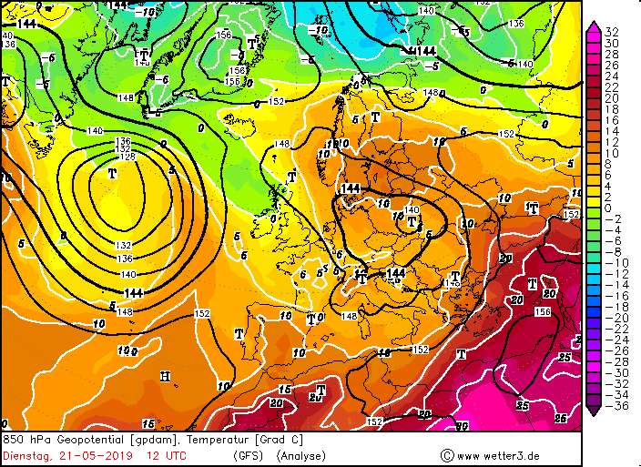
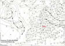
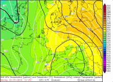
500 hPa Geopotential, 19th Mai to 22nd Mai::
wetter3
|
 |
 |
 |
 |
Days before ZACHARIAS reached Germany it brought severe precipitation up to 95 mm in Croatia, Italy and the Balkan region as it moved
from west to east and northeast. In the course of the 19th and 20th May, it slowly shifted over Eastern Europe to the northwest, which brought
significantly warmer and, above all, humid air to Germany from the Mediterranean region. The wind turned from northeast to southeast. The highest
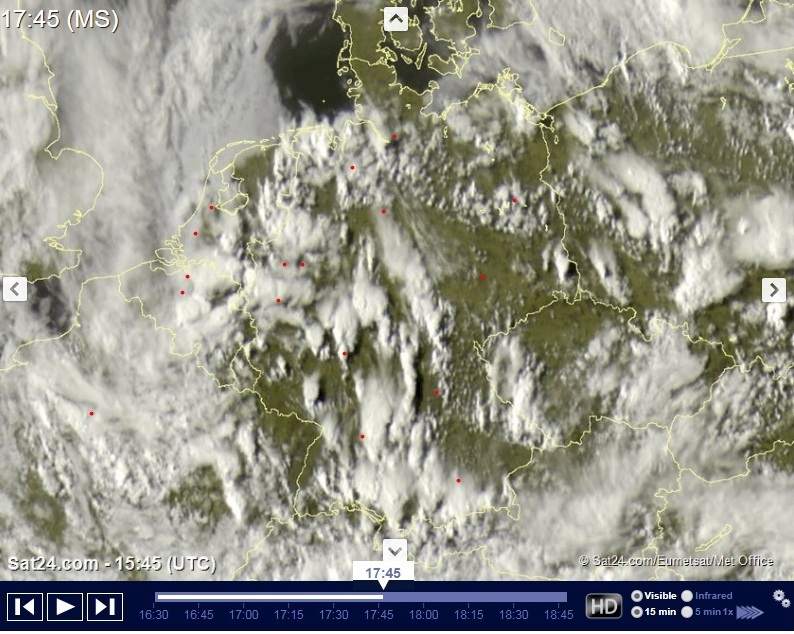
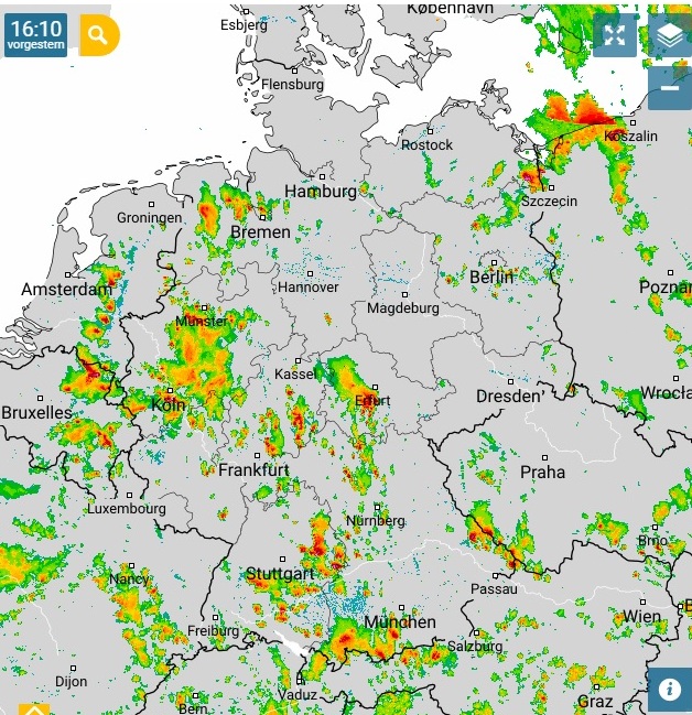
temperatures around 28 ° C were reached in the east of Germany. The first rainfall was in form of local showers and thunderstorms, especially noticeable on Sunday.
The CAPE values rose to over 700 J / kg on Sunday in the south, and over 1000 J / kg in the northeast, which led to stronger thunderstorms than on Saturday.
Due to the wind-weak situation also the wind shear remained small, so that only single unorganized thunderstorm cells could form. This developed first on
the mountains, since the sunny side is heated the strongest and thus trigger thunderstorm at first.
Since there was little wind due to the gradient-weak weather conditions, the storm cells were almost stationary.
This already led to local heavy rains and floods, as discharged by the non-existent speed of displacement.
The thunderstorms led out their entire masses of water at the respective places.
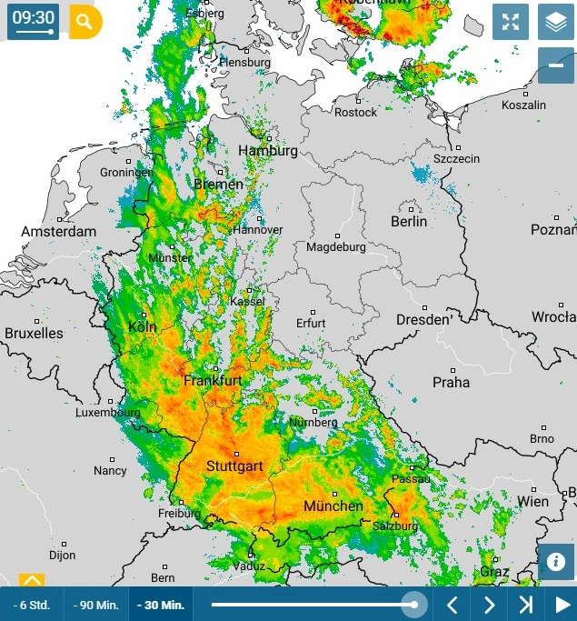
These convective precipitations then passed from May 19 to May 20 into severe stratiform precipitation, which accumulated above all in the low
mountain ranges and the Alps. Due to the shallow bottom low AXEL, which began to occlude at that time, the north wind was maintained and continued
to advect humid air into the south of Germany. The severy precipitations were mainly in Baden-Württemberg and Bavaria. The northeast, as before,
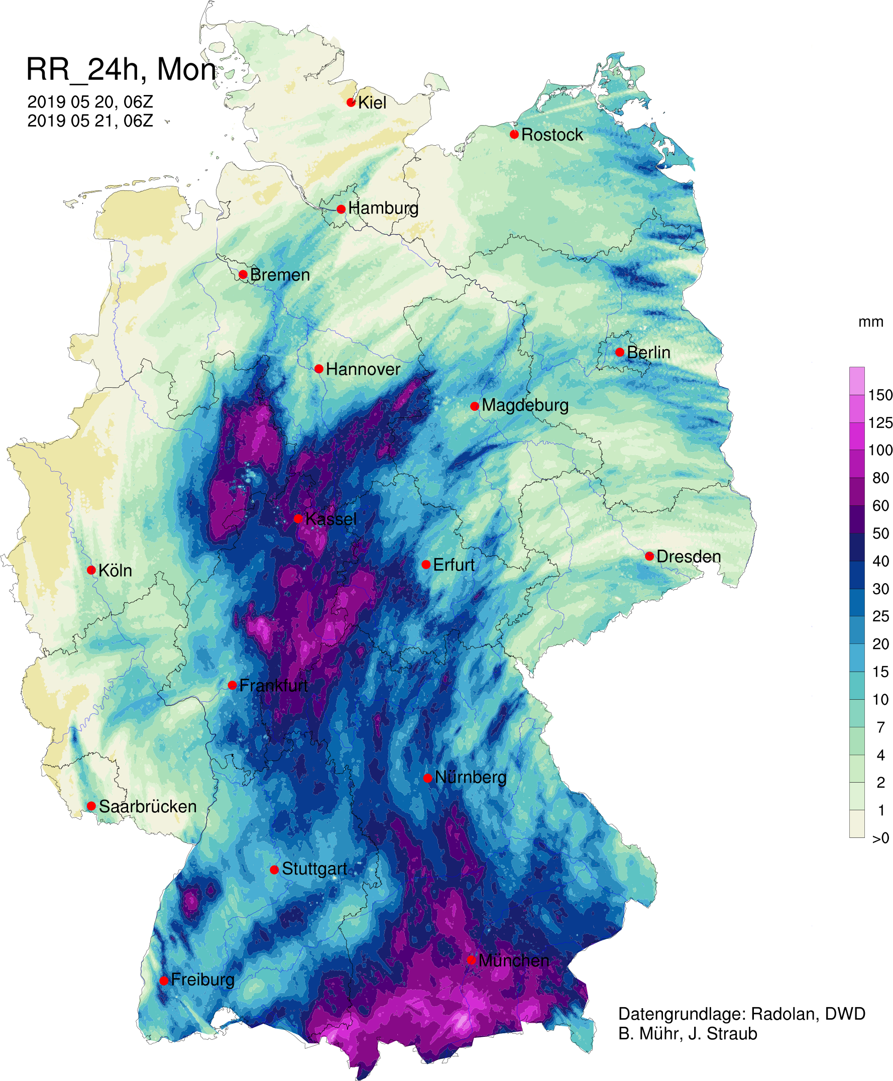
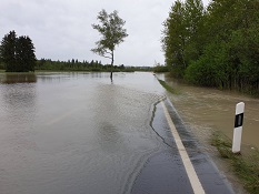
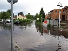
had the least rainfall, although it would have been most needed there. The fiercest hit the south of Bavaria. There, over 200 mm came together within a
few hours. In most cities in Germany the precipitation amount is about 50-70 mm per month. These quantities came together at the weekend alone through the
thunderstorms in a few hours.
|
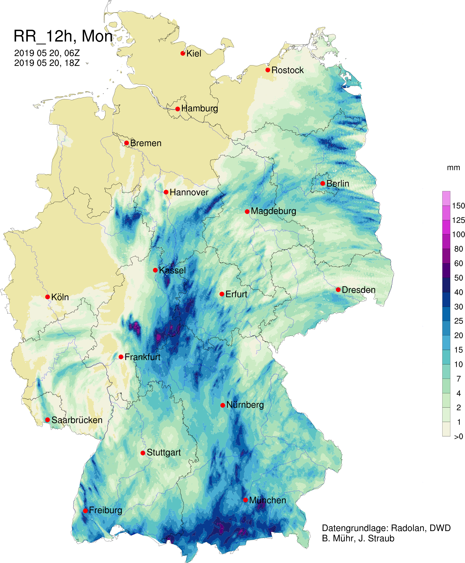
12h/24h accumulated precipitation (RADOLAN) of Germany 20th and 21st May, Flooding in Ohlstadt (Bavaria) and Fürstenwalde/Spree (Brandenburg):
B.Mühr/J.Straub, Andreas Paul, Stefan Kuhlewind
|
 |
 |
 |
 |
| Location |
24 h precipitation in mm |
Date |
Balderschwang (BY)
Ebersberg-Halbing (BY)
Hohenpeißenberg (BY)
Birx/Rhön (TH)
Holzkirchen (BY)
Altenstadt (BY)
Attenkam (BY)
Stötten (BY)
Balderschwang (BY)
Aschau-Stein (BY)
|
112,4
108,3
104,3
93,2
92,3
90,3
88,3
92,7
90,9
84,0
|
20.05.2019
20.05.2019
20.05.2019
20.05.2019
20.05.2019
20.05.2019
20.05.2019
21.05.2019
21.05.2019
21.05.2019
|
|
| Location |
72 h precipitation in mm |
Date |
Jachenau-Tannern (BY)
Balderschwang (BY)
Aschau-Stein(BY)
Stötten (BY)
Oberstdorf (BY)
Munich (BY)
Friedrichshafen (BW)
Stuttgart (BW)
Rheinstetten (BW)
|
231,4
220,1
202,0
120,9
116,8
111,2
78,1
69,1
39,2
|
21.05.2019
21.05.2019
21.05.2019
21.05.2019
21.05.2019
21.05.2019
21.05.2019
21.05.2019
21.05.2019
|
|
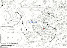
On May 22, the weather calmed down by high OPHELIA. But this is relatively weak and is shifting rapidly to the east.
Already at the beginning of next week, new precipitation is expected due to a low, which in the Alpine area, especially on the southern
side of the Alps, gives an idea of a stormy character.
A similar wind-weak thunderstorm situation already existed in 2016 and 2018 (also in May). Since it was too dry in the rest of the country in 2018, some
places fought with heavy precipitation and its consequences several times, caused by almost stationary thunderstorms. On May 31, 2018 at over 32 ° C local
rainfall over 40 mm came together in a few hours. This was also the case on 6 June at the Feldberg with 70 mm in just a few hours. A day later fell in
Freudenstadt and Stuttgart just under 60 mm (to name only a few examples from 2018). Severe precipitation and stagnation occurred in May 1978, as well as on
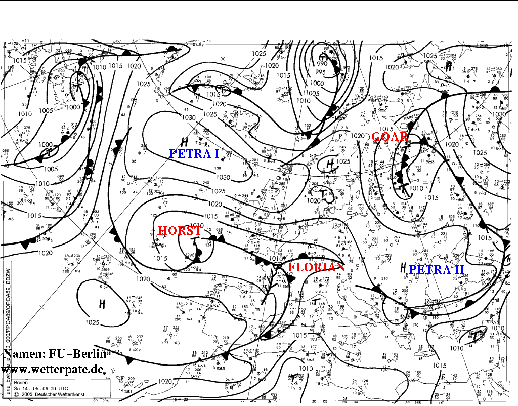
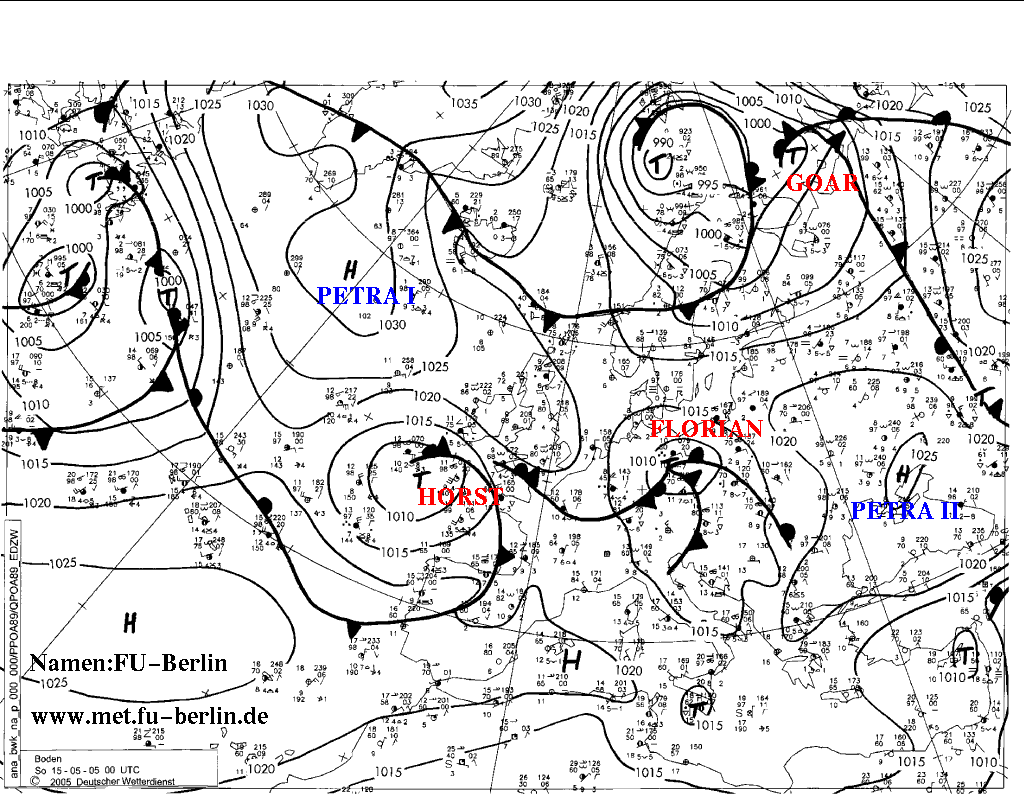
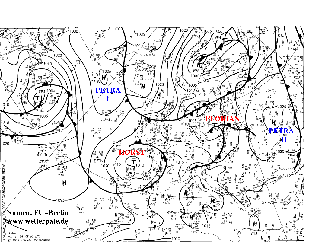
Pentecost 2005 and 1999. In 2005, low Florian moved west to east across southern Germany along the Alps. There, the air masses accumulated and there were also
heavy precipitations.
Text: MG
Mai 24th, 2019
Text: FS
Mai 27th, 2019
|