|
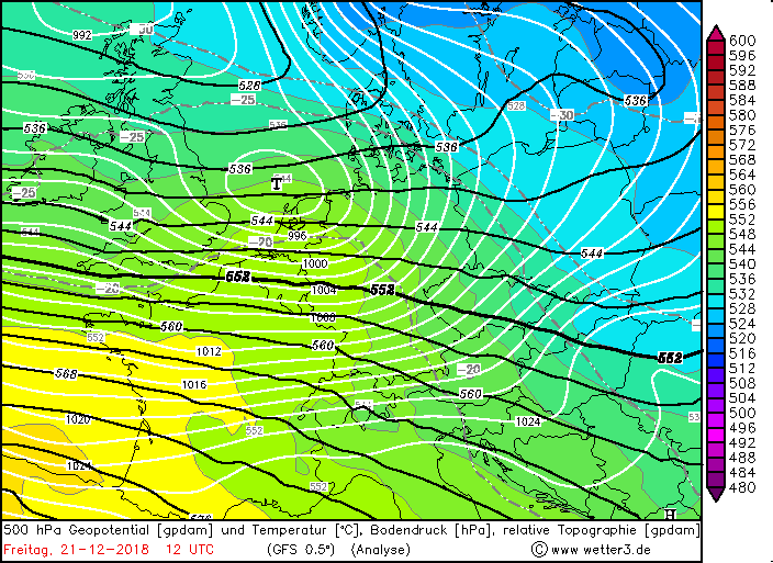
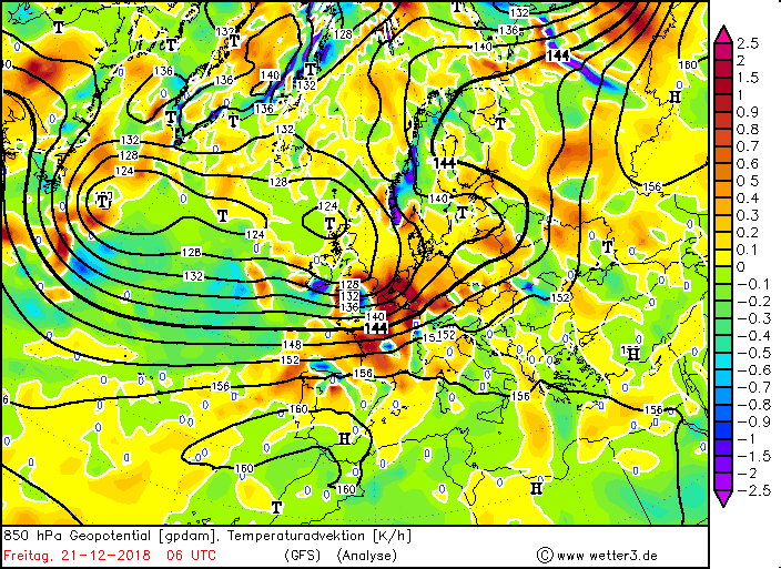
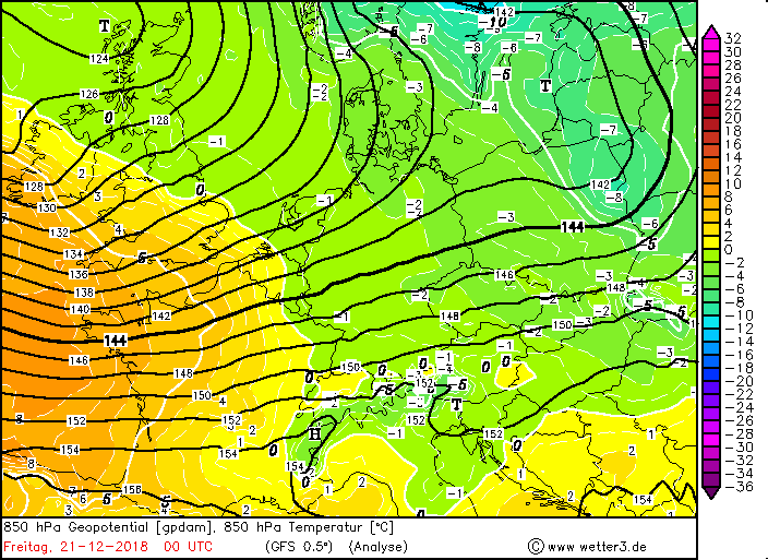
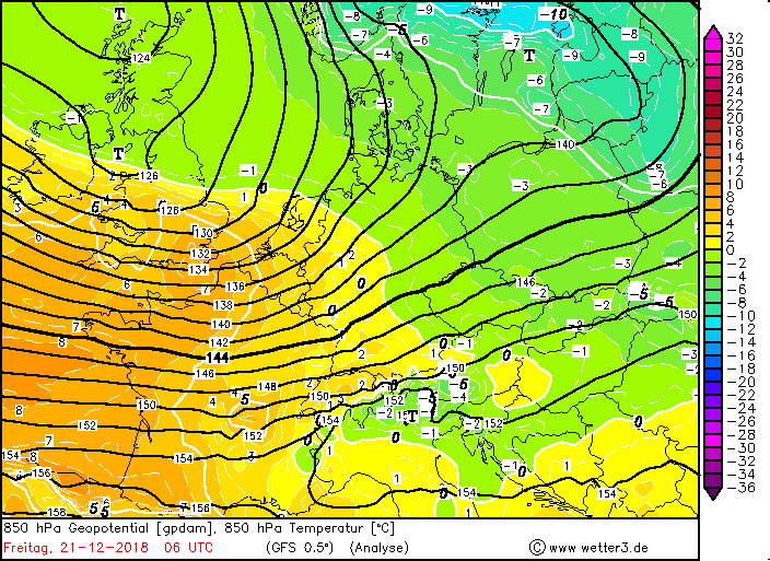
The calendar start of winter starts very stormy in part of Germany. On Friday December 21st in the course of the day, a low pressure system over Germany and brought
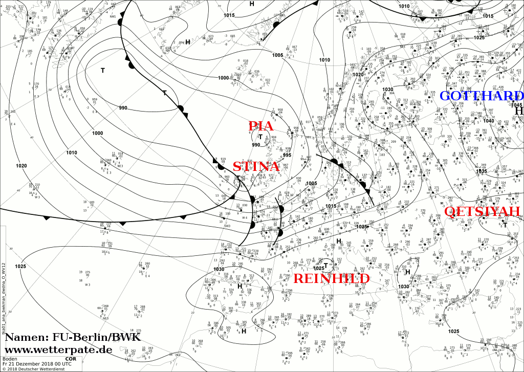
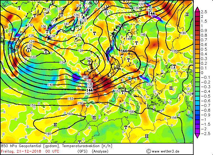
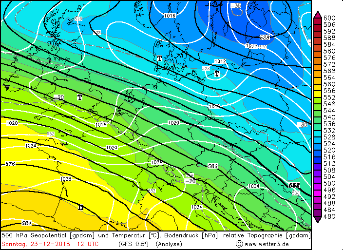
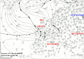
stormy, in the south and on exposed sites also gale-force gusts. Deep STINA II developed in the night from Thursday to Friday on the front of a trough to an
orcantic low. The strongest gust was measured at distance on the Brocken at 155 km / h, 137 km / h on the Feldberg. In addition, STINA advected very mild and very
humid air. Partly the temperatures rose to over 14 ° C.
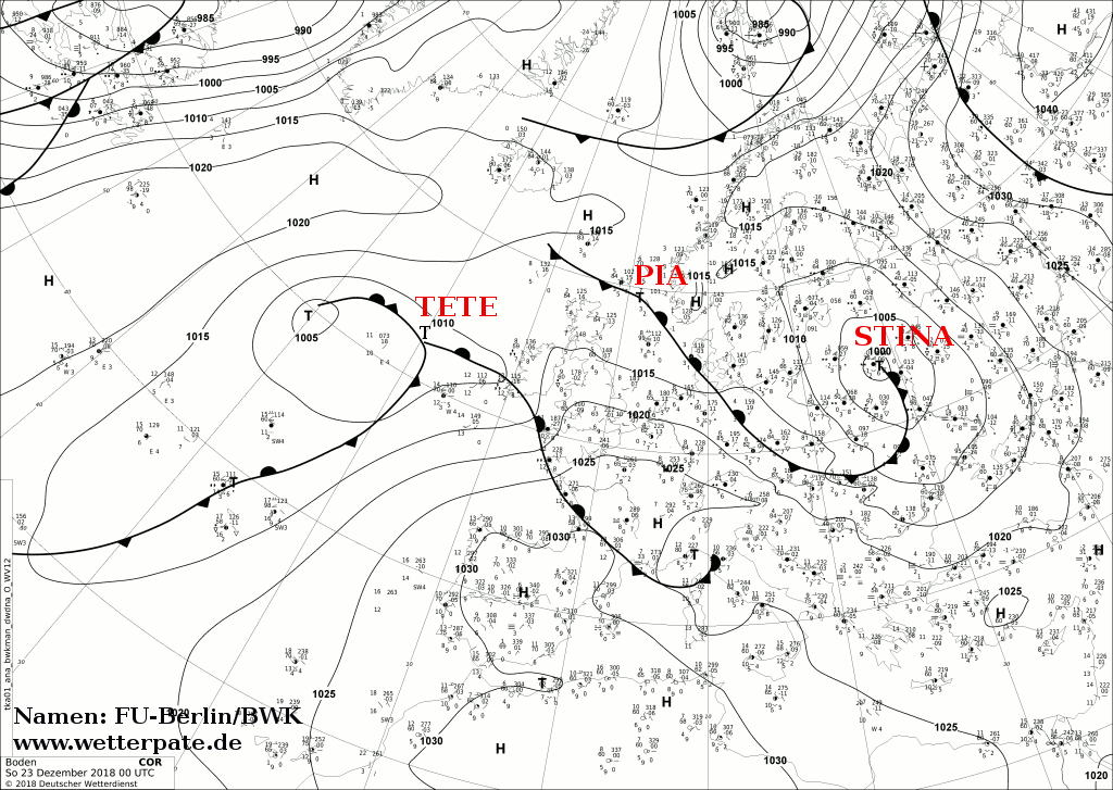
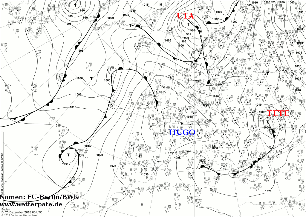
Deep TETE reached Germany directly after STINA. TETE was a relatively weak low-pressure system, but it had very severe rainfall within.
These were problematic in both low-pressure areas, mainly in the Black Forest and on the Alps from December 21st until 24th
due to jams of the air masses.
Winterstorm STINA
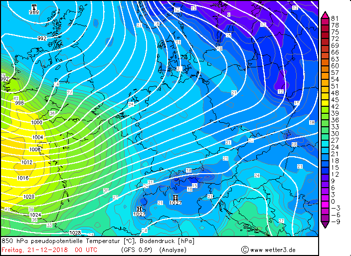
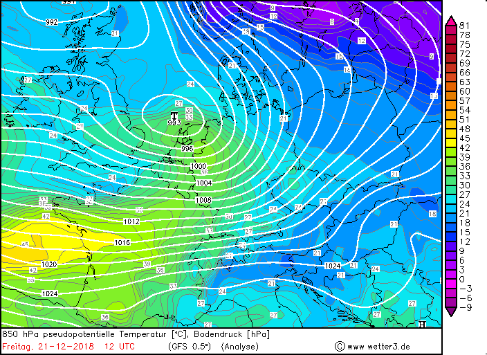
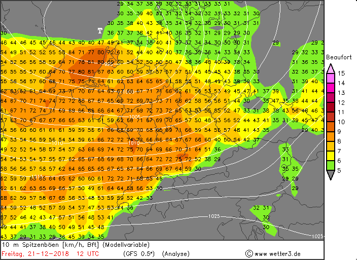
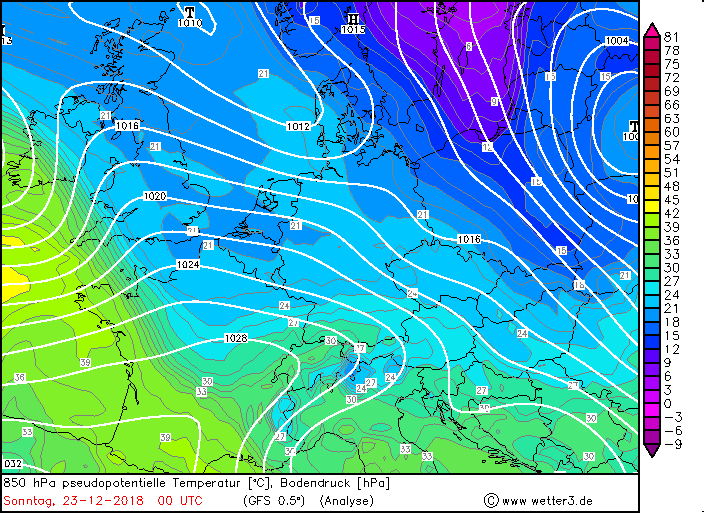
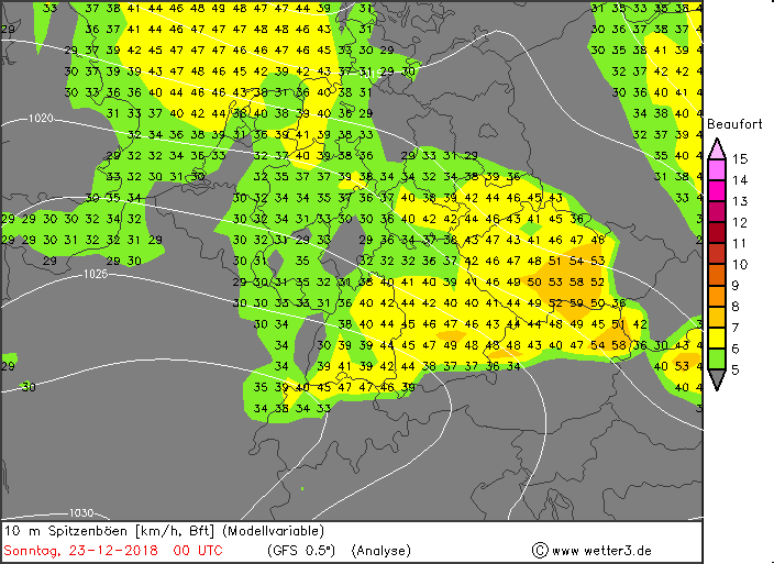
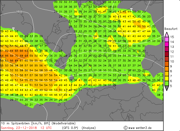
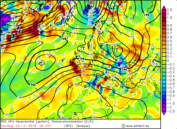
On December 21st just in time for the beginning of the winter, winterstorm STINA swept across Germany and brought stormy gusts in the plains,
and gale-force gusts on exposed plains. STINA was registered for the first time on December 19th as a marginal low on the cold front of a low pressure area
over the northeast of Canada / Newfoundland. It is only recognizable in the ground pressure maps and in the relative topography.
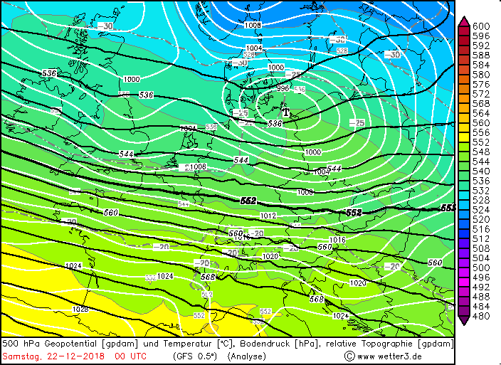
It quickly moved in the course of December 20th almost horizontal to the east and on December 21st it was a closed depression area. STINA's center reached in the
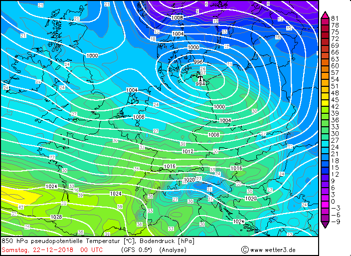
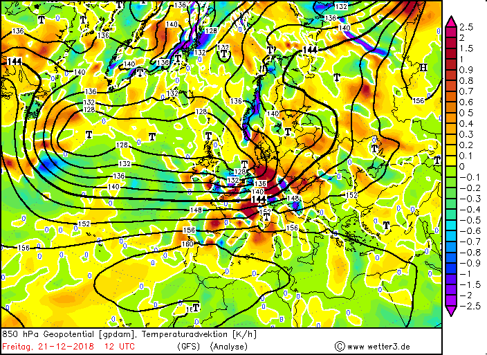
night to December 21st Ireland and Great Britain and migrated the same day across the North Sea, as well as Schleswig-Holstein and the Baltic Sea. STINA's center
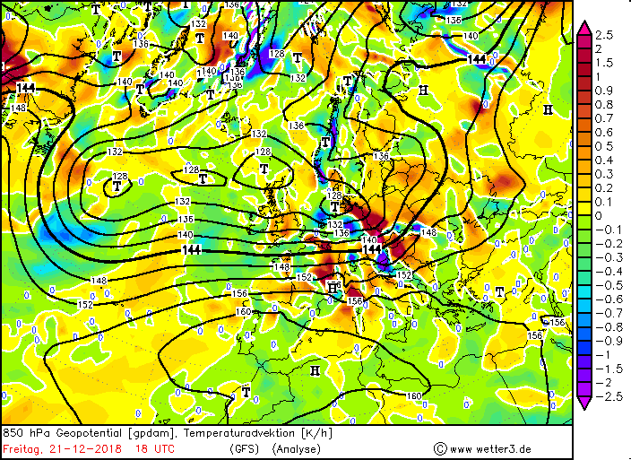
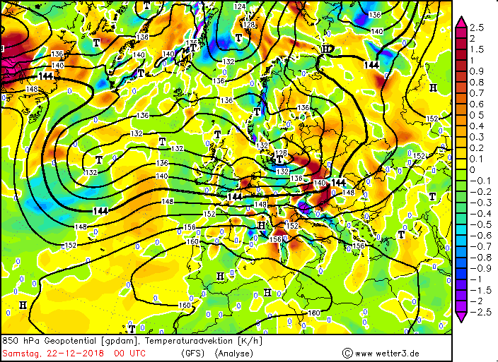
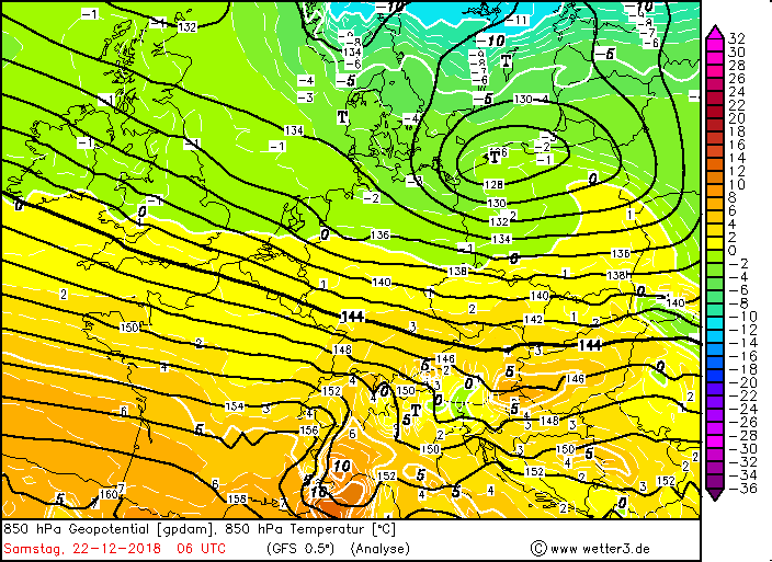
reached an air pressure minimum of 993 hPa. In the night of December 22nd it left Germany via Poland and the core pressure began to rise slowly, as STINA was now on
the front of the trough.
The wind freshened already in the night of December 21st clearly on and reached first the west and southwest of Germany.
In the early morning stormy gusts were already recorded in the lowlands, on exposed sites already the first storm gusts, such as on the Feldberg (Black Forest, BW)
at 101 km / h (Source: Meteociel.fr). The first gale-force gust was recorded at 137 km / h until early noon.
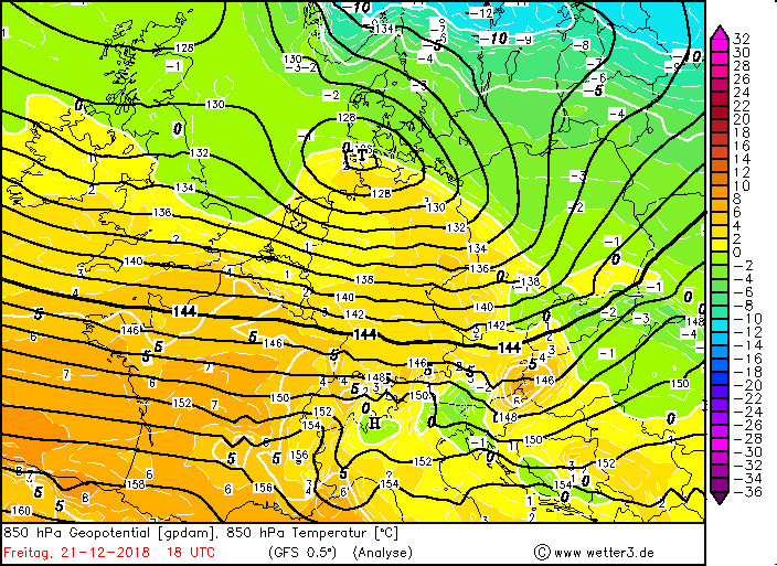
The wind speed increased until the evening again significantly and reached in the lowlands partly storm strength, at higher altitudes hurricane force
(Brocken 155 km / h). The wind maximum stretched as a narrow strip over Baden-Württemberg and moved east over Bavaria.
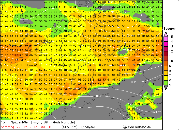
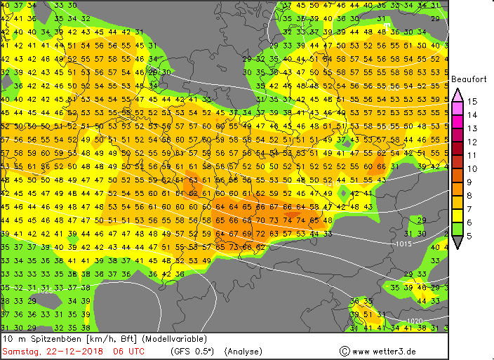
This found its origin in the strong air pressure gradient. Therefore it remained windy in Germany on December 22nd in the above mentioned areas.
On the Feldberg, a gale-force gust of 133 km / h was registered again, on the Brocken 126 km / h and on the Zugspitze 122 km / h were reached.
But not only on exposed locations had to be expected in these days with strong gusts.
STINA also brought rainfall with it, which was manifested among other things by showers and thunderstorms. Also in shower and thunderstorm areas gusts were expected
to storm and gale strenght, as the rainfall can transport the high winds to the ground.
Although the wind freshened up, temperatures rose significantly.
STINA brought Germany not only storm, but also springtime mercury leaps.
The thermometer climbed above the 12 � C in some places at the beginning of the winter, e.g. in Cologne with 14.7 �C, or in Noervenich 14.3 �C and
Dusseldorf 13,8 �C (NRW), as well as in 13,3 �C Mühlacker (BW) (Source Temperatures: Meteociel.fr). Only in 2013 it was even warmer in Stegen at 17.1 �C or in
Bretten at 16.8 �C (BW). Also on December 22nd it stayed with temperatures in the south and southwest with around 12 �C very mild, in the north and northeast with
around 8 �C also mild.
The air masses that were advected by the triggered by STINA southwest wind were not only very mild, but also very humid. This southwest wind transported the moist
and warm air from the Mediterranean region to Germany. This resulted in precipitation, which manifested itself either as a shower or a thunderstorm, or as a storm
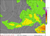
precipitation, especially in the low mountain ranges and the Alps. Especially in the Black Forest came on December 21st high precipitation totals of just under 54 mm
together. It also rained heavily in the Harz at 49.4 mm (source precipitation totals: Meteociel.fr). As a result, the water levels of the rivers finally increased
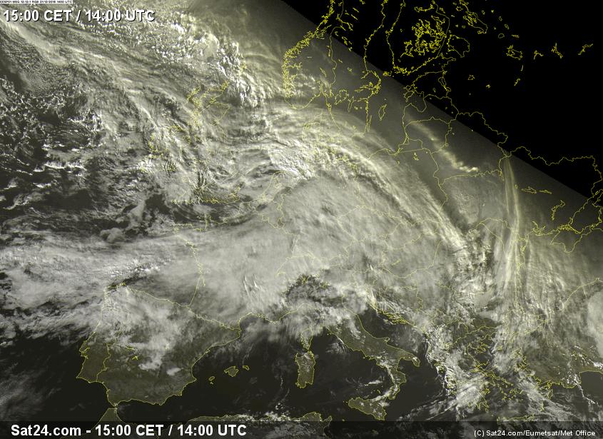
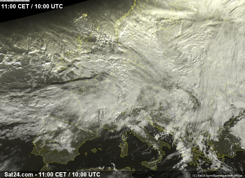
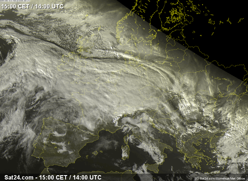
noticeably. This moist, warm air was mainly visible in the pronounced warm-front clouds. The cold front of STINA extended almost horizontally westwards over France
and can be clearly seen from the model maps or the satellite imagery.
|
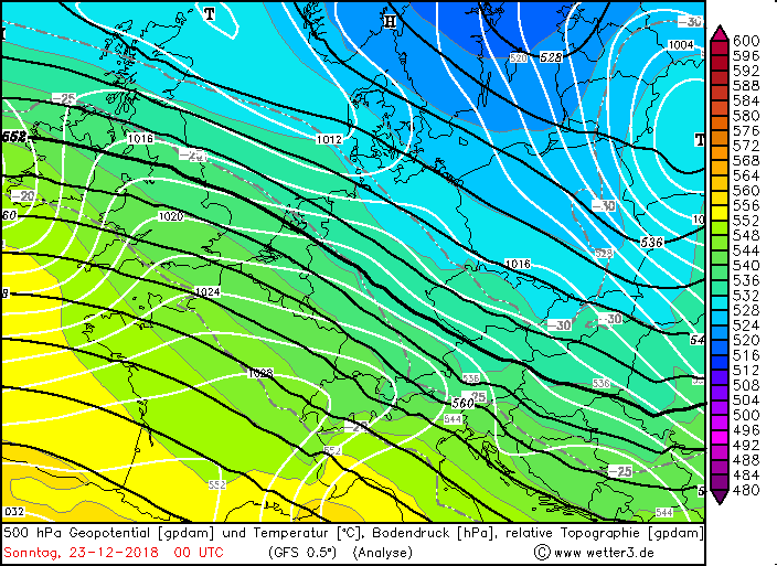
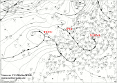
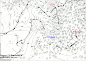
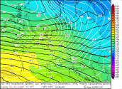
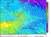
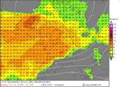
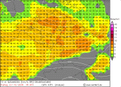
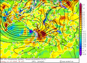
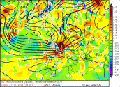
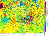
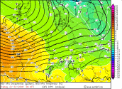
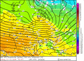
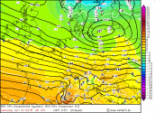
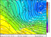
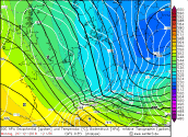
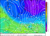
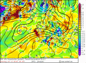
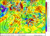
Sea Level Pressure Europe, 500-hPa-Geopotentialand Sea Level Pressure, 850 hPa pseudopot. Temperature, Windmaxima,Temperaturadvection, Temperature |
Quellen: Wetter3,
FU-Berlin/DWD |
 |
 |
 |
 |
 |
 |
 |
 |
 |
 |
 |
 |
 |
 |
 |
 |
 |
 |
 |
 |
 |
 |
 |
 |
 |
 |
 |
 |
 |
 |
Selected peak gusts (Data source: Meteociel)
and temperature on December 21st 2018
(Data source: Ogimet):
| Location |
Altitude |
State |
Peak gusts STINA |
Zugspitze
Brocken
Werningrode/Stierke
Werningrode
Feldberg
Weinbiet
Kahler Asten
Brix/Rhoen
|
2962 m
1134 m
609 m
234 m
1486 m
553 m
839 m
745 m
|
BY
SA
NW
NW
BW
RP
NW
HE
|
158 km/h
148 km/h
148 km/h
140 km/h
137 km/h
112 km/h
101 km/h
94 km/h
|
|
| Location |
Altitude |
State |
Temperature |
Koeln/Bonn
Andernach
Bonn-Roleber
Geilenkirchen
Noervenich
Geisenheim
Duesseldorf
Werl
Koblenz
Muelacker
|
92 m
60 m
160 m
95 m
110 m
90 m
38 m
90 m
73 m
240 m
|
NW
RP
NW
NW
NW
HE
NW
NW
RP
BW
|
14,7 °C
14,6 °C
14,4 °C
14,3 °C
14,3 °C
13,9 °C
13,8 °C
13,7 °C
13,6 °C
13,3 °C
|
|
Selected precipitation amount 21-22 December 2018
(Datasource: Ogimet):
| Location |
Altitude |
State |
Precipitation amount |
Feldberg
Freudenstadt
Brocken
Neuhaus am Rennweg
Bad Lippspringe
Lingen
Luedenscheid
Kahler Asten
Fichtelberg
|
1277 m
732 m
550 m
1141 m
830 m
140 m
21 m
423 m
843 m
1215 m
|
BW
BW
SA
SA
TH
NW
NI
NW
NW
SA
|
55,1 mm
53,7 mm
49,4 mm
40,0 mm
28,0 mm
25,3 mm
23,1 mm
22,7 mm
22,5 mm
21,2 mm
|
|
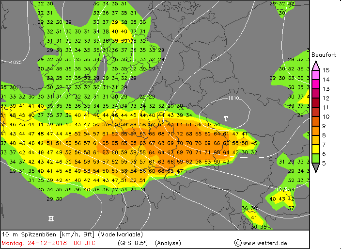
Winterstorm TETE
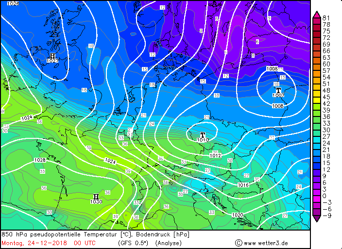
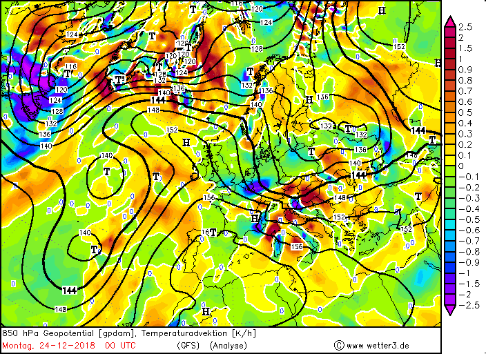
As soon as deep STINA had disappeared a new low pressure system has already announced.
TETE not only brought storm squalls back to Germany, but also mild and humid air.
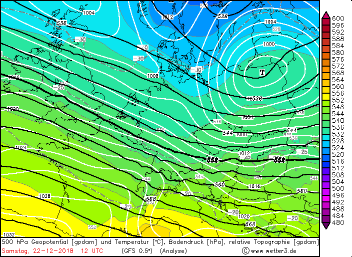
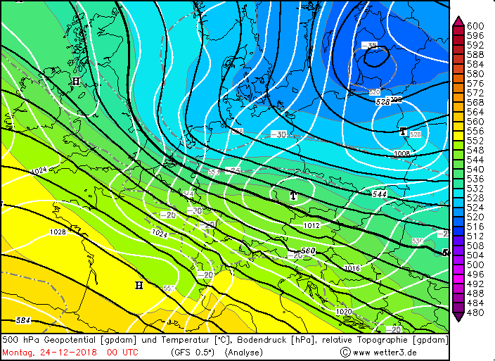
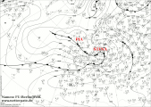
In the night on December 23rd TETE was listed for the first time. It was located west of Ireland on the Atlantic and was a marginal low of a further west lying low
pressure area. Its core pressure at that time was 1010 hPa and was on its way east. In the early morning hours, at 1014 hPa, it reached Ireland and the UK, but moved
rapidly towards the southeast. Its center migrated across the North Sea and central Germany to the Czech Republic, with its core pressure returning to 1010 hPa.
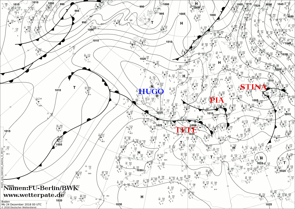
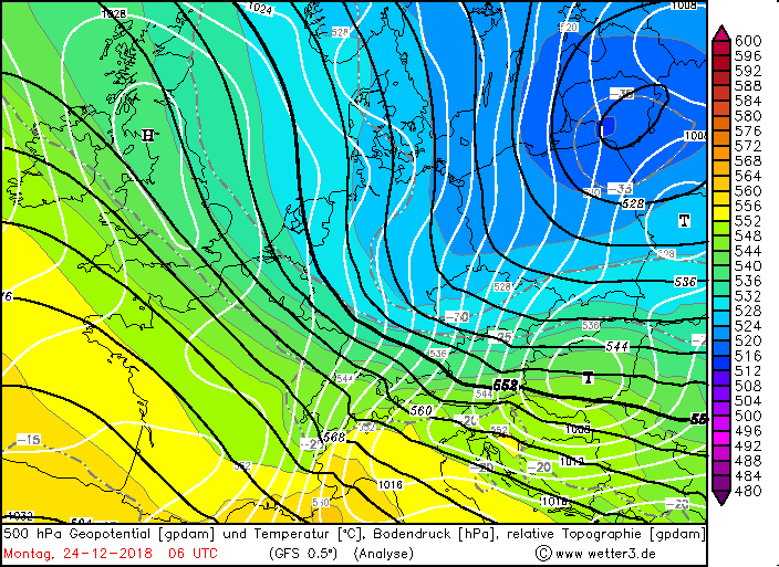
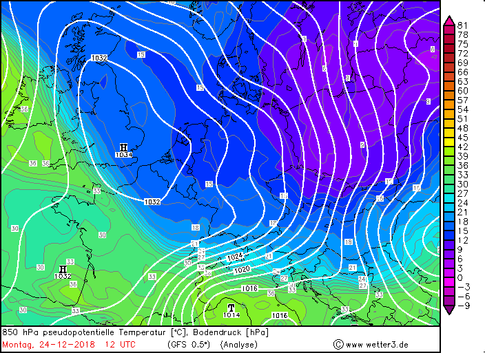
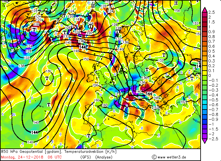
From this point on TETE was a closed low pressure area and intensified from December 24th continue. It reached Austria and Slovenia with a core pressure of 1004 hPa.
The air pressure gradient increased due to the intensification, especially in the south and southeast of Germany. On the Feldberg (Black Forest, BW) gusts up to
101 km / h were measured, on the Zugspitze 97 km / h (Source: Meteociel.fr). In Austria, however, gale gusts were recorded at 155 km / h on the Feuerkogel
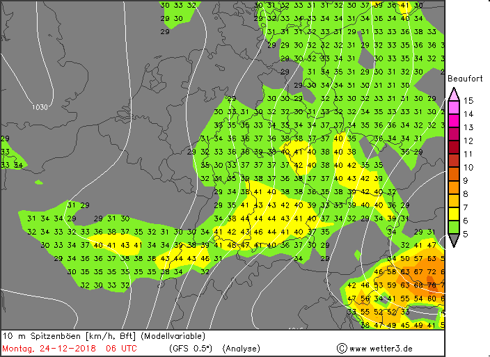
(Source: Meteociel.fr). Due to the initial southwest wind, an inverse daily temperature resulted. This rose until the evening of December 23rd on for this season very
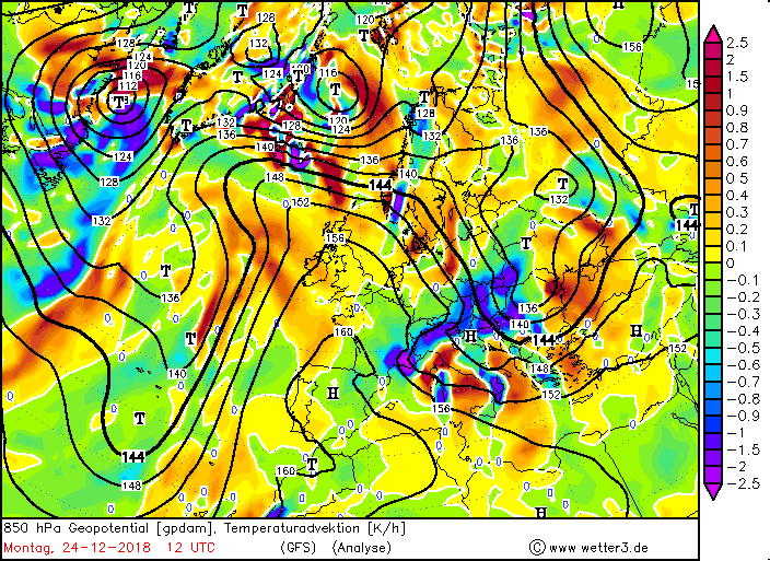
mild temperatures around the 12�C (14,2 �C Neuostheim, source: Meteociel.fr). These were noticeable above all in the southwest and west of Germany. On December 24th
On the other hand, temperatures dropped to 5-8�C over the course of the day. Temperatures below zero were recorded by early evening
(-1.6�C Arkona / Baltic Sea, source: Meteociel.fr). The reason for this was the wind, which turned on north and northeast respectively.
When TETE reached Germany, southwest wind prevailed. In the course of December 23rd turned this as mentioned above but on West and on December 24th with reaching
Eastern Europe then finally on north / northeast. This caused stagnant precipitation in the low mountain ranges such as the Black Forest and the Alps.
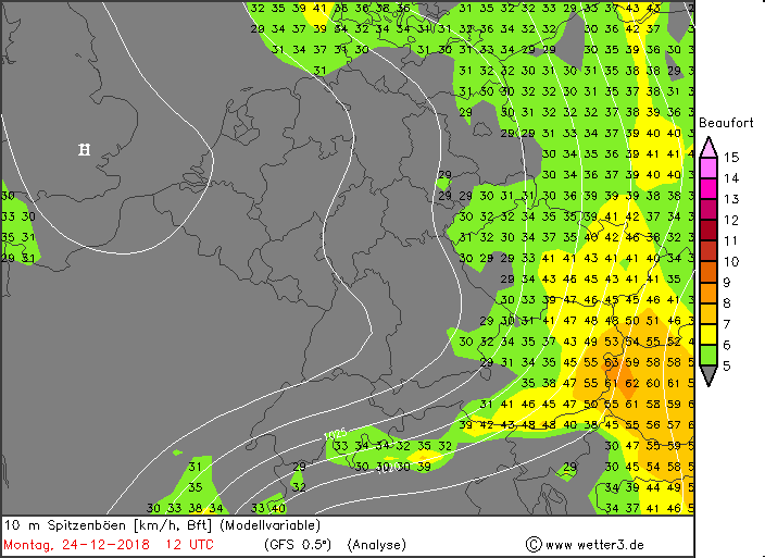
Although TETE was only a relatively small and weak low regarding on the wind it brought severe precipitation. These fell mainly stratiform and as rain, in higher
areas as snow.
TETEs warm front reached the west of Germany at the noon of December 23rd and thus also the precipitation, that was severe in the Black Forest.
This was flown from the west, which led to a congestion of
the air masses (western jam), which then rained off. Also at Christmas heavy precipitation was expected in the Black Forest. The wind turned in
the further course and after subtracting TETE on northeast and north, so that the air masses finally jammed at the Alps (north jam). Especially in the southeast of
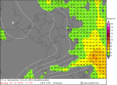
Bavaria heavy precipitation had to be expected. Within 24 hours, rainfall of more than 70 mm occurred in the mentioned areas, in the Alpine area
more than 100 mm came together.
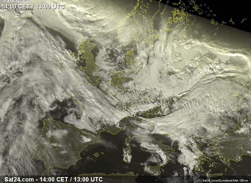
TETE's cold front was nice to recognize on the satellite images of December 24th. It moved south towards the Balkan region and formed showers
and thunderstorms, which can be recognized by the undulating clouds. In addition to the enormous rainfall had to be expected on the first Christmas holiday on
exposed sites again with storm gusts, occasionally with gale gusts. On Christmas day 2, only a few spells of rain fell and the weather gradually calmed down through
High Hugo.
In 2018, significantly less rain fell throughout Germany. The rivers reached new minimum records. Due to the heavy rainfall of STINA and TETE, however,
the river levels rose significantly again. Had the Rhine near Worms still a water level at 101 cm o December 21st, it stands at 235 cm on December 23rd and the tendency remains
rising. The situation is similar for the Rhine and the Neckar near Mannheim. Before STINA, the water levels of the Rhine were 192 cm and now 342 cm, that of the
Neckar at 187 cm and now 348 cm. A significant increase in the level was from December 22nd to 23rd recorded (see table below soon), (source water levels: hochwasserzentrale.de).
On some rivers there was even the danger of flooding. At some small tributaries there was a flood.
|
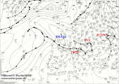
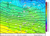
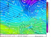
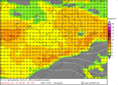
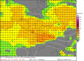
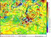
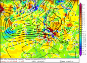
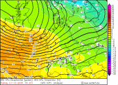
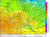
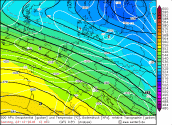
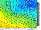
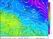
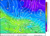
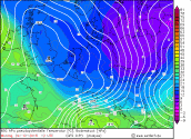
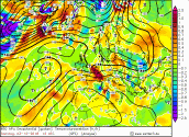
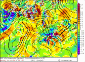
Sea Level Pressure Europe, 500-hPa-Geopotential with Sea Level Pressure, 850 hPa pseudopot. Temperature, Temperaturadvection |
Quellen: Wetter3,
FU-Berlin/DWD |
|
|
|
|
|
 |
 |
 |
 |
 |
 |
 |
 |
 |
 |
 |
 |
 |
 |
 |
 |
 |
 |
 |
 |
Selected precipitation amount
(Data source: Ogimet)
and temperature (Data source:Ogimet)
23-24 December 2018:
| Location |
Altitude |
State |
Precipitation amount |
Freudenstadt
Obersdorf
Feldberg
Garmisch
Kaiserbach-Cronhuette
Neunhuetten/Spessart
Zwiesel
Kempten
Stoetten
Brocken
|
732 m
293 m
1277 m
708 m
565 m
270 m
581 m
674 m
733 m
1141 m
|
BW
BY
BW
BY
BW
BY
BY
BY
BY
SA
|
86,4 mm
65,0 mm
64,4 mm
54,3 mm
45,0 mm
41,4 mm
41,0 mm
39,1 mm
36,6 mm
35,0 mm
|
|
| Location |
Altitude |
State |
Temperature |
Lahr
Mannheim
Geisenheim
Frankfurt Main
Freiburg Breisgau
Rheinstetten
Muelacker
Stuttgart
Idar-Oberstein
Offenbach Wetterpark
|
170 m
97 m
90 m
112 m
278 m
116 m
240 m
247 m
272 m
98 m
|
BW
BW
HE
HE
BW
BW
BW
BW
RP
HE
|
14,4 °C
14,2 °C
13,9 °C
13,0 °C
13,0 °C
13,0 °C
12,5 °C
12,4 °C
12,1 °C
12,1 °C
|
|
German Version
Text: MG
05. Januar 2019
Information on warning levels and icons used
Information on meteoalarm.eu
|