Banner
Der Internet Explorer bietet nur eine eingeschränkte Funktionalität. The browser you're using is only limited functionable.

Thursday, 23 February 2023, 12:00 UTC


Trajectory and strength of Tropical Cyclone FREDDY
23.02., 00 UTC
Source: JTWC
Maximum wind gusts during landfall in Mozambique
24.02. 12 UTC
Source: Windy
72h accumulated precipitation
until 26.02. 00 UTC
Source: Windy
Satellite image
23.02.
Source: NASA Worldview


Tropical Cyclone
Mauritius, La Reunion, Madagascar

Issued: Thursday, 23 February 2022, 12:00 UTC

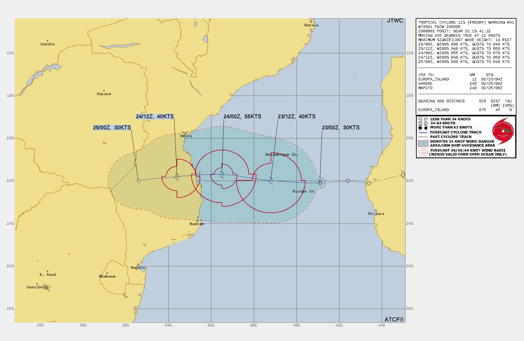
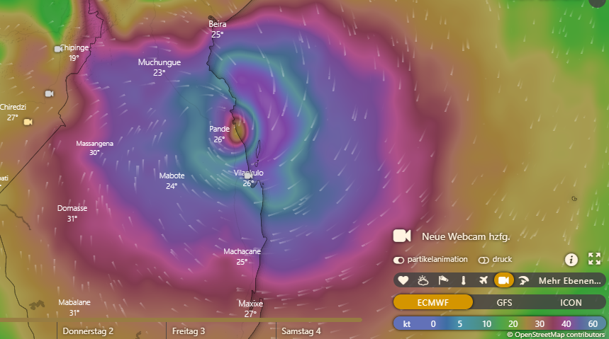
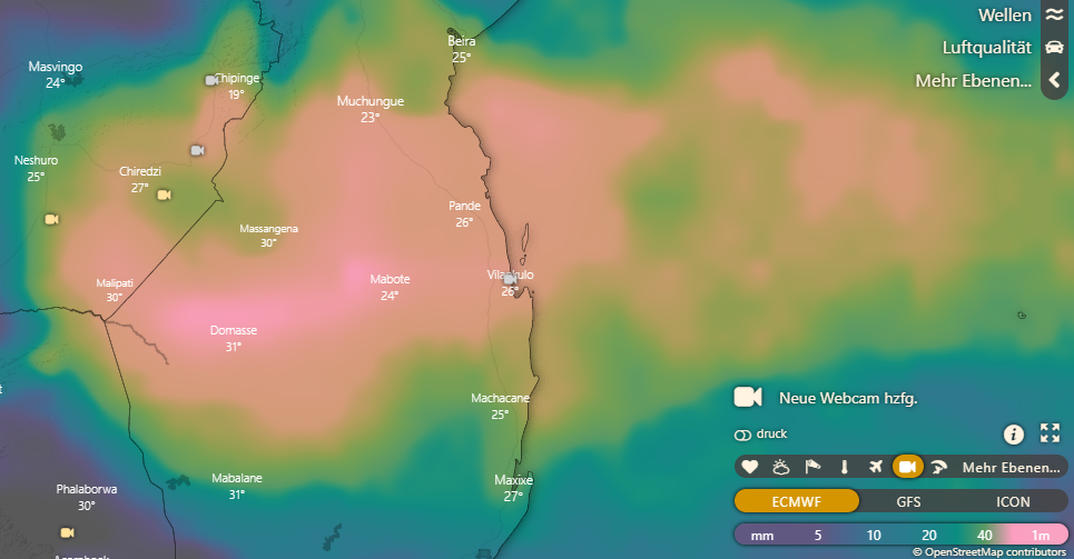
Tropical Cyclone FREDDY heads onto the East coast of Mozambique as a Severe Tropical Storm. Landfall is expected on Friday around 12 UTC with gusts up to 130 kph.

23.02.2023


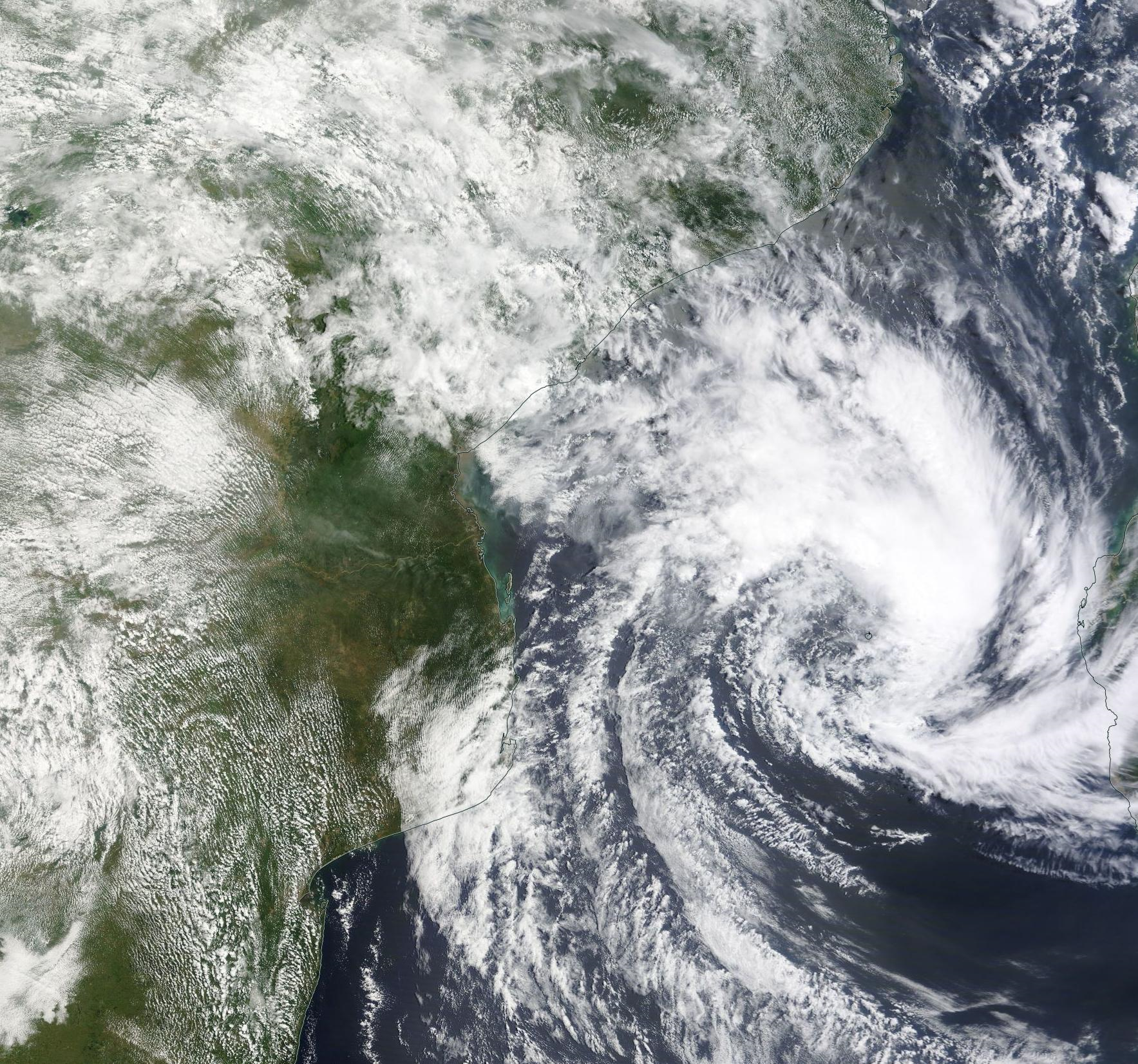
FREDDY has passed over Madagascar and rentered the ocean again in the Mozambique Channel. After decreasing to a Tropical Depression with meand winds of only 30 kt it is now experiencing a re-intensification. Before making landfall on the East coast of Mozambique, FREDDY strengthens to a Severe Tropical Storm again with mean winds of up to 100 kph and gusts up to 130 kph.

There is danger from gale-force gusts and a storm surge along the mouth of the Save River. In addition, rainfall amounts of up to 400 mm within 72h are possible resulting in severe flooding.


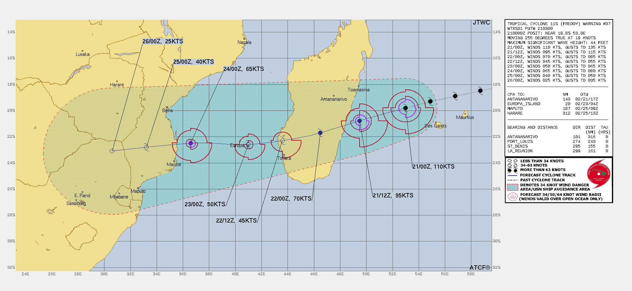
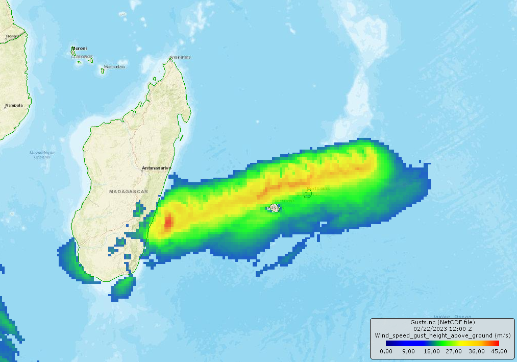
Tuesday, 21 February 2023, 12:00 UTC


Trajectory and strength of Tropical Cyclone FREDDY
21.02., 00 UTC
Source: JTWC
Risk overview related to FREDDY
Source: GDACS
Timeseries of cyclone strength
Feb 06 until Feb22
Source: CIMSS
Satellite image
21.02.
Source: NASA Worldview


Tropical Cyclone
Mauritius, La Reunion, Madagascar

Issued: Tuesday, 21 February 2022, 12:00 UTC

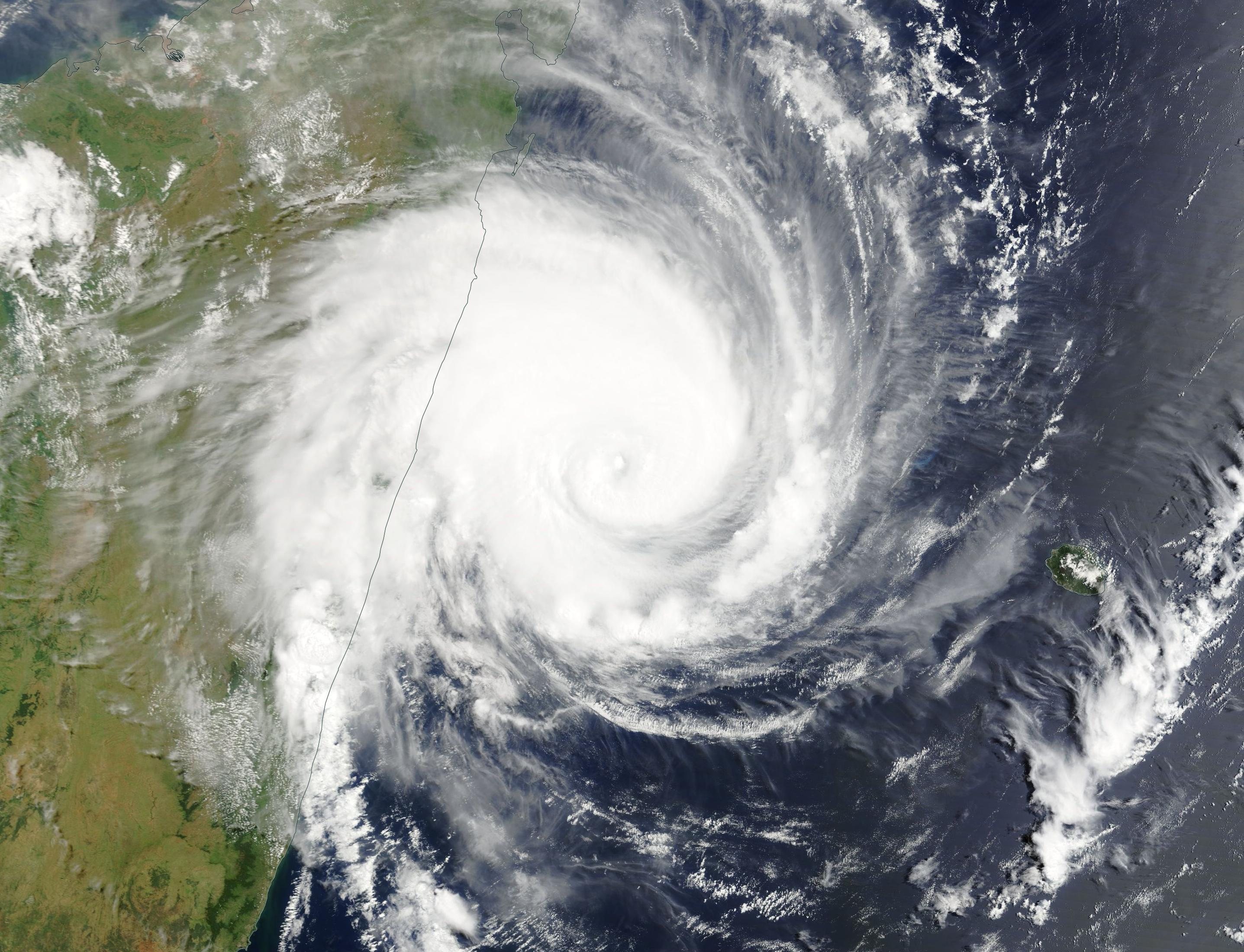
Tropical Cyclone FREDDY is still producing wind gusts in excess of 200 kph and is approaching the coast around Mananjary. Gale-force winds of up to 200 kph and severe storm surge are expected on land.

21.02.2023


FREDDY is currently located about 100 km east of Nosy Varika, a rural community on the east coast of Madagascar. The cyclone is moving west-southwest at 30 kph and is expected to make landfall between Nosy, Varika and Mananjary at 18 CET. The storm currently still shows gusts of just over 200 kph and belongs to the category of Intense Tropical Cyclone with mean winds around 175 kph.

Around the mouth of the Manajary River, the winds will bring a dangerous storm surge. Further inland, at the mountain slopes significant rainfall amounts of up to 300 mm may be produced.

According to current model calculations, FREDDY will cross Madagascar quickly and move offshore again in the early morning of 22 February. Another landfall in Mozambique on 23 February as a Tropical Cyclone of the lowest category is therefore conceivable.


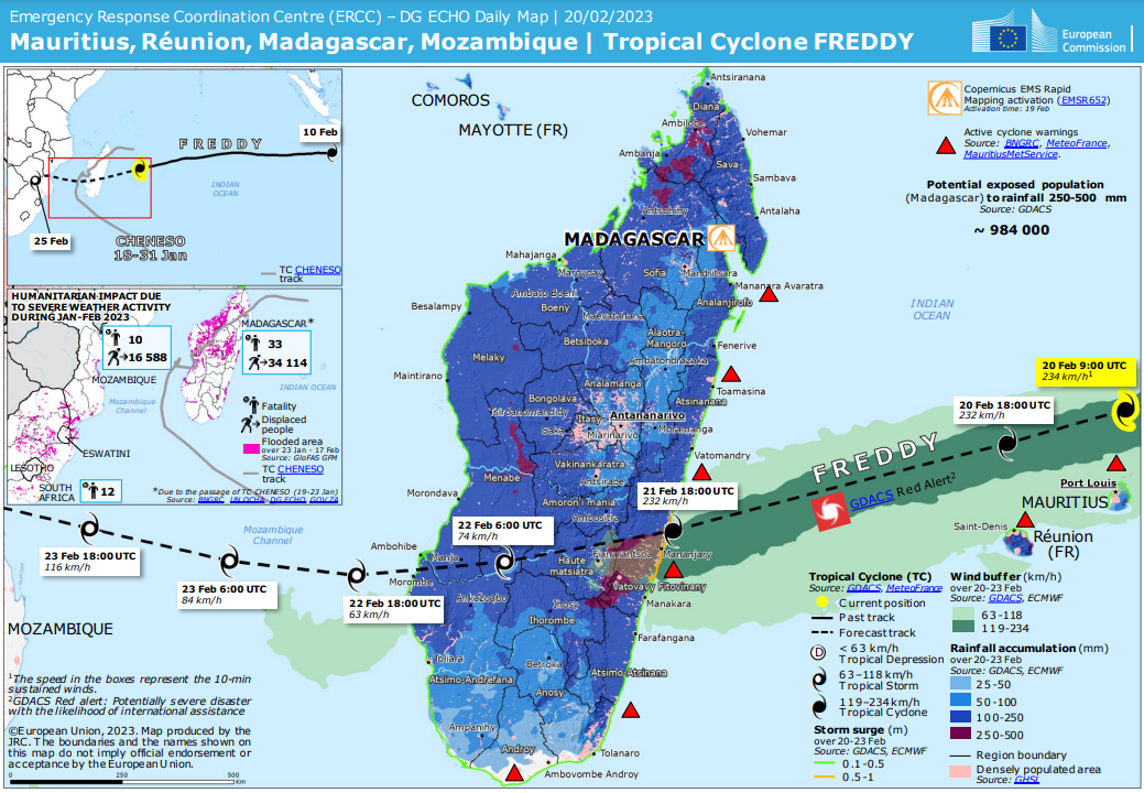
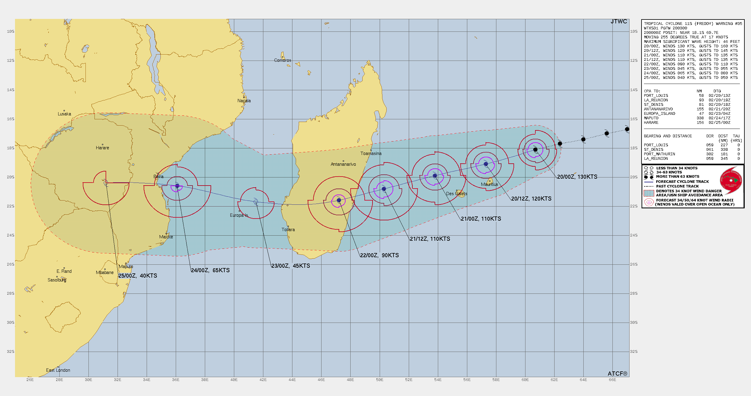
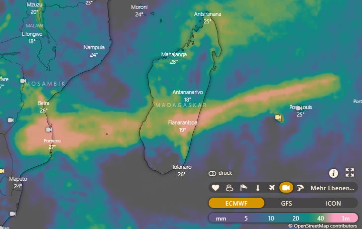
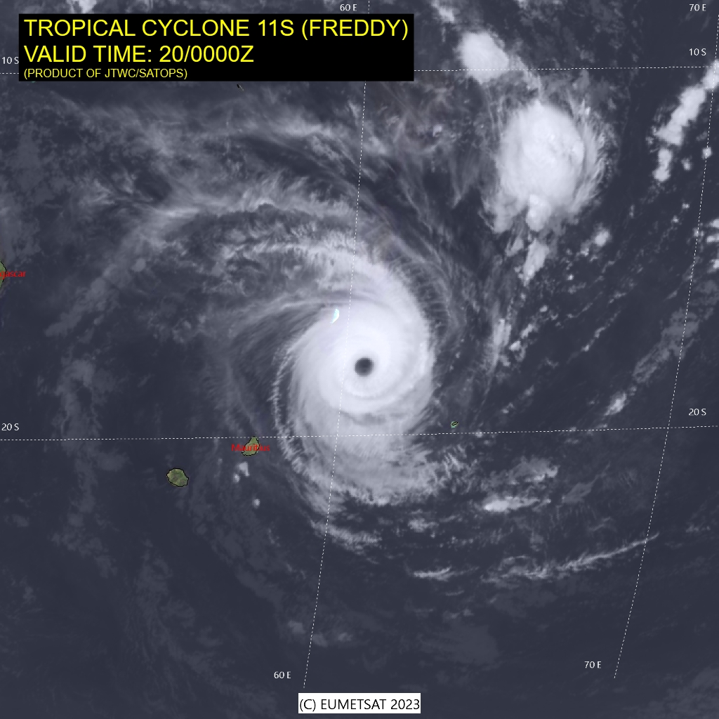
Monday, 20 February 2023, 12:00 UTC


Trajectory and strength of Tropical Cyclone FREDDY
20.02., 00 UTC
Source: JTWC
Maximum wind gusts
from 20.02. 00 UTC until 22.02. 12 UTC
Source: GEM model from WeatherCAN
120h accumulated precipitation
until 25.02. 00 UTC
Source: Windy
Satellite image
20.02. 00 UTC
Source: Eumetsat


Tropical Cyclone
Mauritius, La Reunion, Madagascar

Issued: Monday, 20 February 2022, 12:00 UTC

Tropical Cyclone FREDDY passes 150 km north of Mauritius and heads onto landfall in Madagascar on Tuesday evening. Gusts up to 150 kph in Mauritius and up to 250 in Madagascar expected. Accumulated precipitation of up to 300 mm possible.

20.02.2023


Tropical cyclones in the southern hemisphere are not as common as in the northern hemisphere. This is mainly because the temperature conditions of the Atlantic Ocean in the southern hemisphere are not suitable; the water surface here is too cold all year round. Only in the Indian Ocean and occasionally in the southern Pacific do tropical cyclones occur, but nevertheless they can reach great strength.

FREDDY is currently in the Indian Ocean about 150 km north of Mauritius and is heading towards the east coast of Madagascar, which is still about 1000 km away. With mean winds of 240 kph and gusts of up to 295 kph, it is currently classified in the highest category of the south west Indian Ocean and is therefore a Very Intense Tropical Cyclone. When compared to the Saffir-Simpson-Scale (used for Hurricanes), FREDDY would be very close to the highest category 5 (mean winds of more than 252 kph would be required).

The hurricane is passing the islands of Mauritius and La Reunion today, but they will only be influenced by the extensions of the system. Landfall on Madagascar is expected tomorrow evening at about 8 p.m. in the region around the town of Mananjary. Winds of up to 165 kph and gusts of up to 200 kph are still expected during landfall. In the adjacent mountainous area of the east coast, there is also the possibility of heavy rainfall of up to 300 mm. South of Mananjary is the mouth of the river of the same name. Here, there is a danger of flooding from storm surge.


Issued: February 20, 2023, 12:00 UTC
FS

Issued: February 21, 2023, 12:00 UTC
FS

Issued: February 23, 2023, 12:00 UTC
FS


Visit us at
Facebook:

Information on warning levels and icons used
Information on meteoalarm.eu