Wednesday, 21 December 2022, 14:00 UTC
|
|
|

|
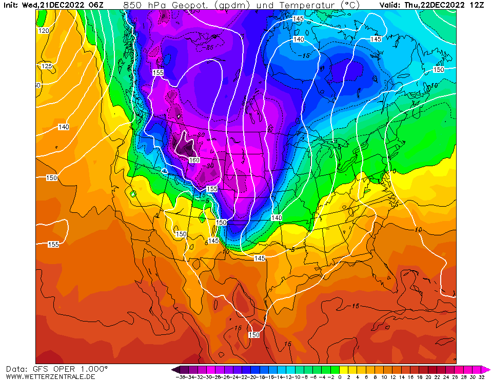
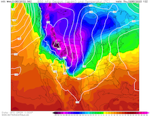
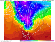
850 hPa Temperatures over Northern America
22.12 12 UTC
Source: Wetterzentrale
|
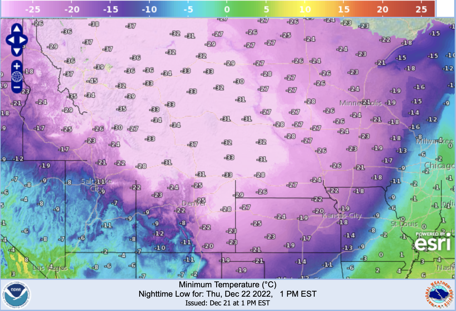
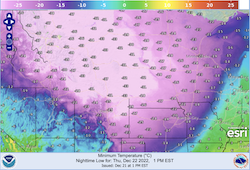
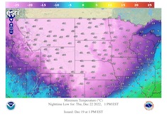
Minimum 2 m-Temperature over the Northern Plains
22.12
Source: Weather.gov
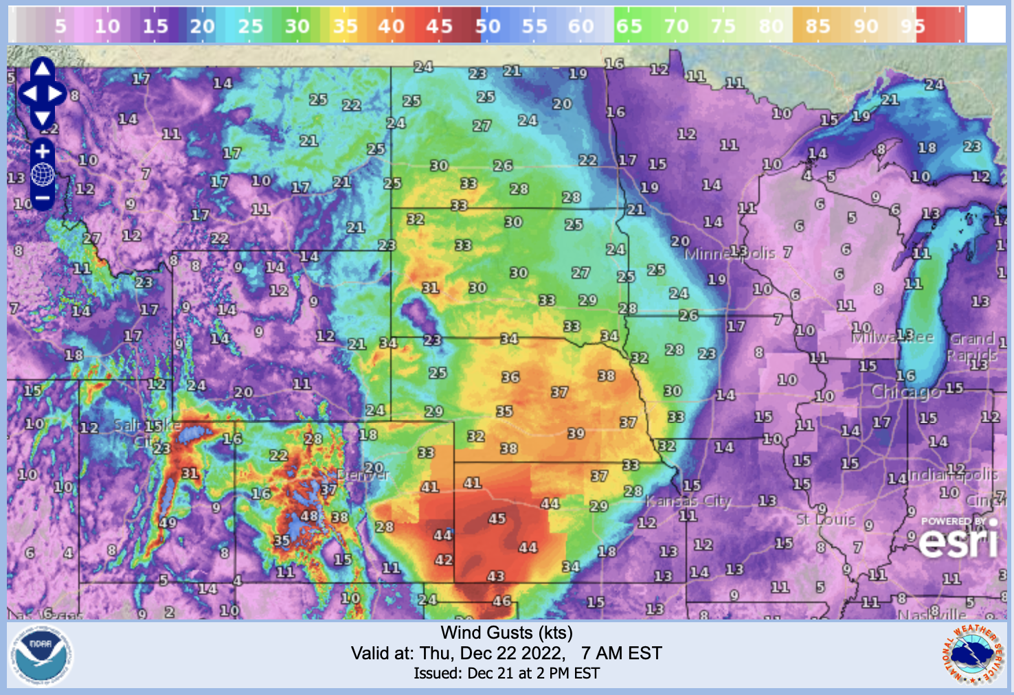
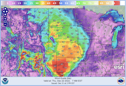
| Wind speed in kt over the Northern Plains
22.12 12 UTC
Source: Weather.gov
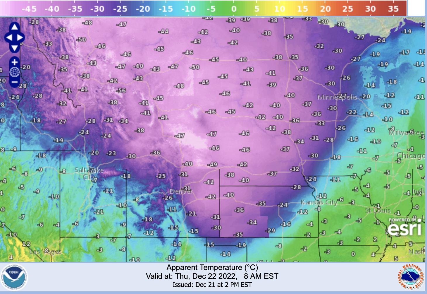
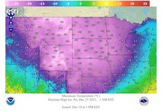
| Apparent 2 m-Temperature over the Northern Plains
22.12 13 UTC
Source: Weather.gov
|
Extreme Cold and Snowfall
Northern Plains, USA
Issued: Wednesday, 21 December 2022, 14:30 UTC
An outbreak of Artic air masses over the US will continue in the coming days with a strong trough plunging southwards over the Great Plains. Enhanced by Lee Cyclogenesis over the Great Plains, exacerbating the southward advection of extremely cold air masses.
21.12.2022
Extremely cold air masses are currently spreading southwards over the US-Canadian border with 850 hPa-temperatures below -30 °C. With a trough plunging southwards over the Great Plains, these extremely cold air masses advance further south. In Northeastern Montana temperatures already dropped below the -30 °C-mark, with yesterday's daytime high temperatures staying below -25 °C.
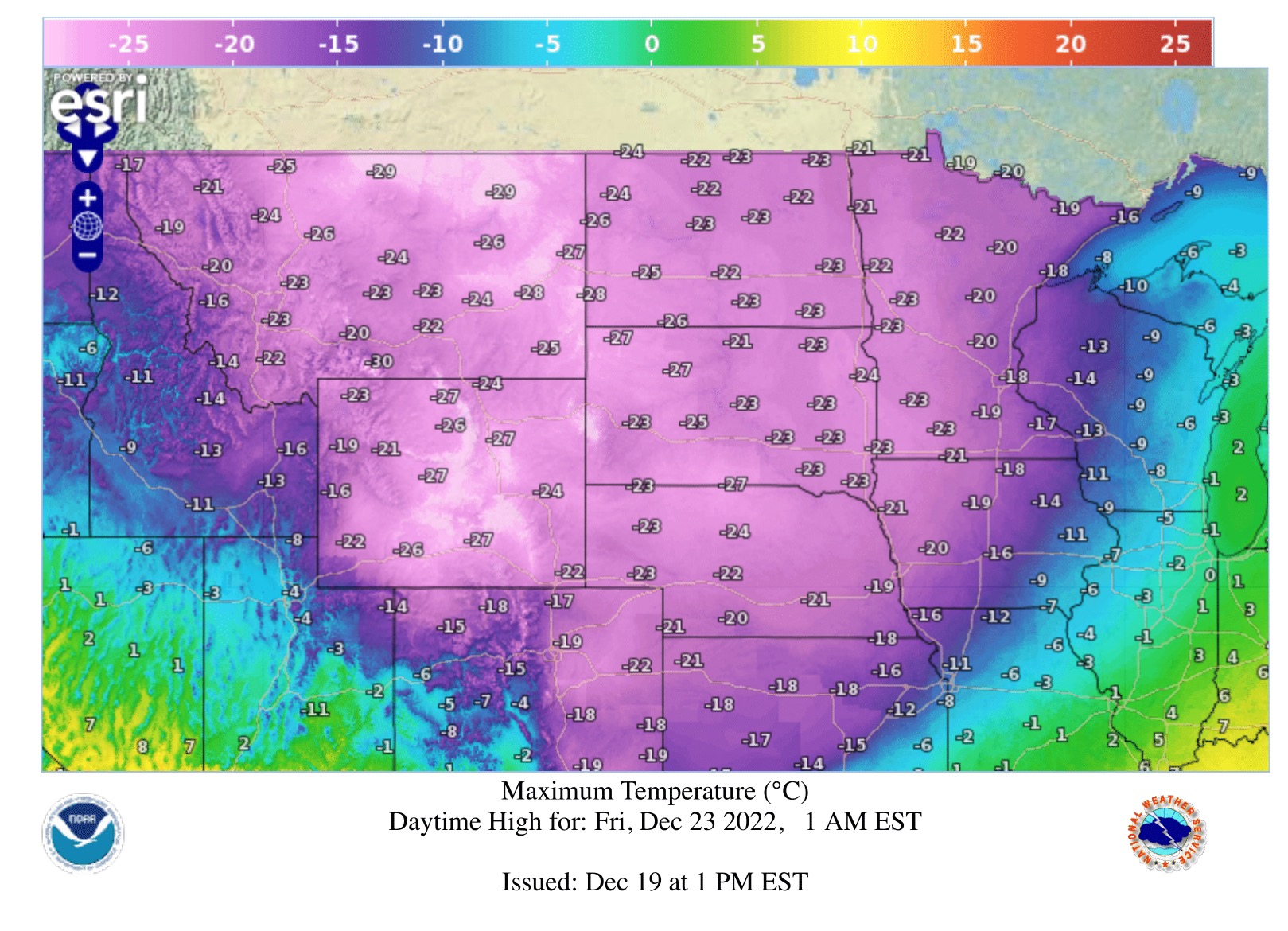
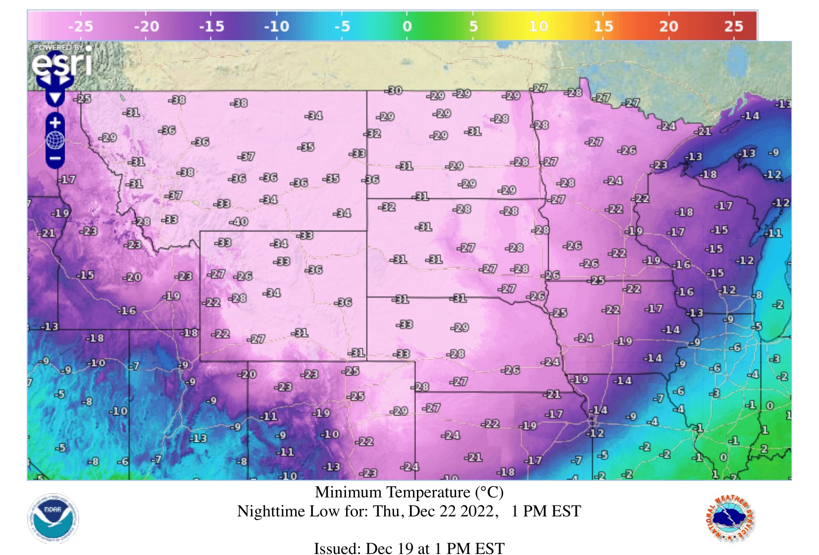
On Thursday, December 22, the extreme cold will affect large parts of the Northern Plains, including Eastern Wyoming, Western North and South Dakota and Western Nebraska with 850 hPa-temperatures dropping below the -30 °C-mark there. Temperatures are expected to drop below -40 °C in Wyoming. With a strong cold front, violent temperature drops are expected as the temperatures in Southern Wyoming are currently still above freezing level. Strong winds, with wind gusts of possibly more than 70 km/h, exacerbate the cold with Windchill temperatures below -50 °C and locally below -55 °C, forecasting values close to the all-time records with the coldest air masses in decades expected, inducing life threatening cold within 5 minutes.
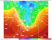
By Friday, December 23, the extreme cold has spread across of the Great Plains, with minimum temperatures below the -15 °C-mark in Northern Texas and Oklahoma. With the Lee Cyclogenesis strong snowfall is expected to move across the Great Lakes region. Temperatures below freezing level will as far south as the US-Mexican border along the Rio Grande.
On Thursday, December 24, the violent cold will ease from the west to the east in the Northern Plains. The cold snap will reach the Gulf Coast, with freezing temperatures of up to -8 °C along the Gulf Coast und freezing in Florida as far south as Orlando, FL. Over the Christmas days the cold will slowly move northeastwards into Canada with temperatures remaining below average in the eastern part of the US.
Monday, 19 December 2022, 15:00 UTC
|
|
|
|
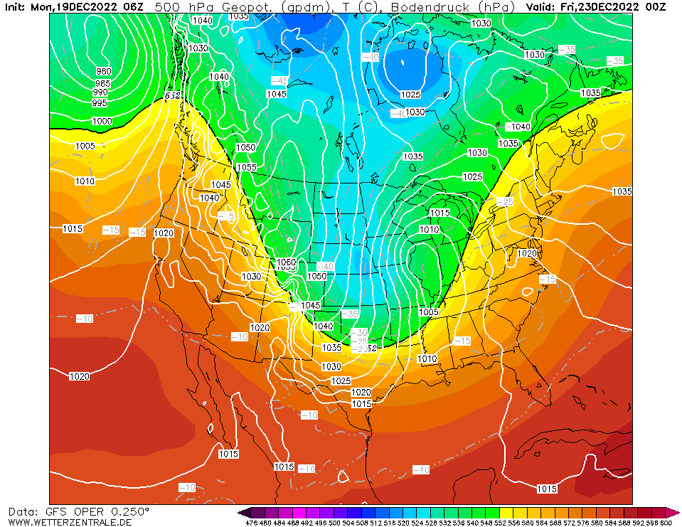
500 hPa Geopotential over Northern America,
23.12, 00 UTC
Source: Wetterzentrale
|
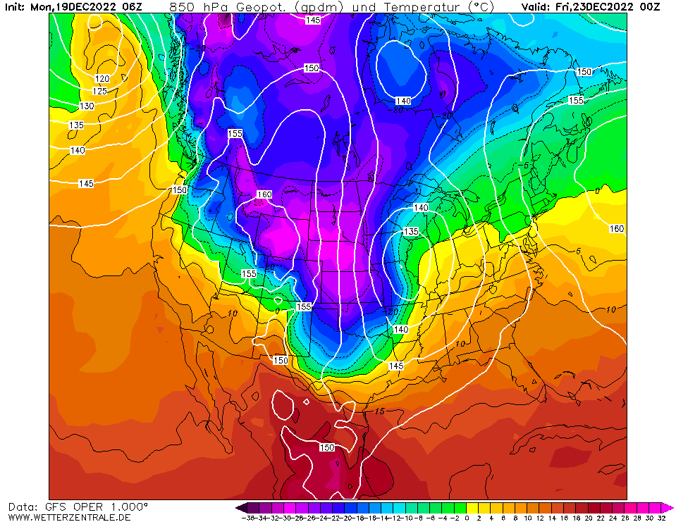
850 hPa Temperatures over Northern America
23.12 00 UTC
Source: Wetterzentrale
| Maximum 2 m-Temperature over the Northern Plains
22.12
Source: Weather.gov
| Minimum 2 m-Temperature over the Northern Plains
21.12
Source: Weather.gov
|
Extreme Cold
Northern Plains, USA
Issued: Monday, 19 December 2022, 15:00 UTC
A trough is expected plunge southwards over the Great Plains, amplifying a strong ride and trough structure over the US bringing Arctic air masses with extreme cold to the Northern Plains with nighttime low temperatures possibly falling under -40 °C.
19.12.2022
With cold air masses already being present over the western part of Canada, a strong trough will develop in the coming over Canada, plunging southwards over the Great Plains from December 21 onwards. Subsequently, very cold air masses are advected southwards, by early Wednesday morning air masses with 850 hPa temperature below -20 °C, regionally -25 °C will spread southwards.
On the backwards flank of low developing in the lee of the Rocky Mountains the advection of very cold air masses is further intensified and expected to advance far into the southern part of the US, with 850 hPa temperatures in Oklahoma and Northern Texas expected to drop beneath -20 °C by Friday, December 23.
The outbreak of Arctic air masses will lead to widespread extreme cold in the northern states of the Great Plains. Already in the coming night from December 19 to December 20 are expected to reach below -35 °C in Northern Montana, spreading southeastwards in the following days. Temperatures in Montana, North Dakota and Wyoming are expected to fall to -40 °C, locally -45 °C are possible, especially when the cold air masses penetrate into the northern ranges of the Rocky Mountains. Daytime high temperatures are expected only to slightly rise above -30 °C in Eastern Montana and Northern Wyoming on December 21 and December 22. With wind gusts of over 50 km/h extreme wind chill temperatures under -50 °C are expected, leading to life-threating cold.
Extreme cold with temperatures under -20 °C are expected to reach as far south as Amarillo, TX and Oklahoma City, OK. With temperatures below freezing expected to reach the Gulf Coast. With the cold expected to move eastwards over the Christmas Day, with freezing possible as far south as Northern Florida on Christmas Day.
Issued: December 19, 2022, 15:00 UTC
KG
Issued: December 21, 2022, 14:30 UTC
KG
|