Sunday, 19 June 2022, 11:00 UTC
|
|
|
|
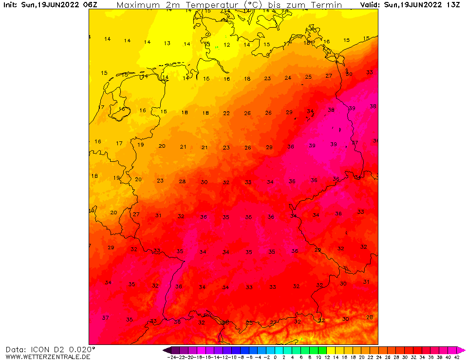
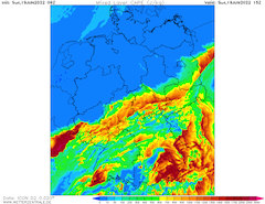
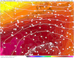
Maximum temperature over Central Europe,
19.06., 18 UTC
Source: Wetterzentrale
|
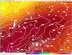
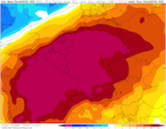
Mixed Layer CAPE over Central Europe,
19.06., 15 UTC
Source: Wetterzentrale
|
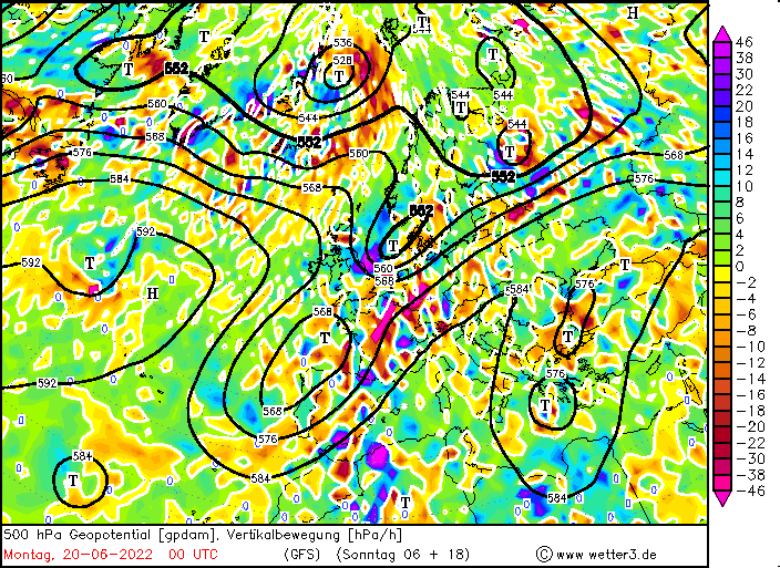
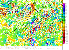
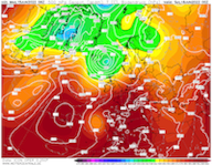
500 hPa vertical velocity over Europe,
20.06., 00 UTC
Source: Wetter3
|
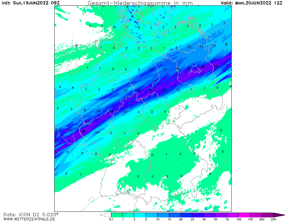
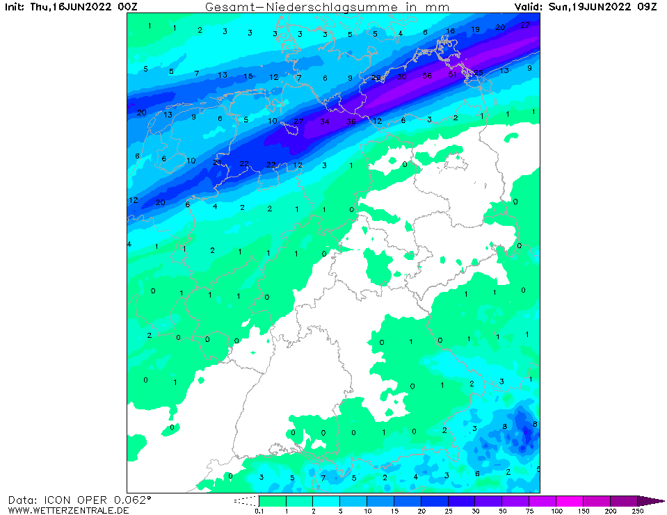
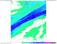
Accumulated precipitation over Central Europe,
20.06., 12 UTC
Source: Wetterzentrale
|
Heat Wave and Thunderstroms
Central Europe
Issued: Sunday, 19 June 2022, 11:00 UTC
The warmest air masses move eastwards over Central Europe, day-time high temperatures over Central Europe are again expected to rise to up 39 °C on Sunday. In the night to Monday enhanced thunderstorm activity is expected in a narrow corridor over Central Europe.
19.06.2022
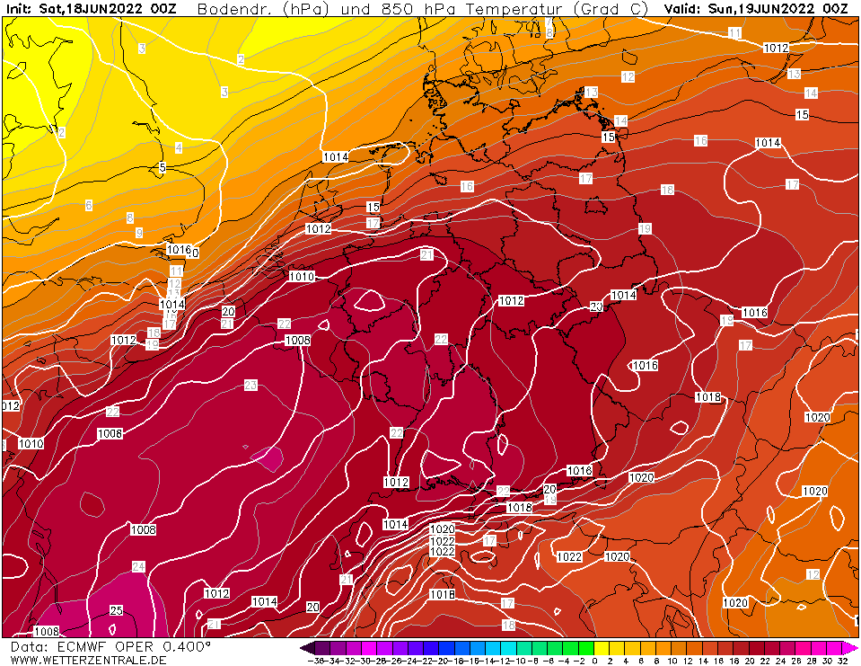
With a trough over the North Sea gaining influence over Central Europe, moving south-eastwards over Denmark, a distinct air mass boundary is slowly shifting south-eastwards over Central Europe, ending the current heat wave on its northern side.
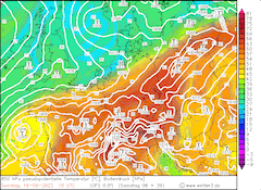
In the southern part of Germany, the 850 hPa-temperature reaches values above 20 °C and therefore temperatures up to 39 °C are expected on the southern side of set air mass boundary, giving the possibility for record-breaking maximum temperatures for June. At 10 UTC at surface level the air mass boundary is situated in a line from Paris over Reims, Koblenz, Kassel to Stettin.
In the afternoon and evening hours significant CAPE is expected to build in a narrow corridor ahead of set air mass boundary. With sufficiently high level of CIN single thunderstorm development is favored. Furthermore, with the trough moving south-eastwards synoptically forced lifting is induced in the middle atmosphere, as well as divergence in the higher troposphere, giving an environment favorable for locally severe thunderstorm activity.
Current model data suggests starting thunderstorm activity over the Grand Est region in France in the evening hours. The cells are expected to move north-eastwards over the middle part of Germany through the night, possibly causing excessive precipitation and high winds.
On Monday, temperatures above the 30 °C-mark are expected in the very southern part of Central Europe, especially in the Alpine foothills.
Saturday, 18 June 2022, 11:00 UTC
|
|
|
|
850 hPa temperature over Central Europe,
19.06., 00 UTC
Source: Wetterzentrale
|
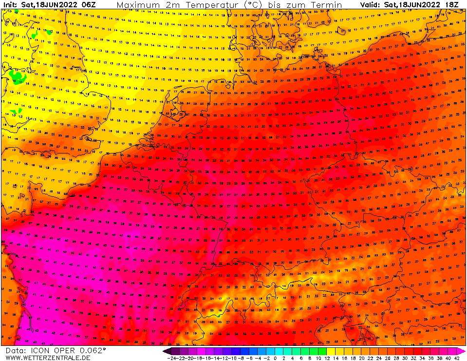
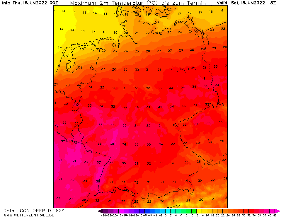
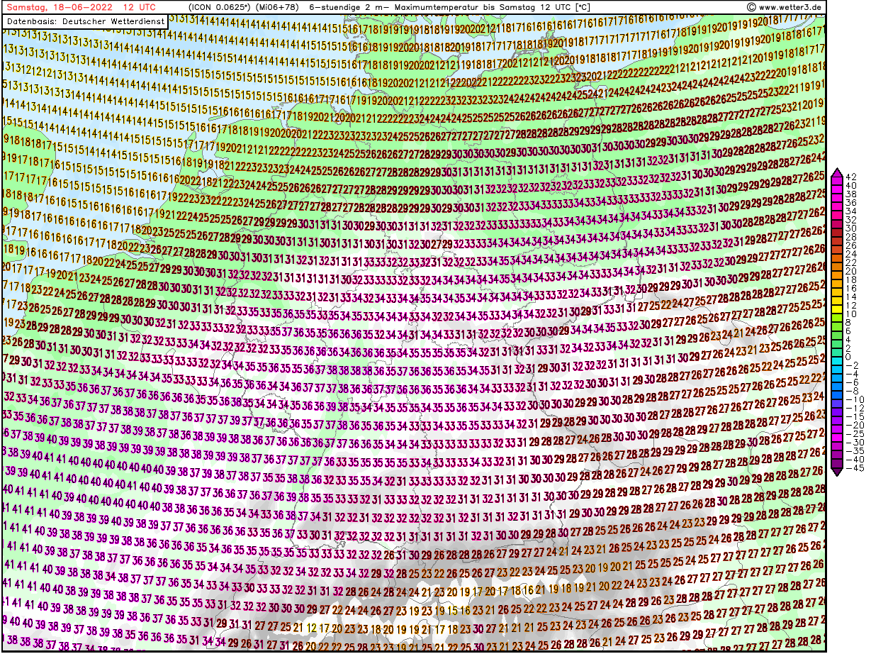
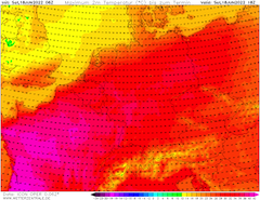
12 h maximum temperature Central Europe,
18.06., 18 UTC
Source: Wetterzentrale
|
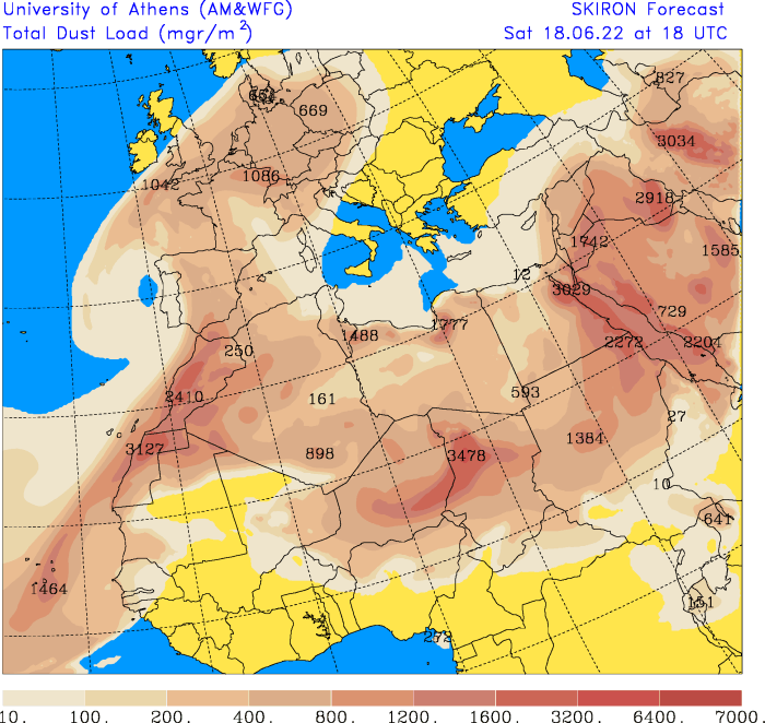
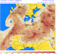
Total dust load Europe and Northern Africa,
18.06., 18 UTC
Source: University of Athens
|
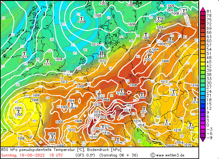
850 hPa pseudo potential temperature Central Europe,
19.06., 18 UTC
Source: Wetter3
|
Heat Wave
Central Europe
Issued: Saturday, 18 June 2022, 11:00 UTC
Even warmer air masses move eastwards over Central Europe causing possibly record braking temperatures for the 2nd June Decade. On Saturday and Sunday the peak of the heat wave is expected with up to 38 °C over Western Germany and up to 44 °C in Southern France.
18.06.2022
Between a cut-off trough off the coast of Portugal and a ridge over the Iberian Peninsula and the western part of Mediterranean Sea very warm air masses are transported towards Central Europe.
On Saturday and Sunday, a swell of even warmer air masses gets transported over Central Europe with 850 hPa-temperatures reaching up to 25 °C over Southern France with slightly lower values over Southern Germany. Day-time maximum temperatures up to 45 °C in Southern France and up to 38 °C in Western Germany are expected, giving the possibility is given for record-breaking temperatures for the 2nd June Decade. With an increasing dust load in the atmosphere over Central Europe there is still some uncertainty in the day-time maximum temperatures.
Especially in the metropolitan areas of Southern France and Western Germany enhanced heat stress is expected due to the very high night-time minimum temperatures in the night from Saturday to Sunday, with temperatures barely falling below the 25 °C-mark during the nighttime.
On Sunday in a combination with a trough over the North Sea a distinct air mass boundary is expected to move south-eastwards over Central Europe, giving larger uncertainty to the maximum temperature over the middle part of Germany. In the evening hours set air mass boundary is expected to move towards Southern Germany, ending the heat wave in the regions it will have passed.
Thursday, 16 June 2022, 07:30 UTC
Heat Wave
Central Europe
Issued: Thursday, 16 June 2022, 07:30 UTC
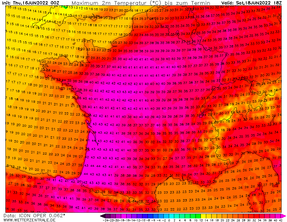
Very warm air masses from Northern Africa are pushed towards Western and Central Europe causing record breaking temperatures for 2nd June Decade. Up to 44 ° in France, up to 38 ° in Western Germany.
16.06.2022
In the transition zone of a cut-off low over the Portuguese coast and a pronounced high-altitude ridge from North Africa to the Western Alps, very warm air will be transported
to Western and Central Europe on Saturday and Sunday. The 850 hPa temperatures will reach values of up to 25 °C in France and southwest Germany, and up to 44 °C are expected in
2 m in western France. In Paris, up to 41 °C are possible. In Germany, the highest temperatures are anticipated in the Rhine Valley, where up to 38 °C are likely.
On Sunday, the heat wave will shift further east, with widespread temperatures above 30 °C in Bavaria, where peaks of up to 36 °C are expected. Starting from the northwest,
cooler air masses are dominating on Sunday. From Saturday evening, rain showers and thunderstorms will occur in the northern half of Germany, in a belt from Bremen via Hamburg
to Rügen, even continuous rain with total precipitation amounts of up to 50 mm is possible.
Wednesday, 15 June 2022, 12:00 UTC
|
|
|
|
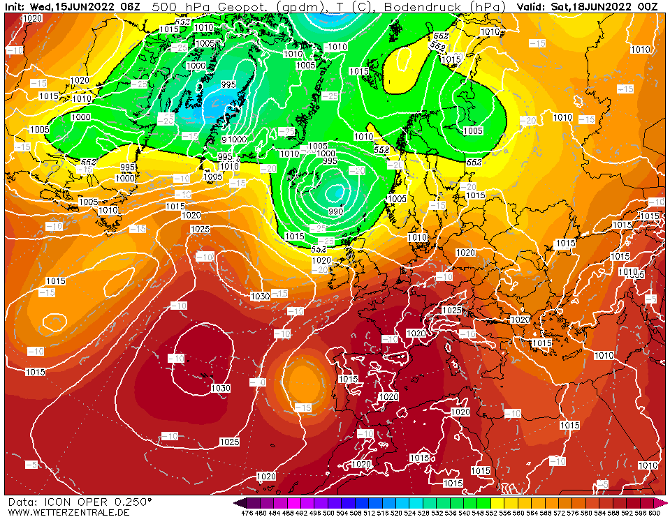
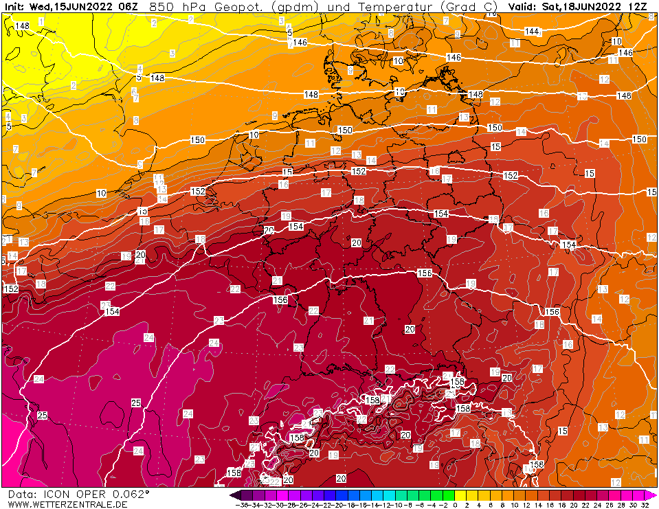
500 hPa Geopotential height Central Europe,
18.06., 00 UTC
Source: Wetterzentrale
|
850 hPa temperature and Geopotential height
Central Europe, 18.06., 12 UTC
Source: Wetterzentrale
|
6 h maximum temperature Central Europe,
18.06., 18 UTC
Source: Wetter3
|
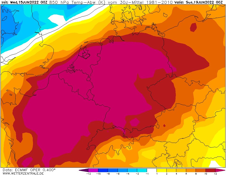
850 hPa temperature deviation, 19.06., 00 UTC
Source: Wetterzentrale
|
Heat Wave
Central Europe
Issued: Wednesday, 15 June 2022, 12:00 UTC
In a combination of a strong rigde over the western part of the Mediterranean Sea and a cut-off trough off the coast of Portugal, Western and Central Europe come under the influence of a very hot air mass originating from Northern Africa.
15.06.2022
From Friday, June 17, 2022, onwards, a heatwave is expected to intensify over Central Europe due to the presence of a very hot air mass, leading to daytime high-temperatures above the 35 °C. The combination of a cut-off trough off the coast of Portugal and a ridge over the western part of the Mediterranean Sea generates a strong south-westerly current over Central and Western Europe.
The present air mass over Central Europe is already expected to lead to the daytime high-temperatures around the 30 °C-mark starting on Wednesday over the southwestern part of Germany. Warmer temperatures are already to be expected over the southern part of France.
On Friday over the western part of Central Europe during the daytime the 850 hPa-temperature is expected to rise above values of 15 °C. On Saturday the south-westerly current is expected to intensify and even warmer air masses will be reaching Central Europe. 850 hPa-temperature values above the 20 °C-mark are expected, leading to daytime high-temperature above the 35 °C-mark, especially in the Rhine valley, giving presently the potential for new decade records for the second June decade to be set.
In the night from Saturday to Sunday the night-time low-temperature is expected to remain well above the 20 °C-mark, leading to the first tropical night of the year and elevated heat stress in the western part of Central Europe, especially in metropolitan areas.
On Sunday a higher uncertainty is given to the potential of another day with daytime high-temperatures reaching the 35 °C-mark, due to a cold front moving south-eastwards, belonging to a low-pressure system over the North Sea. Different numerical weather models give a varying propagation speed and intensity of set cold front. This leads to vastly differing daytime high-temperatures on Sunday and Monday over Central Europe depending on set model and the resulting cold front position. Some model runs even give presently the potential for a prolonged heat wave over Central Europe.
Issued: June 15, 2022, 12:00 UTC
KG
Issued: June 16, 2022, 07:30 UTC
FS
Issued: June 18, 2022, 11:00 UTC
KG
Issued: June 19, 2022, 11:00 UTC
KG
|