|
Sunday, 22 Aug 2021, 12:00 UTC
Issued: Saturday, 11 Sep 2021, 12:30 UTC
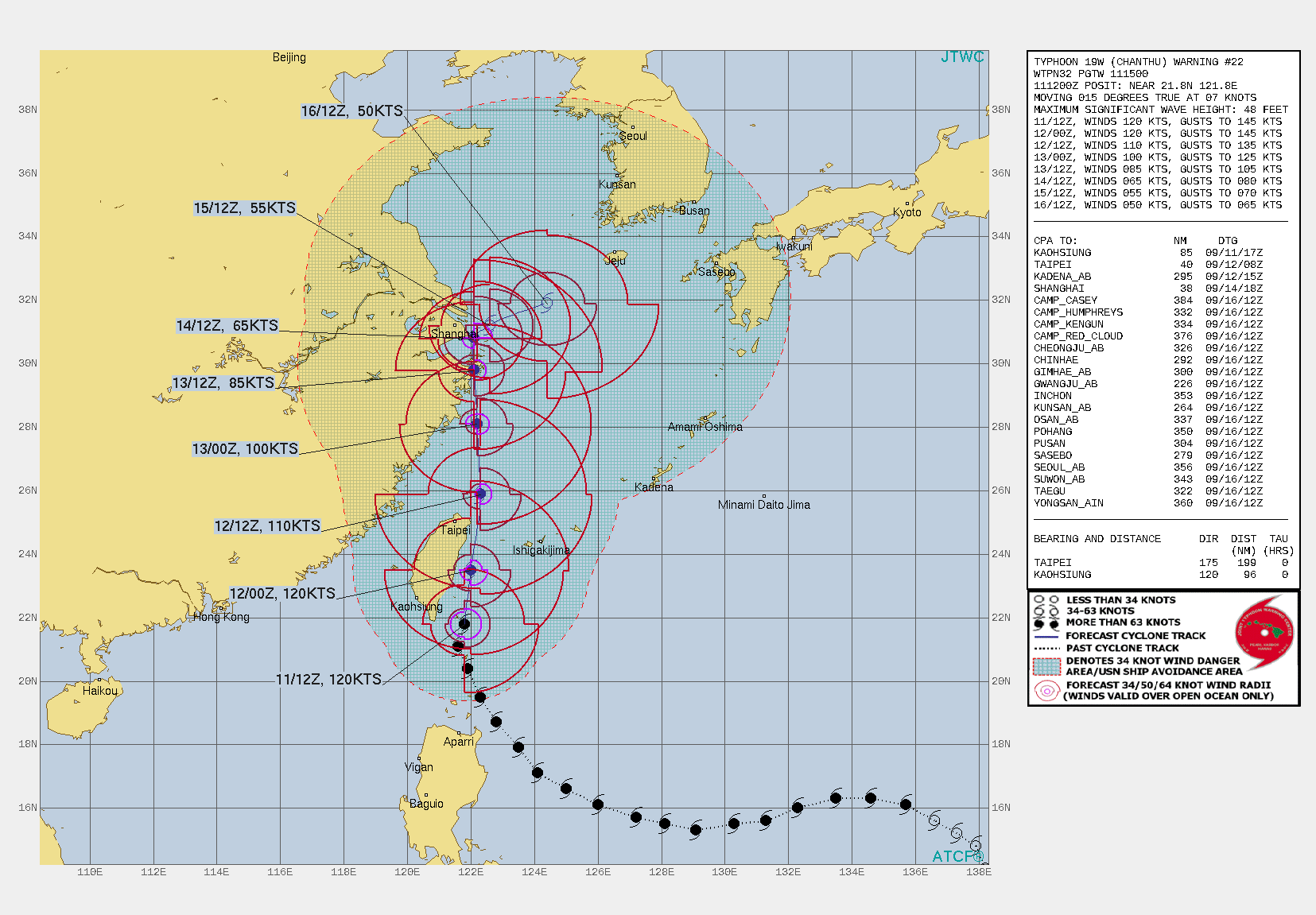
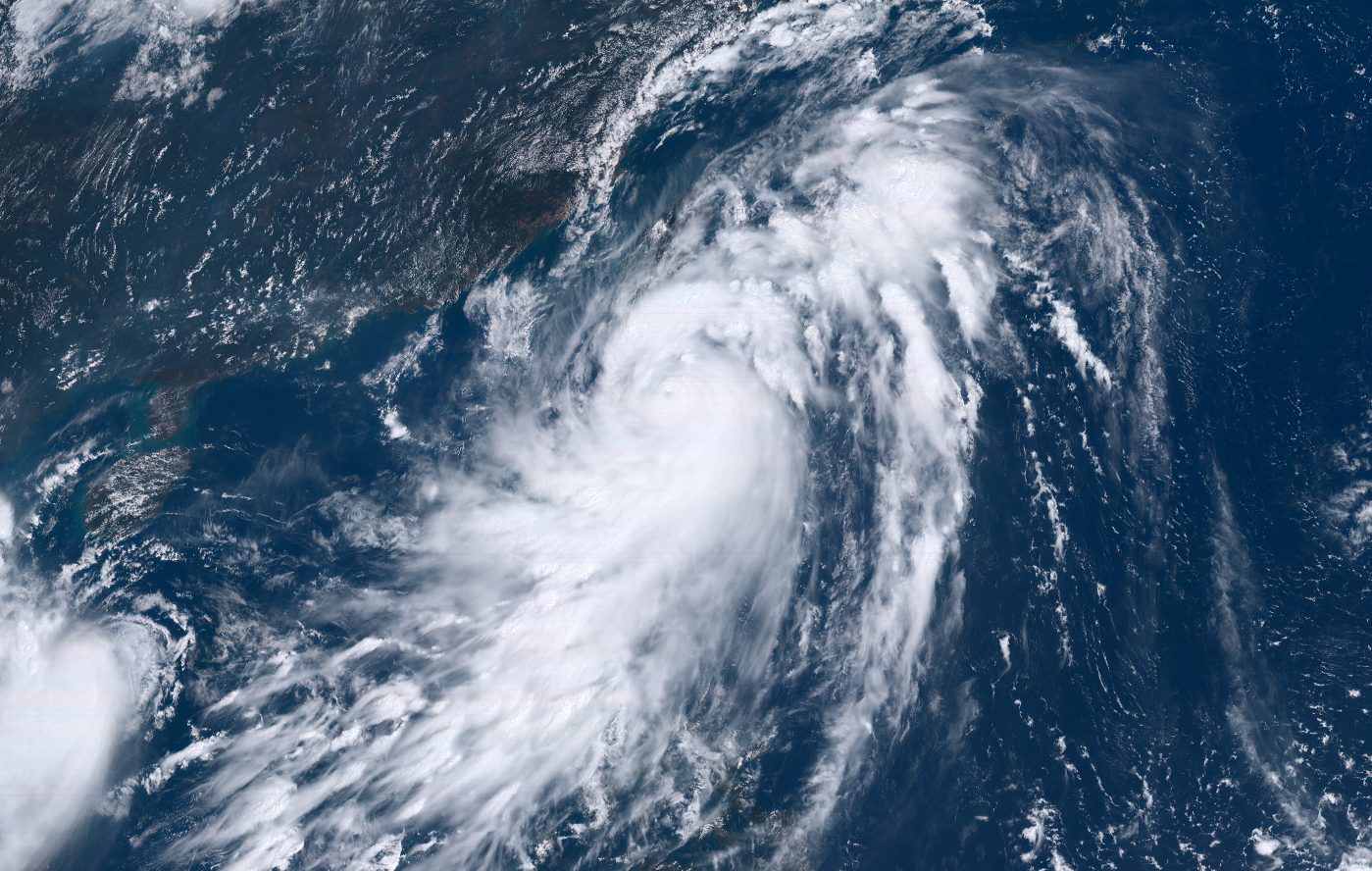
Super Typhoon CHANTHU is passing 50km east of Taiwans eastern Coast as a powerful Super Typhoon with sustained mean winds of up to 120 kt. CHANTHU is forecasted to make
landfall on 13 September in the area of Shanghai.
Super Typhoon CHANTHU originated from a tropical depression around 17°N eastwards of the Philippine Islands. Nearly perfect conditions in the Pacific Warm Pool lead to fast and
continous intensification until September 8, on which CHANTHU reached its initial peak intensity as a Category 5 Typhoon with 1-min sustained wind speeds of up to 140kt. After two
eyewall replacement cycles, which led to a slight reduction in intensity, CHANTHU reached its absolute peak strength at 10 September on 18 UTC with 1-min sustained wind speeds of
up to 155kt.As of 12:00 UTC September 11, Typhoon Chanthu is located near 21.8°N, 121.8°E, about 369 km south of Taipei, Taiwan. Maximum 10-minute sustained winds are at 105 kt,
with gusts up to 150kt while maximum 1-minute sustained winds are at 120kt. The minimum central barometric pressure is 920 hPa, and the system is moving north-northeast
at 8 kn. Issued: Sep 11, 2021, 12:30 UTC FS |