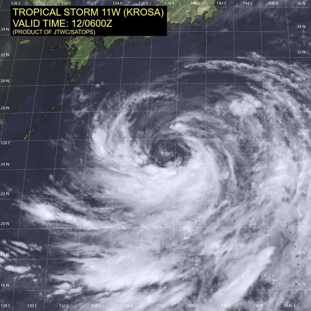
Wednesday, 13 August 2019, 14:00 CET
Ex Typhoon KROSA
Japan
Issued: Wednesday, 13 August 2019, 14:00 CET
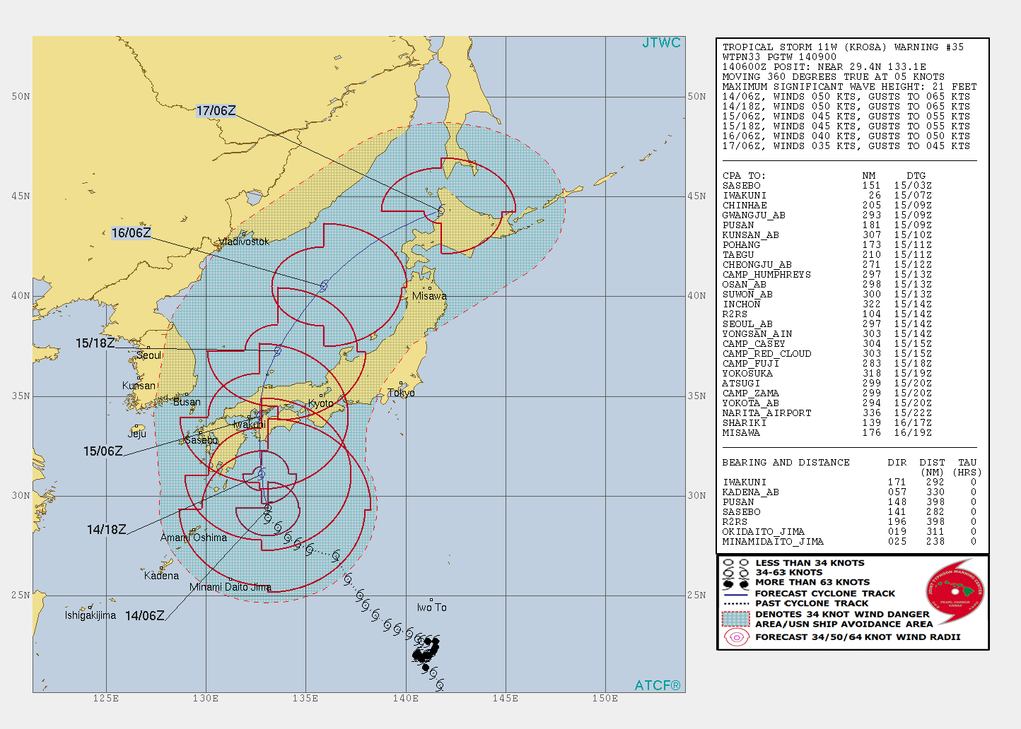
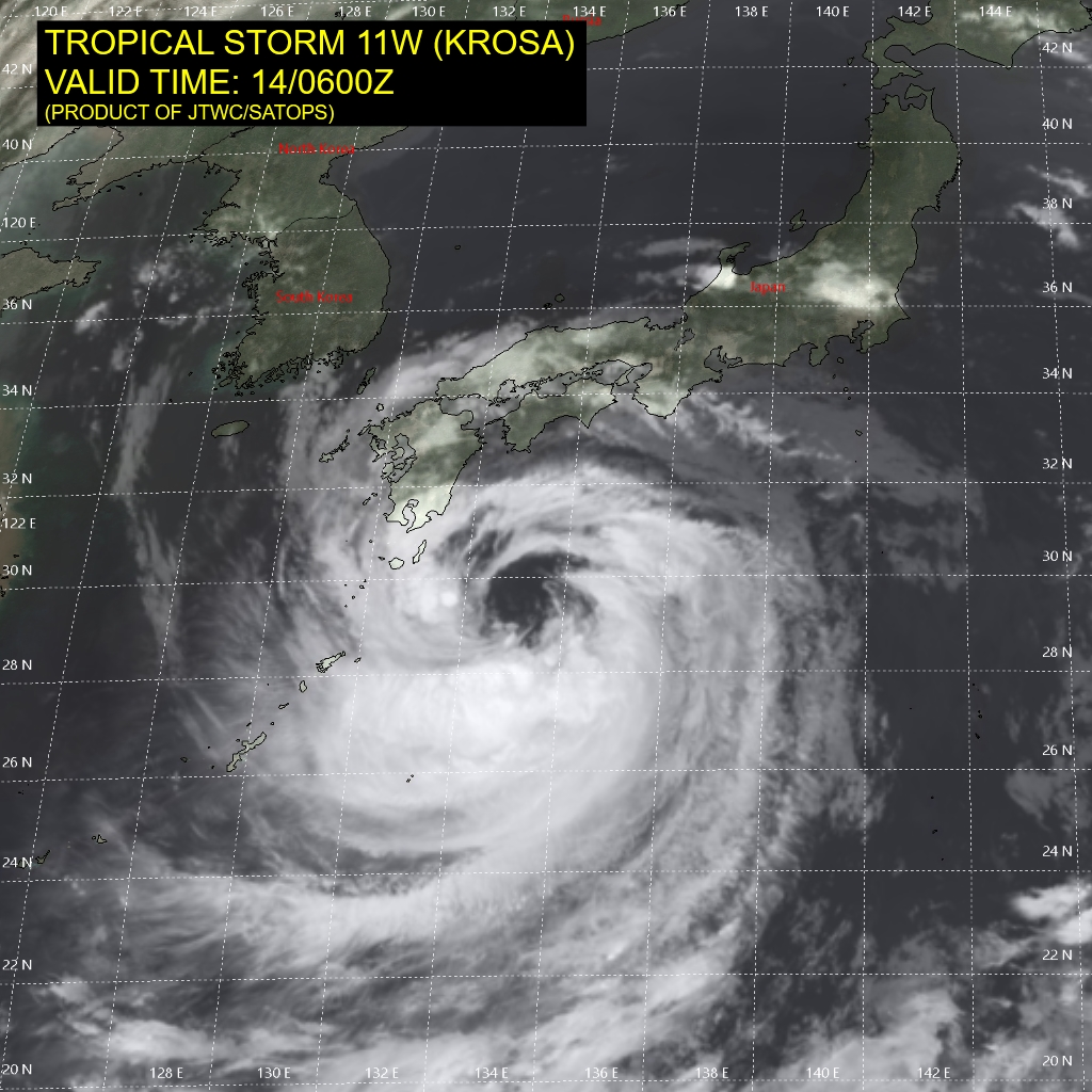
Tropical Storm KROSA has not intensified as strong as expected and will make landfall in Japan as a tropical Storm.
Severe precipitation up to 300 mm expected in Kyushu, Shikoku and southern Honshu.
13-16 August 2019
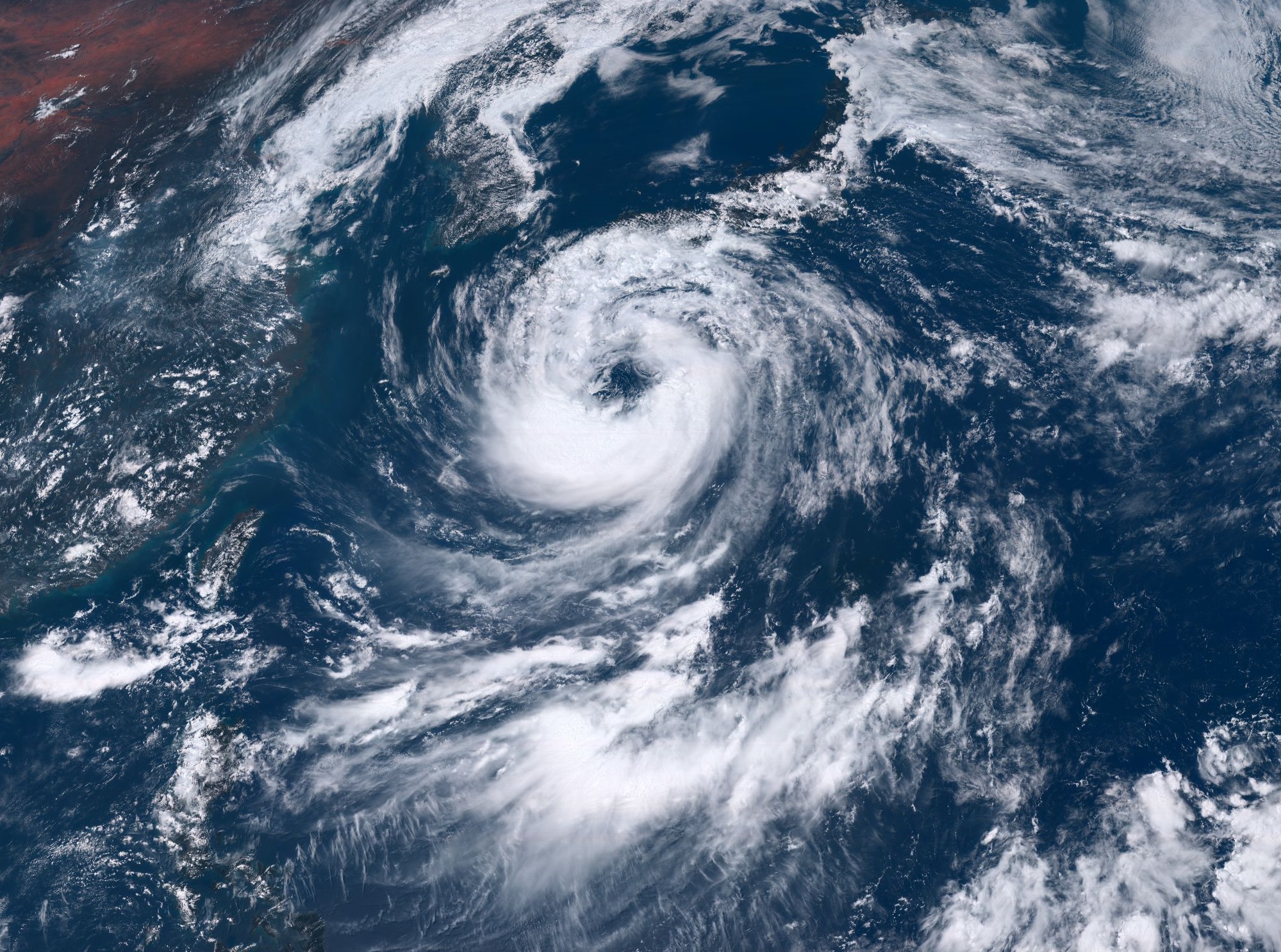
Ex Typhoon KROSA is currently located about 120 km east of Nishinoomote and is moving north with a displacement
speed of about 9 kph. It has average wind speeds around 95 kph and gusts up to 120 kph.
The landfall is expected on August 15 at 03 UTC in the prefecture of Kochi. Afterwards the tropical storm passes over the prefecture Ehime,
then a few km east of Hiroshima and over the prefecture Shimane back to the open sea. Due to the low water temperatures,
the tropical storm will weaken over the Japanese Sea.
In the south of Japan, especially south of the mountains in the prefectures of Kochi, Tokushima, Wakayama and Okayama,
enormous rainfall of up to 300 mm in 48 hours must be expected. There is a risk of flooding and landslides.
Rainfall of up to 150 mm is also possible on the east coast of South and North Korea.
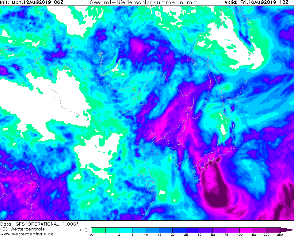
Monday, 12 August 2019, 16:00 CET
Ex Typhoon KROSA
Japan
Issued: Monday, 12 August 2019, 16:00 CET
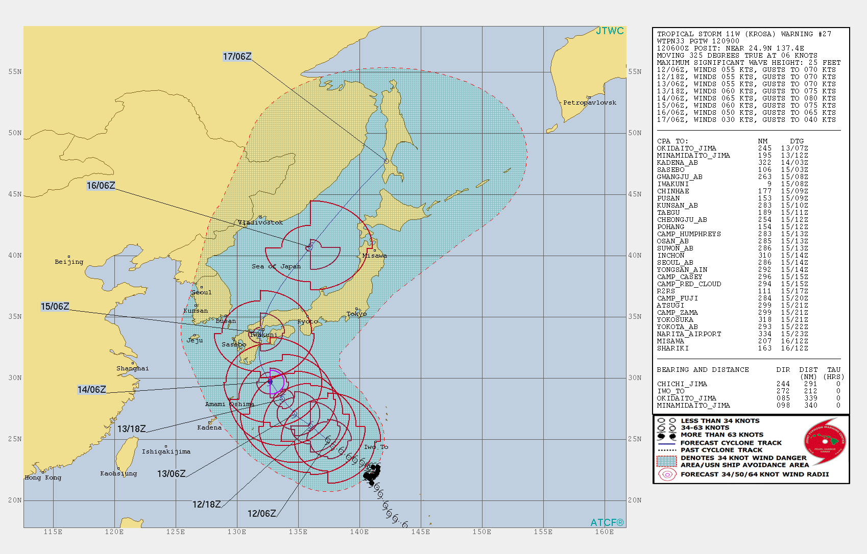
Tropical Storm KROSA has slightly intensified in the last few hours and is still moving very slowly
towards the northwest. Landfall in Japan expected on August 15 at 00 UTC as low category 1 Typhoon.
13-16 August 2019
Tropical storm KROSA is currently located central between the islands of Minamidaito and Ogasawara and is therefore about 750 km away
from the Japanese coast. It moves with a displacement speed of approx. 10 kph in northwestern direction. The mean wind speeds are
about 100 kph, in gusts up to 130 kph. KROSAs Core pressure is about 975 hPa.
The tropical storm is expected to become a Category 1 typhoon again on its way to the Japanese coast. Landfall is expected on 15 August at
00 UTC with average wind speeds of 115 kph and gusts of up to 135 kph. Furthermore, rainfall of up to 100 mm/3h and total precipitation
of more than 250 mm must be expected, particularly on the south coast of Japan. There is a risk of storm damage, landslides and flooding.
After crossing the Southwest of Japan, KROSA will move to the Japanese sea. From there, its trajectory continues north-east between Vladivostok
and Sapporo. As a low-pressure area, KROSA will also provide abundant precipitation in northern Japan and on the mountainous east coast of Russia.
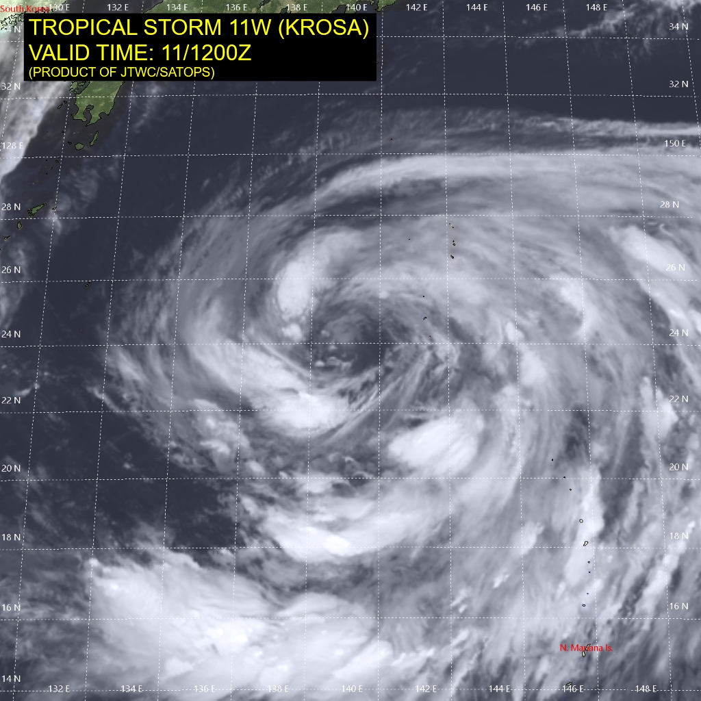
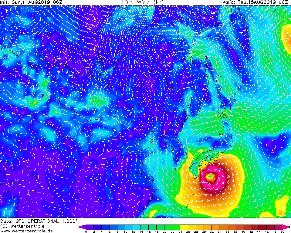
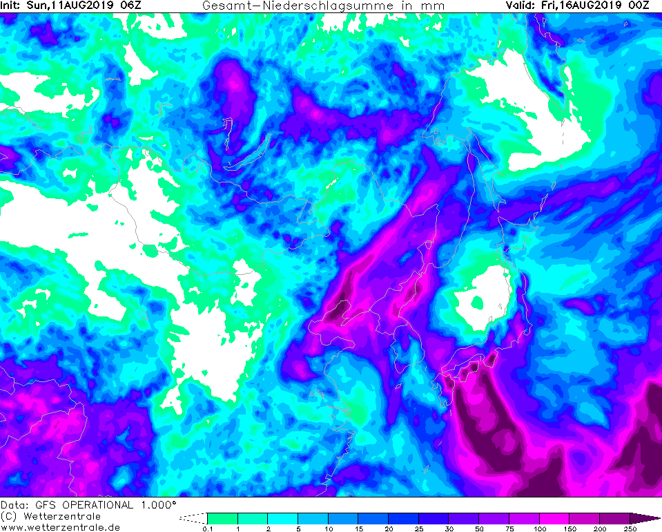
Sunday, 11 August 2019, 18:00 CET
Ex Typhoon KROSA
Japan
Issued: Sunday, 11 August 2019, 18:00 CET
Ex category 3 Typhoon KROSA moves to the Japanese islands of Kyushu and Shikoku. Landfall is expected on August
15 at 00 UTC as a Category 1 hurricane. Precipitation of up to 300 mm/24h possible on the south coast.
13-16 August 2019
After Typhoon KROSA reached its temporary maximum on 08 August, it became almost stationary and weakened due to
vertical wind shear and lack of energy supply. Today, August 11, it is classified as a tropical storm with mean
winds of 95 kph and gusts of up to 120 kph. It is currently shifting northwest with about 15 kph and reaches an
area off the south coast of Japan with sea surface temperatures of up to 29°C due to Kuroshio current.
The high water temperatures reactivate the tropical storm. According to current forecasts, it reaches Typhoon status
again on August 14 with mean winds of 130 kph and gusts of up to 165 kph. Due to the rough earth surface above the
Japanese prefectures Kyushu and Shikoku (mountains up to 2000m altitude) KROSA will weaken rapidly after making landfall
to Japan.
On the south coast of Japan, wind speeds of up to 130 kph and orographic precipitation of up to 300 mm/24h must be expected.
There is a risk of storm damage, landslides and flooding.
Due to the high displacement speed at this time, KROSA will move to the Sea of Japan as early as 12 hours after land fall
and continue northward. As the surface temperature of the Sea of Japan decreases rapidly in a northerly direction, the
tropical storm will collapse there.
Issued: August 11, 2019, 18:00 CET
FS
Issued: August 12, 2019, 16:00 CET
FS
Issued: August 14, 2019, 14:00 CET
FS
|