Friday 09 August 2019, 22:30 CET
Super Typhoon LEKIMA
Taiwan, China
Issued: Friday, 09 August 2019, 22:30 CET
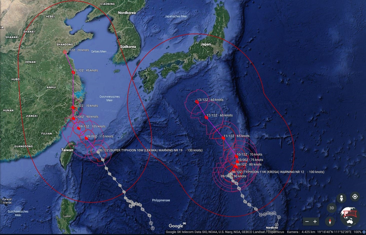
Super Typhoon LEKIMA made landfall 80 km northeast of Whenzou as a high end Category 2 Typhoon. It moves slowly in
northwestern direction with a displacement speed of 10 kph. Windspeeds are still around 150 kph.
08-13 August 2019
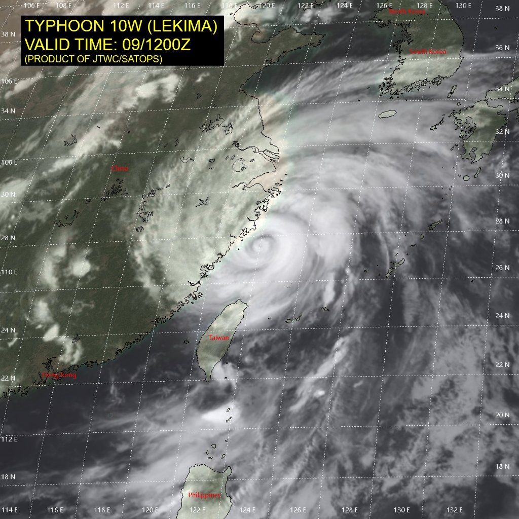
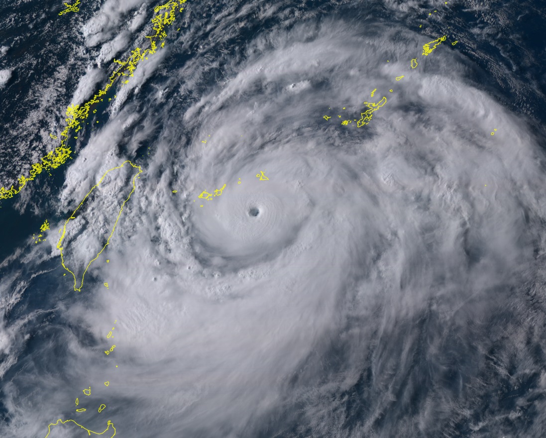
Super Typhoon LEKIMA is currently located a few km west of the Chinese city Taizhou. With average wind speeds of 150 kph
and gusts of up to 175 kph, it belongs to the upper end of category 2.
LEKIMA's trajectory continues north-northwest. On 10 August at 12 UTC it will cross the metropolis of Shanghai.
With mean winds of up to 100 kph and gusts of up to 140 kph, there is still enormous potential for destruction.
In the further course the Typhoon possibly moves again on the East Chinese sea. Due to the prevailing water temperatures
of 27 to 28°C a short re-intensification is possible. Whether and how strong this is depends mainly on the further
trajectory and the vertical wind shear.
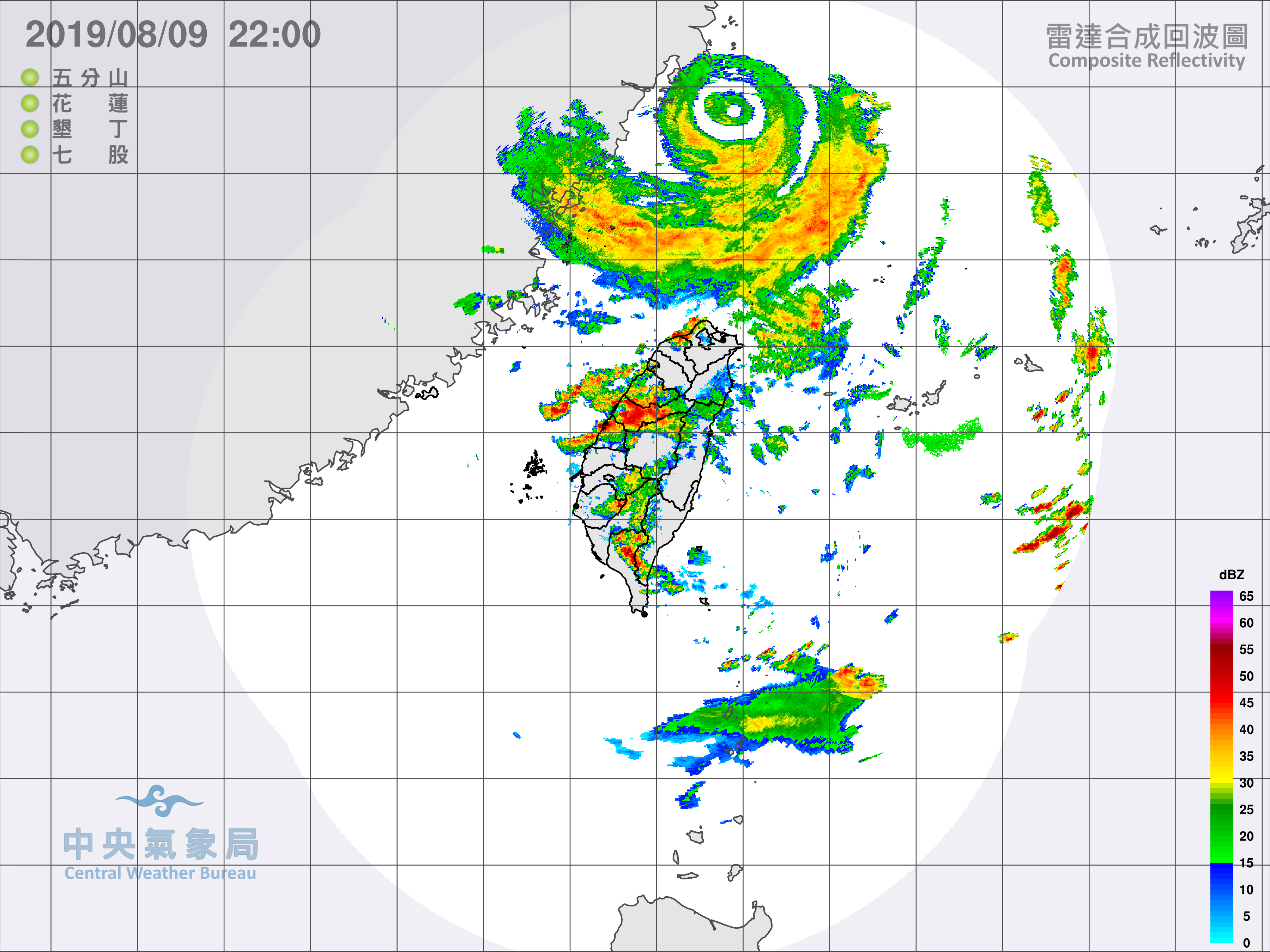
As always during tropical cyclones, there is not only a danger from severe winds, but also from enormous amounts of
precipitation. The weather station Bailan in northern Taiwan recorded a 24h precipitation of 328 mm on 9 August.
In the Chinese provinces of Zhejiang, Shandong, Henan and Liaoning, total precipitation of more than 250 mm must
also be expected.
As it can be see on the precipitation map, enormous amounts of rain may also occur in the south of Japan in
the coming days. These are produced by the category 2 Typhoon KROSA, which is currently located about 1300 km
south-southeast of Tokyo and is slowly shifting towards Japan.
Thursday 08 August 2019, 21:00 CET
Super Typhoon LEKIMA
Taiwan, China
Issued: Thursday, 08 August 2019, 21:00 CET
Super Typhoon LEKIMA originated in Philippine Sea and intensified in the last 24 hours from Category 1 to upper Category 4. The
storm is moving slowly in a northwesterly direction with wind speeds up to 240 kph.
08-13 August 2019
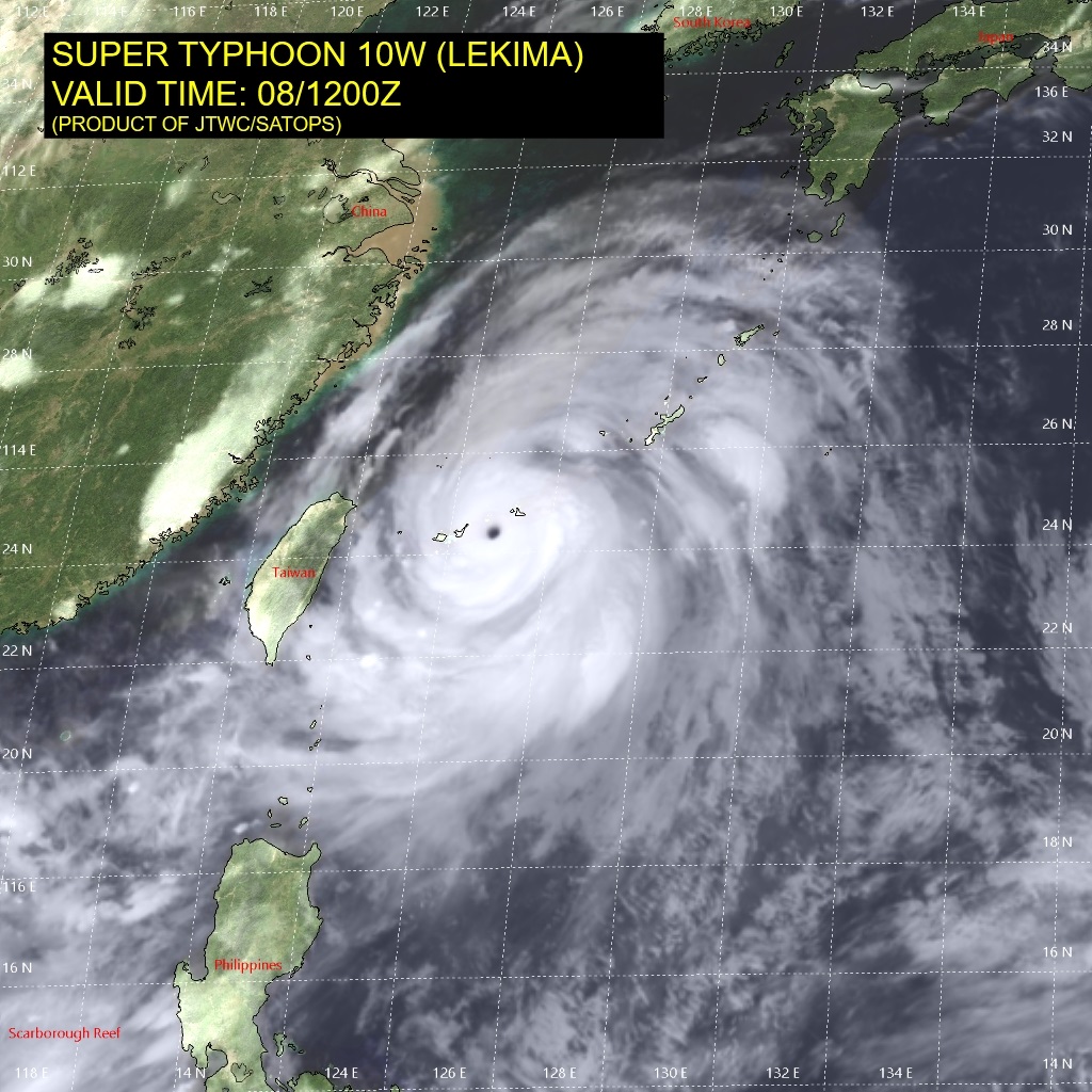
Super Typhoon LEKIMA is currently located about 300 km east of Taipei, the capital city of Taiwan. The current wind speeds are 240 kph,
in gusts up to 295 kph. The storm is moving northwest with about 18 kph. LEKIMA will make landfall as Category 4 Typhoon in the area around
Wenzhou on 10 August at 00 UTC.
The storm will weaken overland, shift further to the north and will move close to the Metropole Shanghai. Wind speeds of up to 95 kph and gusts
of up to 110 kph are expected here as well. LEKIMAs trajectory will then follow the Chinese coast. Re-intensification over the East China Sea
is possible.
On the Chinese east coast and along LEKIMAs trajectory, total precipitation of more than 250 mm has to be expected.
Issued: August 08, 2019, 21:00 CET
FS
Issued: August 09, 2019, 22:30 CET
FS<
|