Friday 26 July 2019, 11:30 CET
Heat wave
France, Benelux, Germany
Issued: Friday, 26 July 2019, 11:30 CET
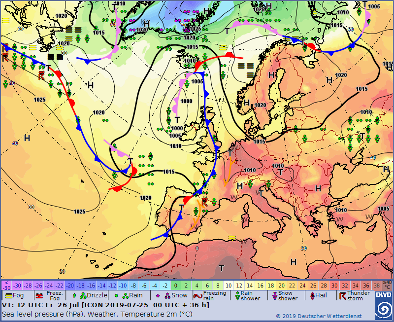
Increasing high pressure influence provides cloudless weather over large parts of Western and Central Europe.
On Thursday and Friday, temperatures of up to 40 °C are expected in northern France,
the Benelux countries and southern and western Germany.
23-27 July 2019
Yesterday the all-time heat record of 24 July was broken again. With 42,6 °C in Lingen a new record was set.
In addition, the record of 40.3 °C in Kitzingen in 2015 was exceeded at 15 stations in Germany. The 40 °C
mark was broken at 25 measurement stations.
Even if the peak of the heat is over, it can still be very hot in Central Europe today. The highest
temperatures occur primarily in western Germany and the Netherlands. In these regions, temperatures rise
to 38 °C in the course of the day. Regionally, the 40 °C mark can also be cracked again.
Towards evening and especially tomorrow there may be thunderstorms. A warning for the
thunderstorms will be issued separately later.
Furthermore, there is an increased risk of forest fires due to the drought.
Thursday 25 July 2019, 09:00 CET
Heat wave
France, Benelux, Germany
Issued: Thursday, 25 July 2019, 09:00 CET
Increasing high pressure influence provides cloudless weather over large parts of Western and Central Europe.
On Thursday and Friday, temperatures of up to 40 °C are expected in northern France,
the Benelux countries and southern and western Germany.
23-27 July 2019
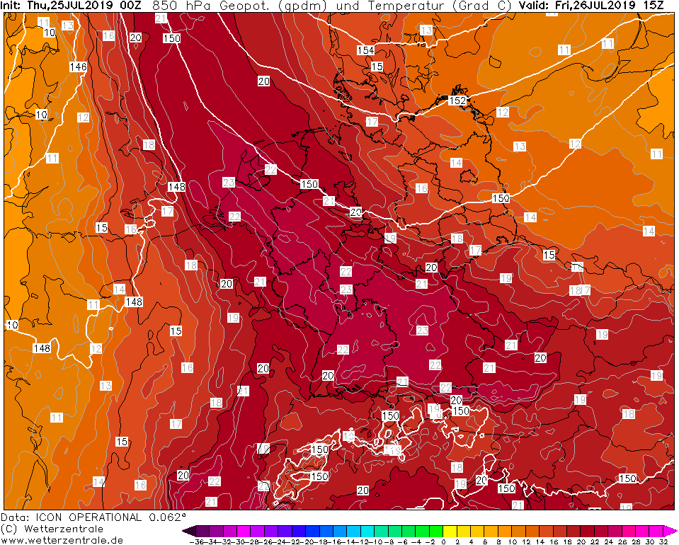
Yesterday the all-time heat record was broken. In Geilenkirchen (NRW), 40.5 °C were measured yesterday. The previous record was 40.3 °C in Kitzingen in 2005.
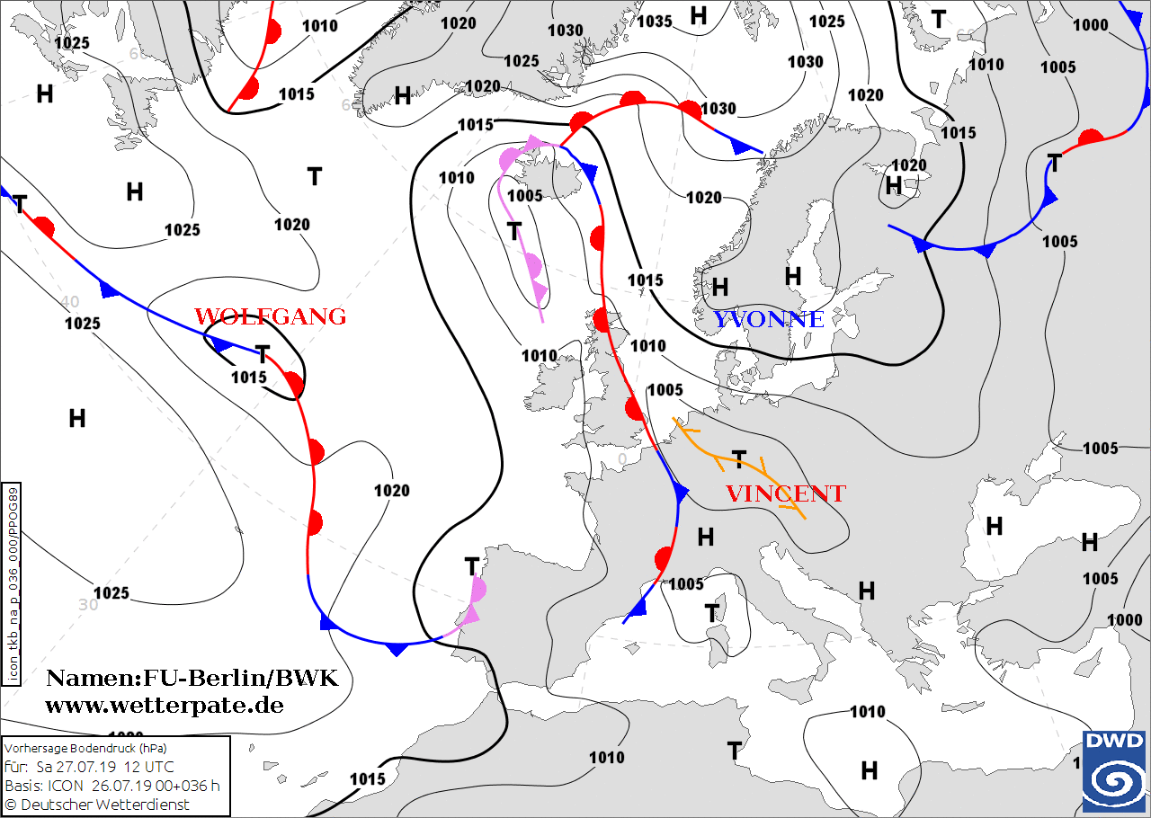
Today, Germany is still within the influence of High YVONNE. Hot air of subtropical origin is transported to Germany.
The focus of the heat is on northern France and Belgium. The influence of high pressure causes the air to sink, which
means that the already warm air mass continues to heat up as it sinks. This means that today and tomorrow maximum
values between 38 °C and 40 °C will be reached. Whether yesterday's all-time heat record will be broken again today
or tomorrow remains to be seen.
The peak of the heat wave is today. With only slight differences in air pressure, VINCENT, which is formed
in the front of an Atlantic front-end system, forms over western France during the course of the day.
VINCENT slowly moves towards the Benelux countries, forming a convergence line. To the west and along the
Rhine, the air becomes more humid and there are thunderstorms of heat along the convergence line and the
cold front following the convergence line. These will reach France and the Benelux countries tomorrow and
thunderstorms in Germany (especially in the west and south) on Saturday.
Furthermore, there is an increased risk of forest fires due to the drought.
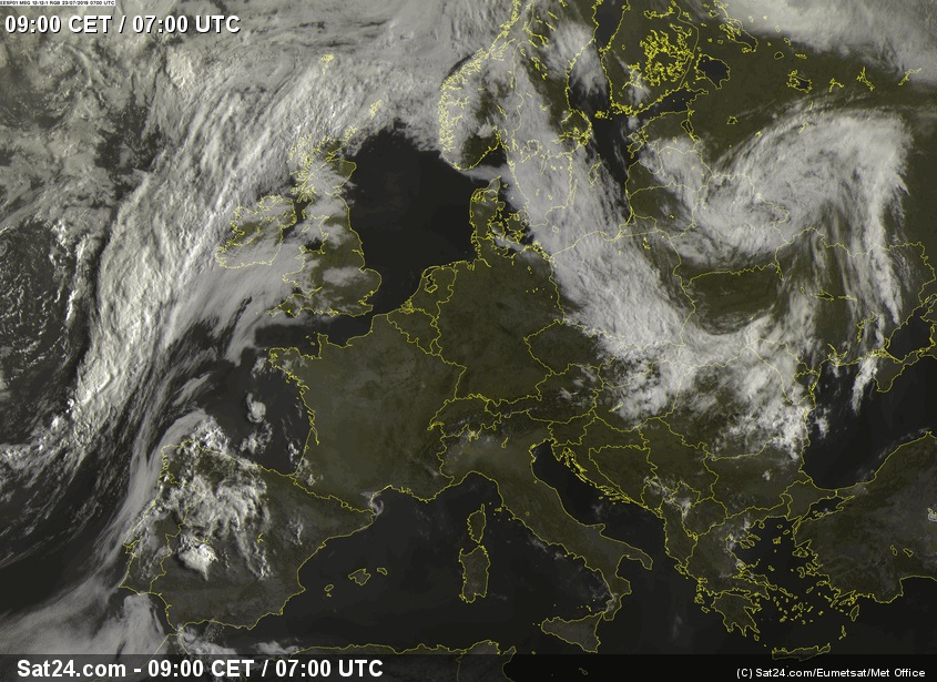
Wednesday 24 July 2019, 08:30 CET
Heat wave
France, Benelux, Germany
Issued: Wednesday, 24 July 2019, 18:30 CET
Increasing high pressure influence provides cloudless weather over large parts of Western and Central Europe.
On Thursday and Friday, temperatures of up to 40 °C are expected in northern France,
the Benelux countries and southern and western Germany.
23-27 July 2019
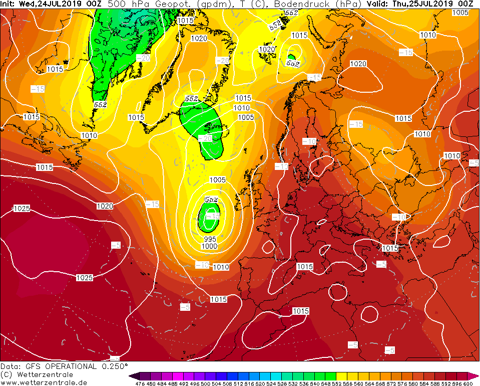
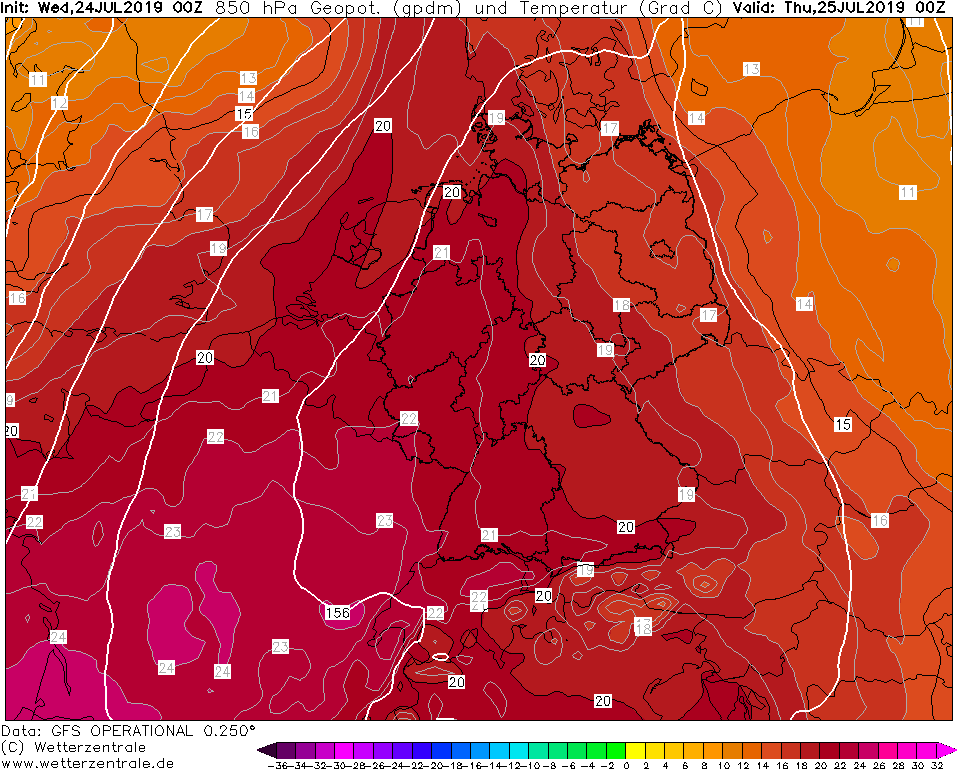
The Yvonne high pressure area continues eastwards to Germany and Central Europe is increasingly under the
influence of high pressure. Due to this high pressure there are no clouds in this area. Temperatures will
continue to rise over the next few days. The highlight of the heat wave is expected on Thursday and Friday.
On these days the temperatures rise to over 38 °C. In some places the 40 °C mark can also be cracked.
These record-breaking temperatures occur mainly in northeastern France, Belgium and southern and
western Germany.
Due to hot temperature and the absence of precipitation, there is an increased risk of forest fires.
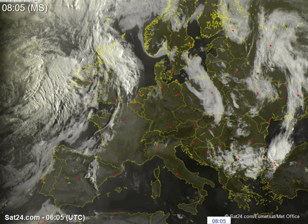
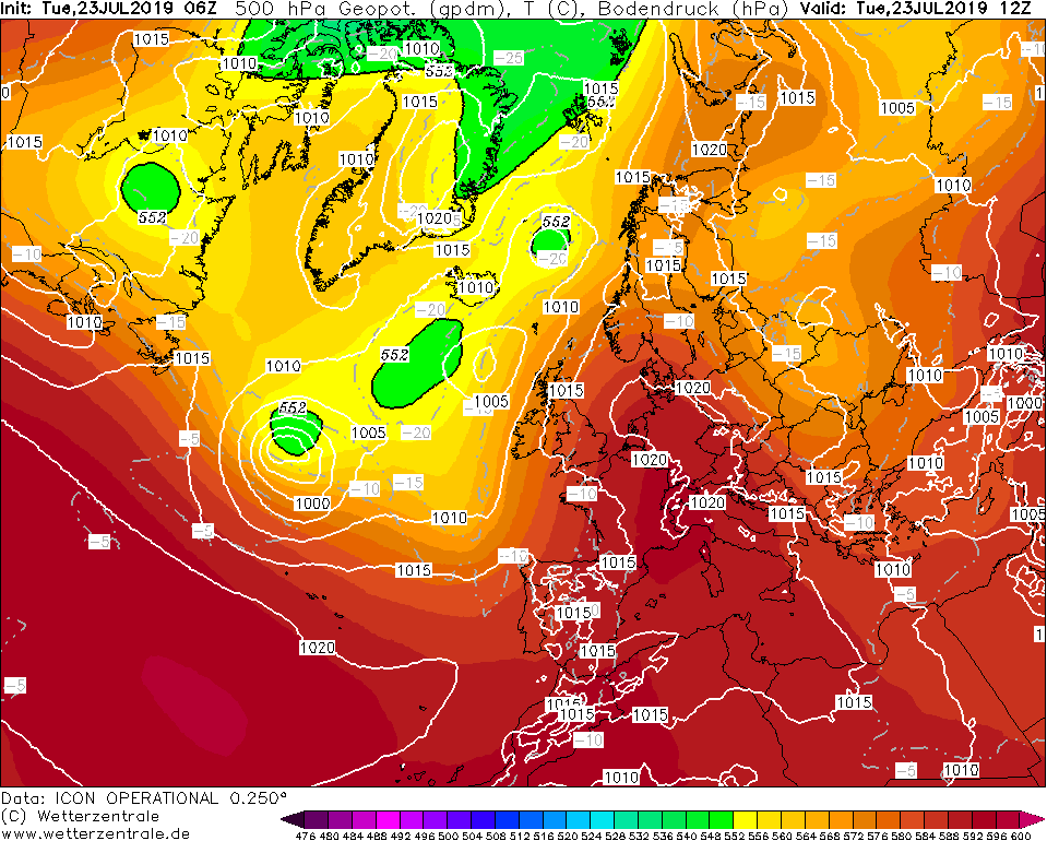
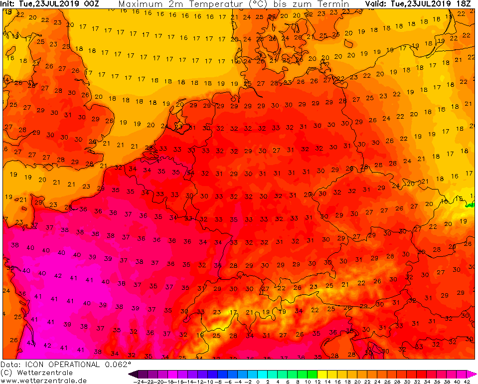
Tuesday 23 July 2019, 11:00 CET
Heat wave
France, Benelux, Germany
Issued: Tuesday, 23 July 2019, 11:00 CET
Increasing high pressure influence provides cloudless weather over large parts of Western and Central Europe.
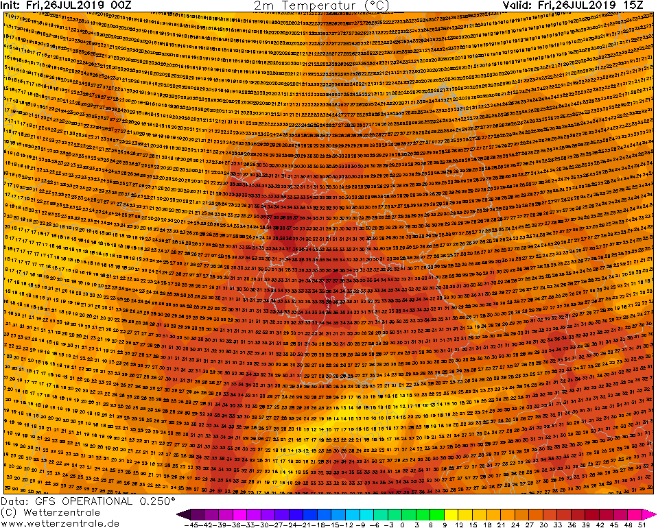
Already on Tuesday temperatures of up to 42°C are possible in France and up to 35°C in Germany.
23-27 July 2019
A high pressure ridge shifting from west to central Europe provides cloudless weather this week. Due to the
seasonally still positive radiation balance in Central Europe, the daily maximum temperatures increase every day.
From Wednesday, hot air from south-southwest will also be advected, which will enable record temperatures of around
40°C in Germany and the Benelux countries. Particularly on the Belgian and Dutch North Sea coasts, temperatures
come unusually close to the 40°C mark.
Due to hot temperature and the absence of precipitation, there is an increased risk of forest fires.
Monday 22 July 2019, 12:00 CET
Heat wave
France, Belgium, Germany
Issued: Monday, 22 July 2019, 12:00 CET
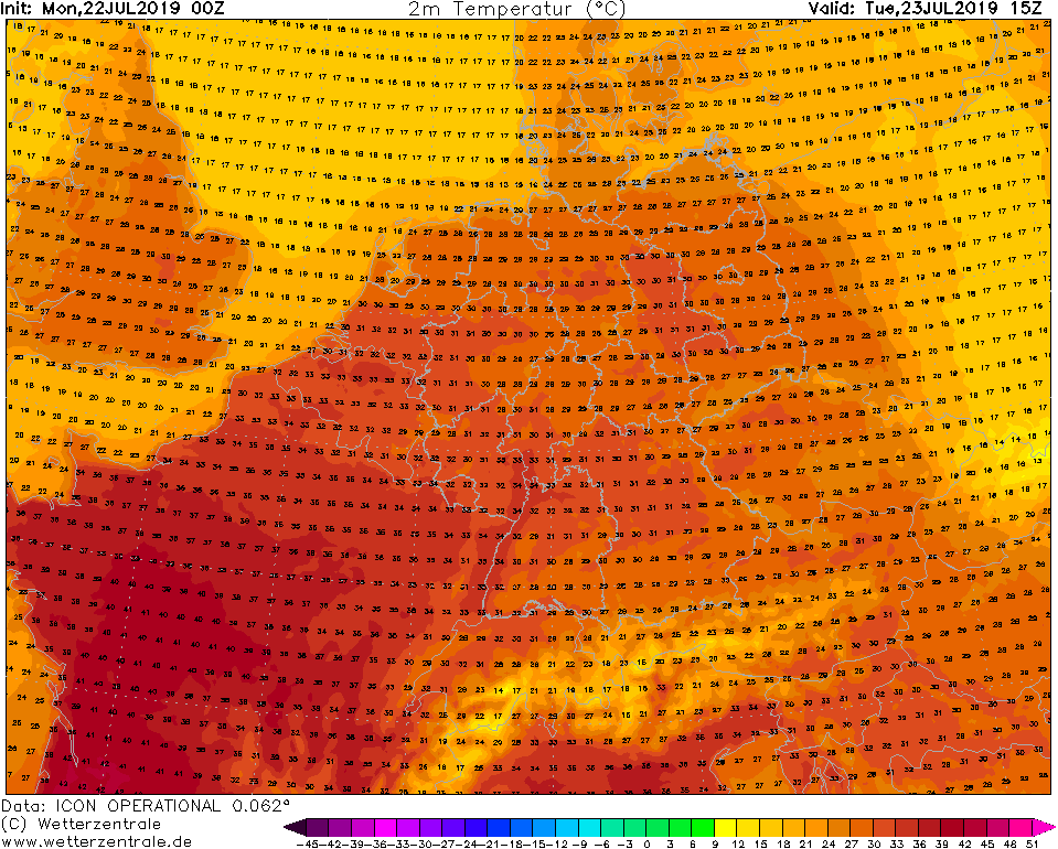
In the course of the next week very warm air from the Iberian peninsula and Africa reaches Central Europe.
Temperatures of up to 35°C are possible in Germany and France, locally up to 40°C.
23-27 July 2019
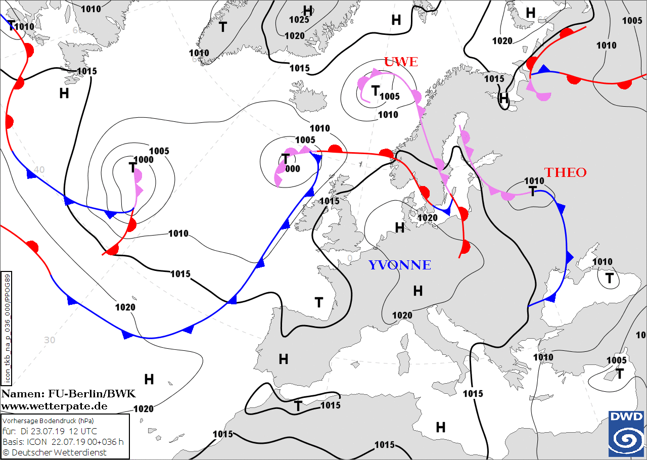
During the week, the influence of High YVONNE becomes stronger and stronger, so that warm air masses are
directed from the Iberian Peninsula and from Africa to Central Europe. Due to the massive high pressure ridge a blocking
weather situation occurs this week, so that low pressure areas cannot reach Central Europe.
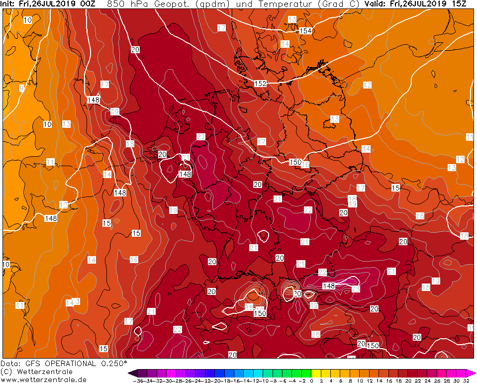
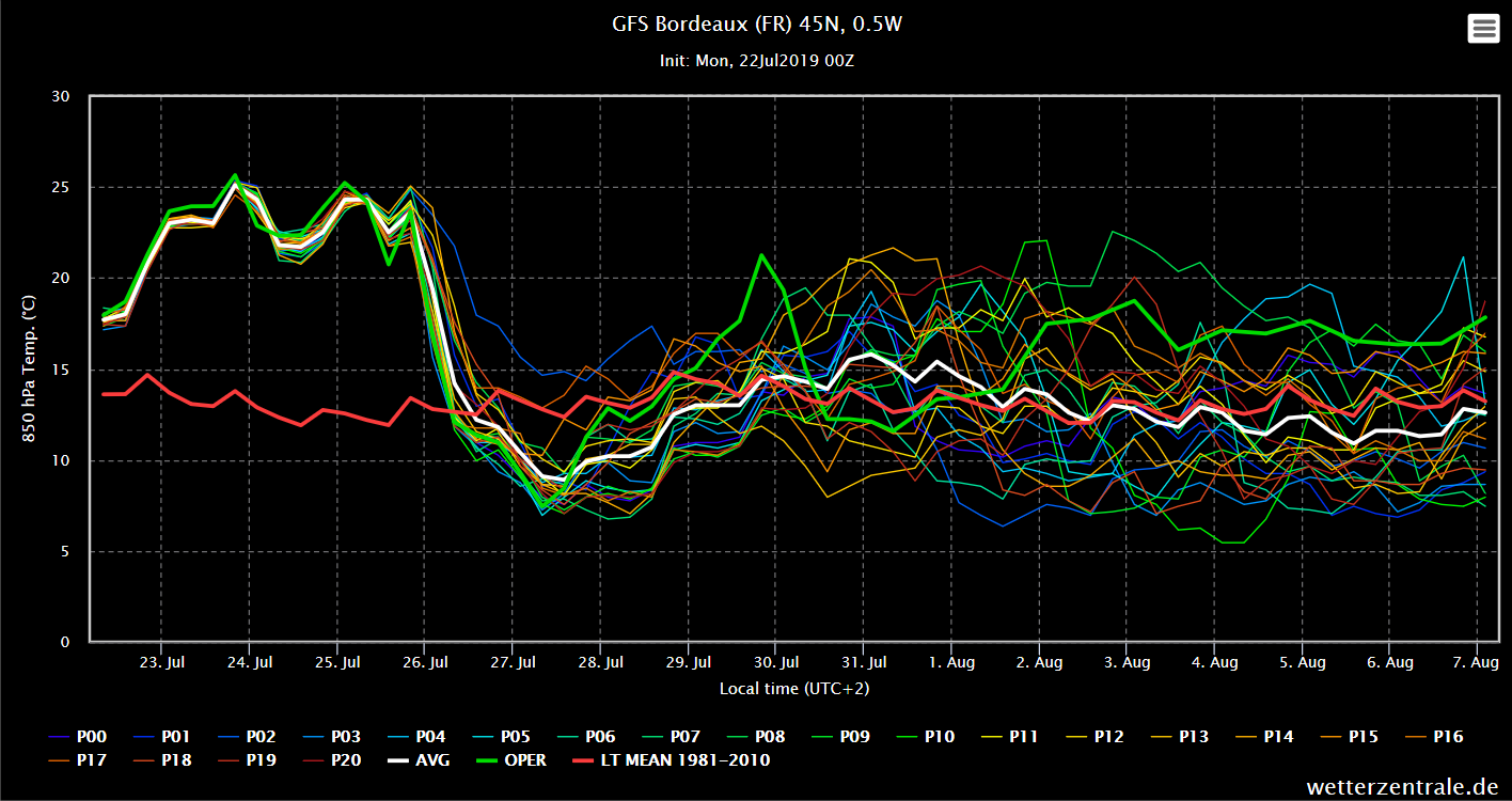
Thus it remains very hot the whole week. In 850 hPa temperatures up to 30°C are possible in Northern France
on Tuesday evening. Also in southwest Germany the temperatures rise up to 24°C in the 850 hPa level. Thus the
2 m temperature rises continuously in the coming days. In France and Belgium temperatures between 35 °C and 38 °C
are possible. In some places temperatures of more than 40 °C can be reached. In Germany it is cooler only
imperceptibly, so that also there temperatures are reached around 38 °C in the southwest.
Due to the heat wave, there is an increased risk of forest fires.
Issued: July 22, 2019, 12:00 CET
CL
Issued: July 23, 2019, 11:30 CET
FS
Issued: July 24, 2019, 08:30 CET
CL
Issued: July 25, 2019, 09:00 CET
CL
Issued: July 26, 2019, 11:30 CET
CL
|