Wednesday 19 June 2019, 22:30 CET
Thunderstorms
Germany, Austria, Czech Republic
Issued: Wednesday, 19 June 2019, 22:30 CET
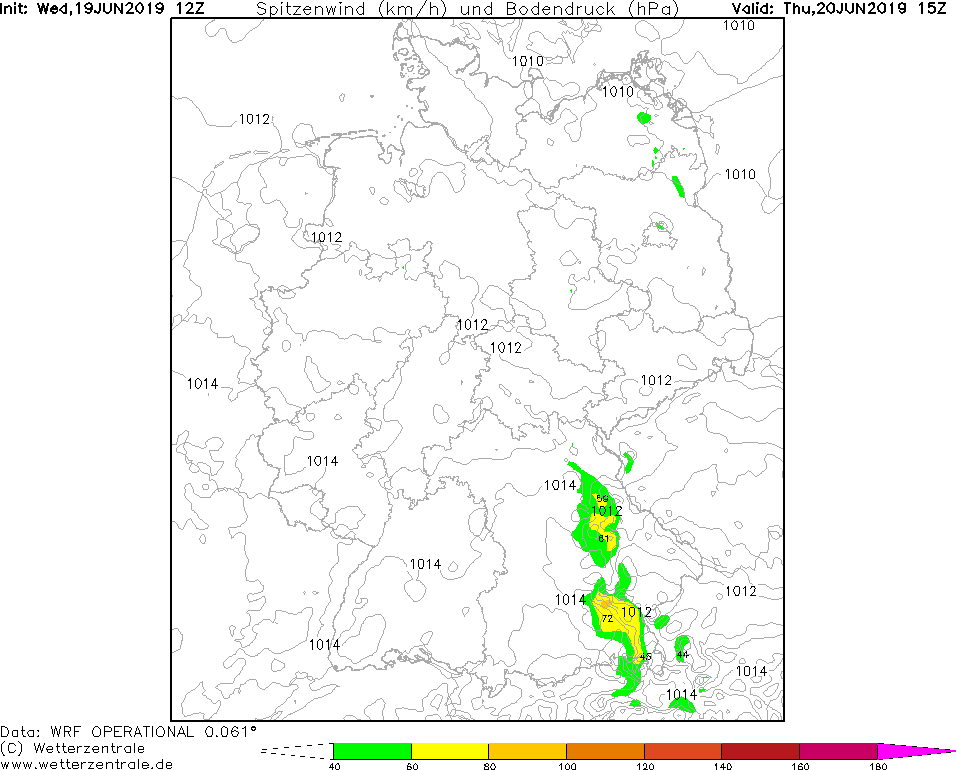
On Thursday, the passage of the cold front from low-pressure area MOMO causes showers and thunderstorms
in southern Germany, Austria and the Czech Republic.
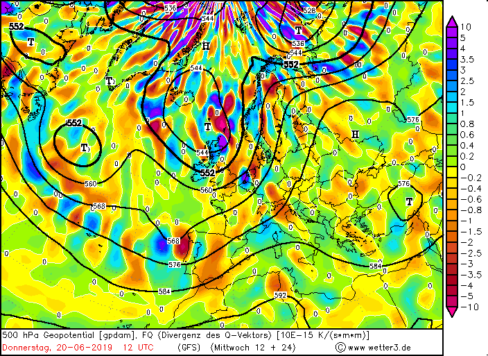
19-21 June 2019
On Thursday, ground level convergence between high pressure area TALE and low pressure area MOMO and KLAUS will occur in the southeast of Germany.
The sum of the dynamic lift drives is negative in southern Germany, which manifests itself as a negative divergence of the Q vector. This indicates upwinds.
Labile air masses in the area of a cold front passing through from the southwest cause showers and thunderstorms over Germany, especially
in Baden Württemberg and Bavaria.
Precipitation intensities of up to 30 mm/h may occur. Gale force gusts of up to 90 kph are also possible.
In the evening the thunderstorm cells continue to move in an east-northeastern direction. This means
that there is also a threat of showers and thunderstorms in Austria and the Czech Republic.
There is danger from floods, swirling objects and falling trees.
Wednesday 18 June 2019, 20:00 CET
Thunderstorms
Germany, Benelux
Issued: Tuesday, 18 June 2019, 20:00 CET
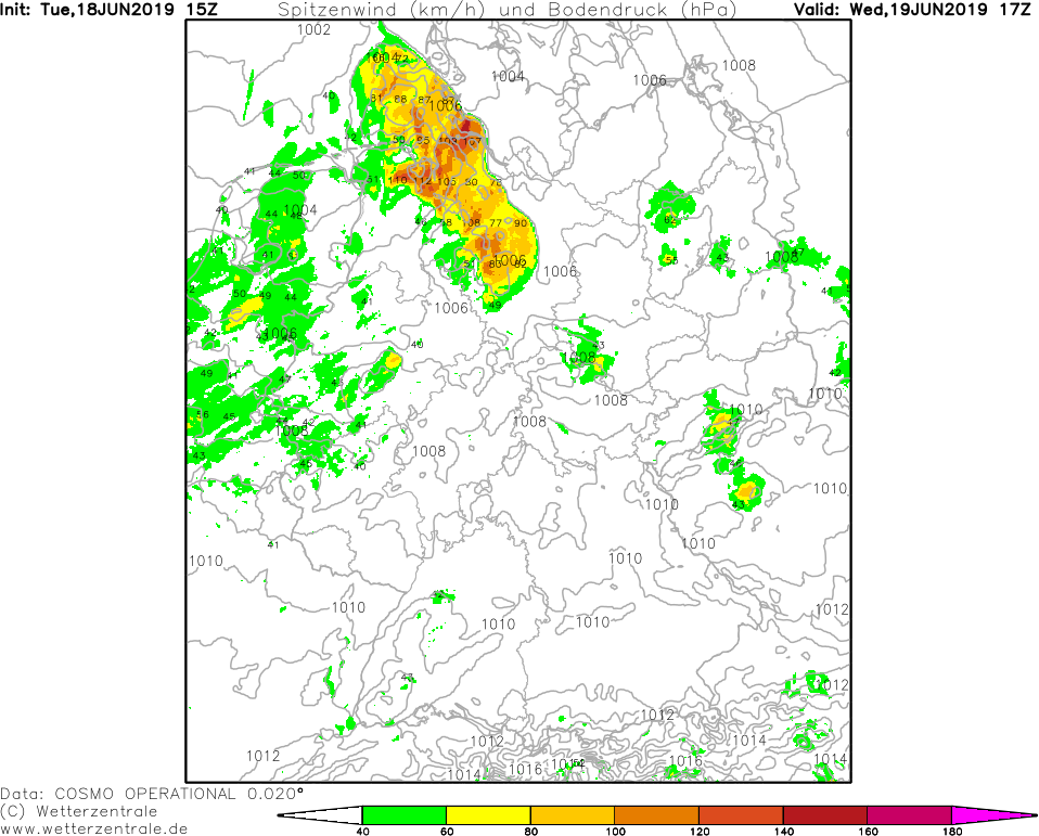
On Wednesday there are showers and thunderstorms in certain parts of Central Europe. Precipitation intensities
of up to 30 mm/h and hurricane-like gusts of up to 125 kph are possible.
19-21 June 2019
On Wednesday there are ascending air masses along the front side of a trough which reaches over the North Atlantic.
Between the low pressure area MOMO and the high pressure area TALE there is ground level convergence over northern Germany.
Due to the unstable atmospheric stratification in the area of the cold front of low MOMO, strong thunderstorms may occur in the
Benelux countries, in the north and in the west of Germany, moving in a north-eastern direction.
Within one hour up to 30 mm precipitation may fall. Stormy gusts, occasionally even hurricane-like gusts, will
occur close to thunderstorms. Also hail cannot be excluded.
There is danger through floods and landslides, through whirling objects and falling masts.
Issued: June 18, 2019, 20:00 CET
FS
|