Tuesday 21 May 2019, 11:15 CET
Heavy precipitation, flooding
Central Europe, Northern Alps
Issued: Tuesday, 21 May 2019, 11:15 CET
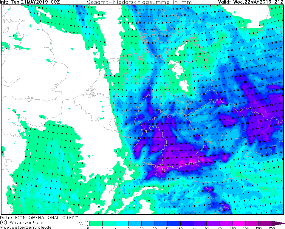
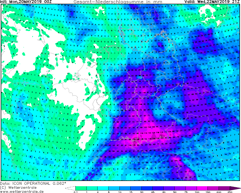
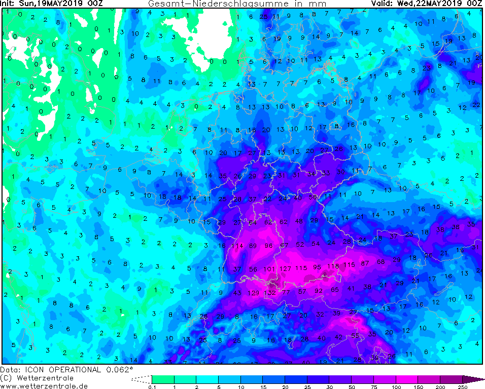
Until Wednesday showers and thunderstorms are expected. Accumulated rainfall of up to 150 mm until Wednesday, locally even more.
Additional thaw in the Alps causes floods and landslides.
19-22 May 2019
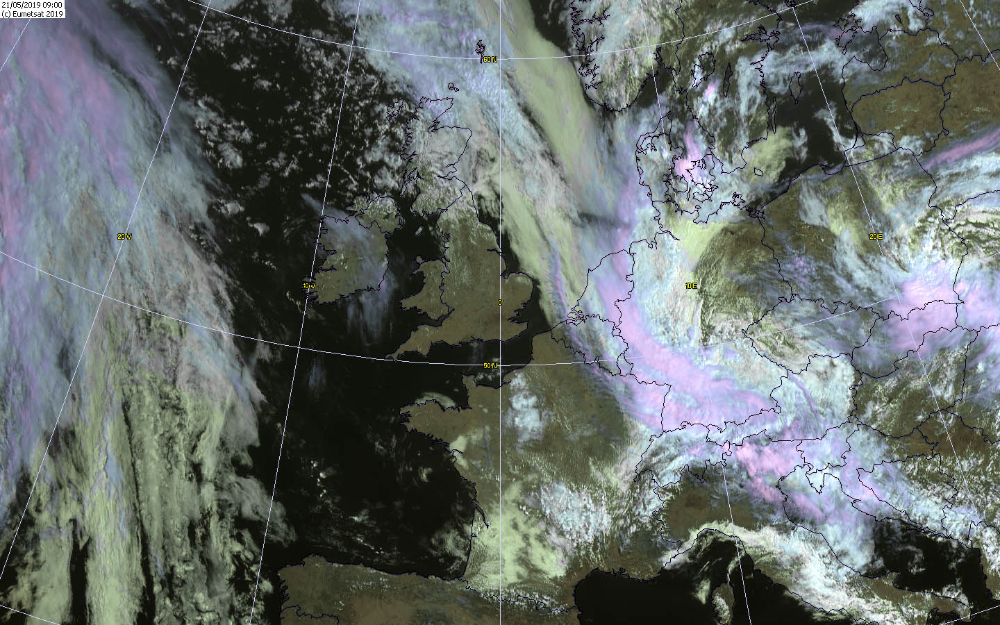
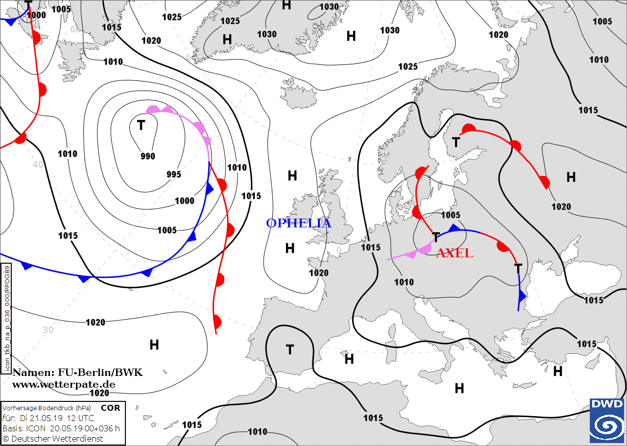
On the back of Low AXEL today, Tuesday, warm and humid air from the northeast will be led towards the Alps,
causing stagnant precipitation. This can also be seen in the radiosonde ascents in the last hours, which show
a strong northwestern inflow in the lower and middle troposphere. Warm air is still coming over Poland to
East Germany. This also leads to further precipitation there. In the warm air, strong showers and
thunderstorms occur again during the course of the day.
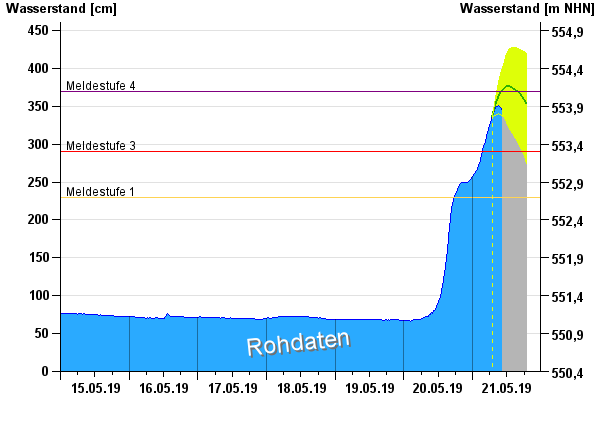
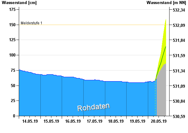
Already now numerous rivers have overflowed due to the precipitation, so for example also the Isar near
Bad Tölz/Bavaria. For the Ammer near Weilheim, reporting level 3 was issued and it is expected that
reporting level 4 will be reached in the course of the day. Especially in the Alpine region there is
heavy precipitation since yesterday (24 hours precipitation in Jachenau: 135.4 mm).
There is still the danger of flooding and landslides. In addition, the heavy rainfall may
cause traffic congestion. Numerous railway lines in Bavaria have already been closed due to
undermining or flooding.
Monday 20 May 2019, 10:15 CET
Heavy precipitation, flooding
Central Europe, Northern Alps
Issued: Monday, 20 May 2019, 10:15 CET
Until Wednesday showers and thunderstorms are expected. Accumulated rainfall of up to 150 mm until Wednesday, locally even more.
Additional thaw in the Alps causes floods and landslides.
19-22 May 2019
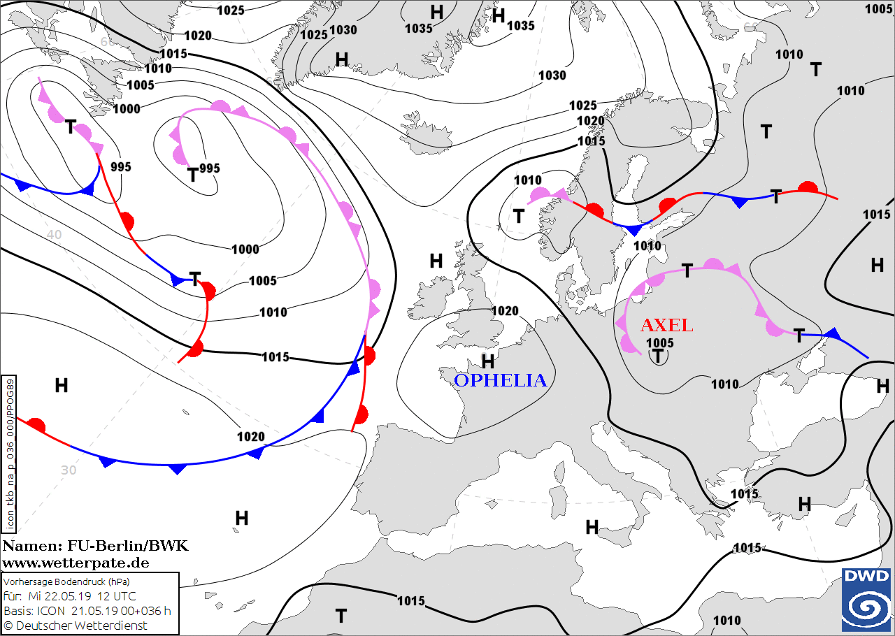
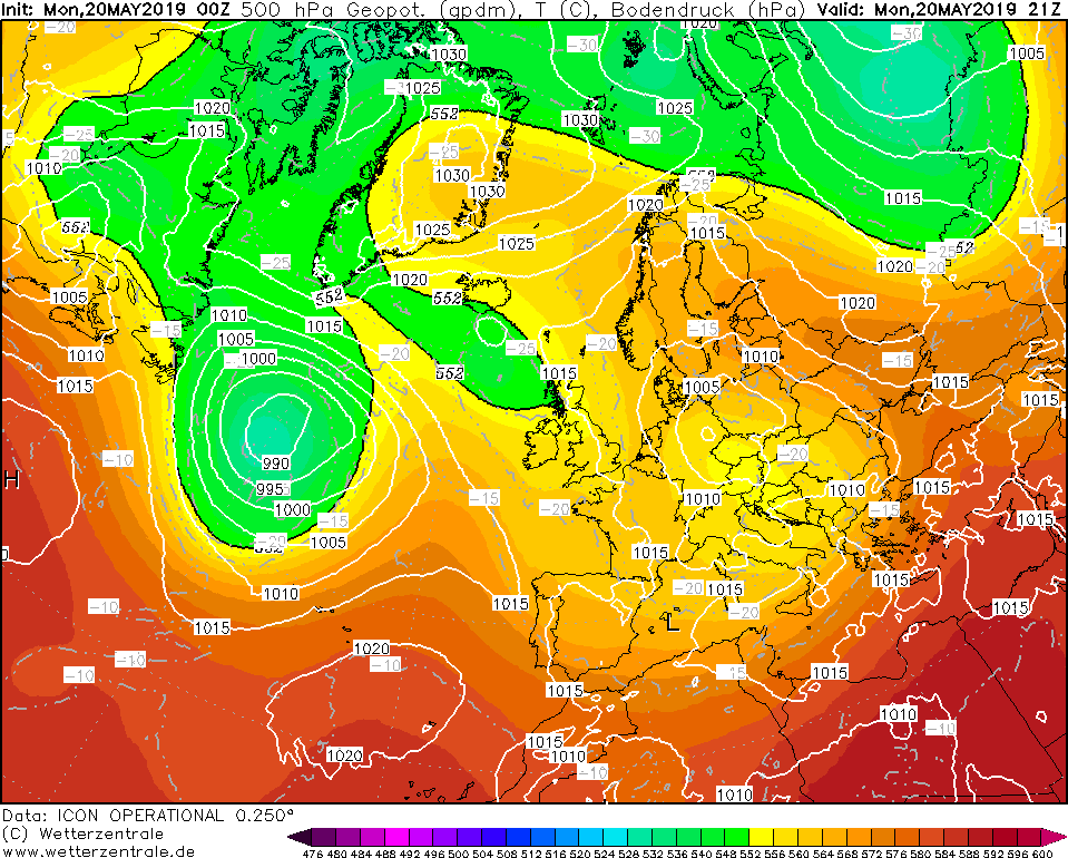
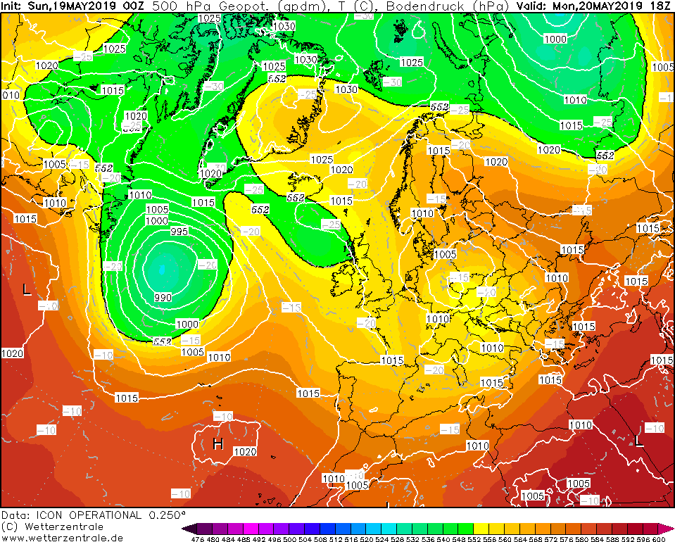
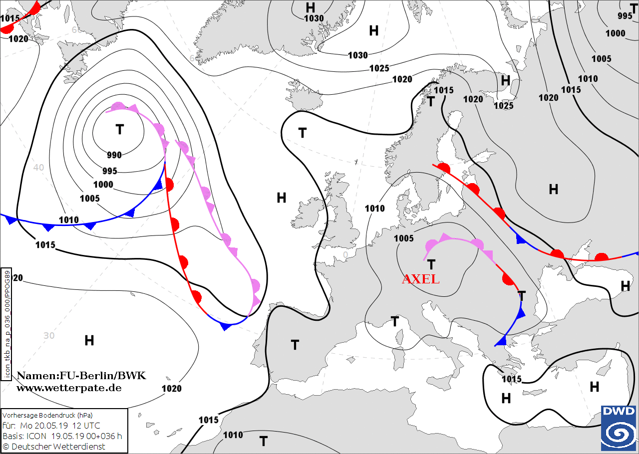
Today there is still a small, weather-active low-pressure area at the side of the ALEX depression above the
Czech Republic and Austria. Low ALEX moves only hesitantly towards Poland in the further course of the day.
With the current still southeastern at the moment, increasingly humid and unstable stratified air masses are
brought in from the Balkans. Due to the cyclonic rotation of the depression, this humid air increasingly
reaches the Alps and is dammed up there. Thus, very unsettled weather awaits us, especially in southern Germany.
In the next few days we will have to expect large amounts of rain locally. At the Alps edge up to 180 mm
of precipitation can fall until Wednesday evening. Especially smaller rivers can cause flooding. Also
additional meltwater (zero degree limit rises to over 2000m) is added. On the Zugspitze, however, the
precipitation falls in the next days as snow, so that with great probability the total snow height on
Germany's highest mountain will grow to over 6m. This enormous amount of snow is unusual for this time of year.
Sunday 19 May 2019, 12:30 CET
Heavy precipitation, flooding
Central Europe, Northern Alps
Issued: Sunday, 19 May 2019, 12:30 CET
Until Wednesday showers and thunderstorms are expected. Accumulated rainfall of up to 150 mm until Wednesday, locally even more.
Additional thaw in the Alps causes floods and landslides.
19-22 May 2019
Low pressure area AXEL has separated itself from the high-altitude current and now is situated as a small but
weather-active low pressure area over Central Europe. The cyclonal rotation leads mild and humid air to southern
Germany, where showers and thunderstorms develop due to dynamic uplifting processes. The low horizontal pressure
gradients and the associated low altitude current prevent the rain areas from displacing and may cause cluster formation.
In Baden Württemberg and Bavaria, especially on the northern side of mountains, precipitation intensities of up to 15 mm/h
and total precipitation of up to 150 mm until wednesyday can be expected. Due to the low displacement speed, the effects can be very regional.
This may result in landslides, floods and high water levels.
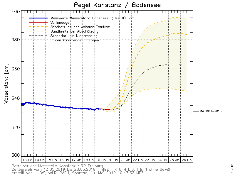
In addition to the abundant precipitation, the rising zero degree limit also causes rising water levels in the outflows of the Alps due to rapid thawing.
The water level at Lake Constance could rise by half a meter by next weekend. In rivers, water levels could also rise significantly more for short-term periods.
Issued: May 19, 2019, 12:30 CET
FS
Issued: May 20, 2019, 10:15 CET
CL
Issued: May 21, 2019, 11:15 CET
CL
|