Friday 03 May 2019, 08:15 CET
Tropical Cyclone - Warning
India
Issued: Friday, 03 May 2019, 08:15 CET
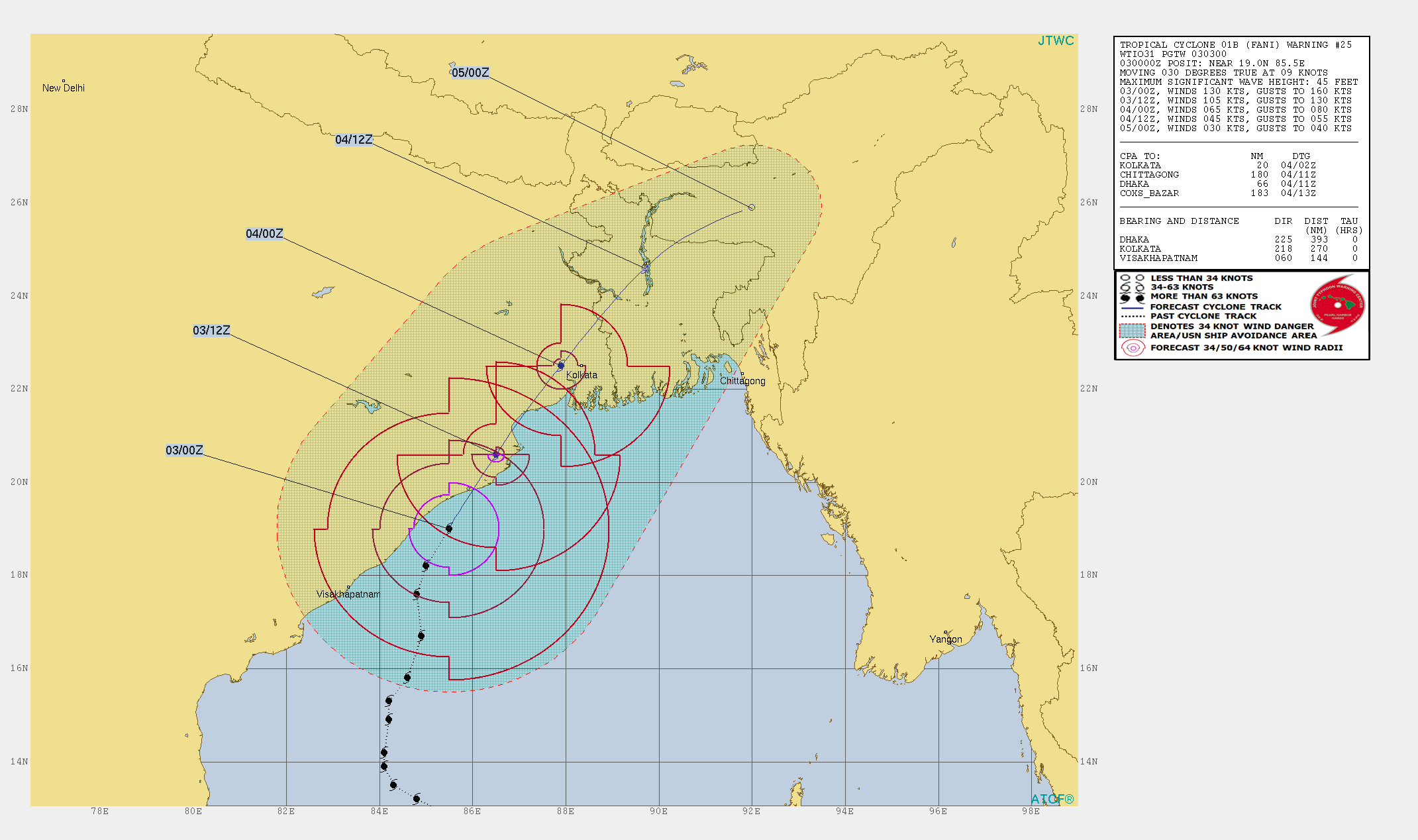
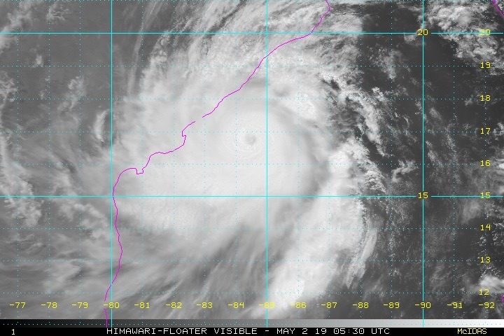
Tropical storm FANI currently reaches the coasts of India 250 km south of Calcutta with wind speeds up to 130 kt or 234 kph, which corresponds to category 5.
02-05 May 2019
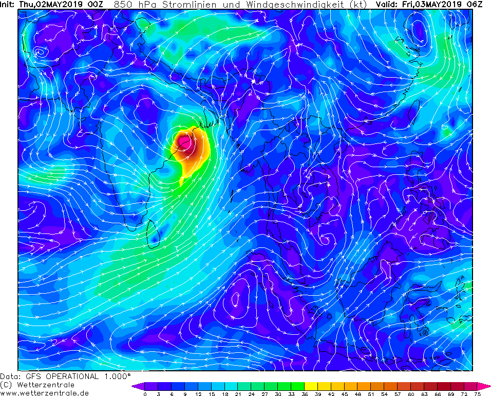
The devastating and dangerous tropical storm FANI reaches the mainland on the shores of India every moment. Yesterday, it was still a Category 3 storm within
the Bay of Bengal. Due to the high water temperatures it strengthened during the night to a category 4 and finally to a category 5 storm and will also reach
the mainland with this category. FANI makes landfall about 250 km southwest of Calcutta and 250 km northeast of Visakhapatnam.
Since FANI will not weaken before landfall wind speeds of up to 130 kt and 234 kph must be expected with.
In addition to the city of Cuttack (600,000 inhabitants) many small settlements and villages are also affected.
There is danger from flying objects, falling trees and masts. Restrictions in road traffic and power cuts are to be expected.
In a corridor about 200 km in width around FANI's railway, rainfall of more than 150 mm/48h must be expected.
Precipitation intensities of more than 50 mm/3h are possible. This can lead to flooding and landslides in the mountains west of Cuttack.
On 03 and 04 May the tropical storm shifts to the northeast. Both the precipitation intensity and the wind speed decrease rapidly after FANI
made landfall. On 03 May at 18 UTC the mean wind speeds are still up to 150 kph, on 04 May at 06 UTC up to 75 kph.
Thursday 02 May 2019, 14:45 CET
Tropical Cyclone - Warning
India
Issued: Thursday, 02 May 2019, 14:45 CET
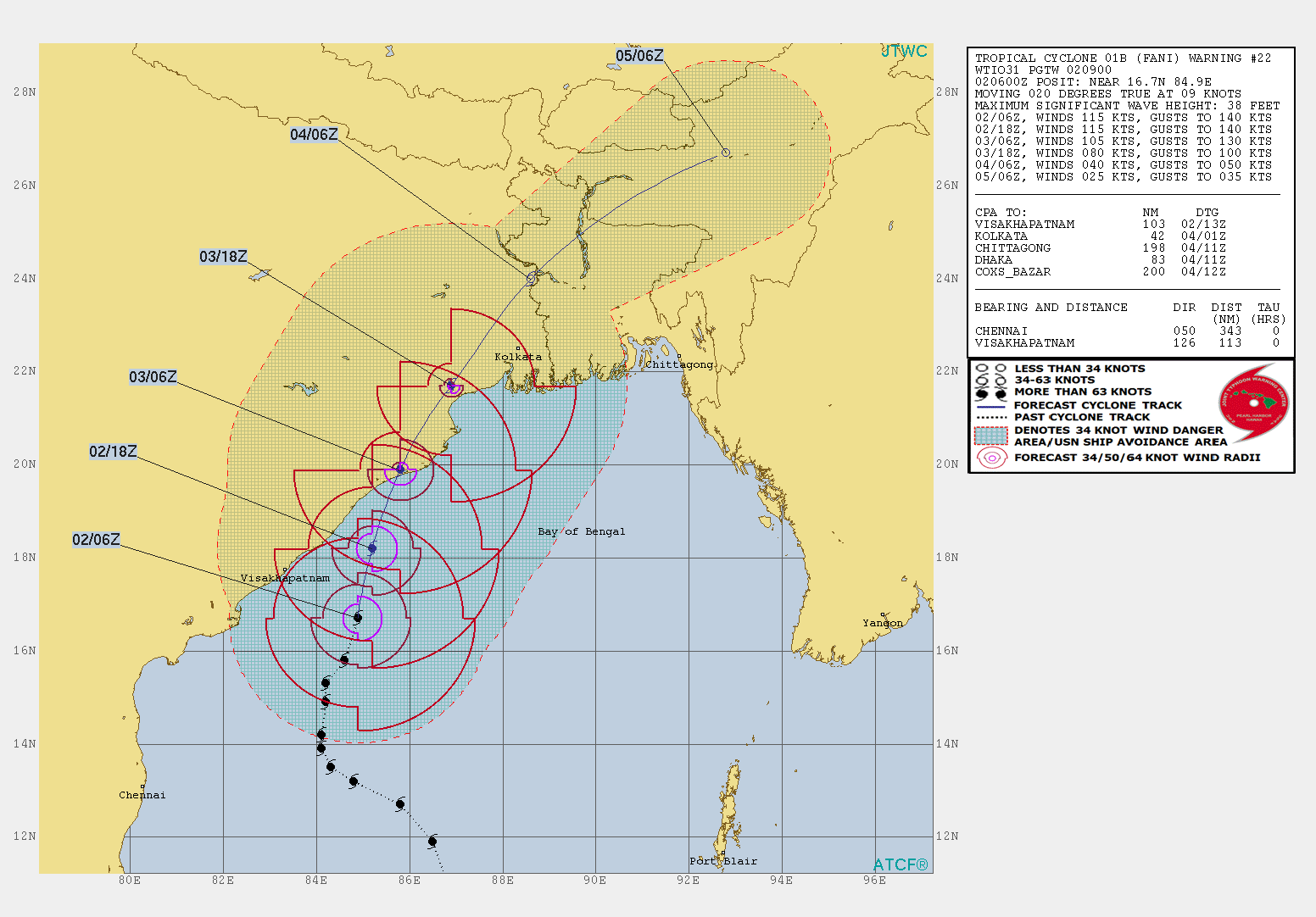
Tropical storm FANI hits land on Friday at wind speeds of up to 195 kph about 250 km southwest of Calcutta.
02-05 May 2019
Tropical storm FANI is currently (02 Mai) located on the northern Indian Ocean in the Bay of Bengal and shifts further north
towards the coasts of India with a displacement speed of 17 kph. Its core pressure is 948 hPa
and its mean wind speeds are about 205 kph. FANI will make landfall on Friday 06 UTC as a Category 3 storm about
250 km southwest of Calcutta and 250 km northeast of Visakhapatnam.
The tropical storm will hardly weaken before landfall. The wind speeds should be up to 195 kph, in gusts even up to 240 kph.
In addition to many smaller settlements and villages, the city of Cuttack (600,000 inhabitants) is located in the area
influenced by the tropical storm. There is danger from flying objects, falling trees and masts.
Restrictions in road traffic and power cuts are to be expected.
In a corridor about 200 km in width around FANI's railway, rainfall of more than 150 mm/48h must be expected.
Precipitation intensities of more than 50 mm/3h are possible. This can lead to flooding and landslides in the mountains west of Cuttack.
On 03 and 04 May the tropical storm shifts to the northeast. Both the precipitation intensity and the wind speed decrease rapidly after FANI
made landfall. On 03 May at 18 UTC the mean wind speeds are still up to 150 kph, on 04 May at 06 UTC up to 75 kph.
Issued: May 02, 2019, 14:45 CET
FS
Issued: May 03, 2019, 08:15 CET
MG
|