Sunday, 09.12.18, 10:15 UTC

|
|
|
|
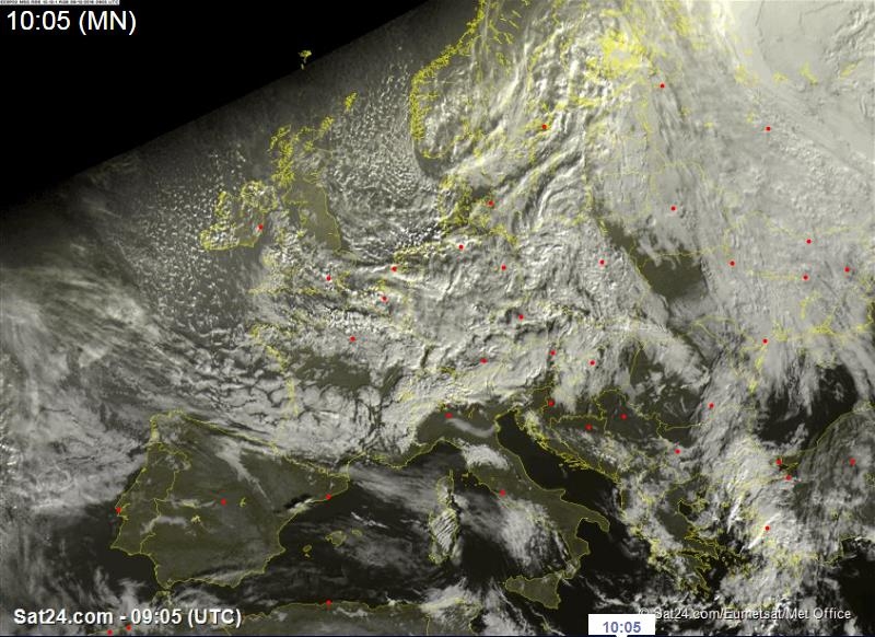
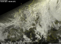
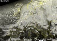
Satellite image, Dec. 9th, 09:05 UTC
Source: Sat24
|
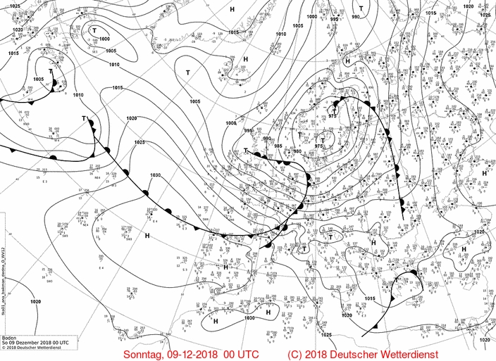
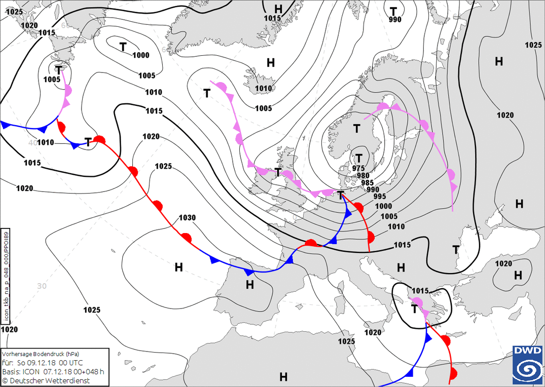
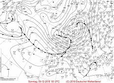
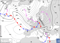
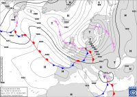
Ground pressure analysis, Dec. 9th, 00 UTC
Source: Wetter3
|
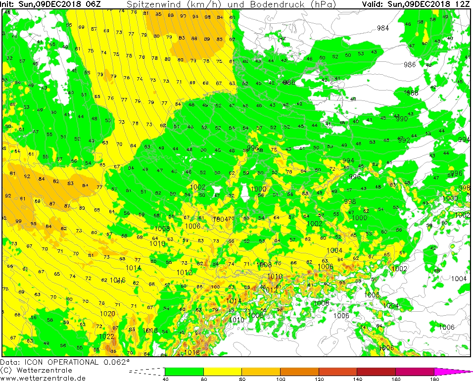
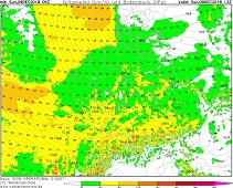
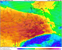
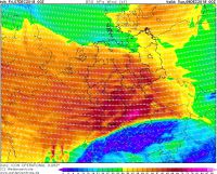
Gusts, Dec. 9th, 12 UTC
Source: Wetterzentrale
|
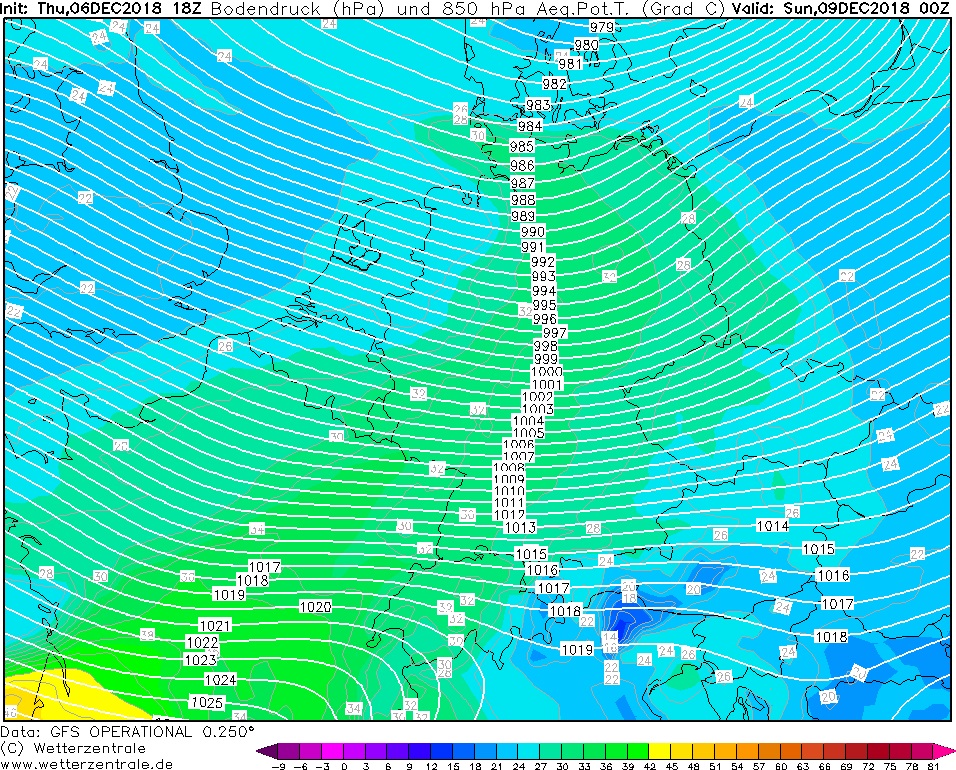
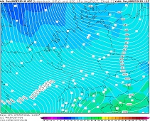
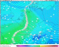
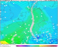
850 hPa equivalent pot. temp., Dec. 9th, 12 UTC
Source: Wetterzentrale
|
Storm - Warning
07.-09th Dec.2018
issued on: Sunday, December 9th, 2018 10:15 UTC
Storm in Central Europe - 07.-09.12.2018
Even though the storm maximum has already passed over Germany, it remains stormy on Sunday. In the early morning
hurricane-like gusts of 157km/h and 126km/h were already registered at Feldberg and Brocken. The stations Deuselbach
and Weinbiet (Rheinland-Pfalz) recorded gusts of 113km/h and 119km/h respectively. Also on the Zugspitze a hurricane-like
gust with 144km/h wind speed was already measured. (Source: Meteociel)
Today, on Sunday, the storm depression MARIELOU II already lies above the Gulf of Bothnia. Germany is now under the
influence of the back of the trough. The wind turns northwest and a colder and drier air mass flows in.
In exposed locations there is still a threat of hurricane-like gusts. In the lowlands, the wind is generally less strong,
only in Rheinland-Pfalz and parts of Baden Württemberg and Bayern storm gusts are still possible. Showers are still likely
in the entire federal state, which occur stronger in the south than in the north of the country. As the ground temperature
is still clearly above freezing point, there is no danger of freezing rain.
German Version
Saturday, 08.12.18, 09:30 UTC
|
|
|
|
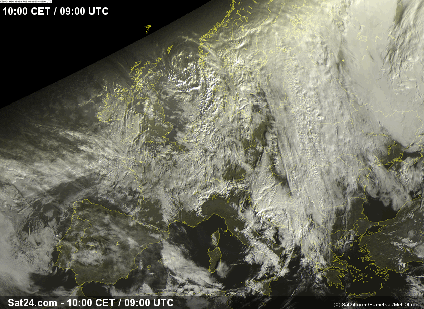
Satellite Image, December 09, 2018 09:00 UTC
Source: Sat24
|
Predicted sea level pressure for December 9th, 2018 00 UTC
Source: Wetter3
|
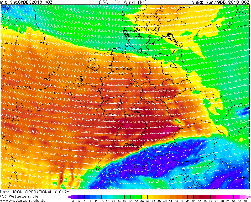
850 hPa Wind, December 9th, 2018 00 UTC
Source: Wetterzentrale
|
850 hPa equivalent pot. temp., December 9th, 2018 21 UTC
Source: Wetterzentrale
|
Storm - Warning
07.-09th Dec.2018
issued on: Saturday, December 8th, 2018 09:30 UTC
Storm in Central Europe - 07.-09.12.2018
The low-pressure systems MARIELOU I and MARIELOU II are currently bringing in a wet weather situation to Germany.
On Friday December 7th the cold front of MARIELOU I crossed Germany. The center of MARIELOU I moved across the UK and brought storm and gale winds up to 143 km/h.
MARIELOU II reaches Germany on Saturday evening and also brings storm and gale winds.
Yesterday on December 7th the cold front of low MARIELOU I crossed Germany from the afternoon onwards. This brought precipitation but also storm and gale winds.
The strongest wind gusts were recorded on the Feldberg (Black Forest) with 122 km/h and on the Brocken with 126 km/h (source Meteociel).
Within the precipitation of the cold front there were some showers and thunderstorms, which reached the west of Germany at about 16:00 CET. The warm air sector brought
very mild temperatures due to southwesterlies. Locally the thermometer climbed up to 12°C.
The cold front belongs to a slow-moving low, which crossed the North Sea today and caused dangerous gale gusts at the coastal regions.
The strongest gusts (143km/h, source Meteociel) was measured southwest of the low pressure center in the morning hours in the north of Great Britain.
A second wind peak formed during the night of Saturday and affected the north of Ireland, as well as the south of England. The strongest gust here
was 117 km/h (source Meteociel).
On Saturday in the southwest of MARIELOU I a short-wave trough is developing and evolving into the storm MARIELOU II.
On late Saturday night the front system of MARIELOU II will reach Germany while the actual center of the depression will pass over Denmark .
It's not sure yet in which area the main storm field will be. The wind maxima are probably located in the middle of Germany and in the extreme southeast and
reach the highest levels in the night from Saturday to Sunday. A strong gradient, however, makes the wind freshes up throughout Germany. Especially in exposed locations
will be gale gusts up to 70kt or 126km/h. In the area of wind maxima gusts up to 78kt or 141km/h are possible! Also on Sunday it remains still windy.
With the fronts also new precipitation reach Germany. These are mainly precipitated as stratiform rain. Behind the cold front showers and
thunderstorms are possible (postfrontal weather). In the Alpine regions the cold front may lead to rain and snowfall.
The temperatures continue to be mild and will drop to around 9°C on Saturday. Also on Sunday the temperatures remain mild.
Until the beginning of next week drop and remain between 1°C and 7°C. Since the blocking high-pressure weather situation has been overborn more
low pressure systems will reach Germany and Central Europe in the near future again. With the low-pressure areas also more precipitation is coming to Germany again.
Especially in the Alpine region the accumulating fronts can cause precipitation in the form of rain and snow.
German Version
Friday, 08.12.18, 09:55 UTC
|
|
|
|
Satellite Image, December 07, 2018 09:40 UTC
Source: Sat24
|
Predicted sea level pressure for December 9th, 2018 00 UTC
Source: Wetter3
|
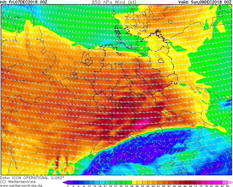
850 hPa Wind, December 9th, 2018 00 UTC
Source: Wetterzentrale
|
850 hPa equivalent pot. temp., December 9th, 2018 00 UTC
Source: Wetterzentrale
|
Storm - Warning
07.-09th Dec.2018
issued on: Friday, December 7th, 2018 09:55 UTC
Storm in Central Europe - 07.-09.12.2018
The low-pressure system MARIELOU and a still nameless low currently bring a wet weather section over the weekend. On Friday December 7th the cold front of MARIELOU
crosses Germany. The center of MARIELOU moves across the UK and brings storm and gale winds there. The still nameless low will reach Germany on Saturday night and
also brings storm and gale gusts.
On today's Friday December 7th the cold front of deep MARIELOU crosses Germany during afternoon. It brings precipitation but also storm and gale winds. The strongest gusts
are expected in the southwest of Germany. In the warm air sector, the southwest wind carries very mild temperatures. Locally the thermometer climbs up to about 12°C.
The cold front belongs to a slow-moving low, which crosses the United Kingdom today and causes dangerous gale gusts there. The strongest gusts are
expected southwest of the low pressure center in the morning hours in northern Great Britain. A second wind maximum forms during the night of Saturday and affects
the northern Ireland.
On late Saturday evening the front system of the nameless low will reach Germany. The center will not reach Germany but will pass over Denmark . It's not sure yet in
which area the main storm field will be. The wind maxima are probably located in the middle of Germany and in the extreme southeast and reach these regions in the
night from Saturday to Sunday. A strong gradient, however, makes the wind freshen up throughout Germany. Especially in exposed locations will be gale gusts up to
70kt or 126km/h. In the area of wind maxima gusts up to 84kt or 152km/h are possible! Also on Sunday it remains windy.
With the fronts also new precipitation reach Germany. These are mainly precipitated as stratiform rain. Behind the cold front, it can also come to showers
(postfrontal weather). In the Alpine regions the cold front are jamming and cause rain and snowfall. The temperatures continue to be mild and will drop to around 9°C on
Saturday. Also on Sunday the temperatures remain mild.
Until the beginning of next week drop and remain between 1°C and 7°C. Since the blocking high-pressure weather situation has been overborn more
low pressure systems will reach Germany and Central Europe in the near future again. With the low-pressure areas also more precipitation is coming to Germany again.
Especially in the Alpine region the accumulating fronts can cause precipitation in the form of rain and snow.
German Version
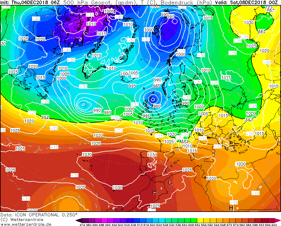
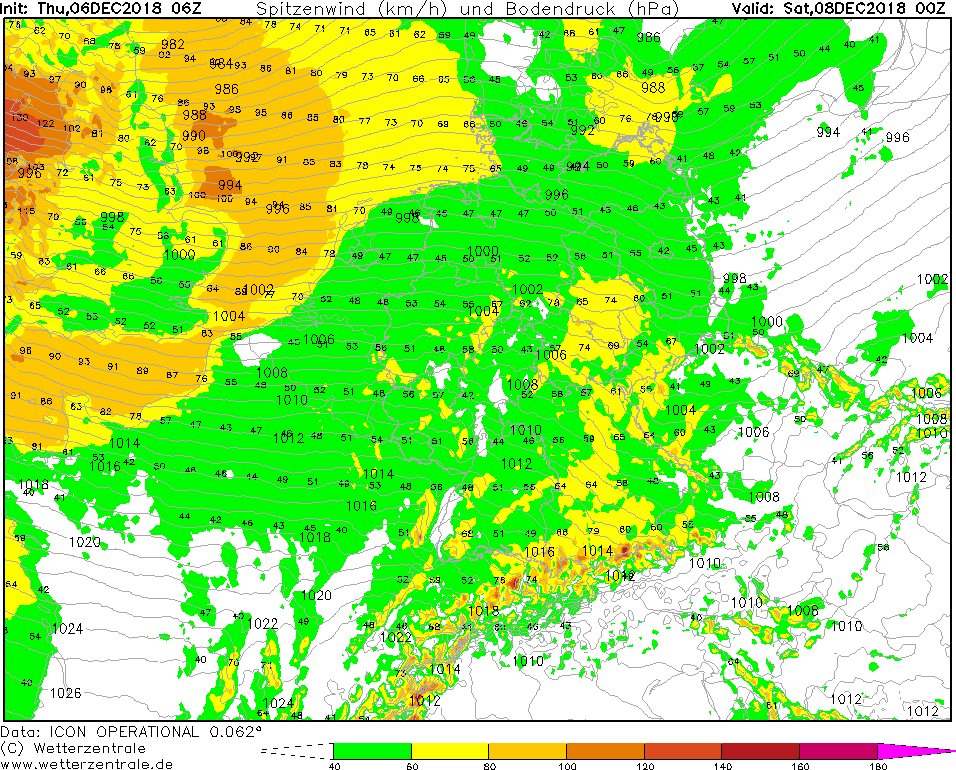
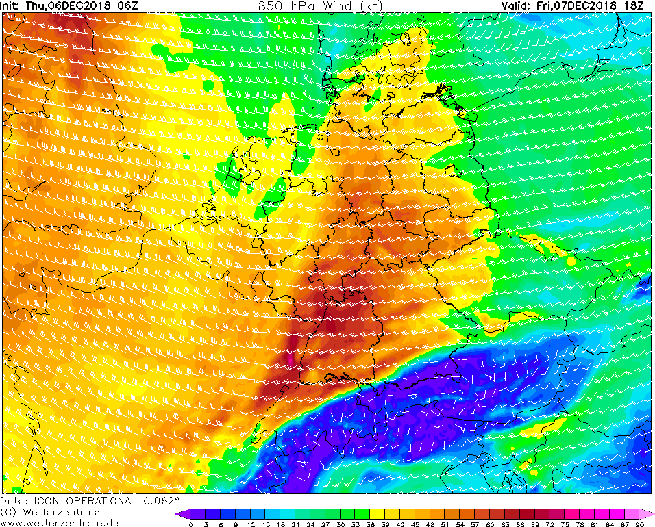
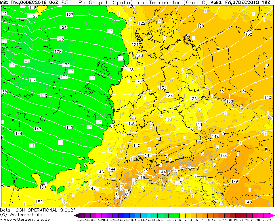
Thursday, December 6th, 2018 12 UTC
Storm - Warning
07.-09th Dec.2018
issued on: Thursday, 06th Dec. 2018, 13:00 UTC
Storm in central Europe - 07.-09th Dec.2018
The low pressure area LUANA is the beginning of a wet weather situation until the weekend. Troughs of low pressure cross
Central Europe again and again, causing rainfall and storms in the next few days. Temperatures are warm for this time of year.
Tomorrow, the cold front of a storm depression moving very slowly over Scotland to the northeast will reach the west of
Germany on Friday afternoon. In the warm sector, the gradient has intensified before and stormy gusts are possible, especially
in the cold front area. In exposed locations, hurricane-like gusts are possible. In the area of the cold front, a strong
rain area is coupled. Within a short time 20 to 50 mm precipitation can occur. In the warm sector, unusually warm temperatures
between 10°C in the Vogtland and 14°C on the Rhine River are expected. In southern Baden, temperatures of up to 16 °C are even possible.
Throughout the upcoming days troughs of low pressure will pass through again and again, causing danger of storm and heavy rainfall.
Temperatures will decerase again and the snow line will drop significantly below 2000m.
German version
established on: 06th Dec. 2018, 13:00 UTC
CL
|